University of Minnesota
http://www.umn.edu/
612-625-5000
http://www.umn.edu/
612-625-5000
Minnesota Biodiversity Atlas
Bell Museum
Dataset: MIN-Plants
Taxa: Kobresia
Search Criteria: excluding cultivated/captive occurrences
1
Page 1, records 1-22 of 22
Bell Museum plants | |
 MIN:Plants | 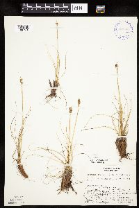 Kobresia simpliciuscula (Wahlenberg) Mackenzie 400804[1021518]Spetzman, L. 10531948-08-10 United States, Alaska, Arctic North Slope...Sadlerochit River;Arctic National Wildlife Refuge;;;, 69.5833333 -144.75, 457m |
MIN:Plants | 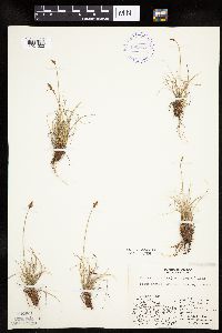 Kobresia simpliciuscula (Wahlenberg) Mackenzie 400803[1021520]Spetzman, L. 11501948-08-13 United States, Alaska, Arctic North Slope ... Sunset Pass;Arctic National Wildlife Refuge;;;, 69.6666641 -144.75, 762m |
MIN:Plants | 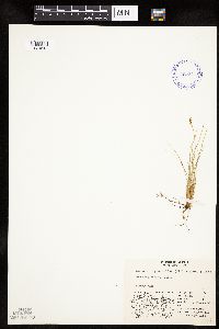 Kobresia myosuroides (Villars) Fiori 409341[1021513]Spetzman, L. 44221949-07-17 United States, Alaska, Arctic North Slope ... Kanayut Lake;Gates of the Arctic National Park;;;, 68.3333359 -151, 914m |
MIN:Plants | 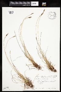 Kobresia simpliciuscula (Wahlenberg) Mackenzie 700002[1021517]Glaser, Paul 9221975-09-02 United States, Alaska, Mt. McKinley National Park ... T17S R17W Sec.17, McKinley River Trail;Denali National Park;017S;17W;17, 610m |
MIN:Plants |  Kobresia myosuroides (Villars) Fiori 400814[1021512]Spetzman, L. 5011948-07-08 United States, Alaska, Arctic North Slope ... Lake Schrader;Arctic National Wildlife Refuge;;;, 69.4166667 -145, 914m |
MIN:Plants | 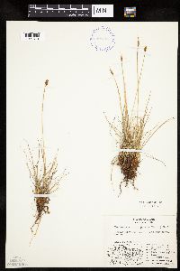 Kobresia simpliciuscula (Wahlenberg) Mackenzie 400805[1021519]Spetzman, L. 10541948-08-10 United States, Alaska, Arctic North Slope...Sadlerochit River;Arctic National Wildlife Refuge;;;, 69.5833333 -144.75, 457m |
MIN:Plants | 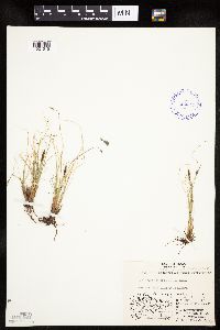 Kobresia simpliciuscula (Wahlenberg) Mackenzie 409345[1021515]Lachenbruch, A. 151949-08-15 United States, Alaska, Arctic North Slope ... Killik R.;Gates of the Arctic National Park;;;, 68.1999969 -154.1999969, 716m |
MIN:Plants | 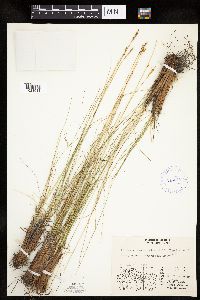 Kobresia myosuroides (Villars) Fiori 416916[1021511]Spetzman, L. 42101950-07-17 United States, Alaska, Arctic North Slope ... Noatak & Kugururok R.;Noatak National Preserve;;;, 67.9666672 -161.9166718, 152m |
MIN:Plants | 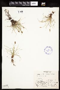 Kobresia simpliciuscula (Wahlenberg) Mackenzie 409340[1021516]Spetzman, L. 19491949-07-17 United States, Alaska, Arctic North Slope ... Kanayut Lake;Gates of the Arctic National Park;;;, 68.3333359 -151, 914m |
MIN:Plants | 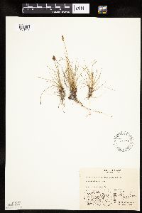 Kobresia simpliciuscula (Wahlenberg) Mackenzie 548431[1021521]Spetzman, L. 38701951-07-15 United States, Alaska, Arctic North Slope ... Canning R. & Ignek Cr.;Arctic National Wildlife Refuge;;;, 69.5833359 -146.25, 305m |
MIN:Plants | 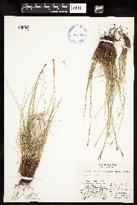 Kobresia myosuroides (Villars) Fiori 409337[1021514]Spetzman, L. 18101949-07-10 United States, Alaska, Arctic North Slope ... Anaktuvuk Pass;Gates of the Arctic National Park;;;, 68.2833333 -151.4166667, 610m |
MIN:Plants | 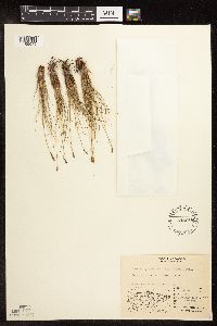 Kobresia myosuroides (Villars) Fiori 548615[1105045]Spetzman, L. 26781951-07-20 United States, Alaska, Arctic North Slope ... Katakturuk River, Igenk Valley;Arctic National Wildlife Refuge;;;, 69.5833359 -145.5833282, 610m |
MIN:Plants | 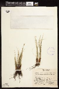 Kobresia myosuroides (Villars) Fiori 416949[1105041]Spetzman, L. 37641950-07-04 United States, Alaska, Arctic North Slope ... Kurupa Lake;Gates of the Arctic National Park;;;, 68.3666687 -154.6666718, 945m |
MIN:Plants | 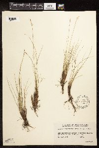 Kobresia myosuroides (Villars) Fiori 539766[1105044]Viereck, Les 1445A1956-07-20 United States, Alaska, Mt. McKinley National Park ... above the Thoroughfare River;Denali National Park;;;, 63.4166679 -150.3333282, 914m |
MIN:Plants | 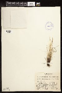 Kobresia myosuroides (Villars) Fiori 409336[1105042]Spetzman, L. s.n.1949-07-05 United States, Alaska, Arctic North Slope ... Anaktuvuk Pass;Gates of the Arctic National Park;;;, 68.2833333 -151.4166667, 762m |
MIN:Plants | 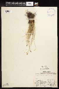 Kobresia myosuroides (Villars) Fiori 400818[1105046]Spetzman, L. 6301948-07-12 United States, Alaska, Arctic North Slope ... Lake Peters;Arctic National Wildlife Refuge;;;, 69.3333333 -145, 1067m |
MIN:Plants | 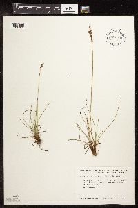 Kobresia simpliciuscula (Wahlenberg) Mackenzie 699974[1105049]Glaser, Paul 8801975-07-30 United States, Alaska, Mt. McKinley National Park ... NW1/4NW1/4Sec.17 T17S R17W, McKinley Bar Trail;Denali National Park;017S;17W;17, 610m |
MIN:Plants |  Kobresia myosuroides (Villars) Fiori 400808[1105047]Spetzman, L. 10461948-08-15 United States, Alaska, Arctic North Slope...Sadlerochit River;Arctic National Wildlife Refuge;;;, 69.5833333 -144.75, 457m |
MIN:Plants |  Kobresia myosuroides (Villars) Fiori 409338[1105043]Spetzman, L. 17551949-07-08 United States, Alaska, Arctic North Slope ... Anaktuvuk Pass, west side of valley;Gates of the Arctic National Park;;;, 68.2833333 -151.4166667, 610m |
MIN:Plants |  Kobresia simpliciuscula (Wahlenberg) Mackenzie 409939[1105050]Spetzman, L. 18721949-07-11 United States, Alaska, Arctic North Slope ... Anaktuvuk Pass;Gates of the Arctic National Park;;;, 68.2833333 -151.4166667, 762m |
MIN:Plants |  Kobresia myosuroides (Villars) Fiori 548447[1105048]Spetzman, L. 38691951-07-15 United States, Alaska, Arctic North Slope ... Canning R. & Ignek Cr.;Arctic National Wildlife Refuge;;;, 69.5833359 -146.25, 305m |
MIN:Plants | 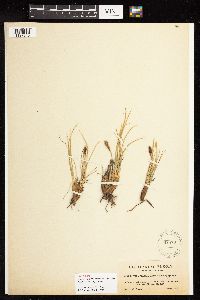 Kobresia macrocarpa Clokey ex Mack. 82579[1127845]Clokey, I.W. 36511920-08-30 United States, Wisconsin, El Paso, Pike's Peak, 3950m |
1
Page 1, records 1-22 of 22
Google Map
Google Maps is a web mapping service provided by Google that features a map that users can pan (by dragging the mouse) and zoom (by using the mouse wheel). Collection points are displayed as colored markers that when clicked on, displays the full information for that collection. When multiple species are queried (separated by semi-colons), different colored markers denote each individual species.