University of Minnesota
http://www.umn.edu/
612-625-5000
http://www.umn.edu/
612-625-5000
Minnesota Biodiversity Atlas
Bell Museum
Dataset: MIN-Plants
Taxa: Mariscus
Search Criteria: excluding cultivated/captive occurrences
1
Page 1, records 1-5 of 5
Bell Museum plants | |
 MIN:Plants | 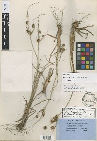 Mariscus curtisii Clarke 502338[1001784]Rugel, F. 4461845-09-00 United States, Florida, Hillsborough, Egmund [Egmont] Key |
MIN:Plants | 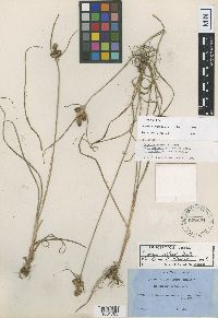 Mariscus curtisii Clarke 527631[1001785]Rugel, F. 4301843-06-00 United States, Florida, Wakulla, Mouth of St. Mark's River |
MIN:Plants | 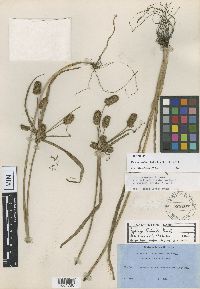 Mariscus curtisii Clarke 528007[1001786]Rugel, F. 3871845-07-00 United States, Florida, Manatee, Manatee River |
MIN:Plants | 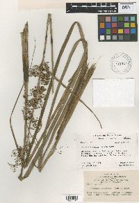 Mariscus elevatus John W. Moore 458721[1001787]Moore, John W. 7711927-05-18 French Polynesia, Society Islands, Raiatea, Tevitoa Road; 3 km. south of Uturoa, -16.754396 -151.434483, 1m |
MIN:Plants | 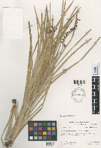 Mariscus societensis John W. Moore 620079[1001788]Moore, John W. 1351926-09-25 French Polynesia, Society Islands, Raiatea, East path to Mt. Temehani, -16.823374 -151.433407, 320m |
1
Page 1, records 1-5 of 5
Google Map
Google Maps is a web mapping service provided by Google that features a map that users can pan (by dragging the mouse) and zoom (by using the mouse wheel). Collection points are displayed as colored markers that when clicked on, displays the full information for that collection. When multiple species are queried (separated by semi-colons), different colored markers denote each individual species.