University of Minnesota
http://www.umn.edu/
612-625-5000
http://www.umn.edu/
612-625-5000
Minnesota Biodiversity Atlas
Bell Museum
Dataset: MIN-Plants
Taxa: Melilotus
Search Criteria: excluding cultivated/captive occurrences
Bell Museum plants | |
 MIN:Plants | 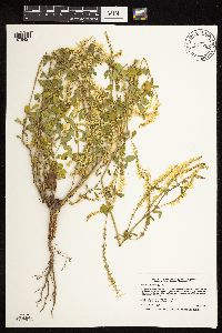 Melilotus officinalis (L.) Lamarck 913786[1078427]Smith, Welby 227391993-07-02 United States, Minnesota, Becker, Dunton County Park. Becker County... In Dunton County Park, about 3 miles southwest of Detroit Lakes...Muskrat Lake...T138N R41W SE1/4 of NE1/4 of Sec 8. 138N 41W 8, 46.7825 -95.8816667 |
MIN:Plants | 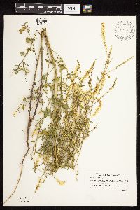 Melilotus officinalis (L.) Lamarck 911305[1078494]Smith, Welby 247001994-07-13 United States, Minnesota, Polk, Polk County...About 5 miles southwest of Erskine...along CSAH 41...T 148N R 43W NE1/4 of NW1/4 of Sec 25;;148N;43W;25, 47.6094444 -96.0797222 |
MIN:Plants | 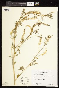 Melilotus officinalis (L.) Lamarck 479991[1078433]Wheeler, Gerald 189751998-06-09 United States, Minnesota, Carver, Carver Co.; Ca. 2.5 mi. E of East Union on Rte. 50, S of road; E1/2 NE1/4 Sec. 6 T114N R23W;;114N;23W;6, 44.710544 -93.6337396 |
MIN:Plants | 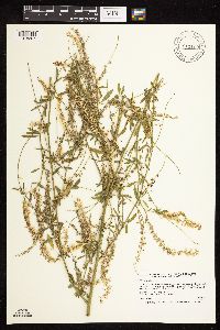 Melilotus alba Medikus 911169[1078207]Smith, Welby 218421992-09-03 United States, Minnesota, Watonwan, Watonwan County...At the public access on the north side of Fedji Lake, about 2 miles northeast of Madelia...T 107N R 30W SW1/4 of SW1/4 of Sec 12. 107N 30W 12, 44.0816667 -94.3880556 |
MIN:Plants | 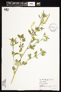 Melilotus officinalis (L.) Lamarck 491632[1078426]Bosch, T. 392001-06-17 United States, Minnesota, Big Stone, Approx. 0.5 mile east of Hwy.75 and 2 miles south of Hwy.7. Sec.1-2;;120N;45W;, 45.2324999 -96.2365357 |
MIN:Plants | 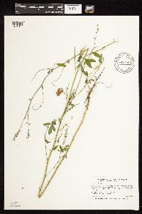 Melilotus alba Medikus 915938[1078183]Smith, Welby 251741994-08-18 United States, Minnesota, Beltrami, Lake Bemidji State Park. Beltrami County...On the northeast side of Lake Bemidji, in Lake Bemidji State Park...T147 N R 33W SW1/4 of NE1/4 of Sec 23. 147N 33W 23, 47.5347222 -94.8311111 |
MIN:Plants | 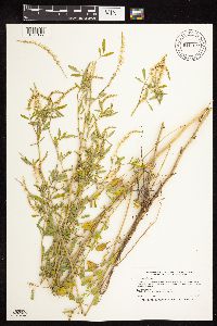 Melilotus alba Medikus 910972[1078177]Smith, Welby 246991994-07-13 United States, Minnesota, Polk, Polk County...About 5 miles southwest of Erskine...along CSAH 41...T 148N R 43W NE1/4 of NW1/4 of Sec 25;;148N;43W;25, 47.6094444 -96.0797222 |
MIN:Plants | 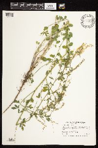 Melilotus officinalis (L.) Lamarck 913698[1078429]Smith, Welby 243951994-06-14 United States, Minnesota, Chippewa, Chippewa County... In the Minnesota Valley about 2 miles northwest of Granite Falls... T116N R39W SW1/4 of SW1/4 of Sec 21.. 116N 39W 21, 44.8361111 -95.5636111 |
MIN:Plants | 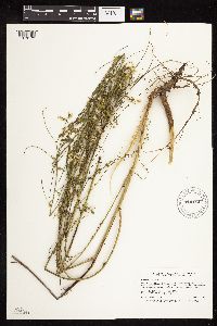 Melilotus alba Medikus 914164[1078173]Smith, Welby 254511994-09-08 United States, Minnesota, Beltrami, Beltrami County...At the Waskish Municipal Campground...between Hwy 72 and adjacent pine forest...T 154N R 30W SE1/4 of NE1/4 of sec 8. 154N 30W 8, 48.1722222 -94.5116667 |
MIN:Plants | 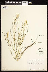 Melilotus officinalis (L.) Lamarck 539943[1078493]Tester, John s.n.1957-08-13 United States, Minnesota, Mahnomen, 3-4 miles W and 1 mile S of Waubun;Waubun Prairie Wildlife Management Area / White Earth Indian Reservation;143N;42W;33, 47.1589 -96.00743 |
MIN:Plants | 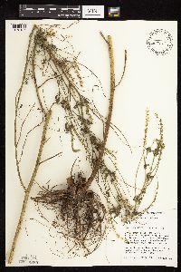 Melilotus alba Medikus 474261[1078187]Schik, K. 95-701995-08-17 United States, Minnesota, Polk, Polk Co.; T149N R43W NW1/4 of the NE1/4 of S16; Mentor Wildlife Management Area.;Mentor Wildlife Management Area;149N;43W;16, 47.7233128 -96.169862 |
MIN:Plants | 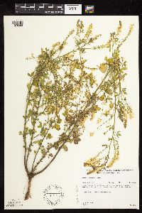 Melilotus officinalis (L.) Lamarck 432207[1078363]Gerdes, Lynden 35511999-07-10 United States, Minnesota, Cook, Superior National Forest. T65N R04W S26. Cook County...Superior National Forest. Old gravel pit/slash burning area; approximately .25 mile north of the Gunflint Trail (Cty. 12) & FR1347 junction; east off FR1347.. 065N 04W 26, 48.0844972 -90.8037529 |
MIN:Plants |  Melilotus alba Medikus 488213[1078174]Smith, Welby 157391989-07-17 United States, Minnesota, Benton, Benton County ... Benlacs State Wildlife Management Area, about 7 miles SE of Foley... SE1/4 SE1/4 section 12, T36N R28W;Benlacs Wildlife Management Area;036N;28W;12, 45.6258528 -93.7706844 |
MIN:Plants |  Melilotus officinalis (L.) Lamarck 912149[1078430]Smith, Welby 230561993-07-21 United States, Minnesota, Meeker, Meeker County... On the south side of T.H. 12; about 2 miles southeast of Darwin... T119N R30W NW1/4 of SE1/4 of Sec 25;;119N;30W;25, 45.0872222 -94.3916667 |
MIN:Plants |  Melilotus alba Medikus 794784[1078158]Schaaf, J. 1851982-07-30 United States, Nevada, Pershing, Pershing Co. ... Rye Patch Reservoir, Humboldt River bank, 1268m |
MIN:Plants |  Melilotus officinalis (L.) Lamarck 912129[1078469]Smith, Welby 228471993-07-14 United States, Minnesota, Sibley, Vale Wildlife Management Area. Sibley County... Vale State Wildlife Management Area; ca 2.5 miles N-NW of Henderson; in the valley of High Island... Creek, ca 2.5 miles SW of its confluence with the Minn R... T113N R26W NE1/4 of SW1/4 of Sec 27. 113N 26W 27, 44.5625 -93.9427778 |
MIN:Plants |  Melilotus officinalis (L.) Lamarck 438085[1078425]Smith, Welby 168761990-06-18 United States, Minnesota, Waseca, Goose Lake County Park. Waseca County ... Goose Lake County Park, at the southwest end of Goose Lake, about 2 miles east of Waseca ... T107N R22W NW 1/4 of SW 1/4 of Sec 14. 107N 22W 14, 44.0705556 -93.4436111 |
MIN:Plants | 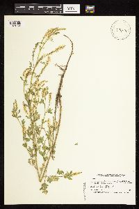 Melilotus alba Medikus 107668[1078159]Smith, Welby 208621992-07-15 United States, Minnesota, Marshall, Marshall Co.; About 9 miles south-southwest of Strandquist; T 156N R 46W SW1/4 of SE1/4 of Sec 1;;156N;46W;1, 48.3572235 -96.5080566 |
MIN:Plants | 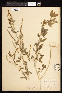 Melilotus alba Medikus 141005[1078268]Manning, Sara s.n.1897-08-14 United States, Minnesota, Wabasha, Lake City;;N;;, 44.449412 -92.266844 |
MIN:Plants | 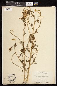 Melilotus alba Medikus 141006[1078319]Skinner, S. 2941902-00-00 United States, Minnesota, Jackson, Heron Lake Region;;N;;, 43.793292 -95.291942 |
MIN:Plants | 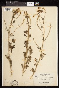 Melilotus alba Medikus 141007[1078317]Skinner, S. 2841902-07-03 United States, Minnesota, Jackson, Sand pit along old beach. Heron Lake Region.;;N;;, 43.786105 -95.281299 |
MIN:Plants | 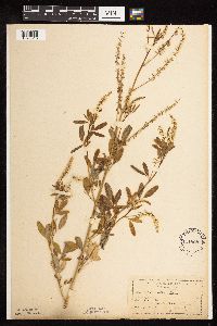 Melilotus alba Medikus 141008[1078318]Moyer, Lycurgus s.n.1893-07-00 United States, Minnesota, Chippewa, Rosewood, Chippewa Co.;;118N;40W;, 45.022809 -95.676 |
MIN:Plants | 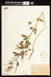 Melilotus alba Medikus 141009[1078307]Sheldon, Edmund S9991891-07-00 United States, Minnesota, Brown, Sleepy Eye;;110N;32W;, 44.299394 -94.725867 |
MIN:Plants | 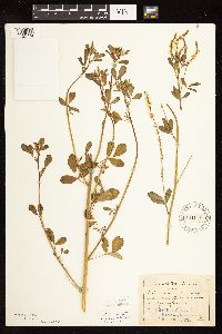 Melilotus alba Medikus 141010[1122774]Aiton, G. s.n.1889-06-00 United States, Minnesota, Hennepin, Campus [U of MN];;N;;, 44.973325 -93.23241 |
MIN:Plants | 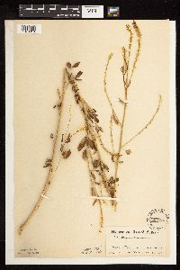 Melilotus alba Medikus 141011[1078316]Aiton, G. 20681902-07-14 United States, Minnesota, Olmsted, Rochester;;106N;14W;00, 44.036442 -92.482259 |
MIN:Plants | 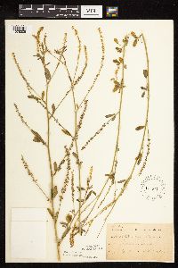 Melilotus alba Medikus 141012[1078305]Ballard, C. B7481891-07-00 United States, Minnesota, Carver, Waconia;;116N;25W;, 44.844832 -93.796865 |
MIN:Plants | 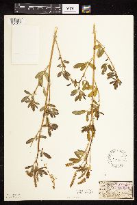 Melilotus alba Medikus 141013[1078261]Sandberg, John s.n.1881-06-00 United States, Minnesota, Goodhue, Cannon Falls;;N;;, 44.513032 -92.905827 |
MIN:Plants | 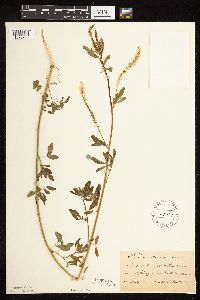 Melilotus alba Medikus 141014[1078236]Ballard, C. B5531891-07-00 United States, Minnesota, Scott, Spring Lake, Scott Co.;;114N;22W;, 44.700698 -93.473879 |
MIN:Plants | 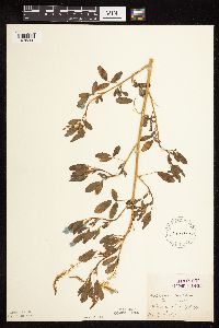 Melilotus alba Medikus 141015[1078290]Herrick, C. 41-91877-07-07 United States, Minnesota, Hennepin, Minneapolis;;N;;, 44.970736 -93.268643 |
MIN:Plants | 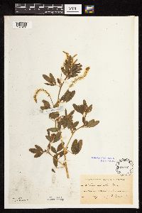 Melilotus alba Medikus 141016[1078297]Kassube, J. s.n.1877-00-00 United States, Minnesota, Hennepin, Minneapolis;;N;;, 44.970736 -93.268643 |
MIN:Plants | 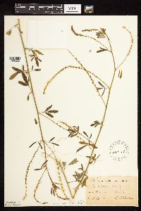 Melilotus alba Medikus 141017[1078239]Ballard, C. B7641891-07-00 United States, Minnesota, Carver, Waconia;;116N;25W;, 44.844832 -93.796865 |
MIN:Plants | 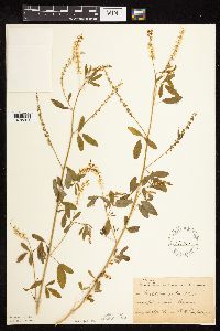 Melilotus alba Medikus 141018[1078301]Taylor, B. T9261891-07-00 United States, Minnesota, Pope, Glenwood;;N;;, 45.652639 -95.382892 |
MIN:Plants | 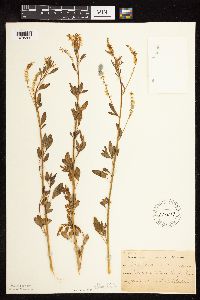 Melilotus alba Medikus 141019[1078302]Sheldon, Edmund S4231891-06-00 United States, Minnesota, Blue Earth, Ash Lake;;N;;, 43.91778 -93.798896 |
MIN:Plants |  Melilotus alba Medikus 264095[1078189]Holzinger, John s.n.1901-07-00 United States, Minnesota, Winona, Winona Co.;;N;;, 43.978945 -91.713211 |
MIN:Plants |  Melilotus alba Medikus 265362[1078199]Goldsmith, G. G451912-00-00 United States, Minnesota, Rice, Northfield;;N;;, 44.4496671 -93.1708471 |
MIN:Plants |  Melilotus alba Medikus 289651[1078224]Moyle, J. 8321933-07-13 United States, Minnesota, Clearwater, Itasca Park. Iron Springs.;Itasca State Park;143N;36W;, 47.193725 -95.23355 |
MIN:Plants |  Melilotus alba Medikus 306955[1078296]Cottrell, R. s.n.1935-08-10 United States, Minnesota, Anoka, Fridley;;030N;24W;, 45.079531 -93.266372 |
MIN:Plants |  Melilotus alba Medikus 333536[1122780]Oestlund, O. 128-31888-08-10 United States, Minnesota, Hennepin, Minneapolis;;N;;, 44.970736 -93.268643 |
MIN:Plants |  Melilotus alba Medikus 337569[1078292]Lakela, Olga 15241936-07-17 United States, Minnesota, Saint Louis, At the end of the pine ridge, Sec. 19, R14 [R13?], T49, Duluth.;Minnesota Point;049N;13W;19, 46.7190518 -92.1617478 |
MIN:Plants | 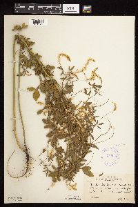 Melilotus alba Medikus 347112[1078230]Moyle, J. 31461938-07-13 United States, Minnesota, Jackson, Shore of Round Lake near Worthington.;;N;;, 43.559383 -95.434306 |
MIN:Plants | 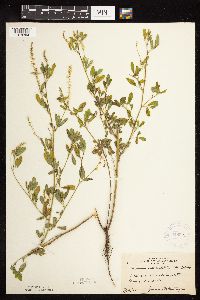 Melilotus alba Medikus 348225[1078304]McCartney, James 701938-07-14 United States, Minnesota, Scott, Hwy. 5 and Grass [sic =Geis] Lake.;;114N;23W;00, 44.688577 -93.546512 |
MIN:Plants | 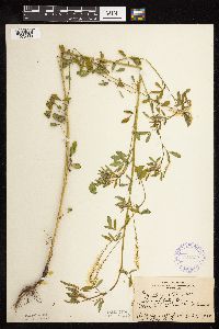 Melilotus alba Medikus 348332[1078309]Buell, Murray; Gordon, William 17961938-07-05 United States, Minnesota, Clearwater, Shore of Lake Itasca, Itasca Park.;Itasca State Park;143N;36W;, 47.214936 -95.19806 |
MIN:Plants | 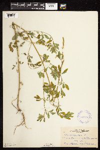 Melilotus alba Medikus 349728[1078291]Hedman, H. 361938-07-00 United States, Minnesota, Hennepin, N shore of Brown's Bay, Lake Minnetonka;;N;;, 44.959273 -93.54689 |
MIN:Plants | 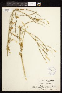 Melilotus alba Medikus 353351[1078286]Moyle, J. 13741934-07-14 United States, Minnesota, Becker, Ponsford Prairie;;N;;, 46.961057 -95.383919 |
MIN:Plants | 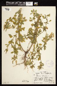 Melilotus alba Medikus 366931[1078196]Moore, John; Moore, Marjorie 102121938-06-26 United States, Minnesota, Dakota, 1/4 mi. W of Fifth Ave. and just S of Church St, South St. Paul.;;028N;23W;, 44.873603 -93.035331 |
MIN:Plants |  Melilotus alba Medikus 383778[1078311]Moore, John; Hall, Robert 160751943-09-05 United States, Minnesota, Lake, Two Harbors;North Shore;052N;11W;01, 47.01954 -91.67918 |
MIN:Plants | 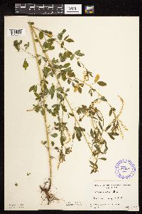 Melilotus alba Medikus 387228[1078310]Linnaean Club, U of M, 2921943-07-10 United States, Minnesota, Rice, Nerstrand Woods. Rice Co. Roadside on way to falls.;Nerstrand Woods State Park;110N;19W;, 44.344855 -93.106783 |
MIN:Plants | 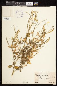 Melilotus alba Medikus 395111[1078293]Butters, F.; Abbe, E. 9311944-08-04 United States, Minnesota, Cook, Along roadside, S of Loon Lake. T65N, R3W.;Boundary Waters Canoe Area Wilderness / Superior National Forest;065N;03W;, 48.066549 -90.685529 |
MIN:Plants | 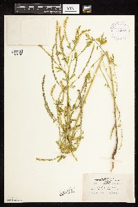 Melilotus alba Medikus 419580[1078192]Lakela, Olga 109571950-07-29 United States, Minnesota, Saint Louis, Duluth Airport, Duluth;;N;;, 46.838488 -92.18005 |
MIN:Plants | 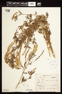 Melilotus alba Medikus 424037[1078308]Emanuel, J. 1041946-06-28 United States, Minnesota, Itasca, County: Itasca. Locality: Nashwauk Township;;057N;22W;00, 47.40917 -93.195 |
MIN:Plants | 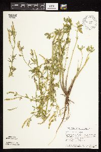 Melilotus alba Medikus 427409[1078201]Smith, Welby 143641988-06-30 United States, Minnesota, Nobles, Nobles Co. About 2 mi SW of Worthington; on the right-of-way of the C&NW Railroad; SW1/4 SE1/4 sec.32, T102N R40W;;102N;40W;32, 43.5877762 -95.6616669 |
MIN:Plants |  Melilotus alba Medikus 430148[1078164]Haferman, J. 1341995-07-22 United States, Minnesota, Scott, Scott Co. T115N R22W S36 SW of SW. Approx. 0.1 mi N-NE of intersection of State Hwy.13 and Co. Road 44 on N side of high Scott Co. T115N R22W S36 SW of SW. Approx. 0.1 mi N-NE of intersection of State Hwy.13 and Co. Road 44 on N side of highway.. 115N 22W 36, 44.7245862 -93.4090306 |
MIN:Plants |  Melilotus alba Medikus 449293[1078267]Moore, John; et al. 174361945-06-28 United States, Minnesota, Kanabec, Kanabec Co. 1 1/2 mi E of Mora;;039N;23W;, 45.876899 -93.262639 |
MIN:Plants | 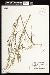 Melilotus alba Medikus 455818[1078167]Smith, Welby 192921991-07-09 United States, Minnesota, Koochiching, Pine Island State Forest. Koochiching County...About 5 miles southwest of Big Falls. Along Hickes Ridge Road, about 0.5 mile north of US Highway 71. Abandonded gravel pit...T 154N R 25W NE1/4 of SW1/4 of Sec 30. 154N 25W 30, 48.1272222 -93.8975 |
MIN:Plants | 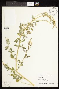 Melilotus alba Medikus 456699[1078170]Nation, R. 94-1001994-06-21 United States, Minnesota, Mower, Lake Louise State Park. Mower Co.; Tract #13N. T101N R14W NE1/4 of SE1/4 of Sec.21;Lake Louise State Park;101N;14W;21, 43.5365784 -92.5190432 |
MIN:Plants | 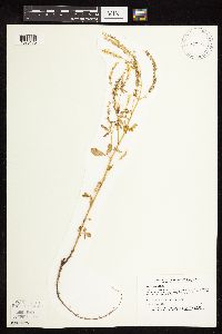 Melilotus alba Medikus 457052[1078175]Puchalski, L. 1601993-07-07 United States, Minnesota, Polk, Polk Co.; Polk WMA. App. 1/3 mi. west of entrance to WMA; T 149N R 41W NW1/4 of SW1/4 of Sec 29;Polk Wildlife Management Area;149N;41W;29, 47.695262 -95.9340953 |
MIN:Plants | 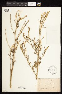 Melilotus alba Medikus 457978[1078269]Manning, Sara s.n.1884-07-10 United States, Minnesota, Goodhue, Central Point [pioneer town on Sand Point, Lake Pepin];Frontenac State Park;112N;13W;12, 44.51982 -92.31912 |
MIN:Plants | 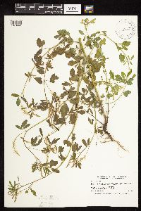 Melilotus alba Medikus 459123[1078243]Smith, Welby 170621990-06-27 United States, Minnesota, Martin, Luedtke Wildlife Management Area. Martin Co.; Luedtke State Wildlife Management Area, about 4 miles S-SE of Granada; Martin Co.; Luedtke State Wildlife Management Area, about 4 miles S-SE of Granada; T102N R29W SW1/4 of NW1/4 of Sec 15. 102N 29W 15, 43.6397209 -94.4313889 |
MIN:Plants | 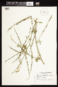 Melilotus alba Medikus 475911[1078161]Smith, Welby 196831991-07-18 United States, Minnesota, Roseau, Roseau Co.; In Warroad, boat landing on Lake of the Woods (muskeg Bay); T 163N R 36W SE Roseau Co.; In Warroad, boat landing on Lake of the Woods (muskeg Bay); T 163N R 36W SE1/4 of SW1/4 of sec 28. 163N 36W 28, 48.9055557 -95.3016663 |
MIN:Plants | 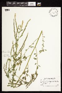 Melilotus alba Medikus 504909[1078240]Smith, Welby 179161990-08-08 United States, Minnesota, Pennington, Pennington Co.; at the SE end of the town of St. Hilaire; Red Lake River; T152N R43W SE1 Pennington Co.; at the SE end of the town of St. Hilaire; Red Lake River; T152N R43W SE1/4 of SE1/4 of SEc 6. 152N 43W 6, 48.0077782 -96.2050018 |
MIN:Plants | 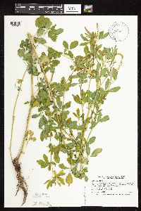 Melilotus alba Medikus 514307[1078160]Smith, Welby 189741991-06-25 United States, Minnesota, Todd, Grey Eagle Wildlife Management Area. Todd Co.; Grey Eagle State Wildlife Management Area, about 3 miles W of Grey Eagle; Todd Co.; Grey Eagle State Wildlife Management Area, about 3 miles W of Grey Eagle; T127N R33W SW1/4 of SE1/4 of sec 10. 127N 33W 10, 45.8191681 -94.815834 |
MIN:Plants | 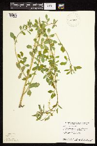 Melilotus alba Medikus 514330[1078202]Smith, Welby 155291989-06-30 United States, Minnesota, Chisago, Chisago Co.; Interstate State Park, about one mile south of Taylors Falls; SW1/4 NW1/4 section 36, T 34N R 19W;Interstate State Park;034N;19W;36, 45.3952789 -92.6688919 |
MIN:Plants | 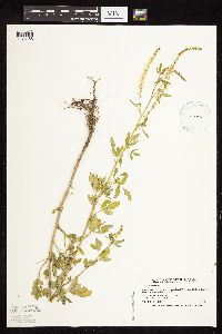 Melilotus alba Medikus 514724[1078168]Smith, Welby 193511991-07-09 United States, Minnesota, Koochiching, Koochiching County...at the SW corner of the intersection of TH 11 and CSAH 1, about 19 miles W of International Falls...T70N R26W NE1/4 of SW1/4 of sec 31. 070N 26W 31, 48.5119444 -93.7338889 |
MIN:Plants | 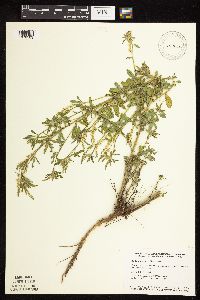 Melilotus alba Medikus 514903[1078203]Smith, Welby 155421989-07-04 United States, Minnesota, Freeborn, Carex Wildlife Management Area. Freeborn County...'Carex' State Wildlife Management Area, about 7 miles east-southeast of Hollandale; NW1/4 NW1/4 section 23, T 103N 19W. 103N 19W 23, 43.7155556 -93.0866667 |
MIN:Plants | 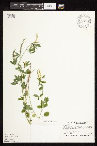 Melilotus alba Medikus 515558[1078166]Smith, Welby 196241991-07-17 United States, Minnesota, Itasca, Itasca Co.; Scenic State Park, about 3 miles southeast of Big Fork; T 60N R 26W NE1/4 of NE1/4 of Sec 1;Scenic State Park;060N;26W;1, 47.7213898 -93.5805588 |
MIN:Plants | 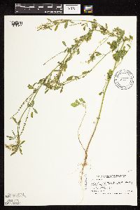 Melilotus alba Medikus 520096[1078165]Smith, Welby 195591991-07-16 United States, Minnesota, Koochiching, Koochiching County...on the N side of TH 65, about 18 mi NW of Silverdale...T65N R24W SE1/4 of NE1/4 of Sec 3;Koochiching State Forest;065N;24W;03, 48.1500015 -93.4186096 |
MIN:Plants | 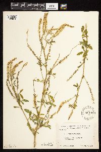 Melilotus alba Medikus 526453[1078314]Moore, John 211591951-08-06 United States, Minnesota, Clay, 1 mi. S of Barnesville;;N;;, 46.627332 -96.41979 |
MIN:Plants | 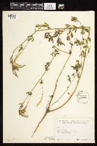 Melilotus alba Medikus 541475[1078228]Scharf, J. s.n.1956-07-20 United States, Minnesota, Murray, Chandler Marsh. 1 mi. NE of Chandler.;Chandler Marsh Wildlife Management Area;106N;42W;, 43.938755 -95.93714 |
MIN:Plants | 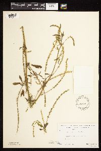 Melilotus alba Medikus 543305[1078188]Lakela, Olga; Davidson, Donald 216461957-07-25 United States, Minnesota, Lake, Lake County...Tomahawk Trail, Phoebe River Area.;Boundary Waters Canoe Area Wilderness / Superior National Forest;063N;06W;00, 47.9332192 -91.0879206 |
MIN:Plants | 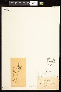 Melilotus alba Medikus 548931[1122779]Pease, T. s.n.1888-08-24 United States, Minnesota, Anoka, [no further data];;N;;, 45.198637 -93.238648 |
MIN:Plants | 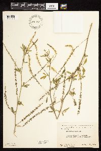 Melilotus alba Medikus 550219[1078315]Moore, John; et al. 222521954-09-21 United States, Minnesota, Pipestone, Pipestone County...2 miles southeast of Edgerton;;105N;44W;, 43.854578 -96.102449 |
MIN:Plants | 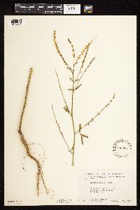 Melilotus alba Medikus 550243[1078221]Moore, John; et al. 222631954-09-22 United States, Minnesota, Lincoln, Lincoln County...Island at NE end of Lake Benton;;110N;45W;25, 44.3067591 -96.2107243 |
MIN:Plants | 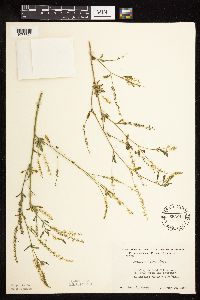 Melilotus alba Medikus 553811[1078320]Moore, John 225951955-07-26 United States, Minnesota, Clay, Clay County...across the road from the entrance to Buffalo River State Park.;;139N;46W;10, 46.8693271 -96.4734276 |
MIN:Plants | 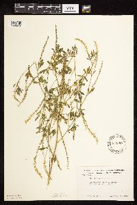 Melilotus alba Medikus 553990[1078298]Moore, John 226381955-07-26 United States, Minnesota, Norman, 1/2 mi. S of Syre;;N;;, 47.173002 -96.258671 |
MIN:Plants | 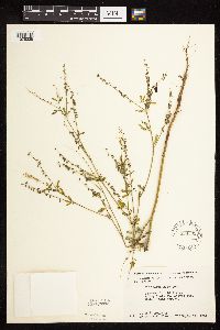 Melilotus alba Medikus 558535[1078235]Moore, John; Moore, Marjorie 235391957-09-19 United States, Minnesota, Isanti, NW1/4 Sec. 16, Athen Twp, Cedar Creek Forest.;Cedar Creek National History Area;034N;23W;16, 45.4357238 -93.2148194 |
MIN:Plants | 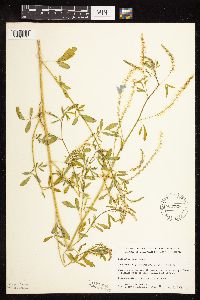 Melilotus alba Medikus 560729[1078313]Ownbey, Gerald; Anderson, Henry 27901959-07-09 United States, Minnesota, Clearwater, SE1/4 Sec. 27, T144N, R36W. Point where Hwy. 92 crosses the Mississippi River, 0.6 mi. W of Lake Itasca Post Office.;;144N;36W;27, 47.2607098 -95.2228712 |
MIN:Plants | 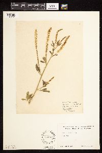 Melilotus alba Medikus 564442[1078232]Rhone, R. s.n.1940-07-12 United States, Minnesota, Ramsey, St. Paul;;;;, 44.957171 -93.092163 |
MIN:Plants | 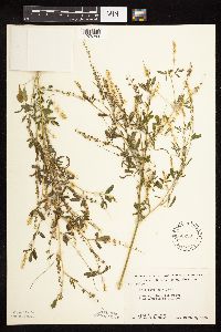 Melilotus alba Medikus 566239[1078289]Moore, John; Heig, V. 240301958-09-09 United States, Minnesota, Kittson, 1 mi. N of Hallock;;N;;, 48.798171 -96.944387 |
MIN:Plants | 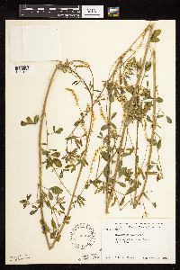 Melilotus alba Medikus 566646[1078190]Moore, John 239101958-06-14 United States, Minnesota, Kittson, Along the river at Hallock;;N;;, 48.774671 -97.144066 |
MIN:Plants | 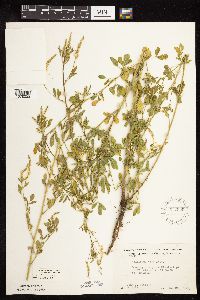 Melilotus alba Medikus 572800[1078303]Moore, John; Baker, Gary 254711961-06-21 United States, Minnesota, Houston, Along the Mississippi River Road, 2 1/2 mi. N of New Albin;Dorer Memorial Hardwood State Forest;101N;04W;, 43.535961 -91.28191 |
MIN:Plants | 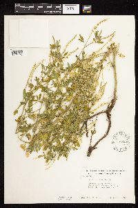 Melilotus alba Medikus 572855[1078198]Moore, John 255571961-07-06 United States, Minnesota, Anoka, Cedar Creek Natural History Area Laboratory grounds.;Cedar Creek National History Area;034N;23W;, 45.409893 -93.197006 |
MIN:Plants | 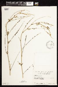 Melilotus alba Medikus 574954[1078299]Wertman, Freida 2831960-08-21 United States, Minnesota, Anoka, Fish Lake, W side. Sec. 26, Co. Rd. 76; Athens Twp.;Cedar Creek National History Area;034N;23W;26, 45.3193726 -93.1740249 |
MIN:Plants |  Melilotus alba Medikus 583925[1078191]Gunderson, R. 4191961-07-18 United States, Minnesota, Washington, Saint Croix National Riverway. Washington County ... St. Croix River, 3 mi. N of Stillwater. Washington Co.; St. Croix River, 3 mi. N of Stillwater.. 030N 20W , 45.109007 -92.762096 |
MIN:Plants |  Melilotus alba Medikus 592293[1078200]Westkaemper, Remberta s.n.1964-07-00 United States, Minnesota, Stearns, Stearns Co. St. Joseph, St. Benedict College campus.;;124N;29W;, 45.580034 -94.393284 |
MIN:Plants |  Melilotus alba Medikus 595351[1078231]Cahoon, E. 671956-07-08 United States, Minnesota, Brown, Och's Clay Pit ca. 1 mi. SW of Springfield.;;N;;, 44.223217 -95.008622 |
MIN:Plants |  Melilotus alba Medikus 607278[1078197]Grafstrom, M. 781968-08-01 United States, Minnesota, Hubbard, Itasca post office and 1 mi. S on sandy road edge.;;N;;, 47.189095 -95.165318 |
MIN:Plants |  Melilotus alba Medikus 616692[1078260]Moore, John; Moore, Marjorie 2051969-07-01 United States, Minnesota, Crow Wing, Crow Wing Natural History Area. Near the gate, E of Chandler Lake, SW1/4 Sec. 22, Garrison Twp.;Crow Wing Natural Area;044N;28W;22, 46.2789902 -93.8633363 |
MIN:Plants |  Melilotus alba Medikus 670630[1078285]Heitlinger, M. 3821971-09-10 United States, Minnesota, McLeod, Schaefer Prairie, The Nature Conservancy. Schaefer Prairie: SE1/4 of Sec. 34, T115N, R29W. W facing slope near boundary between prairie an old field, W of the p Schaefer Prairie: SE1/4 of Sec. 34, T115N, R29W. W facing slope near boundary between prairie an old field, W of the prominent N-S ridge.. 115N 29W 34, 44.7250496 -94.3049103 |
MIN:Plants |  Melilotus alba Medikus 685199[1078233]Stassen, Carol 761977-06-14 United States, Minnesota, Lyon, Camden State Park; T110N, R42W, Sec. 5. Along abandoned grael pit and park entrance road.;Camden State Park;110N;42W;5, 44.3631806 -95.9274434 |
MIN:Plants | 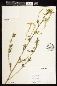 Melilotus alba Medikus 687223[1078312]Wheeler, Gerald; Glaser, Paul 16511977-06-20 United States, Minnesota, Itasca, Site 37. SE1/4 SE1/4 Sec. 20, T55N, R26W. ca. 5.5 mi. W of Grand Rapids.;;055N;26W;20, 47.2325665 -93.6706029 |
MIN:Plants | 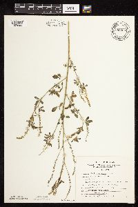 Melilotus alba Medikus 689269[1078306]Christgau, C. s.n.1923-10-01 United States, Minnesota, Hennepin, Mississippi River bank at Minneapolis;;N;;, 44.986764 -93.267956 |
MIN:Plants | 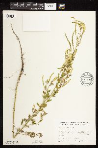 Melilotus alba Medikus 690565[1078300]Siemers, Ross 641977-07-13 United States, Minnesota, Stearns, Stearns Co. Roscoe Prairie. 2 mi SW of Roscoe on Hwy. 16. Near the road. T123N, R32W Sec. 35.;Roscoe Prairie Scientific Natural Area;123N;32W;35, 45.4195202 -94.6709243 |
MIN:Plants | 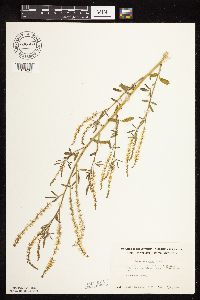 Melilotus alba Medikus 696580[1078234]Smith, Welby 6361978-08-12 United States, Minnesota, Wright, Wright Co.; T121N, R27W, SW1/4 Sec. 9. Between Hwy. 24 and Clearwater Lake.;;121N;27W;9, 45.301274 -94.091615 |
MIN:Plants | 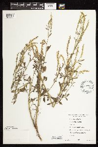 Melilotus alba Medikus 698907[1078266]Sather, Nancy; et al. 2551976-07-15 United States, Minnesota, Saint Louis, Along parking area Norway Pt. SW1/4 NW1/4 SE1/4 Sec. 8 T57N, R14W.;Superior National Forest;57N;14W;08, 47.4367699 -92.1442241 |
MIN:Plants | 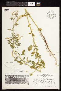 Melilotus alba Medikus 699625[1078288]Ziegler, S. 2201974-06-29 United States, Minnesota, Houston, Upper Mississippi National Wildlife Refuge. Mississippi River Navigation Pool #8. Island 12; Mississippi River mile 690.5; T103N, R4W, Sec. 13. Island on W side o Mississippi River Navigation Pool #8. Island 12; Mississippi River mile 690.5; T103N, R4W, Sec. 13. Island on W side of main channel. N end of the island.. 103N 04W 13, 43.822175 -91.264892 |
MIN:Plants | 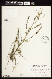 Melilotus alba Medikus 710007[1078225]Wheeler, Gerald 50371979-10-06 United States, Minnesota, Le Sueur, Le Sueur Co. Approx. 1 mi SW of Kasota; overlooking the Minnesota River. High Lime Prairie. T109N, R26, Sec. 6;East Minnesota River Wildlife Management Area;109N;26W;6, 44.3626183 -93.939379 |
MIN:Plants | 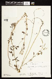 Melilotus alba Medikus 715228[1078262]Severson, M.; et al. 721979-07-23 United States, Minnesota, Polk, 4.5 mi. S of Fischer, W1/2 of NW1/4 of Sec. 16;Malmberg Prairie Scientific Natural Area;149N;48W;16, 47.7241699 -96.8139653 |
MIN:Plants | 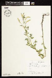 Melilotus alba Medikus 715482[1078264]Ottoson, S. 541979-07-04 United States, Minnesota, Clay, Blazing Star Prairie: (TNC) 4 mi. SE of Felton, NE1/4 Sec. 5, T141N, R45W.;Felton Prairie-Blazing Star Prairie Scientific Natural Area;141N;45W;5, 47.0567136 -96.4173556 |
MIN:Plants | 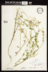 Melilotus alba Medikus 716995[1078263]Heitlinger, M. 7601975-07-08 United States, Minnesota, Anoka, Anoka Co. Allison Savanna. N1/2 of NE1/4 of Sec. 2, T33N, R23W. (TNC);Helen Allison Savanna Scientific Natural Area;033N;23W;2, 45.3777015 -93.1738785 |
MIN:Plants | 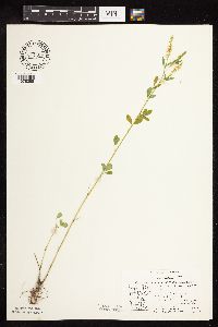 Melilotus alba Medikus 717504[1078265]Mathisen, Ron 1131979-07-07 United States, Minnesota, Hubbard, Spearhead Lake Reserve;Spearhead Lake Preserve (Audubon);145N;34W;, 47.372044 -94.95883 |
Google Map
Google Maps is a web mapping service provided by Google that features a map that users can pan (by dragging the mouse) and zoom (by using the mouse wheel). Collection points are displayed as colored markers that when clicked on, displays the full information for that collection. When multiple species are queried (separated by semi-colons), different colored markers denote each individual species.