University of Minnesota
http://www.umn.edu/
612-625-5000
http://www.umn.edu/
612-625-5000
Minnesota Biodiversity Atlas
Bell Museum
Dataset: MIN-Plants
Taxa: Microgramma
Search Criteria: excluding cultivated/captive occurrences
1
Page 1, records 1-11 of 11
Bell Museum plants | |
 MIN:Plants | 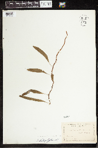 Microgramma heterophylla (L.) Wherry 53610[1342360]Curtiss, A.H. 1880-02-00 United States, Florida, South Florida, 27.44306 -81.25389 |
MIN:Plants | 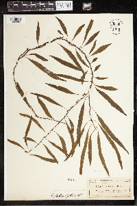 Microgramma heterophylla (L.) Wherry 53611[1342362]Curtiss, A.H. 3669A0000-02-00 United States, Florida, Key Largo, South Florida, 25.174345 -80.321417 |
MIN:Plants | 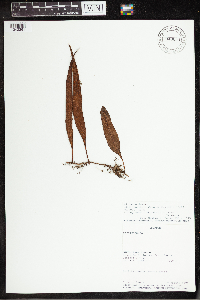 Microgramma fuscopunctata (Hook.) Vareschi 940654[1342361]Rueda, Ricardo 10641992-08-09 Ecuador, Napo, Tena Canton, Estacion Biologica Jatun Sacha, -1.066667 -77.6, 380m |
MIN:Plants | 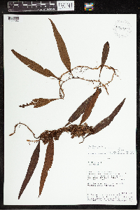 Microgramma fuscopunctata (Hook.) Vareschi 937351[1342363]Vasquez, R. 159441991-04-12 Peru, Maynas, Loreto, Las Amazonas. Quebrada Sucusari, -4.104386 -81.031573, 140m |
MIN:Plants | 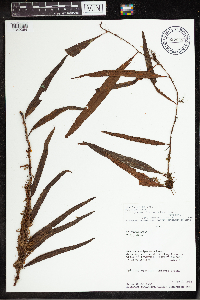 Microgramma fuscopunctata (Hook.) Vareschi 897943[1342364]Smiht, D.N. 67581984-04-04 Peru, Satipo, Junin, Gran Pajonal. E of Chequitavo on trail to Kotampaz, -10.75 -74.383333, 1200m |
MIN:Plants | 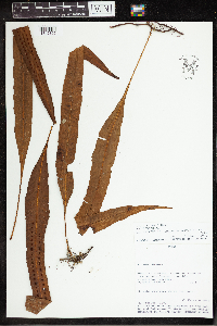 Microgramma percussa (Cav.) de la Sota 950052[1342365]Vasquez, R. 183001993-02-26 Peru, Maynas, Loreto, Indiana district. Explorama Reserve (Yanamono), -3.466667 -72.866667, 106m |
MIN:Plants | 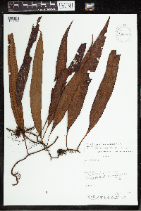 Microgramma percussa (Cav.) de la Sota 928775[1342366]Killeen, T. 43041992-06-24 Bolivia, Carrasco, Cochabamba, Valle de Salta., -17.083333 -64.666667, 288m |
MIN:Plants | 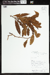 Microgramma persicariifolia (Schrad.) C. Presl 928815[1342367]Killeen, T. 39761992-05-26 Bolivia, Pando, 32 km from Sur del Rio Madre de Dios, -11.3333 -67.6667 |
MIN:Plants | 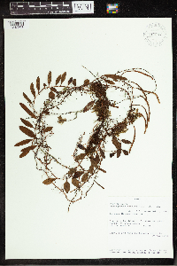 Microgramma reptans (Cav.) A.R. Sm. 910097[1342368]Hedin, Jennifer P. 291993-05-29 Peru, Maynas, Loreto, Quebrada Tamshiyacu, -4.25 -72.75, 160m |
MIN:Plants | 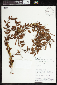 Microgramma reptans (Cav.) A.R. Sm. 485088[1342369]Vasquez, R. 162261991-05-21 Peru, Maynas, Loreto, Iquitos, Allpahuayo, -4.166667 -73.5 |
MIN:Plants | 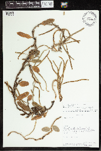 Microgramma vacciniifolia (Langsd. & Fisch.) Copel. 478181[1342370]Zardini, E. 342851992-12-16 Paraguay, Ypoa estuary, Villeta - Puerto Guyrati. 11 km S of Villeta, E of trail to Villa Olivia, -25.606689 -57.565498 |
1
Page 1, records 1-11 of 11
Google Map
Google Maps is a web mapping service provided by Google that features a map that users can pan (by dragging the mouse) and zoom (by using the mouse wheel). Collection points are displayed as colored markers that when clicked on, displays the full information for that collection. When multiple species are queried (separated by semi-colons), different colored markers denote each individual species.