University of Minnesota
http://www.umn.edu/
612-625-5000
http://www.umn.edu/
612-625-5000
Minnesota Biodiversity Atlas
Bell Museum
Dataset: MIN-Plants
Taxa: Ocotea
Search Criteria: excluding cultivated/captive occurrences
1
Page 1, records 1-5 of 5
Bell Museum plants | |
 MIN:Plants | Ocotea veraguensis NULL 939724[]P 492011-07-07 Costa Rica, Guanacaste, Liberia, , 10.84 -85.61, 320m |
MIN:Plants | 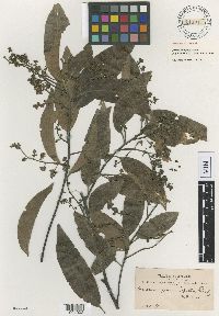 Ocotea prunifolia Rusby 116011[1001902]Bang, M. 21440000-00-00 Bolivia, [no further data] |
MIN:Plants | 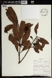 499298[1369020]Randriamampionona, Beberonn 6091993-08-09 Madagascar, Toliara: Full Reserve #11, Andohahela, Parcelle 1, SW of Eminiminy, Manatavona River. Plant preserves in alcohol; -24.666667 46.8, -24.666667 46.8, 200 - 700m |
MIN:Plants | 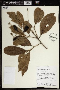 435460[1369021]van der Werff, H. 127451992-10-17 Madagascar, NW of Tolanaro (Fort Dauphin), Reserve Integrale #11 (Andohahela), parcelle I, trail following eastern boundary, -24.75 46.85, 250 - 500m |
MIN:Plants | 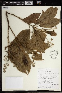 435606[1369022]Werff, H. van der 127321992-10-17 Madagascar, NW of Tolanaro (Fort Dauphin), Reserve Integrale #11 (Andohahela), parcelle I, trail following eastern boundary; -24.75 46.85, -24.75 46.85, 250 - 500m |
1
Page 1, records 1-5 of 5
Google Map
Google Maps is a web mapping service provided by Google that features a map that users can pan (by dragging the mouse) and zoom (by using the mouse wheel). Collection points are displayed as colored markers that when clicked on, displays the full information for that collection. When multiple species are queried (separated by semi-colons), different colored markers denote each individual species.