University of Minnesota
http://www.umn.edu/
612-625-5000
http://www.umn.edu/
612-625-5000
Minnesota Biodiversity Atlas
Bell Museum
Dataset: MIN-Plants
Taxa: Oxyria
Search Criteria: excluding cultivated/captive occurrences
1
Page 1, records 1-37 of 37
Bell Museum plants | |
 MIN:Plants | 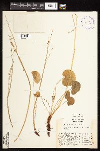 Oxyria digyna (L.) Hill 401540[1085844]Spetzman, L. 11791948-08-17 United States, Alaska, Arctic North Slope...Sadlerochit River;Arctic National Wildlife Refuge;;;, 69.5833333 -144.75, 457m |
MIN:Plants | 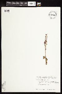 Oxyria digyna (L.) Hill 700047[1085833]Glaser, Paul 718b1974-07-28 United States, Alaska, Mt. McKinley National Park ... SW1/4SE1/4Sec. 31 T17S R13W, Highway Pass;Denali National Park;017S;13W;31, 1189m |
MIN:Plants | 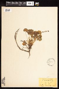 Oxyria digyna (L.) Hill 567607[1085824]Hunnewell, F. 76821921-07-31 United States, Oregon, Klamath, Crater Lake National Park; inside crater |
MIN:Plants | 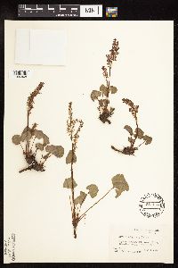 Oxyria digyna (L.) Hill 551113[1085848]Cotter, Shirley 13071950-08-01 United States, Montana, Glacier, Glacier County ... at Logan Pass, Glacier Park;Glacier National Park, 2012m |
MIN:Plants | 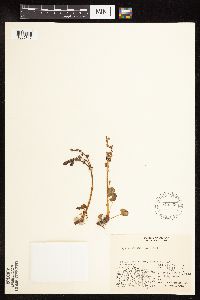 Oxyria digyna (L.) Hill 548339[1085847]Spetzman, L. 38421951-07-20 United States, Alaska, Arctic North Slope ... Katakturuk River, Ignek Valley;Arctic National Wildlife Refuge;;;, 69.5833359 -145.5833282, 610m |
MIN:Plants | 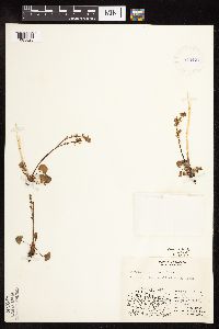 Oxyria digyna (L.) Hill 413401[1085828]Spetzman, L. 19971949-07-17 United States, Alaska, Arctic North Slope ... Kanayut Lake;Gates of the Arctic National Park;;;, 68.3333359 -151, 914m |
MIN:Plants | 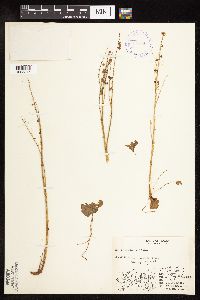 Oxyria digyna (L.) Hill 400754[1085846]Spetzman, L. 4621947-08-11 United States, Alaska, Arctic North Slope ... Shublich Springs, Canning River;Arctic National Wildlife Refuge;;;, 69.4833298 -146.1666718, 305m |
MIN:Plants | 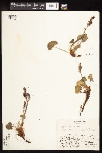 Oxyria digyna (L.) Hill 413403[1085825]Spetzman, L. 16841949-07-07 United States, Alaska, Arctic North Slope ... Anaktuvuk Pass;Gates of the Arctic National Park;;;, 68.2833333 -151.4166667, 914m |
MIN:Plants |  Oxyria digyna (L.) Hill 399488[1085840]Spetzman, L. 2271947-06-09 United States, Alaska, Shaviovik River, E. Fork;Arctic National Wildlife Refuge;;;, 69.4666672 -146.5833282 |
MIN:Plants |  Oxyria digyna (L.) Hill 101868[1085838]Elmer, A.D.E. 26851900-07-00 United States, Washington, Clallam, Olympic Mts. [Olympic National Park] |
MIN:Plants |  Oxyria digyna (L.) Hill 101854[1085837]Nelson, Aven; et al. 59181899-07-17 United States, Wyoming, Park, Yellowstone National Park ... Yancey's;Yellowstone National Park |
MIN:Plants |  Oxyria digyna (L.) Hill 298817[1085851]Umbach, L. 8341903-09-01 United States, Montana, Flathead, Sperry Glacier;Glacier National Park |
MIN:Plants |  Oxyria digyna (L.) Hill 399487[1085839]Spetzman, L. 2101947-06-09 United States, Alaska, Shaviovik River;Arctic National Wildlife Refuge;;;, 69.4666672 -146.5833282 |
MIN:Plants | 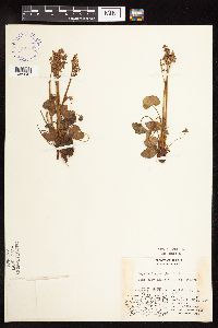 Oxyria digyna (L.) Hill 401539[1085841]Spetzman, L. 12091948-09-04 United States, Alaska, Arctic North Slope ... Barter Island;Arctic National Wildlife Refuge;;;, 70.121454 -143.67307, 3m |
MIN:Plants | 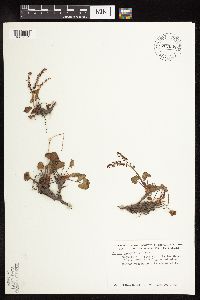 Oxyria digyna (L.) Hill 700048[1085834]Glaser, Paul 181972-06-29 United States, Alaska, Mt. McKinley National Park ... SW1/4SW1/4Sec. 35 T15S R11W, Tatler Creek;Denali National Park;015S;11W;35, 1036m |
MIN:Plants | 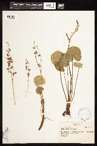 Oxyria digyna (L.) Hill 297086[1085835]Mexia, Ynes 21771928-08-01 United States, Alaska, McKinley National Park ... Near center of N. Boundary of Park. Moose Creek;Denali National Park;;;, 63.804708 -150.997714, 600m |
MIN:Plants | 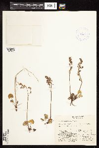 Oxyria digyna (L.) Hill 416990[1085827]Spetzman, L. 38201950-07-04 United States, Alaska, Arctic North Slope ... east side of the lake ... Kurupa Lake;Gates of the Arctic National Park;;;, 68.3666687 -154.6666718, 945m |
MIN:Plants | 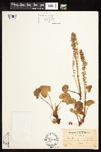 Oxyria digyna (L.) Hill 522509[1085852]Umbach, L. 8341903-09-01 United States, Montana, Flathead, Sperry Glacier;Glacier National Park |
MIN:Plants | 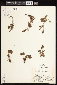 Oxyria digyna (L.) Hill 401541[1085845]Spetzman, L. 8431948-07-26 United States, Alaska, Arctic North Slope...Sadlerochit River;Arctic National Wildlife Refuge;;;, 69.4166667 -149.1666667, 762m |
MIN:Plants | 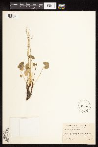 Oxyria digyna (L.) Hill 530509[1085821]Hardy, Robert 3331945-08-26 United States, Alaska, Alleutians ... on Attu Is. ... Holtz Bay, E. Arm;Aleutian Islands Wilderness;;;, 52.947222 173.191944, 15m |
MIN:Plants | 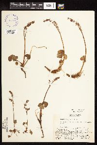 Oxyria digyna (L.) Hill 401542[1085842]Spetzman, L. 6161948-07-11 United States, Alaska, Arctic North Slope ... Lake Peters;Arctic National Wildlife Refuge;;;, 69.3333333 -145, 1067m |
MIN:Plants | 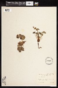 Oxyria digyna (L.) Hill 525409[1085820]Hardy, Robert 1381945-06-24 United States, Alaska, Alleutians ... on Attu Is. ... Falls Creek, Lake Nicholas.;Aleutian Islands Wilderness;;;, 52.876389 173.238056 |
MIN:Plants |  Oxyria digyna (L.) Hill 356417[1085822]West, Phebe s.n.1932-09-03 United States, Alaska, Atka, Aleutian Islands;Aleutian Islands Wilderness;;;, 52.196111 -174.20056 |
MIN:Plants | 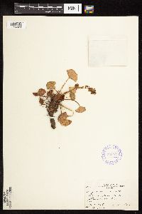 Oxyria digyna (L.) Hill 356407[1085823]West, Phebe 981932-09-03 United States, Alaska, Atka, Aleutian Islands;Aleutian Islands Wilderness;;;, 52.196111 -174.20056 |
MIN:Plants | 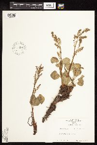 Oxyria digyna (L.) Hill 579290[1085849]Kaul, R. 16121960-07-01 United States, Montana, Glacier, Glacier National Park ... Logan Pass;Glacier National Park |
MIN:Plants | 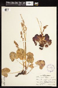 Oxyria digyna (L.) Hill 292998[1085850]Buell, Murray 10561934-09-12 United States, Montana, Glacier, Logan Pass, Glacier National Park;Glacier National Park |
MIN:Plants | 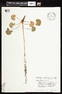 Oxyria digyna (L.) Hill 700043[1085831]Glaser, Paul 2021972-07-19 United States, Alaska, Mt. McKinley National Park ... SE1/4NW1/4Sec. 1 T17S R13W, Highway Pass;Denali National Park;017S;13W;01, 1189m |
MIN:Plants | 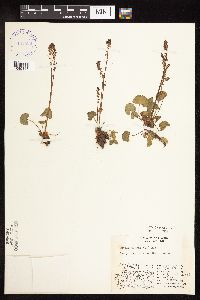 Oxyria digyna (L.) Hill 401538[1085843]Spetzman, L. 5861948-07-08 United States, Alaska, Arctic North Slope ... Lake Schrader;Arctic National Wildlife Refuge;;;, 69.4166667 -145, 914m |
MIN:Plants | 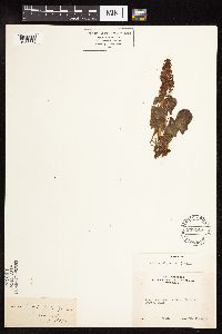 Oxyria digyna (L.) Hill 238148[1085836]Congdon, J. s.n.1894-08-15 United States, California, Tuolumne, Tioga Road, Soda Springs, Tuolumne County;Yosemite National Park |
MIN:Plants |  Oxyria digyna (L.) Hill 700046[1085832]Glaser, Paul 718c1974-07-28 United States, Alaska, Mt. McKinley National Park ... SW1/4SE1/4Sec. 31 T17S R13W, Highway Pass;Denali National Park;017S;13W;31, 1189m |
MIN:Plants |  Oxyria digyna (L.) Hill 700044[1085830]Glaser, Paul 7181974-07-28 United States, Alaska, Mt. McKinley National Park ... SW1/4SE1/4Sec. 31 T17S R13W, Highway Pass;Denali National Park;017S;13W;31, 1189m |
MIN:Plants |  Oxyria digyna (L.) Hill 413402[1085826]Lachenbruch, A. 271949-08-15 United States, Alaska, Arctic North Slope ... Killik R.;Gates of the Arctic National Park;;;, 68.25 -154, 1524m |
MIN:Plants |  Oxyria digyna (L.) Hill 700045[1085829]Glaser, Paul 2251972-07-24 United States, Alaska, Mt. McKinley National Park ... N1/2Sec. 3 T17S R14W, Bergh Lake, Highway Pass;Denali National Park;017S;14W;03, 1067m |
MIN:Plants | 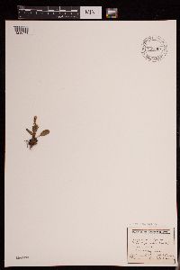 Oxyria digyna (L.) Hill 951084[1290479]Gerenday, A. s.n.1977-08-00 Canada, Northwest Territories, Baffin Island. Moonshine - Tofeness. |
MIN:Plants | 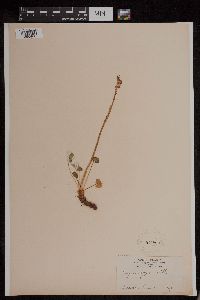 Oxyria digyna (L.) Hill 101860[1295400]Cornell Party, Peary Voyage s.n.1896-08-00 Greenland, Nugsuak Peninsula |
MIN:Plants | 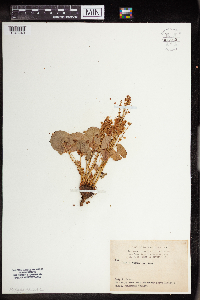 Oxyria digyna (L.) Hill 962559[1346940] United States, Colorado |
MIN:Plants | 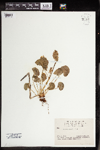 Oxyria digyna (L.) Hill 962560[1346941] United States, Colorado |
1
Page 1, records 1-37 of 37
Google Map
Google Maps is a web mapping service provided by Google that features a map that users can pan (by dragging the mouse) and zoom (by using the mouse wheel). Collection points are displayed as colored markers that when clicked on, displays the full information for that collection. When multiple species are queried (separated by semi-colons), different colored markers denote each individual species.