University of Minnesota
http://www.umn.edu/
612-625-5000
http://www.umn.edu/
612-625-5000
Minnesota Biodiversity Atlas
Bell Museum
Dataset: MIN-Plants
Taxa: Polypodium
Search Criteria: excluding cultivated/captive occurrences
Bell Museum plants | |
 MIN:Plants | 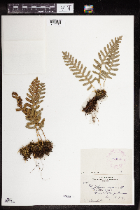 273308[1378616]Rosendahl, C. 60681929-08-14 United States, Minnesota, Cook, Grand Portage;Grand Portage Indian Reservation / North Shore;063N;06E;04, 47.979125 -89.707739 |
MIN:Plants | 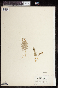 53707[1378884]Conard, Henry 2881902-07-07 United States, Washington, Grays Harbor, summit of Mt. Baldy;Olympic National Park;;;, 47.803236 -123.666112, 1219m |
MIN:Plants | 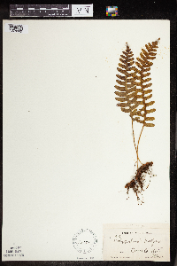 58182[1378890]Hollinshead, C. 23 United States, Wisconsin, Polk, Osceola;Saint Croix National Riverway;;;, 45.32052 -92.70493 |
MIN:Plants | 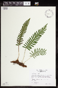 493127[1378584]Wheeler, Gerald 169081997-07-27 United States, Minnesota, Stearns, Stearns County...Ca. 3 mi. W of Cold Spring on Rte. 23; 0.5 mi. S on Frostview Road, NE of road...NE1/4 SW1/4 SW1/4 Sec. 20 T123N R30W (Wakefield 20).. 123N 30W 20, 45.455797 -94.428885 |
MIN:Plants | 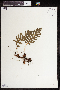 Polypodium glycyrrhiza D.C. Eaton 447039[1378766]Lawrence, Donald s.n.1953-08-19 United States, Alaska, Sebree Island.;Glacier Bay National Park;;;, 58.767611 -136.16222 |
MIN:Plants | 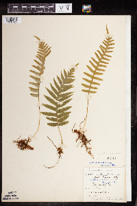 Polypodium glycyrrhiza D.C. Eaton 53711[1378762]Elmer, A.D.E. 28111900-06-00 United States, Washington, Clallam, Olympic Mts. [Olympic National Park], 47.803236 -123.666112 |
MIN:Plants | 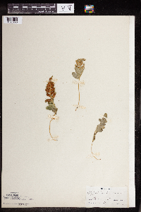 Polypodium hesperium Maxon 53705[1378790]Grant, J. s.n.1915-09-00 United States, Washington, Olympic Mts.;Olympic National Park;;;, 47.803236 -123.666112 |
MIN:Plants | 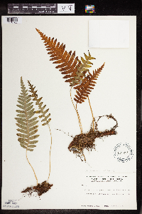 Polypodium glycyrrhiza D.C. Eaton 600231[1378765]Cooper, William 2711929-07-21 United States, Alaska, Glacier Bay, Station 21.;Glacier Bay National Park;;;, 58.802609 -136.1564 |
MIN:Plants | 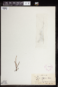 Polypodium saffordii Maxon 272919[1379418]Degener, O. H1641922-12-19 United States, Hawaii, Hawaii, Kilauea, Hawaii.;Hawaii Volcanoes National Park;;;, 19.4 -155.3 |
MIN:Plants | 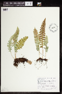 489134[1378640]Zager, S.; Dahle, R. 1261998-06-17 United States, Minnesota, Crow Wing, Crow Wing County...T137N R28W NW 1/4 of NW 1/4 of SE 1/4 of Section 17...MCBS Site CW02;;137N;28W;17, 46.6819444 -94.2472222 |
MIN:Plants | 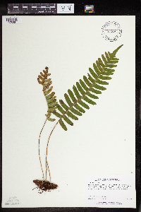 473057[1378561]Lee, Michael MDL16201997-05-06 United States, Minnesota, Wabasha, Dorer Memorial Hardwood State Forest. Wabasha Co.; Along the Zumbro River 2 miles west of Kellogg; 80ft. high river terrace overlooking Pine Slough; T110N R11W SE1/4 of SW1/4 Sec. 20. 110N 11W 20, 44.310695 -92.036044 |
MIN:Plants | 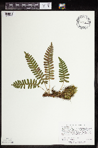 454501[1378603]Lee, Michael MDL24801999-04-28 United States, Minnesota, Winona, Dorer Memorial Hardwood State Forest. Winona County ... Along Cool ridge Creek (tributary of Pine Creek) 2-1/2 miles south-southeast of Fremont ... T105N R9W SW1/4 of SW1/4 of SW1/4 Sec. 23. 105N 09W 23, 43.868242 -91.867015 |
MIN:Plants | 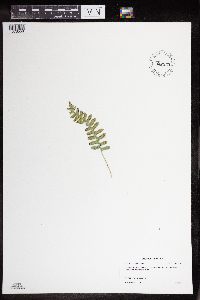 897553[1378558]Bolduan, Brad 92006-06-22 United States, Minnesota, Brown, Brown County...Mound Creek County Park, west of water access...cliff bordering reservoir. T108N T35W NE1/4NW1/4 31;Mound Creek County Park;108N;35W;31, 44.208068 -95.102263 |
MIN:Plants | 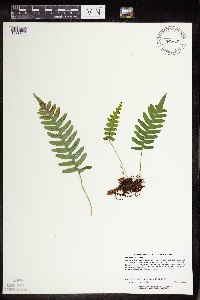 482425[1378585]Lee, Michael MDL24221998-08-27 United States, Minnesota, Benton, Benton County...on the east side of the Mississippi River 1/2 mile south of Watab...T37N R31W NE1/4 of NE1/4 of 1/4 [sic] of SW1/4 Sec. 27. 037N 31W 27, 45.668416 -94.184846 |
MIN:Plants | 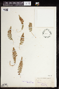 53701[1378886]Piper, C. 2971889-08-12 United States, Washington, Pierce, Mt. Rainier;Mount Rainier National Park;;;, 46.860917 -121.705626 |
MIN:Plants | 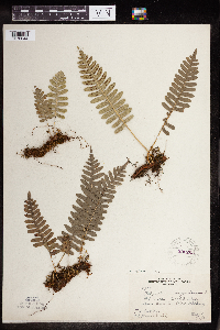 220265[1378644]Butters, F.; et al. 39871921-05-08 United States, Minnesota, Goodhue, About 3 mi below Red Wing;;;;, 44.51902 -92.533801 |
MIN:Plants | 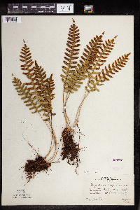 220272[1378539]Butters, F. s.n.1927-08-25 United States, Minnesota, Saint Louis, Clear Lake, N St. Louis Co.;;N;;, 47.647559 -92.451777 |
MIN:Plants | 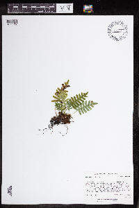 438229[1378617]Rowe, Erika ERR1192005-08-03 United States, Minnesota, Becker, Smokey Hills State Forest. Becker County ... 2.5 miles SW of Osage; 1 mile west of County Hwy 44 in Smoky Hills State Forest ... 1/4 SW 1/4 SW S31 T140 R36W. 140N 36W 31, 46.892764 -95.285684 |
MIN:Plants | 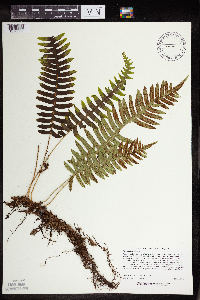 488912[1378562]Lee, Michael MDL27672000-06-22 United States, Minnesota, Lake, Superior National Forest. Lake County...along the Caribou River in the Superior National Forest 2-1/2 miles northeast of Cramer...in small, narrow gorge...T59N R6W SE1/4 of NW1/4 Sec. 35. 059N 06W 35, 47.551365 -91.054946 |
MIN:Plants | 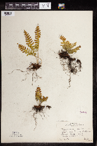 220273[1378672]Butters, F. s.n.1927-09-02 United States, Minnesota, Cook, Susie Island, near Pigeon Point, Cook Co.;North Shore / Susie Islands, The Nature Conservancy;063N;07E;, 47.997942 -89.538143 |
MIN:Plants |  220395[1378630]Rosendahl, C.; Butters, F. 45631924-07-03 United States, Minnesota, Cook, Between Reservation River and Grand Portage, Cook Co.;Grand Portage Indian Reservation / North Shore;N;;, 47.955917 -89.764393 |
MIN:Plants |  242378[1378655]Sheldon, Edmund s.n.1891-05-00 United States, Minnesota, Hennepin, Ft. Snelling;Fort Snelling Military Reservation;N;;, 44.890943 -93.184951 |
MIN:Plants |  273310[1378705]Rosendahl, C. s.n.1929-08-16 United States, Minnesota, Cook, Pigeon Point;Grand Portage Indian Reservation / North Shore;064N;07E;, 47.979125 -89.707739 |
MIN:Plants |  273312[1378706]Rosendahl, C. 60791929-08-16 United States, Minnesota, Cook, End of Pigeon Point;Grand Portage Indian Reservation / North Shore;064N;07E;, 47.979125 -89.707739 |
MIN:Plants |  276711[1378683]Huff, N. 371914-07-02 United States, Minnesota, Lake, North Kawishiwi Riv, Lake Co.;Superior National Forest;N;;, 47.830077 -91.524658 |
MIN:Plants |  278261[1378697]Roberts, Thomas s.n.1884-07-29 United States, Minnesota, Chisago, Taylor's Falls;;N;;, 45.401187 -92.651766 |
MIN:Plants |  282705[1378608]Swanson, Gustav s.n.1932-08-14 United States, Minnesota, Lake of the Woods, Northwest Angle;Northwest Angle;N;;, 49.059039 -94.920086 |
MIN:Plants |  283101[1378716]Butters, F.; Buell, Murray 4701932-07-17 United States, Minnesota, Cook, S shore of Clearwater Lake, Cook Co, T65N, R1E;Boundary Waters Canoe Area Wilderness / Superior National Forest;065N;01E;, 48.087449 -90.322587 |
MIN:Plants | 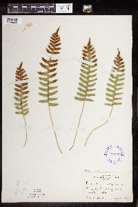 291891[1378609]Fryklund, P. s.n.1925-09-21 United States, Minnesota, Lake of the Woods, Rocky Point, Lake of the Woods Co.;;163N;34W;, 49.059039 -94.920086 |
MIN:Plants | 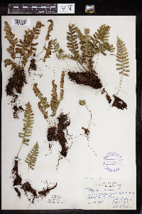 297181[1378621]Moyle, J.; et al. 17081934-08-14 United States, Minnesota, Otter Tail, Lake MacDonald. Ottertail Co.;;;;, 46.425516 -95.557264 |
MIN:Plants | 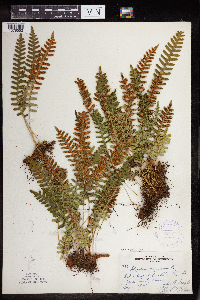 306521[1378552]Moyle, J.; et al. 18871934-08-20 United States, Minnesota, Saint Louis, At Bass Lake, Ely, St. Louis Co.;Superior National Forest;;;, 47.908426 -91.863083 |
MIN:Plants | 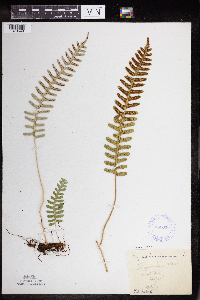 332338[1378548]Roberts, Thomas s.n.1925-07-17 United States, Minnesota, Saint Louis, Burntside Lake;Superior National Forest;063N;13W;00, 47.894351 -91.928757 |
MIN:Plants | 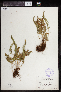 338208[1378542]Moyle, J. 23961936-08-29 United States, Minnesota, Saint Louis, Near Bass Lake, St. Louis Co.;Superior National Forest;063N;12W;, 47.739511 -92.362392 |
MIN:Plants | 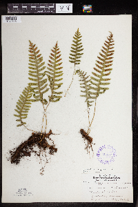 345897[1378546]Lakela, Olga 21751937-08-10 United States, Minnesota, Saint Louis, Hunter's Hill, Duluth;;N;;, 46.783273 -92.106579 |
MIN:Plants | 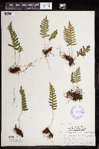 347035[1378730]Lakela, Olga 21691937-08-07 United States, Minnesota, Saint Louis, Jasper Peak [now Chester Peak], Soudan, St. Louis Co.;;062N;15W;36, 47.813798 -92.215428 |
MIN:Plants | 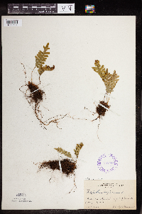 352347[1378631]Benner, F.; Benner, J. 6291929-08-21 United States, Minnesota, Cook, At Hat Point in sight of Grand Portage;Grand Portage Indian Reservation / North Shore;063N;06E;, 47.9667 -89.7667 |
MIN:Plants |  353885[1378556]Lakela, Olga 28101938-09-18 United States, Minnesota, Saint Louis, Above Haines Rd. at Skyline Parkway, 40th Ave W, Duluth;;N;;, 46.759628 -92.164757 |
MIN:Plants |  354386[1378689]Barrows, Vera 801939-07-09 United States, Minnesota, Saint Louis, Echo Trail - W end, Ely;Superior National Forest;N;;, 47.9 -91.8667 |
MIN:Plants |  355782[1378719]Garrison, O. s.n.1880-08-15 United States, Minnesota, Prairie River Falls;;;;, 46.771058 -93.229389 |
MIN:Plants |  356609[1378682]Lakela, Olga 30731939-07-01 United States, Minnesota, Lake, On Moose Lake at the Canadian Border Lodge, Lake Co.;Boundary Waters Canoe Area Wilderness / Superior National Forest;N;;, 47.573263 -91.118393 |
MIN:Plants |  362083[1378549]Lakela, Olga 37281940-08-04 United States, Minnesota, Saint Louis, Burntside Lake at Burntside Lodge, St. Louis Co.;Superior National Forest;063N;13W;23, 47.894351 -91.928757 |
MIN:Plants |  362891[1378577]Lakela, Olga 36931940-07-06 United States, Minnesota, Cook, Windigo Point, Sea Gull Lake. Cook Co.;Boundary Waters Canoe Area Wilderness / Superior National Forest;065N;05W;, 48.149256 -90.887916 |
MIN:Plants |  366081[1378638]Rosendahl, C. 74231940-05-20 United States, Minnesota, Winona, N end of Gwinn's Bluff, near base, short distance S of old red barn; Winona Co.;Great River Bluffs State Park;106N;05W;, 43.946353 -91.399309 |
MIN:Plants |  367062[1378575]Moore, John; Moore, Marjorie 103431938-08-27 United States, Minnesota, Saint Louis, W facing slope of Great Laurentian Highland Divide, 1/2 mi E of Hwy.53, St. Louis Co.;;N;;, 47.583299 -92.48927 |
MIN:Plants | 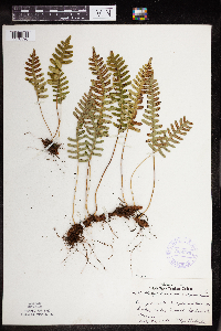 368770[1378596]Lakela, Olga 45611941-07-24 United States, Minnesota, Saint Louis, At Meander Lake, Echo Trail, St. Louis Co.;Superior National Forest;065N;14W;, 46.778826 -92.911778 |
MIN:Plants | 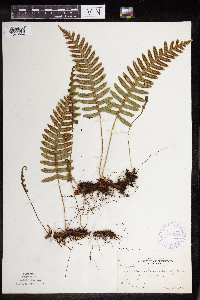 370094[1378622]Moore, John; et al. 141621941-05-25 United States, Minnesota, Pine, Above the Kettle River, E of Sandstone, Pine Co.;Banning State Park;;;, 46.145255 -92.860815 |
MIN:Plants | 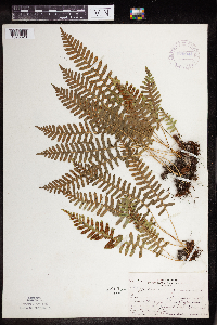 370944[1378623]Moore, John; et al. 133461940-06-27 United States, Minnesota, Redwood, About 7 mi S of Sacred Heart, Redwood Co.;;114N;37W;, 44.315321 -95.2333 |
MIN:Plants | 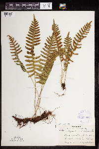 371696[1378715]Lakela, Olga 47881941-08-16 United States, Minnesota, Cook, At Temperance River, Cook Co.;North Shore / Temperance River State Park;059N;04W;, 47.557593 -90.875149 |
MIN:Plants | 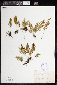 385671[1378684]Lakela, Olga 57611944-08-14 United States, Minnesota, Lake, On Pancake Island in Lake Superior, between East Beaver Bay and the Palisades, Lake Co.;North Shore;055N;07W;00, 47.2677 -91.282943 |
MIN:Plants | 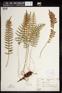 387483[1378717]Butters, F.; Abbe, E.; Abbe, L. 2401937-07-02 United States, Minnesota, Cook, Cook Co. W of portage between Clearwater Lake and Mountain Lake, T65N R1E;Boundary Waters Canoe Area Wilderness / Superior National Forest;065N;01E;, 48.087449 -90.322587 |
MIN:Plants | 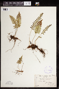 387484[1378629]Butters, F.; Abbe, E. 1551936-06-28 United States, Minnesota, Cook, Cook Co. At Grand Portage, T63N R6E;North Shore;063N;06E;, 47.95 -89.6833 |
MIN:Plants | 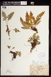 387485[1378663]Nielsen, E. 16341932-09-09 United States, Minnesota, Cook, Pigeon Point, near Grand Portage, Cook Co.;Grand Portage Indian Reservation / North Shore;064N;07E;, 47.979125 -89.707739 |
MIN:Plants | 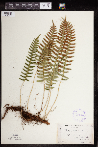 387486[1378700]Burns, G.; Hendrickson, M. 4271938-08-07 United States, Minnesota, Cook, Cook Co. E side of Little Caribou Lake, T65N R1E;Boundary Waters Canoe Area Wilderness / Superior National Forest;065N;01E;, 48.06827 -90.262717 |
MIN:Plants | 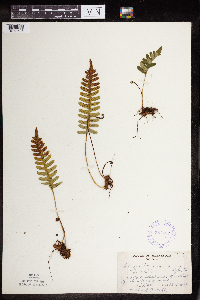 387487[1378698]Dahl, A. 1061945-06-18 United States, Minnesota, Cook, Cook Co. Island #2, Poplar Lake; at waters' edge on N side of island, T64N R2W 12;Superior National Forest;064N;02W;12, 48.046734 -90.508674 |
MIN:Plants | 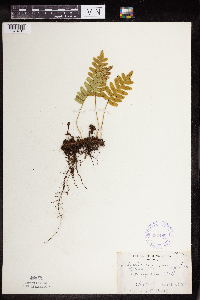 387488[1378701]Dahl, A. 981945-06-18 United States, Minnesota, Cook, Cook Co. Island - #1, Poplar Lake;Superior National Forest;064N;02W;1, 48.046734 -90.508674 |
MIN:Plants | 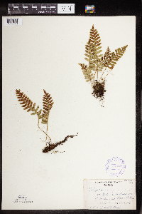 387489[1378578]Dahl, A. 151945-06-16 United States, Minnesota, Cook, Cook Co. Near Poplar Lake, T64N R1W 6;Superior National Forest;064N;01W;6, 48.046734 -90.508674 |
MIN:Plants |  387490[1378714]Dahl, A. 711945-06-17 United States, Minnesota, Cook, Cook Co. Above (SE) Birch Lake, T65N R1W 31;Boundary Waters Canoe Area Wilderness / Superior National Forest;065N;01W;31, 48.066638 -90.519399 |
MIN:Plants |  387491[1378707]Butters, F.; et al. 941938-07-11 United States, Minnesota, Cook, On S side of outlet of Rove Lake.;Boundary Waters Canoe Area Wilderness / Superior National Forest;065N;01E;, 48.0833 -90.35 |
MIN:Plants |  387492[1378671]Moore, John; Barnum, B. 161951944-05-22 United States, Minnesota, Washington, Washington County ... 3 mi NW of Stillwater;Saint Croix National Riverway;030N;20W;, 45.086953 -92.791793 |
MIN:Plants |  387493[1378624]Moore, John; Huff, N. 187151946-06-21 United States, Minnesota, Rock, Rock Co. The Mound, 3 mi N of Luverne;Blue Mounds State Park;103N;45W;, 43.702675 -96.15558 |
MIN:Plants |  387494[1378704]Moore, John; Hall, Robert 165711944-06-12 United States, Minnesota, Cottonwood, Cottonwood Co. Red Rock Dells, 6 mi S of Sanborn;;N;;, 44.136556 -95.130513 |
MIN:Plants |  387495[1378540]Huff, N. s.n.1941-08-23 United States, Minnesota, Cook, Cook Co.; Lake Saginagaw [sic];Boundary Waters Canoe Area Wilderness / Superior National Forest;N;;, 47.726653 -90.386005 |
MIN:Plants |  387496[1378607]Huff, N. s.n.1941-08-30 United States, Minnesota, Fillmore, Rushford;;104N;08W;, 43.796067 -91.799886 |
MIN:Plants |  387497[1378576]Rosendahl, C. 76341943-06-29 United States, Minnesota, Winona, At Indian Inscription Caves, 1 mi S of La Moille, Winona Co.;;N;;, 44.035479 -91.639315 |
MIN:Plants | 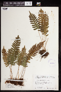 412282[1378681]Moore, John; Moore, Marjorie 113011939-07-29 United States, Minnesota, Lake of the Woods, Lake of the Woods Co. N shore of Magnuson Island;Northwest Angle;168N;34W;, 49.059039 -94.920086 |
MIN:Plants | 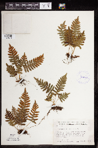 412927[1378679]Moore, John; Moore, Marjorie 116471939-08-12 United States, Minnesota, Koochiching, Koochiching Co. Growing in the vicinity of the Island View Hotel, T71, R22W, Sec.25; along the S shore of Rainy Lake;Voyageurs National Park;071N;22W;25, 48.599102 -93.377757 |
MIN:Plants | 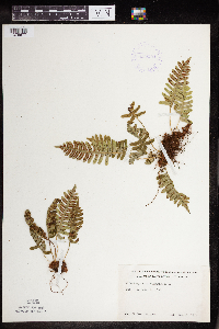 419154[1378677]Ahlgren, Clifford 581949-05-14 United States, Minnesota, Lake, Quetico-Superior Wilderness Research Center...Lake Co. Sec.9 T64N, R10W;Boundary Waters Canoe Area Wilderness / Superior National Forest;064N;10W;09, 48.031651 -91.618861 |
MIN:Plants | 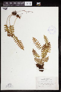 420937[1378555]Lakela, Olga 114761950-08-20 United States, Minnesota, Saint Louis, Curtain Falls, on Crooked Lake, St. Louis Co.;Boundary Waters Canoe Area Wilderness / Superior National Forest;066N;12W;, 48.236564 -91.906242 |
MIN:Plants | 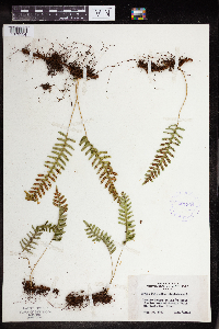 421304[1378554]Lakela, Olga 117911950-08-26 United States, Minnesota, Saint Louis, Lac La Croix, 8 mi W of Curtain Falls, St. Louis Co.;Boundary Waters Canoe Area Wilderness / Superior National Forest;N;;, 48.236433 -92.080077 |
MIN:Plants | 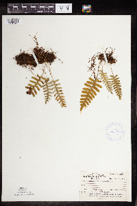 421539[1378589]Ahlgren, Clifford 11491950-08-22 United States, Minnesota, Saint Louis, Lake Co. 1/8 mi W of Curtain Falls, Crooked Lake [this actually in St. Louis Co.];Boundary Waters Canoe Area Wilderness / Superior National Forest;066N;12W;06, 48.23654 -92.07995 |
MIN:Plants | 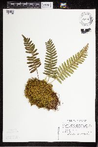 428229[1311434]Lee, Michael MDL4381994-05-17 United States, Minnesota, Fillmore, Dorer Memorial Hardwood State Forest. Fillmore Co.; along South Fork Root River .5 mile upstream from Choice; N-facing slope above large cliffs; T 102N R 8W S Fillmore Co.; along South Fork Root River .5 mile upstream from Choice; N-facing slope above large cliffs; T 102N R 8W SW1/4 of NE1/4 of Sec 9. 102N 08W 9, 43.740311 -91.917641 |
MIN:Plants | 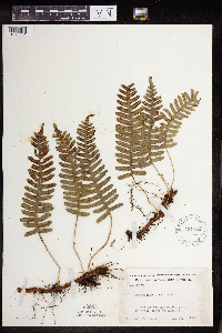 437154[1378661]Moore, John 123281940-05-01 United States, Minnesota, Dakota, Dakota Co. Minnesota River. 1 1/2 mi S of Mendota.;;N;;, 44.866073 -93.187733 |
MIN:Plants |  442414[1378543]Lakela, Olga 131581951-07-13 United States, Minnesota, Saint Louis, Dryweed Island in Rainy Lake, most NW corner of St. Louis Co.;Voyageurs National Park;071N;21W;, 48.483546 -92.838098 |
MIN:Plants |  442431[1378553]Lakela, Olga 129311951-07-10 United States, Minnesota, Saint Louis, At Kettle Falls, Rainy Lake, St. Louis Co.;Voyageurs National Park;070N;18W;, 48.49944 -92.63889 |
MIN:Plants |  442812[1378627]Lakela, Olga 125201951-06-20 United States, Minnesota, Saint Louis, Iron Lake below Curtain Falls, St. Louis Co.;Boundary Waters Canoe Area Wilderness / Superior National Forest;066N;12W;06, 48.219513 -91.957793 |
MIN:Plants |  443347[1378538]Lakela, Olga 128091951-06-28 United States, Minnesota, Saint Louis, Sandpoint Lake, back of the Moon Lodge, St. Louis Co.;Voyageurs National Park;N;;, 48.483546 -92.838098 |
MIN:Plants |  444512[1378560]Butler, Cindy; et al. 970021997-10-29 United States, Minnesota, Aitkin, Aitkin County...About ten miles northeast of Sandy Lake; T 51 R 23 NE1/4 of SE1/4 of Sec 14;Savanna State Forest;051N;23W;14, 46.9016667 -93.2122222 |
MIN:Plants |  445339[1378567]Boe, J. 960531041996-05-31 United States, Minnesota, Itasca, Itasca Co.; Prairie Lake gorge; T 056N R 025W SE1/4 of NE1/4 of Sec 33;Chippewa National Forest;056N;25W;33, 47.466107 -93.390128 |
MIN:Plants |  445837[1378620]Moore, John; Huff, N. 179911945-07-25 United States, Minnesota, Morrison, Morrison Co. Along Little Hillman Creek at Center Valley;;N;;, 46.013631 -93.892596 |
MIN:Plants |  446545[1378569]Moore, John; Huff, N. 185191946-06-07 United States, Minnesota, Blue Earth, Blue Earth Co. Below Minneopa Falls, Minneopa State Park;Minneopa State Park;108N;27W;, 44.162188 -94.10218 |
MIN:Plants | 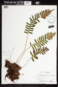 456888[1311438]Myhre, K. 47631994-05-18 United States, Minnesota, Itasca, Chippewa National Forest / Leech Lake Indian Reservation. Itasca Co.; located 5 miles northeast of the town of Squaw Lake; between Sand Lakes; T 148N R 26W NE1/4 of NW1/4 of Sec Itasca Co.; located 5 miles northeast of the town of Squaw Lake; between Sand Lakes; T 148N R 26W NE1/4 of NW1/4 of Sec 18. 148N 26W 18, 47.640895 -94.026811 |
MIN:Plants | 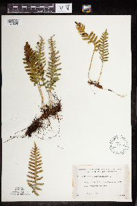 462751[1378626]Lakela, Olga 148471952-07-10 United States, Minnesota, Saint Louis, St. Louis Co. On an island in Rainy Lake, Cranberry Bay area;Voyageurs National Park;N;;, 48.483546 -92.838098 |
MIN:Plants | 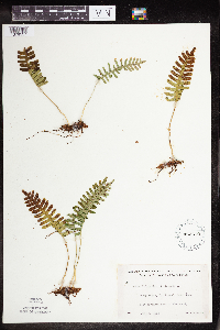 463379[1378557]Lakela, Olga 145551952-07-08 United States, Minnesota, Saint Louis, St. Louis Co. Fox Island, Rainy Lake, most northern part of the county;Voyageurs National Park;071N;21W;, 48.625169 -92.962016 |
MIN:Plants | 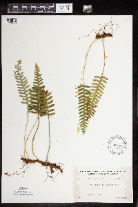 463526[1378615]Lakela, Olga 142421952-06-18 United States, Minnesota, Saint Louis, St. Louis Co. Namakan Lake at the Narrowsa;Voyageurs National Park;069N;17W;, 48.483546 -92.838098 |
MIN:Plants | 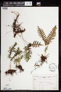 491902[1378726]Lakela, Olga 170751953-09-05 United States, Minnesota, Saint Louis, St. Louis Co. N going trail from Trout Lake, N of Vermilion Lake;Boundary Waters Canoe Area Wilderness / Superior National Forest;063N;16W;, 48.4833 -92.8 |
MIN:Plants | 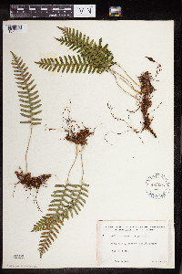 493025[1378588]Lakela, Olga 166071953-08-06 United States, Minnesota, Saint Louis, St. Louis Co. S of Skala's Resort, Lac La Croix;Boundary Waters Canoe Area Wilderness / Superior National Forest;N;;, 48.265868 -92.060542 |
MIN:Plants | 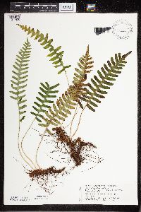 504839[1311436]Puchalski, L. 1011992-06-26 United States, Minnesota, Saint Louis, T159N [sic] R17W S25; St. Louis Co.;;059N;17W;25, 47.5833 -92.5 |
MIN:Plants | 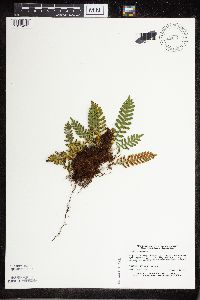 506674[1311439]Harris, Fred 950951995-09-14 United States, Minnesota, Scott, Minnesota Valley State Park. Scott County...Carver Rapids Wayside, Minnesota Valley State Recreation Area; NE edge of 'island' SE of Louisville swamp...T115 R23 NE1/4 of NE1/4 of sec 32. 115N 23W 32, 44.730787 -93.604978 |
MIN:Plants |  506734[1378545]Rosendahl, C. 79381950-06-12 United States, Minnesota, Houston, Houston Co. 3 mi SW of Spring Grove, near the NW corner of Sec.27, Spring Grove Twp.;;101N;07W;27, 43.522193 -91.660358 |
MIN:Plants |  508503[1311440]Lee, Michael MDL8541992-05-02 United States, Minnesota, Wabasha, Whitewater Wildlife Management Area. Wabasha Co.; N-facing slope along upper reaches of Beaver Creek 4 mi ESE of Plainview; along the creek 3/4 mi downstream Wabasha Co.; N-facing slope along upper reaches of Beaver Creek 4 mi ESE of Plainview; along the creek 3/4 mi downstream; Whitewater WMA. T108N R11W SWNW 24. 108N 11W 24, 44.145216 -92.095709 |
MIN:Plants |  514732[1311435]Smith, Welby 192161991-07-08 United States, Minnesota, Koochiching, Franz Jevne State Park. Koochiching County...Franz Jevne State Park, in the Rainy River Valley, about 2 miles NE of Birchdale... T160N R27W SW1/4 of SW1/4 of Sec 26. 160N 27W 26, 48.6427765 -94.078331 |
MIN:Plants |  515154[1311437]Dunevitz, H. 8091990-09-26 United States, Minnesota, Rice, Rice Co.; on the east side of the Cannon River in Rice County Wilderness Park; T 110N R 20W NE1/4 of NE1/4 of Sec 4;;110N;20W;4, 44.368548 -93.230448 |
MIN:Plants | 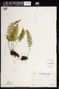 526069[1378541]Lakela, Olga 189251955-07-21 United States, Minnesota, Saint Louis, St. Louis Co. Vermilion River gorge above the Falls;;N;;, 48.275739 -92.506548 |
MIN:Plants | 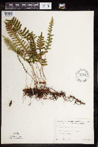 526765[1378550]Lakela, Olga 176481954-06-24 United States, Minnesota, Saint Louis, St. Louis Co. Maki's Island in Burntside Lake, Ely;Superior National Forest;063N;13W;00, 47.9 -91.8667 |
MIN:Plants | 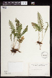 527294[1378544]Lakela, Olga 177951954-07-04 United States, Minnesota, Saint Louis, St. Louis Co. Above Sunday Bay of Crooked Lake;Boundary Waters Canoe Area Wilderness / Superior National Forest;066N;12W;00, 48.205175 -91.870408 |
MIN:Plants | 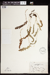 52815[1378678]Moyle, J. 21651936-07-18 United States, Minnesota, Koochiching, Falls of the Big Fork, Koochiching Co.;Pine Island State Forest;155N;25W;, 48.1833 -94.1667 |
MIN:Plants |  52900[1378653]Sandberg, John s.n.1890-08-00 United States, Minnesota, Hennepin, Hennepin Co.;;N;;, 45.004576 -93.476884 |
MIN:Plants |  52920[1378728]Arthur, J.; et al. B1761886-07-21 United States, Minnesota, Saint Louis, Vermilion Lake;;;;, 47.891581 -92.366824 |
MIN:Plants |  52921[1378710]Taylor, B. T13691892-07-00 United States, Minnesota, Chisago, Taylors Falls;;N;;, 45.401187 -92.651766 |
MIN:Plants |  52923[1378720]Juni, B. s.n. United States, Minnesota, North Shore Lake Superior;North Shore;;;, 47.528816 -87.760022 |
Google Map
Google Maps is a web mapping service provided by Google that features a map that users can pan (by dragging the mouse) and zoom (by using the mouse wheel). Collection points are displayed as colored markers that when clicked on, displays the full information for that collection. When multiple species are queried (separated by semi-colons), different colored markers denote each individual species.