University of Minnesota
http://www.umn.edu/
612-625-5000
http://www.umn.edu/
612-625-5000
Minnesota Biodiversity Atlas
Bell Museum
Dataset: MIN-Plants
Taxa: Pterocarpus
Search Criteria: excluding cultivated/captive occurrences
1
Page 1, records 1-10 of 10
Bell Museum plants | |
 MIN:Plants | 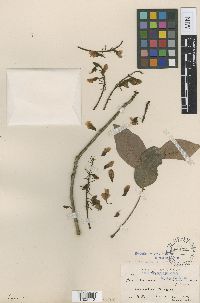 142402[1002113]Palmer, E. 831894-10-00 Mexico, Guerrero, Acapulco, 16.872423 -99.902977 |
MIN:Plants | 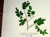 Pterocarpus indicus Willd. 913881[]Weiblen, G.D. & Binatang Research Center WP2D03812007-04-10 Papua New Guinea, Madang, Wanang Village, -5.2373 145.177183, 115m |
MIN:Plants | Pterocarpus indicus Willd. 913874[]Weiblen, G.D. & Binatang Research Center WS1Z32762008-04-23 Papua New Guinea, Madang, Wanang Village, -5.229583 145.178467, 115m |
MIN:Plants | 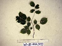 Pterocarpus indicus Willd. 913809[]Weiblen, G.D. & Binatang Research Center WS3D27822007-05-22 Papua New Guinea, Madang, Wanang Village, -5.229583 145.178467, 115m |
MIN:Plants | 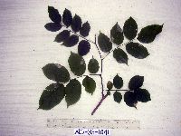 Pterocarpus indicus Willd. 913875[]Weiblen, G.D. & Binatang Research Center WS3E10412007-09-12 Papua New Guinea, Madang, Wanang Village, -5.229583 145.178467, 115m |
MIN:Plants | 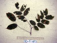 Pterocarpus indicus Willd. 913811[]Weiblen, G.D. & Binatang Research Center WS4E11432007-09-20 Papua New Guinea, Madang, Wanang Village, -5.229583 145.178467, 115m |
MIN:Plants | 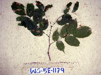 Pterocarpus indicus Willd. 913810[]Weiblen, G.D. & Binatang Research Center WS5E11792007-10-24 Papua New Guinea, Madang, Wanang Village, -5.229583 145.178467, 115m |
MIN:Plants | Pterocarpus indicus Willd. 905967[]Molem, K. FAM161999-10-05 Papua New Guinea, Madang, Nearest village: Baitabag, -5.133333 145.766667, 50m |
MIN:Plants | Pterocarpus indicus Willd. 936015[]Weiblen, G.D. GW28282008-08-02 Papua New Guinea, Madang, Wanang village, Middle Ramu, -5.25 145.266667, 115m |
MIN:Plants | Pterocarpus indicus Willd. 488237[]D. Stancik & Nathaniel 51982003-09-17 Papua New Guinea, Baitabag, 45.766667 -5.15, 150m |
1
Page 1, records 1-10 of 10
Google Map
Google Maps is a web mapping service provided by Google that features a map that users can pan (by dragging the mouse) and zoom (by using the mouse wheel). Collection points are displayed as colored markers that when clicked on, displays the full information for that collection. When multiple species are queried (separated by semi-colons), different colored markers denote each individual species.