University of Minnesota
http://www.umn.edu/
612-625-5000
http://www.umn.edu/
612-625-5000
Minnesota Biodiversity Atlas
Bell Museum
Dataset: MIN-Plants
Taxa: Rheum
Search Criteria: excluding cultivated/captive occurrences
1
Page 1, records 1-4 of 4
Bell Museum plants | |
 MIN:Plants | 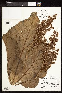 485002[1087938]Whitfeld, T.J.S. 2612001-06-27 United States, Minnesota, Kandiyohi, Randall Wildlife Management Area. Kandiyohi County ... Randall WPA. 1/2 mile north of 270 Av. NW; 2-1/2 miles east of US Hwy. 104 ... T 122 N R 36 W SE1/4 of NW1/4 of NW1/4 of Section 9. 122N 36W 9, 45.390981 -95.203885 |
MIN:Plants | 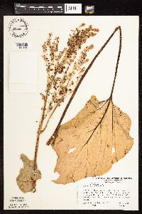 305880[1087939]Ownbey, Gerald 70031985-06-05 United States, Minnesota, Washington, Saint Croix Savanna Scientific Natural Area. Washington Co. T29N R20W, W1/2 of the W1/2, Sec.14, N end. E side of a high sand and gravel ridge paralleling Minn. Rt.9 Washington Co. T29N R20W, W1/2 of the W1/2, Sec.14, N end. E side of a high sand and gravel ridge paralleling Minn. Rt.95, just S of Bayport. 029N 20W 14, 44.999602 -92.77898 |
MIN:Plants | 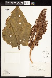 568943[1087940]Moore, John; et al. 251791960-07-15 United States, Minnesota, Anoka, Anoka County...1/4 mi E of Decodon Pond;Cedar Creek National History Area;034N;23W;, 45.40217 -93.199397 |
MIN:Plants | 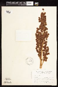 574985[1087937]Wertman, Freida 621960-07-04 United States, Minnesota, Anoka, Anoka Co. Cedar Creek Natural History Area; Athen Twp, Sec.27. Sect. 27c, Co. Rd.24, N side, coordinates 878.8-2208.3;Cedar Creek National History Area;034N;23W;27, 45.319728 -93.316639 |
1
Page 1, records 1-4 of 4
Google Map
Google Maps is a web mapping service provided by Google that features a map that users can pan (by dragging the mouse) and zoom (by using the mouse wheel). Collection points are displayed as colored markers that when clicked on, displays the full information for that collection. When multiple species are queried (separated by semi-colons), different colored markers denote each individual species.