University of Minnesota
http://www.umn.edu/
612-625-5000
http://www.umn.edu/
612-625-5000
Minnesota Biodiversity Atlas
Bell Museum
Dataset: MIN-Plants
Taxa: Rhinanthus
Search Criteria: excluding cultivated/captive occurrences
1
Page 1, records 1-10 of 10
Bell Museum plants | |
 MIN:Plants | Rhinanthus minor subsp. groenlandica (Ostenfeld) L. Neumann 657001[]Noble, Mark; et al. 4971974-08-05 United States, Alaska, Muir Point; from site deglaciated ca. 1880.;Glacier Bay National Park;;;, 58.82694 -136.07722 |
MIN:Plants | Rhinanthus minor subsp. groenlandica (Ostenfeld) L. Neumann 657326[]Noble, Mark; et al. 4401974-08-05 United States, Alaska, Muir Point; from site deglaciated ca. 1880.;Glacier Bay National Park;;;, 58.82694 -136.07722 |
MIN:Plants | Rhinanthus minor subsp. groenlandica (Ostenfeld) L. Neumann 520487[]Lawrence, Donald s.n.1952-08-17 United States, Alaska, Glacier Bay National Monument. Sandy Cove.;Glacier Bay National Park;;;, 58.797428 -136.838127 |
MIN:Plants | Rhinanthus minor subsp. groenlandica (Ostenfeld) L. Neumann 456734[]Lawrence, Donald s.n.1952-08-17 United States, Alaska, Glacier Bay National Monument. Sandy Cove.;Glacier Bay National Park;;;, 58.797428 -136.838127 |
MIN:Plants | Rhinanthus minor subsp. groenlandica (Ostenfeld) L. Neumann 656961[]Noble, Mark; et al. 3411974-08-05 United States, Alaska, Muir Point; from site deglaciated ca. 1880.;Glacier Bay National Park;;;, 58.82694 -136.07722 |
MIN:Plants | 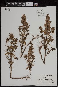 956172[1296020]Lawrence, D. B. s.n.1949-08-12 United States, Alaska, Glacier Bay National Monument. Station 49-3. [Glacier Bay National Park], 58.797428 -136.838127 |
MIN:Plants | 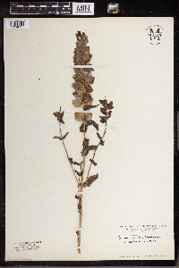 Rhinanthus alectorolophus (Scop.) Pollich 961220[1334695] Switzerland |
MIN:Plants | 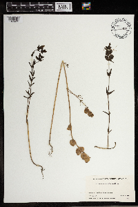 Rhinanthus crista-galli L. p.p. 965635[1356493]Stuart K. Harris 324131968-07-16 United States, Vermont, Essex, Keyer Brook |
MIN:Plants | 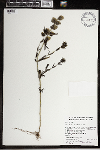 968187[1368775]Timothy J. S. Whitfeld 15382017-10-06 United States, Rhode Island, Providence, Snake Den State Park, west of Poppy Hill Road, 41.85246 -71.52181 |
MIN:Plants |  972334[1395884]Janssens, J. 76/791976-06-13 Belgium, Nicasiusdijk |
1
Page 1, records 1-10 of 10
Google Map
Google Maps is a web mapping service provided by Google that features a map that users can pan (by dragging the mouse) and zoom (by using the mouse wheel). Collection points are displayed as colored markers that when clicked on, displays the full information for that collection. When multiple species are queried (separated by semi-colons), different colored markers denote each individual species.