University of Minnesota
http://www.umn.edu/
612-625-5000
http://www.umn.edu/
612-625-5000
Minnesota Biodiversity Atlas
Bell Museum
Dataset: MIN-Plants
Taxa: Robinia
Search Criteria: excluding cultivated/captive occurrences
1
Page 1, records 1-60 of 60
Bell Museum plants | |
 MIN:Plants |  462107[1078827]Smith, Welby 280261999-07-19 United States, Minnesota, Sibley, Sibley County ... Near the intersections of Hwy 93 and 169 ... T 112N R 26W SE1/4 of NE1/4 of Sec 34;;112N;26W;34, 44.4672222 -93.9313889 |
MIN:Plants |  898963[1078832]Smith, Welby 272711998-06-23 United States, Minnesota, Fillmore, Fillmore County...Along the Root River Trail, about 3 miles west of Rushford...T 104N R 8W SW1/4 of NW1/4 of Sec 21;Dorer Memorial Hardwood State Forest;104N;08W;21, 43.7991667 -91.8075 |
MIN:Plants |  904729[1078834]Smith, Welby 280471999-07-21 United States, Minnesota, Lac Qui Parle, Lac Qui Parle County...In Lac Qui Parle State Park...along the Lac Qui Parle River. T118N R42W SE1/4 of NE1/4 of Sec 15;Lac Qui Parle State Park;118N;42W;15, 45.0325 -95.9019444 |
MIN:Plants | 478567[]Arboretum, Cary 73-391973-00-00 United States, New York, Dutchess, Dutchess Co. |
MIN:Plants |  911758[1078853]Cholewa, A. 26862009-08-13 United States, Minnesota, Anoka, Anoka County, Lake George County Park, parking lot across road from public boat ramp.;Lake George County Park;033N;24W;09, 45.3632397 -93.3374776 |
MIN:Plants |  898965[1078833]Smith, Welby 271711998-06-01 United States, Minnesota, Mille Lacs, Kunkel Wildlife Management Area. Mille Lacs County...Kunkel State Wildlife Management Area, about 4.5 miles west of Princeton...T 36N R 27W SW1/4 of NE1/4 of Sec 26. 036N 27W 26, 45.5841667 -93.6638889 |
MIN:Plants |  794785[1078854]Schaaf, J. 1821982-07-29 United States, Nevada, Pershing, Pershing Co. ... Rye Patch Gulch, 1585m |
MIN:Plants |  477447[1078822]Smith, Welby 205321992-06-24 United States, Minnesota, Brown, Flandrau State Park. Brown County ... Flandrau State Park, on the south side of New Ulm in the Cottonwood River Valley ... T 110N R 30W NW1/4 of SE1/4 of sec 32. 110N 30W 32, 44.2874985 -94.4608307 |
MIN:Plants | Robinia hispida var. fertilis (Ashe) R.T. Clausen 478582[]US Nat. Arboretum staff s.n.1981-00-00 United States, Maryland, Allegany, Alleghany Co. |
MIN:Plants |  462317[1078819]Smith, Welby 287462000-07-14 United States, Minnesota, Ramsey, Ramsey County ... Battle Creek County Park, In St. Paul ... T28N R22W SE1/4 of SE1/4 of Sec 3;Battle Creek County Park;028N;22W;03, 44.9361115 -93.0280533 |
MIN:Plants |  427109[1078826]Smith, Welby 250381994-08-04 United States, Minnesota, Houston, Beaver Creek Valley State Park. Houston County ... Along Beaver Creek in Beaver Creek Valley State Park; about three miles west of Caledonia ... T 102N R 6W SE1/4 of NE1/4 of Sec 17. 102N 06W 17, 43.6394463 -91.5747223 |
MIN:Plants |  454331[1078818]Smith, Welby 286672000-07-09 United States, Minnesota, Ramsey, Ramsey County ... Swede's Hollow City Park, in St. Paul ... T 29N R 22W SE1/4 of NW1/4 of Sec 32;;029N;22W;32, 44.9577789 -93.0763855 |
MIN:Plants |  436870[1078830]Juhnke, C. 514 CMJ FRO1999-08-07 United States, Minnesota, Goodhue, Frontenac State Park. Frontenac State Park Goodhue County ... On west side of the steepest part of main park road north of contact station T 112N R 13W NW NE NW 11. 112N 13W 11, 44.5199905 -92.3392244 |
MIN:Plants |  543029[1078824]Lakela, Olga 217851957-08-03 United States, Minnesota, Lake, Just NE of Ollie's Store, Hwy. 61, Larsmont area.;North Shore;052N;11W;21, 46.9781342 -91.7471054 |
MIN:Plants |  432094[1078820]Myhre, K. 31771992-08-23 United States, Minnesota, Cass, Cass County ... Located at the public access to Sylvan Lake on the west side of the Gull River ... T 133N R 29W NE1/4 of NW1/4 of Sec 30. 133N 29W 30, 46.3011777 -94.3818202 |
MIN:Plants |  461558[1078823]Myhre, K. 45101993-08-18 United States, Minnesota, Pine, Pine County ... Located 1 mi SW of the town of Finlayson ... N shore of Indian Lake ... T43N R21W SW1/4 of SE1/4 Sec 24;;043N;21W;24, 46.1946845 -92.9390417 |
MIN:Plants |  568741[1078817]Moore, John 249281959-09-30 United States, Minnesota, Blue Earth, Blue Earth Co.; at Lake Rapidan;;N;;, 44.091207 -94.108474 |
MIN:Plants |  142507[1078846]Manning, Sara s.n.1887-05-27 United States, Minnesota, Wabasha, Lake City;;N;;, 44.449412 -92.266844 |
MIN:Plants |  142509[1122802]Oestlund, O. s.n.1986-06-04 United States, Minnesota, Hennepin, [no further data];;;;, 45 -93.47 |
MIN:Plants |  265511[1078839]Goldsmith, G. G2361912-00-00 United States, Minnesota, Rice, Northfield;;N;;, 44.4496671 -93.1708471 |
MIN:Plants |  375209[1078844]Lakela, Olga 50121942-07-12 United States, Minnesota, Saint Louis, A large island on Lake Superior terrace, near city pumping station, Duluth.;;N;;, 46.712875 -92.197347 |
MIN:Plants |  381532[1078838]Moore, John; et al. 142831942-05-02 United States, Minnesota, Winona, Hwy. 14, top of a hill above Winona, Winona Twp. Winona Co.;;107N;07W;, 44.027257 -91.756731 |
MIN:Plants |  421185[1078842]Lakela, Olga 108571950-07-26 United States, Minnesota, Saint Louis, Terrace of Lake Superior E of the pumping station, Duluth.;;N;;, 46.755054 -92.134045 |
MIN:Plants |  427391[1078850]Smith, Welby 138281987-08-11 United States, Minnesota, Washington, Washington Co. Bayport State Wildlife Management Area, about 1 mi S of Bayport; NE1/4 SE1/4 sec.15, T29N R20W;Saint Croix Savanna Scientific Natural Area;029N;20W;15, 44.8738899 -92.7825012 |
MIN:Plants |  428629[1078849]Wheeler, Gerald 113371988-07-25 United States, Minnesota, Lac Qui Parle, Lac Qui Parle State Park. Lac Qui Parle Co.; ca. 15 mi. E of Madison, Lac Qui Parle State Park, N of Rte. 33; bordering Lac Qui Parle River; N1/2 Lac Qui Parle Co.; ca. 15 mi. E of Madison, Lac Qui Parle State Park, N of Rte. 33; bordering Lac Qui Parle River; N1/2 NE1/4 Sec. 23 T118N R42W (Lac Qui Parle Township). 118N 42W 23, 45.0151565 -95.8888708 |
MIN:Plants |  585506[1078845]Moore, John 259411962-05-22 United States, Minnesota, Blue Earth, Along the Minnesota River at Mankato;;N;;, 44.167754 -94.011458 |
MIN:Plants |  592095[1078840]Moore, John 266731964-06-03 United States, Minnesota, Pipestone, Pipestone Co.; along the r.r, 2 miles north of Pipestone;;107N;45W;, 44.028673 -96.266198 |
MIN:Plants |  643808[1078837]Ownbey, Gerald 47461973-12-02 United States, Minnesota, Washington, 0.5 mi. W of Afton village, near Afton Hills Drive.;;028N;20W;, 44.9126091 -92.7918606 |
MIN:Plants |  679015[1078836]Ownbey, Gerald 48891975-04-12 United States, Minnesota, Washington, Afton Hills Drive, 0.5 mi. W of Afton Village.;;028N;20W;, 44.850681 -92.830152 |
MIN:Plants |  696586[1078841]Smith, Welby 6451978-06-05 United States, Minnesota, Wright, Wright Co.; T121N, R27W SW1/4 Sec. 9. Between Hwy. 24 and Clearwater Lake.;;121N;27W;9, 45.300983 -94.091127 |
MIN:Plants |  722665[1078847]Lustig, K. 9081979-08-13 United States, Minnesota, Anoka, 18 mi. SE of Cambridge.;Boot Lake Scientific Natural Area;033N;22W;, 45.34066 -93.08146 |
MIN:Plants |  749524[1078848]Ehritt, K. s.n.1977-05-15 United States, Minnesota, Le Sueur, Le Sueur Co. Ottawa Bluffs: NE1/4 Sec. 3, T110N, R26W;Ottawa Bluffs, The Nature Conservancy;110N;26W;3, 44.3626183 -93.939379 |
MIN:Plants |  763656[1078843]Lyon, H. s.n.1897-00-00 United States, Minnesota, Ramsey, Hamline [St. Paul neighborhood near Hamline University];;029N;23W;, 44.961903 -93.163047 |
MIN:Plants |  519191[1078855]Morley, T. 17791994-05-24 United States, Minnesota, Ramsey, Ramsey County...in the [Army Ammunition] Arsenal grounds. Arden Hills area ca. 1 mile ENE of intersection of highways 10 and 96. T 30 N, R 23 W, NW 1/4 sec.15.. 030N 23W 15, 45.0864512 -93.1575501 |
MIN:Plants |  456175[1078831]Smith, Welby 280251999-07-19 United States, Minnesota, Nicollet, Nicollet County ... Along Hwy 169, one mile north of St. Peter ... T110N R26W SE1/4 of NE1/4 of Sec 9;;110N;26W;09, 44.3491667 -93.9466667 |
MIN:Plants | 478565[]US Nat. Arboretum staff 1071974-00-00 United States, New York, Dutchess, Dutchess Co. |
MIN:Plants |  904517[1078852]Smith, Welby 154841989-06-26 United States, Minnesota, Houston, Houston County ... Beaver Creek Valley State Park, about 4 miles west of Caledonia ... NW1/4 NW1/4 section 17, T102N R6W;Beaver Creek Valley State Park;102N;06W;17, 43.6436111 -91.5869444 |
MIN:Plants | Robinia viscosa Ventenat 478574[]US Nat. Arboretum staff 1081974-00-00 United States, District of Columbia, Washington |
MIN:Plants |  439066[1078829]Smith, Welby 272121998-06-06 United States, Minnesota, Anoka, Lamprey Pass Wildlife Management Area. Anoka County ... Lamprey Pass State Wildlife Management Area, about 2 miles southwest of Forest Lake (town) ... T32N R22W SW1/4 of NE1/4 of Sec 13. 032N 22W 12, 45.2619438 -93.0294418 |
MIN:Plants | 478564[]US Nat. Arboretum staff 1111978-00-00 United States, Virginia, James City, James City Co. |
MIN:Plants |  493433[1078828]Smith, Welby 271411998-05-26 United States, Minnesota, Pine, Pine County ... At the public access on the Snake River in Pine City ... between the railroad and the river ... T39N R21W SW1/4 of SE1/4 of Sec 28. 039N 21W 28, 45.8311119 -92.9705582 |
MIN:Plants |  476897[1078821]Smith, Welby 271351998-05-24 United States, Minnesota, Chisago, At the junction of County Highway 30 and 18, about one mile north of Stacy. SW1/4 of SW1/4 of Sec;;034N;21W;21, 45.4147222 -92.9702778 |
MIN:Plants | 478568[]US Nat. Arboretum staff 1061974-00-00 United States, District of Columbia, USNA [Nat. Arboretum] |
MIN:Plants |  898342[1078851]Smith, Welby 280261999-07-19 United States, Minnesota, Sibley, Sibley County...Near the intersections of Hwy 93 and 169...T 112N R 26W SE1/4 of NE1/4 of Sec 34;;112N;26W;34, 44.4672222 -93.9313889 |
MIN:Plants | 528827[]US Nat. Arboretum staff 1171976-00-00 United States, District of Columbia, USNA [Nat. Arboretum] |
MIN:Plants |  462322[1078825]Smith, Welby 278661999-07-10 United States, Minnesota, Todd, Todd County ... About 10 miles northeast of Browerville ... T131N R32W SE1/4 of SW1/4 of Sec 13;;131N;32W;13, 46.1527786 -94.6602783 |
MIN:Plants |  924653[1078835]Cholewa, A. 28182011-07-08 United States, Minnesota, Anoka, Island Lake, overflow parking area along access road to picnic area.;Martin-Island-Linwood Lakes County Park;033N;22W;09, 45.3677778 -93.0916667 |
MIN:Plants |  921501[1122801]Perry, Ethan 100312010-06-30 United States, Minnesota, Cass, Chippewa National Forest / Leech Lake Indian Reservation. along trail just south of lease cabins on west shore of Star Island in Cass Lake...T145N R31W NE1/4 of NW1/4 of Sec2. 145N 31W 2, 47.4105556 -94.5808333 |
MIN:Plants |  930973[1122803]Smith, Welby R. 159511989-07-31 United States, Minnesota, Kanabec, North side of Ann Lake; about 5 miles northwest of Mora. SW1/4 of NE1/4 of section;Ann Lake Wildlife Management Area;040N;24W;30, 45.925 -93.3772222 |
MIN:Plants |  Robinia pringlei Rose 142481[1002169]Pringle, C.G. 102181906-03-23 Mexico, Hidalgo, Valley near Tula, 2073m |
MIN:Plants |  818133[1283052]Olson, J. W. s.n.1989-08-05 United States, Minnesota, Winona, 44.027463 -91.769873 |
MIN:Plants |  919529[1283041]Westbrook, Tavis s.n.2014-08-20 United States, Minnesota, Lake, former homesite within Tettegouche State Park, 1.3km southwest of Park headquarters on lake side of Highway 61, T56N R07W Sec15 SW/SE, 47.3298 -91.2075 |
MIN:Plants |  947459[1283032]Nee, M. 611802014-06-10 United States, Wisconsin, Polk, Interstate Park, St. Croix Falls, along Hwy. 8 right-of-way at bridge approach over the St. Croix River. T34N R18W sect. 30., 45.401944 -92.648889, 230m |
MIN:Plants |  955044[1295668]Anonymous s.n.1896-05-25 United States, Minnesota, Hennepin, Minnetonka Lake, 44.9167 -93.608688 |
MIN:Plants |  959614[1311925]Esther Burrouhg 1914-05-25 United States, Iowa |
MIN:Plants |  959615[1311926]Ray C. Friesner 73631934-05-19 United States, Indiana, Marion, Butler University campus |
MIN:Plants |  959613[1311924] 1890-06-00 United States, Illinois |
MIN:Plants |  962704[1346248]Dzuik, Peter M. MWI18-0072018-06-28 United States, Minnesota, Aitkin, East side of Big Sandy Lake, along the west side of Lake Ave just South of Lily Ave ; T49N R23W NE Sec 9, 46.74828 -93.25771 |
MIN:Plants |  962708[1346252]Dzuik, Peter M. MWI18-0062018-07-06 United States, Minnesota, Pine, near NW shore of Razor Lake, along unnamed road about 100 yards E Alma Razor Rd ; T41N R17W SW Sec 4, 46.06206 -92.49241 |
MIN:Plants | 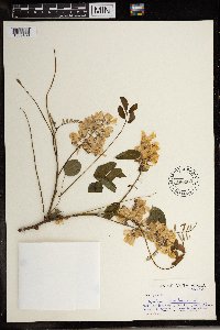 596569[1369409]James L. Sidey 39581965-11-00 South Africa, KwaZulu-Natal, Volksrust, Natal |
1
Page 1, records 1-60 of 60
Google Map
Google Maps is a web mapping service provided by Google that features a map that users can pan (by dragging the mouse) and zoom (by using the mouse wheel). Collection points are displayed as colored markers that when clicked on, displays the full information for that collection. When multiple species are queried (separated by semi-colons), different colored markers denote each individual species.