University of Minnesota
http://www.umn.edu/
612-625-5000
http://www.umn.edu/
612-625-5000
Minnesota Biodiversity Atlas
Bell Museum
Dataset: MIN-Plants
Taxa: Schoenoplectiella
Search Criteria: excluding cultivated/captive occurrences
1
Page 1, records 1-5 of 5
Bell Museum plants | |
 MIN:Plants | 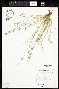 Schoenoplectiella purshiana var. purshiana (Fernald) Lye 805830[1021754]Almendinger, J. C. s.n.1988-00-00 United States, Minnesota, Washington, Katherine Abbot Park (MCBS-#111). Mahtomedi. E shore (N of Long Lake), 1 mi. S town. T30N, R21W, NW1/4 SW1/4 of section 32, 45.043045 -92.954644 |
MIN:Plants | 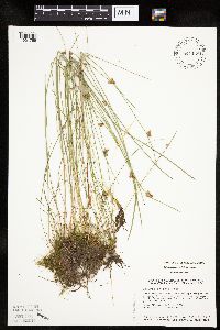 Schoenoplectiella purshiana var. purshiana (Fernald) Lye 841148[1021755]Smith, Welby R. 134281987-07-08 United States, Minnesota, Washington, About 2 miles north of Scandia. NW1/4 NW1/4 section 12, T32N, R20W, 45.2813889 -92.7927778 |
MIN:Plants | 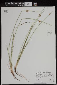 Schoenoplectiella purshiana var. purshiana (Fernald) Lye 952834[1295554]Kerns, Courtney CKK00682014-08-24 United States, Minnesota, Saint Louis, 47.75632 -92.0145, 453m |
MIN:Plants | 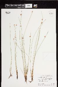 Schoenoplectiella purshiana var. purshiana (Fernald) Lye 952985[1297505]Smith, Welby R. 28017 United States, Minnesota, Pine |
MIN:Plants | 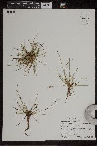 Schoenoplectiella smithii (A. Gray) Shiels & Monfils 959424[1311255]Lynden B. Gerdes 73872015-08-25 United States, Minnesota, Saint Louis, Superior National Forest. Fenske Lake, approximately 6.34 miles NNW of Ely, MN. Far bay in the lower southwest portion of lake., 47.98611111 -91.90222222 |
1
Page 1, records 1-5 of 5
Google Map
Google Maps is a web mapping service provided by Google that features a map that users can pan (by dragging the mouse) and zoom (by using the mouse wheel). Collection points are displayed as colored markers that when clicked on, displays the full information for that collection. When multiple species are queried (separated by semi-colons), different colored markers denote each individual species.