University of Minnesota
http://www.umn.edu/
612-625-5000
http://www.umn.edu/
612-625-5000
Minnesota Biodiversity Atlas
Bell Museum
Dataset: MIN-Plants
Taxa: Sorocea
Search Criteria: excluding cultivated/captive occurrences
1
Page 1, records 1-7 of 7
Bell Museum plants | |
 MIN:Plants | Sorocea guilleminiana Gaudich. 431618[]Weiblen, G.D. GW15042001-11-02 Brazil, Kilometer 41, -1.5 -46.166667, 4m |
MIN:Plants | Sorocea steinbachii C. C. Berg 431434[]Weiblen, G.D. GW15012001-11-02 Brazil, Kilometer 41, -1.5 -46.166667, 4m |
MIN:Plants |  Sorocea bondplandii (Baill.) Burger, Lanj. & Boer 453597[]Weiblen, G.D. GW11862000-08-23 Brazil, Hotel Bourbon, Iguassu Falls, -4.616667 -39.366667, 297m |
MIN:Plants |  Sorocea bondplandii (Baill.) Burger, Lanj. & Boer 453596[]Weiblen, G.D. GW11872000-08-23 Brazil, Hotel Bourbon, Iguassu Falls, -4.616667 -39.366667, 297m |
MIN:Plants | Sorocea pubivena Hemsley 431456[]Weiblen, G.D. GW14092001-09-12 Costa Rica, La Selva, 9.766667 -83.75, 972m |
MIN:Plants | Sorocea briquetii Macbride 431435[]Weiblen, G.D. GW14572001-10-12 Peru, Cocha Cashu, Manu National Park, -7.983333 -74.683333, 153m |
MIN:Plants | 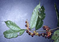 Sorocea affinis Hemsl. 431455[]Weiblen, G.D. GW14372001-09-26 Panama, Barro Colorado Island, 9.15 -79.833333, 62m |
1
Page 1, records 1-7 of 7
Google Map
Google Maps is a web mapping service provided by Google that features a map that users can pan (by dragging the mouse) and zoom (by using the mouse wheel). Collection points are displayed as colored markers that when clicked on, displays the full information for that collection. When multiple species are queried (separated by semi-colons), different colored markers denote each individual species.