University of Minnesota
http://www.umn.edu/
612-625-5000
http://www.umn.edu/
612-625-5000
Minnesota Biodiversity Atlas
Bell Museum
Dataset: MIN-Plants
Taxa: Uncinia
Search Criteria: excluding cultivated/captive occurrences
1
Page 1, records 1-10 of 10
Bell Museum plants | |
 MIN:Plants | 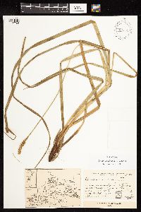 Uncinia andina G.A. Wheeler 939962[1127705]Cusato, L. 24541983-01-26 Argentina, Rio Negro, Parque Nacional NaRuel Huapi Tronador. Laguna Los Cesaies |
MIN:Plants | 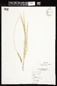 Uncinia andina G.A. Wheeler 655367 939970[1127706]Zollner, O. 153641989-01-22 Chile, Araucania, Malleco, Region de la Araucania. Termas de Tolhuaca, 900m |
MIN:Plants | 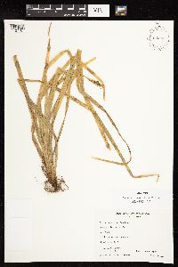 Uncinia araucana G.A. Wheeler 939967[1127707]Zollner, O. 76811974-01-08 Chile, Araucania, Malleco, Region de la Araucania. Malalcahuello (near Curacautin) |
MIN:Plants | 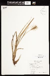 Uncinia chilensis G.A. Wheeler 939963[1127708]Zollner, O. 152031989-01-22 Chile, Araucania, Malleco, Region de la Araucania. WSW of Longuimay. Cordillera de Las Raices, 1000m |
MIN:Plants | 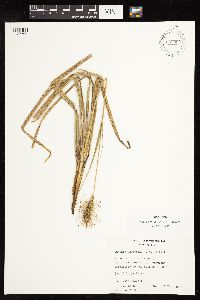 Uncinia chilensis G.A. Wheeler 939965[1127709]Zollner, O. 188121992-02-14 Chile, Araucania, Malleco, Region de la Araucania. WSW of Longuimay. Cordillera de Las Raices, 1100m |
MIN:Plants | 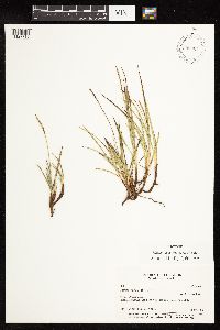 Uncinia lacustris G.A. Wheeler 939964[1127710]Laegaard, S. 518871984-03-29 Ecuador, Pichincha, Paramo de Guamani, app. 5 km W of Paso de La Virgen. At small lake., 3900m |
MIN:Plants | 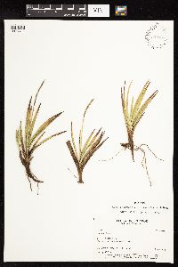 Uncinia paludosa G.A. Wheeler & Goetghebeur 939966[1127711]Laegaard, S. 710141988-04-26 Ecuador, Chimborazo, Paramo above Azul along road to Osogochi, 4200m |
MIN:Plants | 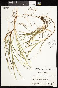 Uncinia subsacculata G.A. Wheeler & Goetghebeur 939968[1127712]Laegaard, S. 54469A1985-06-04 Ecuador, Pichincha, N side of Volcan pichincha above Hacienda Yanacocha, 3800m |
MIN:Plants | 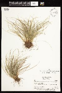 Uncinia tenuifolia G.A. Wheeler & Goetghebeur 939969[1127713]Ollgaard, B. 908841989-03-08 Ecuador, Zamora-Chinchipe, Loja--Zamora Road, ca. 13 km E of the pass, just before junction with old road, 2030m |
MIN:Plants | 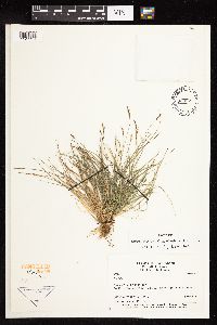 Uncinia tenuifolia G.A. Wheeler & Goetghebeur 939971[1127714]Ollgaard, B. 908841989-03-08 Ecuador, Zamora-Chinchipe, Loja--Zamora Road, ca. 13 km E of the pass, just before junction with old road, 2030m |
1
Page 1, records 1-10 of 10
Google Map
Google Maps is a web mapping service provided by Google that features a map that users can pan (by dragging the mouse) and zoom (by using the mouse wheel). Collection points are displayed as colored markers that when clicked on, displays the full information for that collection. When multiple species are queried (separated by semi-colons), different colored markers denote each individual species.