University of Minnesota
http://www.umn.edu/
612-625-5000
http://www.umn.edu/
612-625-5000
Minnesota Biodiversity Atlas
Bell Museum
Dataset: MIN-Plants
Taxa: Capparaceae
Search Criteria: excluding cultivated/captive occurrences
1
Page 1, records 1-16 of 16
Bell Museum plants | |
 MIN:Plants |  582389[1369683]Sidey, James L. 34591960-01-00 South Africa, Natal, Umkomaas Valley |
MIN:Plants | Atamisquea emarginata Miers ex Hooker & Arnott 564318[]Mason, Charles; et al. 17691959-05-29 United States, Arizona, Pima, 40 mile drive roadway...0.4 mile east of Quitobaquito turnoff. Organ Pipe Cactus National Monument. Pima County.;Organ Pipe Cactus National Monument;;;, 31.940065 -113.010546 |
MIN:Plants |  Capparis flexuosa (L.) L. 262835[1299101]Harris, J. Arthur C199811919-08-21 United States, Florida, Brevard, Merritts Island |
MIN:Plants |  Capparis erythrocarpos Isert 577997[1299102]Troupin, G. 11.7391959-05-08 Rwanda, Region du Mutara, environ de Mimuli, Reserve IRSAC, colline Mimuli, 1400 - 1450m |
MIN:Plants |  Capparis erythrocarpos Isert 578013[1369685]Mat. Alcool II.6121959-03-25 Rwanda, Region du Mutara, environ de Mimuli, reserve IRSAC, colline Nteko. Noms(s) Vern.: UMUKOROKOMBE, (dial Kinyaruanda), 1400 - 1450m |
MIN:Plants | Capparis indica NULL 939752[]P 212011-07-07 Costa Rica, Guanacaste, Liberia, , 10.84 -85.61, 320m |
MIN:Plants |  121657[1001172]Palmer, E. 167s1891-04-01 Mexico, Guaymas |
MIN:Plants |  Capparis pringlei Brig. 121529[1000502]Pringle, C.G. 46391894-05-18 Mexico, Oaxaca, Tomellin Canyon, 914m |
MIN:Plants |  577928[1369690]Troupin, G. 7571959-08-07 Rwanda, Mutara region, around Mimuli, IRSAC reserve, Karukwanzi hill, 1400 - 1450m |
MIN:Plants |  Maerua cafra (DC.) Pax 586146[1369689]Sidey, J. L. 38361963-09-00 South Africa, Bathurst Dist. E. Cape |
MIN:Plants |  Maerua nervosa (Hochst.) Oliv. 575878[1369691]Sidey, James L. 34791960-07-00 South Africa, Natal, Willards Beach, N. Coast |
MIN:Plants | 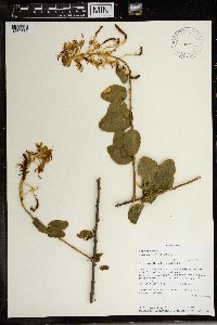 Cadaba kirkii Oliv. 492320[1369682]Lovett, J. C. 47061990-06-09 Tanzania, United Republic of, Makete District, Kimani Waterfall., -9 34.233333, 1500m |
MIN:Plants | 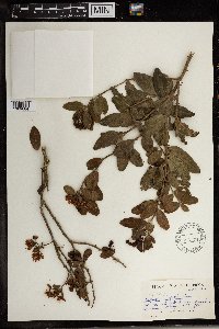 Capparis citrifolia Lam. 586176[1369684]Sidey, James L. 38371963-09-00 South Africa, Bathurst Dist. E. Cape |
MIN:Plants | 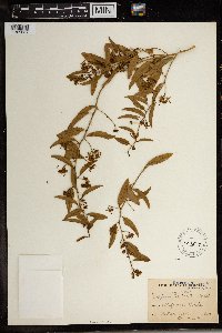 Capparis gueinzii Sond. 121537[1369687]Wood, J. M. 49111893-08-21 South Africa, Bluff near Durban, 200m |
MIN:Plants | 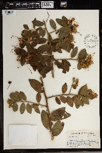 Capparis tomentosa Lam. 582398[1369688]Sidey, James L. 34571960-01-00 South Africa, KwaZulu-Natal, Umkomaas Valley |
MIN:Plants |  577957[1369686]Troupin, G. 7541959-08-07 Rwanda, Mutara region, around Mimuli, IRSAC reserve, Karukwanzi hill, 1400 - 1450m |
1
Page 1, records 1-16 of 16
Google Map
Google Maps is a web mapping service provided by Google that features a map that users can pan (by dragging the mouse) and zoom (by using the mouse wheel). Collection points are displayed as colored markers that when clicked on, displays the full information for that collection. When multiple species are queried (separated by semi-colons), different colored markers denote each individual species.