University of Minnesota
http://www.umn.edu/
612-625-5000
http://www.umn.edu/
612-625-5000
Minnesota Biodiversity Atlas
Bell Museum
Dataset: MIN-Plants
Taxa: Dennstaedtiaceae
Search Criteria: excluding cultivated/captive occurrences
Bell Museum plants | |
 MIN:Plants |  53574[1339133]Riedel 1885-12-00 Brazil |
MIN:Plants | 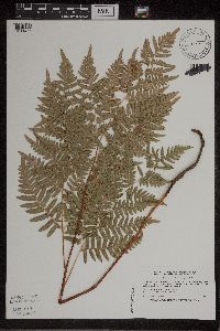 Pteridium aquilinum var. latiusculum (L.) Kuhn 520557[1311465]Smith, Welby 194981991-07-16 United States, Minnesota, Koochiching, Koochiching Co.; on the W side of Silverdale; T64N R22W SW1/4 of NE1/4 of Sec 35;Koochiching State Forest;064N;22W;35, 47.9866676 -93.1188889 |
MIN:Plants | 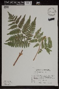 Pteridium aquilinum var. latiusculum (L.) Kuhn 829977[1311464]Townsend, D. 91-1491991-07-05 United States, Minnesota, Red Lake, Gervais Wildlife Management Area. Red Lake Co. Gervais WMA; SE1/4; S-center of S25 old farm opening. W portion of SE1/4; E portion og SE1/4; S1/2 Sec 25 T Red Lake Co. Gervais WMA; SE1/4; S-center of S25 old farm opening. W portion of SE1/4; E portion og SE1/4; S1/2 Sec 25 T151N R43W. 151N 43W 25, 47.868882 -96.107171 |
MIN:Plants | 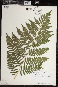 Pteridium aquilinum var. latiusculum (L.) Kuhn 835606[1383058]Schimpf, D.; et al. 1791983-08-24 United States, Minnesota, Cook, Grand Portage National Monument. Cook Co, R-6E, T-64N, S-30, NW of Visitor Center 2.5 to 3 mi;Grand Portage National Monument / North Shore;064N;06E;30, 47.999682 -89.760688 |
MIN:Plants | 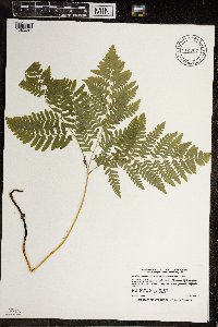 Pteridium aquilinum var. latiusculum (L.) Kuhn 914607[1383041]Smith, Welby 225001993-06-18 United States, Minnesota, Douglas, Douglas County...Lake Carlos State Park, about 6 miles north of Alexandria... T129N R 37W SE1/4 of SW 1/4 of Sec 9;Lake Carlos State Park;129N;37W;09, 45.9958333 -95.3469444 |
MIN:Plants |  Pteridium aquilinum var. latiusculum (L.) Kuhn 931736[1383164]Smith, Welby R. 203351992-06-04 United States, Minnesota, Goodhue, About 2 miles northeast of Sogn SW of NW of section;;111N;17W;17, 44.4222222 -92.8897222 |
MIN:Plants |  Pteridium aquilinum var. latiusculum (L.) Kuhn 953437[1292679]Olson, R. s.n.1954-06-27 United States, Minnesota, Saint Louis |
MIN:Plants |  Pteridium aquilinum (L.) Kuhn 954156[1295719]Eyerdam, Walter J. 74041949-08-24 United States, Alaska |
MIN:Plants |  Pteridium aquilinum (L.) Kuhn 954154[1295718]Sundberg, Marsh s.n.1969-08-09 United States, Wisconsin, Washburn |
MIN:Plants |  Pteridium aquilinum (L.) Kuhn 952994[1297496]Smith, Welby R. 28172 United States, Minnesota, Pine |
MIN:Plants |  Pteridium aquilinum (L.) Kuhn 953012[1297586]Smith, Welby R. 28311 United States, Minnesota, Pine |
MIN:Plants |  Pteridium aquilinum (L.) Kuhn 976593[1402183]Timothy J. S. Whitfeld 30192021-07-21 United States, Minnesota, St. Louis, Voyageurs National Park, Sand Point Lake, 0.15 miles west of the northwest end of Grassy Bay, Sand Point Lake, 48.396879 -92.558588, 375m |
MIN:Plants |  Pteridium aquilinum (L.) Kuhn 0968808[1391406]Janssens, J. 75/120 Belgium, 550m |
MIN:Plants | 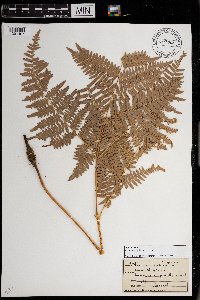 Pteridium aquilinum (L.) Kuhn 0968809[1391407]Bieberdorf, F. s.n.1939-00-00 United States, Montana |
MIN:Plants | 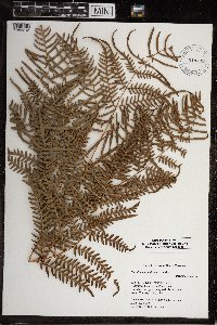 Pteridium aquilinum (L.) Kuhn 919795[1383218] United States, South Carolina |
MIN:Plants | 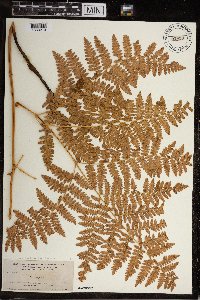 Pteridium aquilinum (L.) Kuhn 53930[1383219] United States, Wyoming |
MIN:Plants | 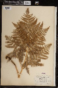 Pteridium aquilinum (L.) Kuhn 240551[1383220] United States, Pennsylvania |
MIN:Plants |  Pteridium aquilinum (L.) Kuhn 54039[1383221] United States, Washington |
MIN:Plants |  Pteridium aquilinum (L.) Kuhn 360076[1383222] Canada, Nova Scotia |
MIN:Plants |  Pteridium aquilinum (L.) Kuhn 358403[1383223] United States, Washington |
MIN:Plants |  Pteridium aquilinum (L.) Kuhn 357108[1383224] Canada, British Columbia |
MIN:Plants |  Pteridium aquilinum (L.) Kuhn 53921[1383225] Canada, British Columbia |
MIN:Plants |  Pteridium aquilinum (L.) Kuhn 569637[1383226] United States, California |
MIN:Plants |  Pteridium aquilinum (L.) Kuhn 59939[1383227] United States, Oregon |
MIN:Plants |  Pteridium aquilinum (L.) Kuhn 53929[1383228] United States, Montana |
MIN:Plants |  Pteridium aquilinum (L.) Kuhn 53915[1383229] United States, California |
MIN:Plants |  Pteridium aquilinum (L.) Kuhn 53916[1383230] United States, California |
MIN:Plants |  Pteridium aquilinum (L.) Kuhn 348624[1383231] United States, Tennessee |
MIN:Plants |  Pteridium aquilinum (L.) Kuhn 335969[1383232] United States, Oklahoma |
MIN:Plants |  Pteridium aquilinum (L.) Kuhn 53926[1383233] United States, Idaho |
MIN:Plants |  Pteridium aquilinum (L.) Kuhn 290743[1383234] United States, Washington |
MIN:Plants |  Pteridium aquilinum (L.) Kuhn 60025[1383235] United States, Idaho |
MIN:Plants |  Pteridium aquilinum (L.) Kuhn 60029[1383236] United States, Idaho |
MIN:Plants |  Pteridium aquilinum (L.) Kuhn 53922[1383237] United States, Idaho |
MIN:Plants |  Pteridium aquilinum (L.) Kuhn 58732[1383238] United States, California |
MIN:Plants |  Pteridium aquilinum (L.) Kuhn 58798[1383239] United States, Idaho |
MIN:Plants |  Pteridium aquilinum (L.) Kuhn 59798[1383240] United States, California |
MIN:Plants |  Pteridium aquilinum (L.) Kuhn 279484[1383241] United States, Massachusetts |
MIN:Plants |  Pteridium aquilinum (L.) Kuhn 261147[1383242] United States, Wyoming |
MIN:Plants |  Pteridium aquilinum (L.) Kuhn 452488[1383243] United States, New York |
MIN:Plants |  Pteridium aquilinum (L.) Kuhn 244714[1383244] United States, New York |
MIN:Plants |  Pteridium aquilinum (L.) Kuhn 589244[1383245] United States, Rhode Island |
MIN:Plants |  Pteridium aquilinum (L.) Kuhn 544834[1383246] United States, Ohio |
MIN:Plants |  Pteridium aquilinum (L.) Kuhn 540356[1383247] United States, Montana |
MIN:Plants |  Pteridium aquilinum (L.) Kuhn 540318[1383248] United States, Montana |
MIN:Plants |  Pteridium aquilinum (L.) Kuhn 561836[1383249] United States, New Mexico |
MIN:Plants |  Pteridium aquilinum (L.) Kuhn 346750[1383250] United States, New Jersey |
MIN:Plants |  Pteridium aquilinum (L.) Kuhn 578270[1383251] United States, Idaho |
MIN:Plants |  Pteridium aquilinum (L.) Kuhn 598207[1383252] United States, Michigan |
MIN:Plants |  Pteridium aquilinum (L.) Kuhn 597825[1383253] United States, North Carolina |
MIN:Plants |  Pteridium aquilinum (L.) Kuhn 531131[1383254] United States, Ohio |
MIN:Plants |  Pteridium aquilinum (L.) Kuhn 239714[1383255] United States, California |
MIN:Plants |  Pteridium aquilinum (L.) Kuhn 240176[1383256] United States, California |
MIN:Plants |  Pteridium aquilinum (L.) Kuhn 549602[1383257] United States, Indiana |
MIN:Plants |  Pteridium aquilinum (L.) Kuhn 388101[1383258] United States, Wisconsin |
MIN:Plants | 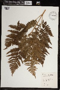 Pteridium aquilinum (L.) Kuhn 516807[1383259] United States, Illinois |
MIN:Plants | 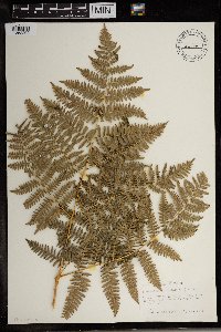 Pteridium aquilinum (L.) Kuhn 507992[1383290] United States, Idaho |
MIN:Plants | 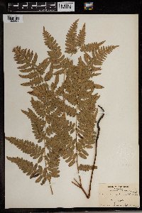 Pteridium aquilinum (L.) Kuhn 300617[1383291] United States, New Jersey |
MIN:Plants | 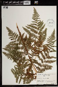 Pteridium aquilinum (L.) Kuhn 621906[1383292] United States, Vermont |
MIN:Plants |  Pteridium aquilinum (L.) Kuhn 292629[1383293] United States, Florida |
MIN:Plants |  Pteridium aquilinum (L.) Kuhn 521498[1383294] United States, Michigan |
MIN:Plants |  Pteridium aquilinum (L.) Kuhn 680198[1383295] United States, Wisconsin |
MIN:Plants |  Pteridium aquilinum (L.) Kuhn 531810[1383296] United States, Wisconsin |
MIN:Plants |  Pteridium aquilinum (L.) Kuhn 297488[1383297] United States, Wisconsin |
MIN:Plants |  Pteridium aquilinum (L.) Kuhn 716275[1383298] United States, West Virginia |
MIN:Plants |  Pteridium aquilinum (L.) Kuhn 622593[1383299] Canada |
MIN:Plants |  Pteridium aquilinum (L.) Kuhn 635335[1383300] United States, Texas |
MIN:Plants | 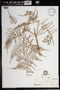 Pteridium aquilinum (L.) Kuhn 635471[1383301] United States, Florida |
MIN:Plants | 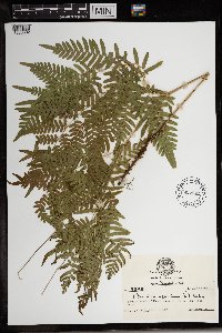 Pteridium aquilinum (L.) Kuhn 635345[1383302] United States, Texas |
MIN:Plants | 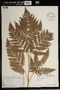 Pteridium aquilinum (L.) Kuhn 564837[1383303] United States, Massachusetts |
MIN:Plants | 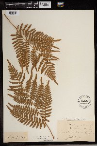 Pteridium aquilinum (L.) Kuhn 525255[1383304] United States, Massachusetts |
MIN:Plants |  Pteridium aquilinum (L.) Kuhn 117046[1383305] United States, New York |
MIN:Plants |  Pteridium aquilinum (L.) Kuhn 297268[1383306] United States, Wyoming |
MIN:Plants |  Pteridium aquilinum (L.) Kuhn 411640[1383307] United States, New Jersey |
MIN:Plants |  Pteridium aquilinum (L.) Kuhn 346966[1383308] United States, Pennsylvania |
MIN:Plants |  Pteridium aquilinum (L.) Kuhn 383877[1383309] United States, Virginia |
MIN:Plants |  Pteridium aquilinum (L.) Kuhn 755585[1383310] United States, Idaho |
MIN:Plants |  Pteridium aquilinum (L.) Kuhn 832231[1383390] Belize |
MIN:Plants |  Pteridium aquilinum (L.) Kuhn 704394[1383391] Belize |
MIN:Plants |  Pteridium aquilinum (L.) Kuhn 384399[1383412] Russian Federation |
MIN:Plants |  Pteridium aquilinum (L.) Kuhn 384618[1383413] Ukraine |
MIN:Plants |  Pteridium aquilinum (L.) Kuhn 261072[1383416] France |
MIN:Plants |  Pteridium aquilinum (L.) Kuhn 274975[1383419] Germany |
MIN:Plants | 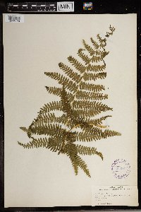 Pteridium aquilinum (L.) Kuhn 303907[1383420] France |
MIN:Plants | 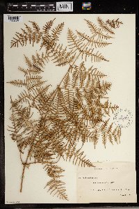 Pteridium aquilinum (L.) Kuhn 270359[1383428] New Zealand |
MIN:Plants | 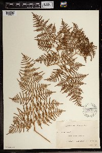 Pteridium aquilinum (L.) Kuhn 270357[1383429] New Zealand |
MIN:Plants | 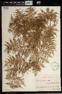 Pteridium aquilinum (L.) Kuhn 270358[1383430] New Zealand |
MIN:Plants |  Pteridium aquilinum (L.) Kuhn 270361[1383431] New Zealand |
MIN:Plants |  Pteridium aquilinum (L.) Kuhn 305909[1383432] Australia |
MIN:Plants |  Pteridium aquilinum (L.) Kuhn 305908[1383433] Australia |
MIN:Plants |  Pteridium aquilinum (L.) Kuhn 305910[1383434] Australia |
MIN:Plants |  Pteridium aquilinum (L.) Kuhn 305989[1383435] Australia |
MIN:Plants |  Pteridium aquilinum (L.) Kuhn 281777[1383436] Australia |
MIN:Plants |  Pteridium aquilinum (L.) Kuhn 368510[1383437] United States, Hawaii |
MIN:Plants |  Pteridium aquilinum (L.) Kuhn 368511[1383438] United States, Hawaii |
MIN:Plants | 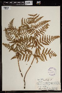 Pteridium aquilinum (L.) Kuhn 357754[1383439] United States, Hawaii |
MIN:Plants | 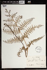 Pteridium aquilinum (L.) Kuhn 603251[1383440] Malaysia |
MIN:Plants | 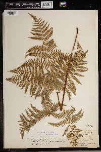 Pteridium aquilinum (L.) Kuhn 53905[1383441] United States, Hawaii |
MIN:Plants | 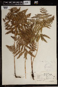 Pteridium aquilinum (L.) Kuhn 335144[1383442] United States, Hawaii |
MIN:Plants | 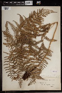 Pteridium aquilinum (L.) Kuhn 305825[1383443] Australia |
Google Map
Google Maps is a web mapping service provided by Google that features a map that users can pan (by dragging the mouse) and zoom (by using the mouse wheel). Collection points are displayed as colored markers that when clicked on, displays the full information for that collection. When multiple species are queried (separated by semi-colons), different colored markers denote each individual species.