University of Minnesota
http://www.umn.edu/
612-625-5000
http://www.umn.edu/
612-625-5000
Minnesota Biodiversity Atlas
Bell Museum
Dataset: MIN-Plants
Taxa: Diapensiaceae
Search Criteria: excluding cultivated/captive occurrences
1
Page 1, records 1-9 of 9
Bell Museum plants | |
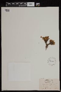
MIN:Plants | 601044[]Munns, C. 4761966-06-28 United States, Alaska, Highway Pass on Park Road. McKinley National Park;Denali National Park;;;, 63.473611 -150.148611 |
MIN:Plants | 281552[]Mexia, Ynes 21441928-07-25 United States, Alaska, McKinley National Park...Upper slope Copper Mt.;Denali National Park;;;, 60.868333 -146.585556, 1300m |
MIN:Plants | 169617[1295393]Cornell Party, Peary Voyage s.n.1896-08-12 Greenland, Nugsuak Peninsula |
MIN:Plants | Diapensia obovata (F. Schmidt) Nakai 417913[]Spetzman, L. 38121950-07-04 United States, Alaska, Arctic North Slope...Kurupa Lake;Gates of the Arctic National Park;;;, 68.3666667 -154.6666667, 945m |
MIN:Plants | Diapensia obovata (F. Schmidt) Nakai 700184[]Glaser, Paul 551975-06-30 United States, Alaska, Mt. McKinley National Park...N1/2NE1/4Sec.22 T16S R13W, near Toklat River Bridge;Denali National Park, 1859m |
MIN:Plants | Diapensia obovata (F. Schmidt) Nakai 700012[]Glaser, Paul 9671975-09-18 United States, Alaska, Mt. McKinley National Park...T17S R17W Sec. 29, near Wonder Lake Ranger Station;Denali National Park;;;, 63.45884 -150.86412, 610m |
MIN:Plants | Diapensia obovata (F. Schmidt) Nakai 413530[]Spetzman, L. 16731949-07-05 United States, Alaska, Arctic North Slope ... Anaktuvuk Pass;Gates of the Arctic National Park;;;, 68.2833333 -151.4166667, 610m |
MIN:Plants | Diapensia obovata (F. Schmidt) Nakai 413529[]Spetzman, L. 20661949-07-17 United States, Alaska, Arctic North Slope...Kanayut Lake;Gates of the Arctic National Park;;;, 68.3333333 -151, 914m |
MIN:Plants | Diapensia obovata (F. Schmidt) Nakai 413531[]Spetzman, L. 16851949-07-07 United States, Alaska, Arctic North Slope ... Anaktuvuk Pass;Gates of the Arctic National Park;;;, 68.2833333 -151.4166667, 914m |
1
Page 1, records 1-9 of 9
Google Map
Google Maps is a web mapping service provided by Google that features a map that users can pan (by dragging the mouse) and zoom (by using the mouse wheel). Collection points are displayed as colored markers that when clicked on, displays the full information for that collection. When multiple species are queried (separated by semi-colons), different colored markers denote each individual species.
