University of Minnesota
http://www.umn.edu/
612-625-5000
http://www.umn.edu/
612-625-5000
Minnesota Biodiversity Atlas
Bell Museum
Dataset: MIN-Plants
Taxa: Hypericaceae
Search Criteria: excluding cultivated/captive occurrences
Bell Museum plants | |
 MIN:Plants |  953761[1294724]Linnell, Bertha s.n.1926-00-00 United States, Maine, York, Saco |
MIN:Plants |  953737[1294747]Oliver, E. s.n.1930-06-00 United States, Michigan, Manistee, Manistee |
MIN:Plants |  223508[1370107]Cook, A.C. 3031897-02-00 Spain, Guia |
MIN:Plants |  155091[1370112]Alice Carter Cook 6601897-07-00 Spain, Canary Islands. Gran Canaria: San Mateo |
MIN:Plants | Hypericum punctatum Lamarck 912071[]Smith, Welby 229541993-07-15 United States, Minnesota, Fillmore, Beaver Creek Wildlife Management Area. Fillmore County...Beaver Creek State Wildlife Management Area; about 9.5 miles south of Spring Valley...T101N R31W NE1/4 of SW1/4 of Sec 21. 101N 31W 21, 43.5341667 -92.4025 |
MIN:Plants | Hypericum punctatum Lamarck 920278[]Smith, Welby 240081993-09-21 United States, Minnesota, Winona, Winona County ... About 3 miles west of Winona ... T107N R8W NE1/4 of NW1/4 of Sec 24;;107N;08W;24, 44.0622222 -91.7313889 |
MIN:Plants | Hypericum punctatum Lamarck 441734[]Husveth, J. 95-1121995-08-07 United States, Minnesota, Wright, Wright County...T120N R25W SE1/4 of the NW1/4 of S25;M Schmidt Crawford Woods Scientific Natural Area;T120N R25W S25, 45.172755 -93.775986 |
MIN:Plants | Hypericum punctatum Lamarck 154904[]Rosendahl, C. 2051901-08-00 United States, Minnesota, Houston, Spring Grove;;101N;07W;, 43.543165 -91.672028 |
MIN:Plants | Hypericum punctatum Lamarck 154924[]Rosendahl, C. 12911903-07-26 United States, Minnesota, Fillmore, Root River Valley 4 mi E of Whalan;;N;;, 43.731554 -91.85961 |
MIN:Plants | Hypericum punctatum Lamarck 154925[]Manning, Sara 24551883-08-09 United States, Minnesota, Goodhue, Frontenac;;N;;, 44.507468 -92.326291 |
MIN:Plants | Hypericum punctatum Lamarck 154926[]Wheeler, William 4831899-08-07 United States, Minnesota, Houston, Jefferson;Dorer Memorial Hardwood State Forest;101N;04W;35, 43.50806 -91.28287 |
MIN:Plants | Hypericum punctatum Lamarck 154927[]Wheeler, William 4421899-08-02 United States, Minnesota, Houston, Jefferson;Dorer Memorial Hardwood State Forest;101N;04W;35, 43.50806 -91.28287 |
MIN:Plants | Hypericum punctatum Lamarck 154928[]Lyon, H. s.n.1899-08-24 United States, Minnesota, Houston, Jefferson;Dorer Memorial Hardwood State Forest;101N;04W;35, 43.50806 -91.28287 |
MIN:Plants | Hypericum punctatum Lamarck 154929[]Sheldon, Edmund S32941892-07-00 United States, Minnesota, Mille Lacs, Bridgeman [original name for current town of Foreston];;T037N R27W S33, 45.65603 -93.707991 |
MIN:Plants | Hypericum punctatum Lamarck 154930[]Wheeler, William 6151899-08-25 United States, Minnesota, Houston, Brownsville;;103N;04W;, 43.694136 -91.279857 |
MIN:Plants | Hypericum punctatum Lamarck 154931[]Sandberg, John s.n.1886-06-00 United States, Minnesota, Goodhue, [no further data];;;;, 44.40976099 -92.72282341 |
MIN:Plants | Hypericum punctatum Lamarck 154932[]Hvoslef, H. s.n.1892-00-00 United States, Minnesota, Fillmore, Lanesboro;;103N;10W;, 43.720797 -91.976822 |
MIN:Plants | Hypericum punctatum Lamarck 154933[]Sandberg, John s.n.1885-07-00 United States, Minnesota, Goodhue, Red Wing;;113N;15W;, 44.562468 -92.533801 |
MIN:Plants | Hypericum punctatum Lamarck 154934[]Ballard, C. B11581892-08-00 United States, Minnesota, Goodhue, Zumbrota;;N;;, 44.294132 -92.669081 |
MIN:Plants | Hypericum punctatum Lamarck 274950[]Rosendahl, C. 57201928-08-11 United States, Minnesota, Houston, in Beaver Valley S of Sheldon, S13, Blackhammer Twp;;102N;07W;13, 43.637756 -91.620207 |
MIN:Plants | Hypericum punctatum Lamarck 383667[]Moore, John 159831943-08-23 United States, Minnesota, Houston, Houston County...1.9 mi N of Iowa-Minn state line, Jefferson Twp.;Dorer Memorial Hardwood State Forest;101N;04W;00, 43.519068 -91.277911 |
MIN:Plants | Hypericum punctatum Lamarck 383689[]Moore, John 159941943-08-24 United States, Minnesota, Fillmore, 2 mi up the Root River from Peterson;;N;;, 43.798111 -91.805236 |
MIN:Plants | Hypericum punctatum Lamarck 440531[]Smith, Welby 149411988-08-23 United States, Minnesota, Houston, Houston Co. About 4 mi E-SE of Rushford; SW1/4 NW1/4 sec.27, T104N R7W;Dorer Memorial Hardwood State Forest;104N;07W;27, 43.7844429 -91.6694412 |
MIN:Plants | Hypericum punctatum Lamarck 441292[]Smith, Welby 155101989-06-30 United States, Minnesota, Chisago, Chisago Co.; Interstate State Park, in Taylors Falls, in the St. Croix Valley; SW1/4 SE1/4 section 25, T 34N R 19W;Interstate State Park;034N;19W;25, 45.398836 -92.659396 |
MIN:Plants | Hypericum punctatum Lamarck 444232[]Nation, R. 94-2371994-07-05 United States, Minnesota, Mower, Lake Louise State Park. Mower Co.; Tract 6. T101N R14W SW1/4 of NE1/4 of Sec. 29;Lake Louise State Park;101N;14W;29, 43.522073 -92.538882 |
MIN:Plants |  Hypericum punctatum Lamarck 541512[]Morley, T. 9341957-08-03 United States, Minnesota, Washington, NE1/4 S4, Afton Twp, J.R. Stoltze estate; 0.9 mi S of US 12 in Co Rd 3, 0.5 mi W of co rd 3 on private road, 0.4 mi N;;028N;20W;4, 44.945042 -92.806625 |
MIN:Plants | Hypericum punctatum Lamarck 609998[]Rosendahl, C. 74861941-07-20 United States, Minnesota, Houston, farm 1 1/2 mi NW of Spring Grove;;101N;07W;, 43.576442 -91.65718 |
MIN:Plants | Hypericum punctatum Lamarck 782307[]Tenney, M. 4981982-08-03 United States, Minnesota, Winona, Whitewater State Park. Winona Co. T107N, R10W, S29, E1/2 NE1/4 SW1/4 NW1/4;Whitewater State Park;107N;10W;29, 44.042035 -92.049333 |
MIN:Plants | Hypericum punctatum Lamarck 782550[]Tenney, M. 5571982-08-19 United States, Minnesota, Fillmore, Forestville State Park. Fillmore Co. T102N, R11W, S18, SE1/4 NW1/4 NE1/4;Forestville State Park;102N;11W;18, 43.638081 -92.319098 |
MIN:Plants | Hypericum punctatum Lamarck 830303[]Myhre, K. 29311992-08-04 United States, Minnesota, Cass, Cass Co. Located 1.3 mi NW of Nushka Lake; T145N R27W NE1/4 of NE1/4 of sec.32;Chippewa National Forest / Leech Lake Indian Reservation;145N;27W;32, 47.337795 -94.119249 |
MIN:Plants | Hypericum punctatum Lamarck 833458[]Juhnke, C. 1641991-07-08 United States, Minnesota, Fillmore, Forestville State Park. Fillmore Co. T102N R12W Sec.19 SE SE SE. Root River bank near Mystery Cave I;Forestville State Park;102N;12W;19, 43.623689 -92.318983 |
MIN:Plants | Hypericum punctatum Lamarck 834109[]Smith, Welby 197711991-07-24 United States, Minnesota, Winona, Whitewater Wildlife Management Area. Winona County...Whitewater State Wildlife Management Area, about 4 miles S-SW of Altura, along the South Fork Whitewater River. T107N R10W SW1/4 of SW1/4 of Sec. 36. 107N 10W 36, 44.0216667 -91.9777778 |
MIN:Plants | Hypericum punctatum Lamarck 922809[]Smith, Welby 238161993-09-01 United States, Minnesota, Fillmore, Beaver Creek Wildlife Management Area. Beaver Creek State Wildlife Management Area, about 9.5 miles south of Spring Valley...T 101N R 31W NE1/4 of SW1/4 of Sec 21. 101N 31W 21, 43.5341667 -92.4025 |
MIN:Plants |  Hypericum punctatum Lamarck 953460[1292956]Jenkins, F. E. s.n.1894-07-20 United States, Illinois, Montgomery, Butler |
MIN:Plants |  Hypericum punctatum Lamarck 953758[1294726]Wible, Paul G. s.n.1928-07-26 United States, Indiana, Lawrence, Northeastern Lawrence County |
MIN:Plants |  Hypericum punctatum Lamarck 953759[1294727]Friesner, Ray C. 9729 United States, Indiana, Marion |
MIN:Plants | Triadenum virginicum Rafinesque 510877[]US Nat. Arboretum staff s.n.1981-00-00 United States, New Jersey, Ocean, Ocean Co. |
MIN:Plants |  Triadenum virginicum Rafinesque 953745[1294835]anonymous s.n.1896-08-01 United States, Massachusetts, Essex, Marblehead Neck |
MIN:Plants |  Triadenum virginicum Rafinesque 953763[1294722]Putnam, Mary P. s.n.1905-00-00 United States, Massachusetts, [no further data] |
MIN:Plants |  Triadenum virginicum Rafinesque 953762[1294723]M. M. s.n. United States, Massachusetts, Barnstable |
MIN:Plants |  Triadenum virginicum Rafinesque 968207[1368831]Timothy J. S. Whitfeld 16412017-08-16 United States, Rhode Island, Washington, Frying Pan Pond, Wood River, 0.75 miles north-northwest of dam on Arcadia Road., 41.54914 -71.70397 |
MIN:Plants | 480664[]Hammer, W. s.n.2002-07-01 United States, Minnesota, Ramsey, Ramsey County, Arden Hills. Twin Cities Army Ammunition Plant-Arden Hills Army Training Site. Grass management unit 11. S 1/2, NE 1/4, SE 1/4, section 15, T.30 N, R.23W. 030N 23W 15, 45.085133 -93.149202 |
MIN:Plants | 497755[]Anderson, Craig 6011999-07-29 United States, Minnesota, Stevens, Stevens Co.; Verlyn Marth memorial Prairie SNA; T126N R42W: SE 1/4 of SW 1/4 of SW 1/4 of Sect. 6;Verlyn Marth Memorial Prairie Scientific Natural Area;126N;42W;6, 45.752126 -95.995413 |
MIN:Plants | 690717[]Shane, L. 77-521977-07-20 United States, Maine, Oxford, Oxford County ... on summit of Mt. Sabattus, Lovell Township, 390m |
MIN:Plants | 914870[]Smith, Welby 226881993-07-01 United States, Minnesota, Otter Tail, Maplewood State Park. Otter Tail County ... Maplewood State Park, about 5 miles east-southeast of Pelican Rapids ... T135N R 42W SE1/4 of NE1/4 of Sec 9. 135N 42W 9, 46.5225 -95.9727778 |
MIN:Plants | 432620[]Gerdes, Lynden 37121999-08-03 United States, Minnesota, Cook, Superior National Forest. T64N R01E S03SESESE. Cook County ... Superior National Forest, old Cook County gravel pit approx. .25 mile north of the northwestern corner of Aspen Lake.. 064N 01E 3, 48.055437 -90.306846 |
MIN:Plants | 906326[]Gerdes, Lynden 55132007-08-14 United States, Minnesota, Lake, Superior National Forest. T61N R08W S19NWSESE. Lake County, MN. Superior National Forest. Approx. 9.13 miles WNW of Isabella, MN and 0.09 miles east of the Northwest Road (FR 373). Near the junction of creek and FR 903...NAD 83 / 620739 / 5289410. 061N 08W 19, 47.750658 -91.394556 |
MIN:Plants | 510475[]Gerdes, Lynden 30161998-07-22 United States, Minnesota, Cook, Superior National Forest. T65N R03W S32SWNE. Cook County ... Superior National Forest. Boat landing/public acces area at the far west end of Loon Lake.. 065N 03W 32, 48.070286 -90.740698 |
MIN:Plants | 898000[]Scott, P. 17462004-07-20 United States, Minnesota, Cook, Cook Co. ... old Clearwater dump. T64N R1W sec. 3 SESESE.;Superior National Forest;064N;01W;03, 48.054938 -90.437086 |
MIN:Plants | 355499[]Norman, Robert s.n.1939-07-24 United States, Minnesota, Saint Louis, East Boulevard, Duluth;;N;;, 46.7833 -92.1 |
MIN:Plants | 355882[]Lakela, Olga 33721939-10-07 United States, Minnesota, Saint Louis, ca 9 mi N of Duluth, Hwy no. 4;;N;;, 46.913564 -92.106579 |
MIN:Plants | 385539[]Moyle, J. 38111944-07-28 United States, Minnesota, Saint Louis, Hwy 4, ca 10 mi N of Duluth;;N;;, 46.92804 -92.106579 |
MIN:Plants | 386032[]Moyle, J. 40441945-08-03 United States, Minnesota, Freeborn, S of Albert Lea;;N;;, 43.6236 -93.311845 |
MIN:Plants | 407809[]Lakela, Olga 91921949-07-30 United States, Minnesota, Saint Louis, Rice Lake Road, 8 mi N of Duluth;;N;;, 46.899087 -92.106579 |
MIN:Plants | 413761[]Moore, John 100401937-07-25 United States, Minnesota, Hennepin, between the lakes road, 2 mi W of Excelsior;;N;;, 44.903289 -93.607236 |
MIN:Plants | 429992[]Smith, Welby 145941988-07-22 United States, Minnesota, Washington, Afton State Park. Washington Co.; In Afton State Park, about 3 miles south of the town of Afton; St. Croix River. NE1/4 NW1/4 sec.2, T 27N Washington Co.; In Afton State Park, about 3 miles south of the town of Afton; St. Croix River. NE1/4 NW1/4 sec.2, T 27N R 20W. 027N 20W 2, 44.857379 -92.774016 |
MIN:Plants | 436388[]Swanson, Gary s.n.1998-07-06 United States, Minnesota, Sherburne, Sherburne National Wildlife Refuge; NWNE 04-34-27;Sherburne National Wildlife Refuge;T034N R27W S4, 45.465538 -93.705276 |
MIN:Plants | 439489[]Smith, Welby 163541989-09-05 United States, Minnesota, Mille Lacs, Mille Lacs Co.; at the railroad crossing in Onamia (Soo Line and CSAH 25). NW1/4 NE1/4 sec.6, T41N R26W;;041N;26W;6, 46.062224 -93.673226 |
MIN:Plants | 444380[]Nation, R. 94-1891994-06-30 United States, Minnesota, Mower, Lake Louise State Park. Lake Louise State Park. Mower Co.; Tract #1A, south of the Old Minnesota Highway 56 road bed. T101N R14W E1/2 SW1/4 of S Lake Louise State Park. Mower Co.; Tract #1A, south of the Old Minnesota Highway 56 road bed. T101N R14W E1/2 SW1/4 of Sec. 21. 101N 14W 21, 43.536579 -92.519043 |
MIN:Plants | 452698[]Lee, Michael MDL3851993-09-09 United States, Minnesota, Dakota, Dakota Co.; 2 miles SE of New Trier; T 113N R 17W NE1/4 of NW1/4 of sec 19;;113N;17W;19, 44.584931 -92.906352 |
MIN:Plants | 453675[]Myhre, K. 43041993-08-03 United States, Minnesota, Pine, Along the Nemadji River at Maheu Lake. NE1/4 of NE1/4 of section.;;045N;17W;08, 46.39726 -92.506406 |
MIN:Plants | 464635[]Harris, Fred 941891994-08-29 United States, Minnesota, Olmsted, Olmsted Co.; NE1/4 of SW1/4 of SW1/4 Sect. 17 T106N R14W;;106N;14W;17, 43.981323 -92.533761 |
MIN:Plants | 476449[]Dunevitz, H. 7181992-07-29 United States, Minnesota, Goodhue, Goodhue Co.; bluff in Red Wing, accessed from Tyler Road; T 113N R 15W SE1/4 of NE1/4 of Sec 34;Spring Creek Prairie Scientific Natural Area;113N;15W;34, 44.551448 -92.594862 |
MIN:Plants | 515870[]Myhre, K. 27761992-07-20 United States, Minnesota, Cass, Cass Co.; located 1.3 mi N of Norway Lake; T138N R29W NW1/4 of NW1/4 of Sec 19;;138N;29W;19, 46.758948 -94.404115 |
MIN:Plants | 516078[]Butts, A. 181996-06-30 United States, Minnesota, Lyon, Camden State Park; Lyon Co. - Lyons Township. NW 1/4 of SE 1/4, sect.7, T110N R42W;Camden State Park;110N;42W;7, 44.346395 -95.944003 |
MIN:Plants | 519165[]Lobien, D. s.n.1993-07-07 United States, Minnesota, Washington, About one mile and a half east of White Bear Lake in Washington Co.; NW 1/4 SEC.26, NE 1/4 SEC.27 T30N, R21W;;030N;21W;, 45.062045 -92.903734 |
MIN:Plants | 532606[]Lakela, Olga 210721956-09-05 United States, Minnesota, Lake, Highway 2 and Stony River;;N;;, 47.658421 -91.603326 |
MIN:Plants | 585262[]Moore, John 263201963-06-06 United States, Minnesota, Houston, 4 1/2 mi NE of Caledonia;;N;;, 43.680764 -91.433126 |
MIN:Plants | 586527[]Moore, John 264861963-08-19 United States, Minnesota, Houston, 6 mi NE of Caledonia;;N;;, 43.696113 -91.411898 |
MIN:Plants | 619875[]Ownbey, Gerald 43481970-09-06 United States, Minnesota, Washington, 2.5 mi N of Afton, Rte 95;;028N;20W;, 44.936033 -92.785769 |
MIN:Plants | 622315[]Westkaemper, Remberta s.n.1971-07-00 United States, Minnesota, Stearns, Stearns Co. Zum Wolde Lake, Richmond;;123N;30W;, 45.454111 -94.519989 |
MIN:Plants | 698976[]Sather, Nancy; et al. 1251976-06-23 United States, Minnesota, Saint Louis, ditch at jnc of USFS road 559 and USFS 565, SW1/4 NE1/4 NE1/4 S16 T58N R14W;Superior National Forest;T058N R14W S16, 47.510762 -92.123096 |
MIN:Plants | 745445[]Smith, Welby 55431981-08-26 United States, Minnesota, Mower, Wild Indigo Scientific Natural Area. Wild Indigo Scientific and Natural Area, ca 2 mi ESE of the jnc of State Hwy 56 and Co Hwy 2 in Brownsdale, SE1/4 SE1/4 Wild Indigo Scientific and Natural Area, ca 2 mi ESE of the jnc of State Hwy 56 and Co Hwy 2 in Brownsdale, SE1/4 SE1/4 S11, T103N, R17W. 103N 17W 11, 43.739546 -92.839221 |
MIN:Plants | 747291[]Galatowitsch, S. 4121982-07-14 United States, Minnesota, Houston, Caledonia Oaks, T102N, R5W, E1/2 SW1/4 S24;Caledonia Oaks, The Nature Conservancy;102N;05W;24, 43.623103 -91.382423 |
MIN:Plants | 759035[]Smith, Welby 69631982-07-30 United States, Minnesota, Mower, Brandt-Larson State Wildlife Management Area, ca 4 mi NE of Lyle, along Otter Creek, NE1/4 SW1/4 S16, T101N, R17W;Brandt-Larson Wildlife Management Area;101N;17W;16, 43.55122 -92.879061 |
MIN:Plants | 802769[]Smith, Welby 118621986-06-22 United States, Minnesota, Ramsey, Maplewood Nature Center. Ramsey County...Maplewood, about 1/2 mi S of Larpenteur Avenue and 1/2 mi E of McKnight Road SE1/4 NW1/4 S24, T29N, R22W. 029N 22W 24, 44.9855556 -92.9894444 |
MIN:Plants | 816437[]Bender, J. s.n.1986-06-14 United States, Minnesota, Washington, Belwin Outdoor Education Laboratory, T28N, R20W, S10;Belwin Outdoor Education Laboratory;028N;20W;10, 44.927188 -92.791852 |
MIN:Plants | 827547[]Almendinger, J. s.n.1989-06-29 United States, Minnesota, Anoka, Anoka Co.; Carlos Avery Wildlife Mgmt. Area. NE 1/4 sec. 14, T 33 N, R 22 W;Carlos Avery Wildlife Management Area;033N;22W;14, 45.347871 -93.050717 |
MIN:Plants | 835449[]Myhre, K. 42631993-07-23 United States, Minnesota, Pine, Pine Co. Located 5.5 mi SE of the town of Nickerson; T45N R16W SW1/4 of NW1/4 of sec 29;Nemadji State Forest;045N;16W;29, 46.352317 -92.394696 |
MIN:Plants | 837323[]Smith, Welby 173931990-07-18 United States, Minnesota, Morrison, Camp Ripley Military Reservation. Camp Ripley Military Reservation Morrison Co. On the W side of Shiloh Road. UTM: 389500E 5105500N T130N R30W SW1/4 of SW Camp Ripley Military Reservation Morrison Co. On the W side of Shiloh Road. UTM: 389500E 5105500N T130N R30W SW1/4 of SW1/4 of Sec 2. 130N 30W 2, 46.100229 -94.4217 |
MIN:Plants | 840404[]Smith, Welby 135361987-07-18 United States, Minnesota, Sherburne, Sherburne Co. Sherburne national Wildlife Refuge, about 2 mi NE of Orrock; NE1/4 NW1/4 sec.4, T34N R27W.;Sherburne National Wildlife Refuge;034N;27W;4, 45.465538 -93.705276 |
MIN:Plants | 510472[]Gerdes, Lynden 30161998-07-22 United States, Minnesota, Cook, Superior National Forest. T65N R03W S32SWNE. Cook County ... Superior National Forest. Boat landing/public acces area at the far west end of Loon Lake.. 065N 03W 32, 48.070286 -90.740698 |
MIN:Plants | 480746[]Smith, Welby 171461990-07-04 United States, Minnesota, Pine, Pine County ... On the Hinkley Bike Trail where if crosses CSAH 26 at Friesland ... T42N R21W SE1/4 of SE1/4 of Sec 25;;042N;21W;25, 46.0855556 -92.9327778 |
MIN:Plants | 906322[]Gerdes, Lynden 55162007-08-17 United States, Minnesota, Lake, Superior National Forest. T60N R11W S07NESW. Lake County, MN. Superior National Forest. Approx. 7.68 miles ESE of Babbit [sic], MN. South of FR 178 and south of isolated ponds...NAD 83 / 592003 / 5283352. 060N 11W 7, 47.699286 -91.778821 |
MIN:Plants | 508788[]Kaul, R. 71671992-08-28 United States, Wisconsin, Saint Croix, St. Croix County ... about one mile south of Hudson, just west of the valley forest of the St. Croix River.;Saint Croix National Riverway;;;, 44.959412 -92.74794 |
MIN:Plants | 913034[]Gutzmer, Michael s.n.2009-06-24 United States, Minnesota, Goodhue, Goodhue County...Mississippi River bottomland.;;;;, 44.6186111 -92.6475 |
MIN:Plants | 567879[]Smith, Welby 156561989-07-11 United States, Minnesota, Kanabec, Mille Lacs Wildlife Management Area. Kanabeck County ... Mille Lacs State Wildlife Management Area, about 9 miles northwest of Mora ... SW1/4 SW1/4 section 16, T 40N R 25W. 040N 25W 16, 45.9511111 -93.4711111 |
MIN:Plants | 477314[]Whitfeld, T.J.S. 2702001-07-06 United States, Minnesota, Kandiyohi, Kandiyohi County ... 1/4 mile north of County Road 40; 2 miles east of New London ... T121N R34W SW1/4 of NW1/4 of NW1/4 of Section 13. 121N 34W 13, 45.289293 -94.896604 |
MIN:Plants | 918112[]Zelazny, J. s.n.2005-08-19 Poland, Szczawa-Wiatrowki;;;;, 49.6166667 -20.25 |
MIN:Plants | 929456[]Scott, P. 34762011-08-01 United States, Minnesota, Cook, Washout Road. SW of section.;Superior National Forest;T064N R01W S05, 48.055989 -90.48028 |
MIN:Plants | 935983[]Orf, Madeline 72012-07-25 United States, Minnesota, Lake, Roadside of Lake County 151, about 1/2 mile south of Lake County 15. UTM: 593799E 5249468N. SE1/4 of section.;Superior National Forest;057N;11W;29, 47.3919258 -91.7570919 |
MIN:Plants |  935987[1299111]Orf, Madeline 22012-07-25 United States, Minnesota, Lake, At intersection of Snowbank Road and parking area for Snowbank Trail trailhead. UTM: 614689E 5314033N. NW1/4 of section.;Superior National Forest;063N;09W;03, 47.9693175 -91.4634131 |
MIN:Plants | 935982[]Fetterer, Matt 42012-07-25 United States, Minnesota, Saint Louis, West side of US 53 south of Orr. UTM: 516908E 5304171N. NW1/4 of section.;;062N;19W;04, 47.8906472 -92.773815 |
MIN:Plants | 935989[]Fetterer, Matt 142012-07-25 United States, Minnesota, Saint Louis, Along St Louis County 116 on west side of road about .5 miles west of North Hegman Lake. UTM: 580005E 5322281N. NE1/4 of section.;;064N;13W;12, 48.0487933 -91.9264631 |
MIN:Plants | 447801[]Pomroy, Deborah; Barnes, Raymond 28142013-07-08 United States, Minnesota, Saint Louis, Sullivan Lake, SW of Sullivan Lake, N side of Co. Rd. 547 (Brimson Rd.) at junction with Pequaywayn Hoyt Lakes Snowmobile Trail. UTM: 0570025E, 5231236N. SE1/4 of sec.;Cloquet Valley State Forest;055N;14W;23, 47.2305556 -92.0752778 |
MIN:Plants | 579226[]Kaul, R. B. 14341960-07-12 United States, Montana, Flathead, Glacier National Park. Near Fish Creek |
MIN:Plants |  572333[1290424]Hsi, Eugene 6291962-08-21 United States, Wisconsin, Ashland, Grant's Point, Madeline Island [Apostle Islands National Lakeshore] |
MIN:Plants |  953754[1294728]Putnam, Mary P. s.n. United States, Massachusetts, [no further data] |
MIN:Plants |  953755[1294729]Mowery, May s.n.1928-07-12 United States, Massachusetts, Barnstable, Woods Hole and vicinity |
MIN:Plants | 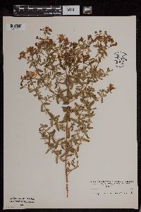 953756[1294730]Wible, Paul G. s.n.1928-07-28 United States, Indiana, Lawrence, Northeastern Lawrence County |
Google Map
Google Maps is a web mapping service provided by Google that features a map that users can pan (by dragging the mouse) and zoom (by using the mouse wheel). Collection points are displayed as colored markers that when clicked on, displays the full information for that collection. When multiple species are queried (separated by semi-colons), different colored markers denote each individual species.