University of Minnesota
http://www.umn.edu/
612-625-5000
http://www.umn.edu/
612-625-5000
Minnesota Biodiversity Atlas
Bell Museum
Dataset: MIN-Plants
Taxa: Ochnaceae
Search Criteria: excluding cultivated/captive occurrences
1
Page 1, records 1-9 of 9
Bell Museum plants | |
 MIN:Plants | 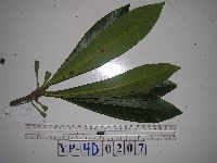 951793[1297975]Weiblen, G.D. YP4D02072012-08-24 Papua New Guinea, Morobe, Yawan Village, -6.1642 146.840083, 1738m |
MIN:Plants | 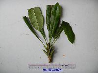 951794[1297974]Weiblen, G.D. YS3F03672010-08-12 Papua New Guinea, Morobe, Yawan Village, -6.16255 146.839933, 1721m |
MIN:Plants | 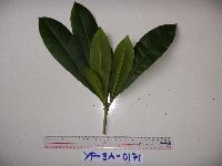 951796[1297973]Weiblen, G.D. YP3A01712010-10-22 Papua New Guinea, Morobe, Yawan Village, -6.162617 146.841967, 1777m |
MIN:Plants | 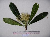 951800[1297969]Weiblen, G.D. YS1F00152010-07-05 Papua New Guinea, Morobe, Yawan Village, -6.16255 146.839933, 1721m |
MIN:Plants | 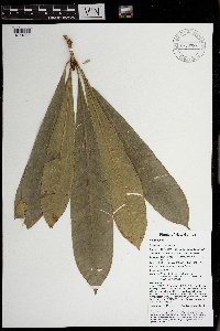 Schuurmansia elegans Blume 970296[1371896]Weiblen, G. D. & Binatang Research Center NP1A00412013-05-30 Papua New Guinea, Madang, Numba, -5.7222 145.2714, 1200m |
MIN:Plants | 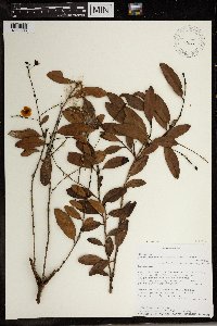 492650[1369506]L.M. Randrianjanaka 5252000-02-18 Madagascar, Toamasina, Parc National de Zahamena. Vinanitelo, a 4 km au SE d'Andranomalaza Sud., -17.653889 48.663611, 1140m |
MIN:Plants | 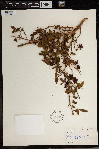 589846[1369502]James L. Sidey 38601963-12-00 South Africa, Natal |
MIN:Plants | 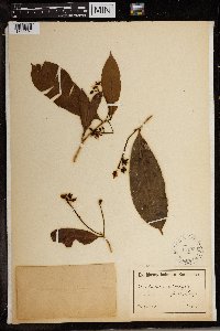 Ouratea calophylla (Hook. f.) Engl. & Gilg 154260[1369504]Preuss 1255 Cameroon |
MIN:Plants | 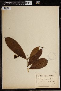 Ouratea calophylla (Hook. f.) Engl. & Gilg 154261[1369505]Preuss 1255 Cameroon |
1
Page 1, records 1-9 of 9
Google Map
Google Maps is a web mapping service provided by Google that features a map that users can pan (by dragging the mouse) and zoom (by using the mouse wheel). Collection points are displayed as colored markers that when clicked on, displays the full information for that collection. When multiple species are queried (separated by semi-colons), different colored markers denote each individual species.