University of Minnesota
http://www.umn.edu/
612-625-5000
http://www.umn.edu/
612-625-5000
Minnesota Biodiversity Atlas
Bell Museum
Dataset: MIN-Plants
Taxa: Phrymaceae
Search Criteria: excluding cultivated/captive occurrences
Bell Museum plants | |
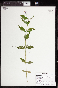
MIN:Plants | 453613[]Smith, Welby 139521987-09-11 United States, Minnesota, Lyon, Lyon Co. Camden State Park, about 3 mi N of Russell. NW1/4 SE1/4 sec 5, T110N R42W;Camden State Park;110N;42W;5, 44.361708 -95.925556 |
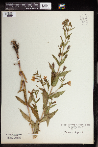
MIN:Plants | 458927[]Smith, Welby 146261988-07-25 United States, Minnesota, Kanabec, Kanabec Co.; on the west bank of the Snake River, just south of the Highway 3 crossing; NE1/4 NW1/4 sec.22, T 41N R 23W, Kanabec Co.; on the west bank of the Snake River, just south of the Highway 3 crossing; NE1/4 NW1/4 sec.22, T 41N R 23W. 041N 23W 22, 46.0238876 -93.2333298 |
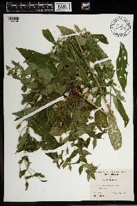
MIN:Plants | 518702[]Smith, Welby 211391992-07-28 United States, Minnesota, Fillmore, Dorer Memorial Hardwood State Forest. Fillmore Co.; in the Root River Valley, about 2 miles west-southwest of Peterson; on the bank of Big Springs Creek; Fillmore Co.; in the Root River Valley, about 2 miles west-southwest of Peterson; on the bank of Big Springs Creek; T 104N R 9W SE1/4 of SE1/4 of Sec 26. 104N 09W 26, 43.7761116 -91.875 |
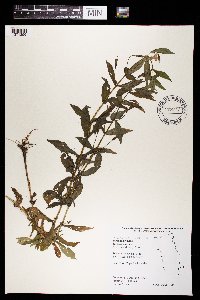
MIN:Plants | 832277[]Myhre, K. 27021992-07-14 United States, Minnesota, Cass, Cass Co. Located 2.5 mi N of Stony Lake; T141N R30W NE1/4 of NW1/4 of Sec 33;Chippewa National Forest;141N;30W;33, 46.992056 -94.483954 |
MIN:Plants | 833408[]Juhnke, C. 2021991-07-19 United States, Minnesota, Fillmore, Forestville State Park. Fillmore Co. T102N R12W Sec.24 NW NE NW; near interpretive center;Forestville State Park;102N;12W;24, 43.623411 -92.219151 |
MIN:Plants | 836247[]Smith, Welby 182251990-08-30 United States, Minnesota, Morrison, Camp Ripley Military Reservation. Camp Ripley Military Reservation. Morrison Co.; about 1 km E of the jnc. of Chorwan Road and East Boundary Road; Mississ Camp Ripley Military Reservation. Morrison Co.; about 1 km E of the jnc. of Chorwan Road and East Boundary Road; Mississippi River; UTM: 396600E 5124800N T132N R29W SE1/4 of SW1/4 of Sec 4. 132N 29W 4, 46.272931 -94.344197 |
MIN:Plants | 839358[]Cholewa, A.; Engels, A. 23661995-07-27 United States, Minnesota, Aitkin, Savanna Portage State Park. Aitkin Co. Savanna Portage State Park, about 17 mi NE of McGregor, E side of Savanna Lake at boat access, T50N R22W S6 S Aitkin Co. Savanna Portage State Park, about 17 mi NE of McGregor, E side of Savanna Lake at boat access, T50N R22W S6 SE1/4 of NW1/4.. 050N 22W 6, 46.850494 -93.192696 |
MIN:Plants | 841087[]Smith, Welby 134991987-07-13 United States, Minnesota, Scott, Murphy-Hanrahan County Park Reserve. Scott County...Murphy-Hanrahan Regional Park, on the S side of Hanrahan Lake, about 2 mi W of Burnsville SW1/4 NW1/4 sec. 34, T115N R21W. 115N 21W 34, 44.7277778 -93.3363889 |
MIN:Plants | 515064[]Scott, P. 14352002-08-29 United States, Minnesota, Cook, COOK CO ... On Rose/Daniels portage, BWCAW. T65N R1W sec.24 SESENE.;Boundary Waters Canoe Area Wilderness / Superior National Forest;065N;01W;24, 48.095412 -90.397251 |
MIN:Plants | 931532[]Gerdes, Lynden B.; Smith, Welby R. 63452011-08-10 United States, Minnesota, Lake, Superior National Forest. Eastern shores of Isabella Lake and just entering the Boga River inlet. SESWSWNE. 062N 07W 31, 47.8113889 -91.2669444 |
MIN:Plants | 935440[]Smith, Welby R. 331712011-08-02 United States, Minnesota, Koochiching, About 15 miles W-SW of Silverdale along Holmstrom Forest Road. NE of NE of section;Koochiching State Forest;063N;24W;17, 47.95085 -93.42985 |
MIN:Plants | 936969[]Smith, Welby R. 302512007-07-11 United States, Minnesota, Marshall, SW of NW of section;Thief Lake Wildlife Management Area;158N;39W;31, 48.4631926 -95.7269614 |
MIN:Plants | 937040[]Smith, Welby R. 322252010-09-03 United States, Minnesota, Saint Louis, Along the Whiteface River about 6 miles east of Cotton. NE of NE of section;;054N;16W;10, 47.1808761 -92.348627 |
MIN:Plants | 904796[]Smith, Welby R. 320732010-08-27 United States, Minnesota, Lake, Forest Hwy 11, about 5 miles northwest of Silver Bay. SE of NE of section;;056N;08W;21, 47.3236809 -91.3485343 |
MIN:Plants | 778287[]Smith, Welby R. 318942010-07-27 United States, Minnesota, Dakota, Along the Vermillion River about 7 miles southeast of Hastings. SE of NE of section;;114N;16W;21, 44.6682304 -92.7360854 |
MIN:Plants | 905528[]Vanderbosch, Dana 12005-08-05 United States, Minnesota, Ramsey, Phalen Lake - SW; W 1/2 of the SE1/4 of Sec 21 T29N R22W Ramsey County ... Southwest side of Phalen Lake.;;029N;22W;21, 44.981342 -93.051823 |
MIN:Plants | 962976[1346575]Whitfeld, T.J.S. 23832019-08-27 United States, Minnesota, Aitkin, US Army Corps of Engineers Big Sandy Lake Recreation Area, campground-marsh, 46.786545 -93.316505 |
MIN:Plants | 962210[1340847]Kaliher, Earl L. 1927-07-28 United States, Minnesota, Todd, Ward Springs, 45.791389 -94.808333 |
MIN:Plants | 965640[1356498]Stuart K. Harris 1964-09-13 United States, New Hampshire, Rockingham, Mammoth Road |
MIN:Plants | []Timothy J. S. Whitfeld 33372022-07-06 United States, Minnesota, Swift, Fairfield 21-1 Native Prairie Bank, 7.8 miles north-north west of Holloway, 45.35837 -95.949446, 309m |
MIN:Plants | 969667[1371256]B. Bartodziej 56-00 B2000-08-07 United States, Minnesota, Ramsey, Subwatershed number: C-45, 44.937636 -92.999316 |
MIN:Plants | 975866[1404920]Dunevitz, Hannah L. 10251994-08-09 United States, Minnesota, Dakota, Peninsula in the Mississippi River at the east edge of Inver Grove Heights., 44.852384 -93.015018 |
MIN:Plants | 976175[1373710]Smith, Welby R WRS369132020-08-24 United States, Minnesota, Wright, On the northeast side of Pelican Lake, about 7 km (4.35 miles) southeast of the approximate center of Monticello., 45.252978 -93.748712 |
MIN:Plants | Mimulus laciniatus A. Gray 239618[]Congdon, J. s.n.1885-07-01 United States, California, Mariposa, Foot of Yosemite Falls, Mariposa County;Yosemite National Park |
MIN:Plants | Mimulus laciniatus A. Gray 239645[]Congdon, J. s.n.1883-06-04 United States, California, Mariposa, Big Tree Turnpike, Mariposa County;Yosemite National Park |
MIN:Plants | Mimulus laciniatus A. Gray 239236[]Congdon, J. s.n.1890-08-12 United States, California, Mariposa, Buck Camp, Mariposa County;Yosemite National Park |
MIN:Plants | Mimulus laciniatus A. Gray 239222[]Congdon, J. s.n.1897-06-04 United States, California, Mariposa, Chilnualna Trail, Mariposa County;Yosemite National Park |
MIN:Plants | Mimulus laciniatus A. Gray 239647[]Congdon, J. s.n.1883-06-03 United States, California, Mariposa, Yosemite Cliffs, Mariposa County;Yosemite National Park |
MIN:Plants | Mimulus nanus Hooker & Arnott 509573[]Davis, Owen s.n.1978-08-29 United States, Idaho, Bingham, [no further data] |
MIN:Plants | Mimulus guttatus de Candolle 794662[]Schaaf, J. 2921982-07-14 United States, Nevada, Humboldt, Pine Canyon, Santa Rosa Mts.;;;;, 36.25611 -115.60667, 1585m |
MIN:Plants | Mimulus guttatus de Candolle 478471[]Bright, R. 72-521972-00-00 United States, Idaho, Franklin, [no further data] |
MIN:Plants | Mimulus guttatus de Candolle 492434[]Williams, M. s.n.1982-00-00 United States, Nevada, Washoe Co. -- cultivated |
MIN:Plants | Mimulus guttatus de Candolle 509570[]Univ. of Calif. Bot. Gard. list 17 - 941974-00-00 United States, California, Stanislaus, Stanislaus Co. |
MIN:Plants | Mimulus guttatus de Candolle 949229[]Schneider, Heather 70-20140426-1V2014-04-26 United States, California, Inyo, Death Valley National Park, approx. 28 miles SW of Stovepipe Wells airport in Death Valley National Park, CA, 36.318567 -117.52521, 923m |
MIN:Plants | Mimulus guttatus de Candolle 972322[1395872]Janssens, J. 75/3091975-07-30 United Kingdom, Scotland, Isle of Skye, Broadway |
MIN:Plants | Mimulus guttatus de Candolle []Olson, Emily GW25812004-08-07 United States, Colorado, Gunnison, On trail toward W. Maroon Pass, before hitting fork toward Frigid Air Pass, 39.001222 -107.013286, 3562m |
MIN:Plants | Mimulus guttatus de Candolle []McElderry, M. GW25862004-08-03 United States, Colorado, Gunnison, Daisy Pass, 38.951361 -107.091778, 3158m |
MIN:Plants | Mimulus guttatus de Candolle []Weiblen, G. D. GW13012001-07-30 United States, Colorado, Gunnison, 1.67 km W of cemetary on Kebler Pass Road, 38.833333 -107.083333, 2987m |
MIN:Plants | Mimulus guttatus de Candolle []Strickler, Stephanie GW26182004-08-06 United States, Colorado, Gunnison, along stream feeding into small waterfall, Gothic, Gunnison County, Clorado, USA, 38.9604 -106.9929, 2910m |
MIN:Plants | Mimulus guttatus de Candolle []Whitney, H. GW25852004-08-05 United States, Colorado, Gunnison, Coal Creek, Kebler Pass Road, East of Crested Butte, 38.863528 -107.033917, 2860m |
MIN:Plants | Mimulus bicolor Hartweg ex Bentham 239681[]Congdon, J. s.n.1890-06-01 United States, California, Mariposa, Snow Creek;Yosemite National Park |
MIN:Plants | Mimulus bicolor Hartweg ex Bentham 239524[]Congdon, J. s.n.1885-06-27 United States, California, Mariposa, Big Tree road, Mariposa County;Yosemite National Park |
MIN:Plants | Mimulus bicolor Hartweg ex Bentham 239638[]Congdon, J. s.n.1883-06-02 United States, California, Mariposa, Yosemite Valley;Yosemite National Park;;;, 37.71639 -119.66417 |
MIN:Plants | Mimulus bicolor Hartweg ex Bentham 239326[]Congdon, J. s.n.1892-06-12 United States, California, Mariposa, Snow Creek;Yosemite National Park |
MIN:Plants | Mimulus bicolor Hartweg ex Bentham 239523[]Congdon, J. s.n.1897-06-03 United States, California, Mariposa, Wawona Turnpike, Mariposa County;Yosemite National Park;;;, 37.53694 -119.65528 |
MIN:Plants | Mimulus bicolor Hartweg ex Bentham 239682[]Congdon, J. s.n.1885-06-00 United States, California, Mariposa, Snow Creek;Yosemite National Park |
MIN:Plants | Mimulus bicolor Hartweg ex Bentham 592715[]Carter, Annetta 31981952-06-29 United States, California, Tuolumne, Above South Grove, Calaveras Big Trees between Beaver Creek and Griswold Creek.;Yosemite National Park, 1676m |
MIN:Plants | Mimulus bicolor Hartweg ex Bentham 239522[]Congdon, J. s.n.1884-06-00 United States, California, Mariposa, Snow Creek |
MIN:Plants | Mimulus glabratus Kunth 970712[1394201]Timothy J. S. Whitfeld 30702021-07-29 United States, Minnesota, Pine, Kettle River Scientific and Natural Area, east of the Kettle River, north of Highway 48, 4.5 miles east of intersection with Interstate 35, 46.019723 -92.84436, 287m |
MIN:Plants | Mimulus glabratus Kunth 967164[1359823]Rowe, Erika R. ERR6312009-08-12 United States, Minnesota, Beltrami, 0.3 miles east of Beltrami County Hwy 7; 3 miles southwest of Bemidji., 47.46 -94.94, 402m |
MIN:Plants | 452985[]Kaul, R.; et al. 51001985-07-25 United States, Minnesota, Steele, Steele County...at Mineral Springs Parks, Owatonna.;;107N;20W;, 44.09663 -93.197154 |
MIN:Plants | 474153[]Moore, John 2711971-07-08 United States, Minnesota, Sherburne, NE1/4 S.34 - Blue Hill Twnshp. [Sherburne National Wildlife Refug];Sherburne National Wildlife Refuge;T035N R27W S34, 45.479607 -93.684948 |
MIN:Plants | 498976[]Juhnke, C. 404 CMJ FRO1999-07-01 United States, Minnesota, Goodhue, Frontenac State Park Goodhue County ... On Rattelsnake [sic] Bluff near bridge on Hill Ave. ... T112N R13W SW SW NE 5;Frontenac State Park;112N;13W;05, 44.535039 -92.400072 |
MIN:Plants | 473634[]Nation, R. 94-2921994-07-18 United States, Minnesota, Mower, Lake Louise State Park. Mower Co.; Tract 14. T101N R14W SW1/4 of SE1/4 of Sec. 20;Lake Louise State Park;101N;14W;20, 43.536572 -92.538985 |
MIN:Plants | 910712[]Rowe, Erika ERR2832007-08-29 United States, Minnesota, Hubbard, Paul Bunyan State Forest. Hubbard County...On the west side of Waboose Lake and approx. 60 meters east of another unnamed lake; 0.5 mile east of Inner Forest Rd. ...T141N R33W SESE S03. 141N 33W 3, 47.0527778 -94.8344444 |
MIN:Plants | 438816[]Rowe, Erika ERR982005-07-07 United States, Minnesota, Becker, Tamarac National Wildlife Refuge. Becker County ... 0.25 miles south of County Hwy 26 in Tamarac National Wildlife Refuge just north of Tamarac Lake .. 1/4NW 1/4SE S12 T140N R40W. 140N 40W 12, 46.951806 -95.666637 |
MIN:Plants | 438440[]Smith, Welby 258881995-08-23 United States, Minnesota, Yellow Medicine, Upper Sioux Agency State Park. Yellow Medicine County...In Upper Sioux Agency State Park. On the floodplain of the Minnseota River about 5 miles east-southeast of Granite Falls...T 115N R 38W SE1/4 of NW1/4 of Sec 29. 115N 38W 29, 44.7405556 -95.4505556 |
MIN:Plants | 191961[]Wheeler, William 2981899-07-07 United States, Minnesota, Houston, Crooked Creek;Dorer Memorial Hardwood State Forest;N;;, 43.592621 -91.284352 |
MIN:Plants | 191972[]G. & L. 81-41885-08-00 United States, Minnesota, Chippewa, Chippewa Valley, Chippewa Co.;;N;;, 44.934473 -95.733328 |
MIN:Plants | 191973[]Rosendahl, C. 22971909-07-19 United States, Minnesota, Hennepin, Ft. Snelling Reservation, near river [old regional park spanning junction of Minnesota and Mississippi rivers];;028N;23W;, 44.875594 -93.213123 |
MIN:Plants | 191974[]Goldsmith, G. G.1451912-00-00 United States, Minnesota, Rice, Northfield;;N;;, 44.458298 -93.161604 |
MIN:Plants | 191975[]Rosendahl, C. s.n.1899-07-00 United States, Minnesota, Houston, Spring Grove;;101N;07W;, 43.543165 -91.672028 |
MIN:Plants | 191976[]Ainslie, G. s.n.1902-07-04 United States, Minnesota, Olmsted, Rochester;;106N;14W;, 43.97834 -92.49834 |
MIN:Plants | 191977[]Heller, A. s.n.1896-09-15 United States, Minnesota, Hennepin, Lake Harriet, Minneapolis;;N;;, 44.921821 -93.304866 |
MIN:Plants | 191978[]MacMillan, C.; et al. 241SK1900-08-00 United States, Minnesota, Polk, Crookston;;150N;46W;30, 47.782 -96.60007 |
MIN:Plants | 191979[]Oestlund, O. s.n.1888-08-01 United States, Minnesota, Hennepin, [no further data];;;;, 45 -93.47 |
MIN:Plants | 191980[]Manning, Sara 33771892-07-07 United States, Minnesota, Goodhue, Central Point [pioneer town on Sand Point, Lake Pepin];Frontenac State Park;112N;13W;12, 44.51982 -92.31912 |
MIN:Plants | 191981[]G. & L. 33771885-08-00 United States, Minnesota, Chippewa, Chippewa Valley, Chippewa Co.;;N;;, 44.934473 -95.733328 |
MIN:Plants | 191982[]Manning, Sara 33771886-07-08 United States, Minnesota, Wabasha, Lake City;;N;;, 44.449412 -92.266844 |
MIN:Plants | 191983[]Sheldon, Edmund S8901891-07-00 United States, Minnesota, Brown, Sleepy Eye;;N;;, 44.297183 -94.72415 |
MIN:Plants | 191984[]Frost, W. F2821892-07-00 United States, Minnesota, Kandiyohi, Willmar;;N;;, 45.121908 -95.043342 |
MIN:Plants | 191985[]Oestlund, O. s.n.1888-08-00 United States, Minnesota, Hennepin, Minneapolis;;N;;, 44.979965 -93.263836 |
MIN:Plants | 191986[]Taylor, B. T.14491892-07-00 United States, Minnesota, Chisago, Center City;;N;;, 45.389814 -92.821151 |
MIN:Plants | 191987[]Ballard, C. B5401891-07-00 United States, Minnesota, Scott, Cleary's Lake, Scott Co.;;114N;21W;7, 44.691509 -93.392626 |
MIN:Plants | 191988[]Kassube, J. s.n.1878-07-00 United States, Minnesota, Hennepin, Minneapolis;;N;;, 44.979965 -93.263836 |
MIN:Plants | 191989[]Sheldon, Edmund S29941892-06-00 United States, Minnesota, Aitkin, Nichols;;044N;27W;04, 46.32387 -93.75721 |
MIN:Plants | 191990[]Taylor, B. T6651891-07-00 United States, Minnesota, Blue Earth, Cobb River;;N;;, 44.077466 -94.000788 |
MIN:Plants | 191991[]Aiton, G. s.n.1899-07-00 United States, Minnesota, Hennepin, [no further data];;;;, 45 -93.47 |
MIN:Plants | 191992[]Ballard, C. B16511893-07-00 United States, Minnesota, Cass, Lake Kilpatrick;;135N;29W;, 46.495108 -94.365032 |
MIN:Plants | 191993[]Sandberg, John s.n.1881-06-00 United States, Minnesota, Goodhue, Cannon Falls;;N;;, 44.506911 -92.905484 |
MIN:Plants | 191994[]Sheldon, Edmund S5651891-06-00 United States, Minnesota, Waseca, Waseca;;N;;, 44.077741 -93.507443 |
MIN:Plants | 191995[]Ballard, C. B4251891-07-00 United States, Minnesota, Scott, New Prague;;113N;22W;, 44.551346 -93.574768 |
MIN:Plants | 191996[]Sheldon, Edmund S10991891-07-00 United States, Minnesota, Brown, Springfield;;N;;, 44.238848 -94.975823 |
MIN:Plants | 191997[]Burglehaus, F. s.n.1891-07-00 United States, Minnesota, Hennepin, [no further data];;;;, 45 -93.47 |
MIN:Plants | 191998[]MacMillan, C.; et al. 241Sk1900-08-00 United States, Minnesota, Polk, Crookston;;150N;46W;30, 47.782 -96.60007 |
MIN:Plants | 191999[]Taylor, B. T8211891-08-00 United States, Minnesota, Pope, Glenwood;;N;;, 45.648982 -95.401248 |
MIN:Plants | 192000[]Ballard, C. B7711891-07-00 United States, Minnesota, Carver, Swan Lake, Carver Co.;;116N;25W;9, 44.864037 -93.834305 |
MIN:Plants | 192001[]Ballard, C. 40311891-07-00 United States, Minnesota, Scott, Jordan, Scott Co.;;114N;23W;, 44.66532 -93.627759 |
MIN:Plants | 192002[]Ballard, C. B8901891-08-00 United States, Minnesota, Hennepin, St. Bonifacius, Carver Co. [actually in Hennepin Co.];;117N;24W;, 44.907881 -93.746736 |
MIN:Plants | 192003[]Ballard, C. B10881892-07-00 United States, Minnesota, Nicollet, Nicollet;;109N;28W;, 44.276077 -94.187463 |
MIN:Plants | 192004[]Sandberg, John s.n.1890-07-00 United States, Minnesota, Hennepin, [no further data];;;;, 45 -93.47 |
MIN:Plants | 227686[]Roberts, Thomas s.n. United States, Minnesota, Wabasha, Brook Lodge;;N;;, 44.383856 -92.032945 |
MIN:Plants | 227687[]Stork, H. 11121925-06-00 United States, Minnesota, Itasca, Bowstring;Chippewa National Forest;;;, 47.54306 -93.79639 |
MIN:Plants | 264141[]Holzinger, John s.n.1897-07-00 United States, Minnesota, Winona, Winona Co.;;N;;, 43.98685 -91.779129 |
MIN:Plants | 270032[]Wheeler, William 341893-07-18 United States, Minnesota, Houston, Winnebago Valley, Houston Co.;Dorer Memorial Hardwood State Forest;N;;, 43.537379 -91.40119 |
MIN:Plants | 276223[]Grant, Martin 28861929-07-23 United States, Minnesota, Clearwater, Itasca Park. Floating Bog Bay. NE1/4 NE1/4 Sec. 11, T143N, R36W.;Itasca State Park;143N;36W;11, 47.218013 -95.200853 |
MIN:Plants | 277595[]Hotchkiss, N.; et al. 3211930-07-21 United States, Minnesota, Cottonwood, Augusta Lake. Cottonwood Co.;;;;, 44.006506 -95.270844 |
MIN:Plants | 278012[]Roberts, Thomas s.n.1884-07-19 United States, Minnesota, Hennepin, Minneapolis;;N;;, 44.979965 -93.263836 |
MIN:Plants | 278013[]Roberts, Thomas s.n.1877-07-00 United States, Minnesota, Hennepin, Minneapolis;;N;;, 44.979965 -93.263836 |
MIN:Plants | 332045[]Sather, Nancy s.n.1995-08-30 United States, Minnesota, Mahnomen, Mahnomen Co.; just northeast of St. Joseph's Church; T144 R40 NENW of Sec. 7;White Earth Indian Reservation;144N;40W;7, 47.307899 -95.797692 |
Google Map
Google Maps is a web mapping service provided by Google that features a map that users can pan (by dragging the mouse) and zoom (by using the mouse wheel). Collection points are displayed as colored markers that when clicked on, displays the full information for that collection. When multiple species are queried (separated by semi-colons), different colored markers denote each individual species.
