University of Minnesota
http://www.umn.edu/
612-625-5000
http://www.umn.edu/
612-625-5000
Minnesota Biodiversity Atlas
Bell Museum
Dataset: MIN-Plants
Taxa: Polemoniaceae
Search Criteria: excluding cultivated/captive occurrences
Bell Museum plants | |
 MIN:Plants | 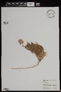 954884[1295377]Wood, P. 2771948-08-02 United States, Alaska, St. Elias Mountains. Mt. Vancouver, Bonnite Spur, 1890m |
MIN:Plants | 598907[]Tryon, R. 45791936-05-17 United States, Indiana, Porter, Indiana Dunes State Park, 3 miles N of Chesterton, Porter Co.;;;;, 41.663093 -87.032128 |
MIN:Plants | 832109[]Ballow, T.; Sage, Rowan 91979-04-25 United States, Missouri, Franklin, Meramack State Park |
MIN:Plants | 475505[]Smith, Welby 151621989-05-26 United States, Minnesota, Mille Lacs, Mille lacs Co.; About 11 miles north of Milaca; SW1/4 SE!/4 section 26, T 40N R 27W;;040N;27W;26, 45.9249992 -93.6680527 |
MIN:Plants | 829893[]Delaney, B. 910111991-05-21 United States, Minnesota, Morrison, Morrison Co.; along the Mississippi River; along S side of Co.Rd.26 on E side of river, 3 mi W of Royalton. NW1/4 SE1/4 Morrison Co.; along the Mississippi River; along S side of Co.Rd.26 on E side of river, 3 mi W of Royalton. NW1/4 SE1/4 sec.34, T39N, R32W. 039N 32W 34, 45.829738 -94.31442 |
MIN:Plants | 833928[]Smith, Welby 140531988-05-20 United States, Minnesota, Kanabec, Kanabec Co. On the W side of the Snake River, just S of the Hwy 3 crossing. NE1/4 NW1/4 sec 22, T41N R23W;;041N;23W;22, 46.0238876 -93.2333298 |
MIN:Plants | 690651[]Smith, Welby R. 4521978-05-20 United States, Minnesota, Wright, about 50 meters from Mississippi River. [corrected locality per W.R. Smith, Dec 2017]: T122N R25W NW1/4 of NW1/4 section 32, 45.337618 -93.866146 |
MIN:Plants | 479863[]Campbell, E. s.n.1883-05-11 United States, Oregon, Margaret Fuller Island |
MIN:Plants | 950363[]Rummels, Amy G. s.n.1896-05-16 United States, Minnesota, Dakota, Trout Brook, 44.542944 -92.806791 |
MIN:Plants |  964033[1375003]Kramer, Leona s. n.1927-00-00 United States, Minnesota, Mower |
MIN:Plants |  964041[1375011] United States, Iowa |
MIN:Plants |  964042[1375012] United States, Iowa |
MIN:Plants |  964043[1375013] United States, Indiana |
MIN:Plants |  964044[1375014] United States, Wisconsin |
MIN:Plants |  964045[1375015] United States, Illinois |
MIN:Plants |  0968604[1391202]Hinds, R. s.n. United States, Texas |
MIN:Plants | []Donna C. Amundson 81970-05-09 United States, Iowa, Marion, Sec. 27, T16N, R18W, Pella City Dump |
MIN:Plants | []J. C. B. Waddington 131966-05-07 United States, Minnesota, Hennepin, Bluff overlooking Mississippi River at Fort Snelling, 44.893715 -93.181644 |
MIN:Plants | []Kerstin Griffin 131964-05-10 United States, Minnesota, Hennepin, Fort Snelling Reserv. Found in upland, 44.864412 -93.191212 |
MIN:Plants | []J.C.B. Waddington 131966-05-07 United States, Minnesota, Hennepin, Bluff overlooking Mississippi River at Fort Snelling, 44.892742 -93.178383 |
MIN:Plants | []Donna C. Amundson 81970-05-09 United States, Iowa, Marion, Sec. 27 T16N R18W, Pella City Dump, 41.444062 -92.91721 |
MIN:Plants | Collomia linearis Nuttall 508818[]Wheeler, Gerald 187401998-05-25 United States, Minnesota, Lac Qui Parle, Big Stone National Wildlife Refuge. Lac Qui Parle County ... Ca. 2.2 mi. SE of Ortonville; Big Stone Wildlife Refuge ... ourcopr N of auto tour route ... S1/2 SW1/4 SE1/4 Sec. 26 T121N R46W (Yellow Bank 26). 121N 46W 26, 45.262178 -96.400328 |
MIN:Plants | Collomia linearis Nuttall 237182[]Congdon, J. s.n.1899-08-22 United States, California, Madera, Rush Creek Divide, east of Minarets, Madera County |
MIN:Plants | Collomia linearis Nuttall 237197[]Congdon, J. s.n.1899-08-22 United States, California, Madera, Summit Rush Creek Divide, east of Minarets, Madera County |
MIN:Plants | Collomia linearis Nuttall 237162[]Congdon, J. s.n.1890-08-12 United States, California, Mariposa, Buck Camp, Mariposa County;Yosemite National Park |
MIN:Plants | Collomia linearis Nuttall 237161[]Congdon, J. s.n.1899-08-18 United States, California, Madera, Mt. east of Old Norris Store, east of Minarets, Madera County;Yosemite National Park |
MIN:Plants | Collomia linearis Nuttall 175803[]Sheldon, Edmund S24451892-06-00 United States, Minnesota, Aitkin, Nichols;;044N;27W;04, 46.32387 -93.75721 |
MIN:Plants | Collomia linearis Nuttall 175804[]Sheldon, Edmund s.n.1895-06-00 United States, Minnesota, Ramsey, St. Anthony Park [St. Paul neighborhood near U of M];;029N;23W;, 44.98382 -93.194806 |
MIN:Plants | Collomia linearis Nuttall 175805[]Moyer, Lycurgus s.n.1894-06-00 United States, Minnesota, Chippewa, Cedar Lake, Montevideo;;117N;40W;, 44.942457 -95.723637 |
MIN:Plants | Collomia linearis Nuttall 175806[]Moyer, Lycurgus s.n.1894-06-00 United States, Minnesota, Chippewa, Cedar Lake, Montevideo;;117N;40W;, 44.942457 -95.723637 |
MIN:Plants | Collomia linearis Nuttall 175807[]Moyer, Lycurgus s.n.1912-06-09 United States, Minnesota, Chippewa, Montevideo, T117N R40W Sec.29;;117N;40W;29, 44.912701 -95.706488 |
MIN:Plants | Collomia linearis Nuttall 175808[]Menzel, Max s.n.1894-05-00 United States, Minnesota, Pipestone, Pipestone [assuming the quarry area; town generally noted as Pipestone City by collector];Pipestone National Monument;106N;46W;01, 44.01585 -96.31767 |
MIN:Plants | Collomia linearis Nuttall 175809[]Sheldon, Edmund s.n.1892-06-00 United States, Minnesota, Mille Lacs, Mille Lacs Lake;;N;;, 46.193893 -93.624594 |
MIN:Plants | Collomia linearis Nuttall 175810[]Sandberg, John s.n.1885-08-00 United States, Minnesota, Goodhue, Red Wing;;N;;, 44.562468 -92.533801 |
MIN:Plants | Collomia linearis Nuttall 175811[]Campbell, Jennie s.n.1897-06-00 United States, Minnesota, Stearns, St. Cloud;;N;;, 45.557693 -94.1603 |
MIN:Plants | Collomia linearis Nuttall 175812[]Skinner, S. 2431902-06-28 United States, Minnesota, Murray, Lake Shetek. Heron Lake region.;;N;;, 44.124433 -95.693123 |
MIN:Plants | Collomia linearis Nuttall 175814[]Moyer, Lycurgus s.n.1894-05-00 United States, Minnesota, Chippewa, Cedar Lake, Montevideo;;117N;40W;, 44.942457 -95.723637 |
MIN:Plants | Collomia linearis Nuttall 289646[]Moyle, J. 9261933-07-18 United States, Minnesota, Becker, Itasca Park, near Twin Island Lake; SW1/4 SW1/4 Sec. 5 T142N R36W;Itasca State Park;142N;36W;5, 47.139445 -95.272921 |
MIN:Plants | Collomia linearis Nuttall 298961[]Chandonnet, Z. s.n.1910-06-06 United States, Minnesota, Otter Tail, RR track, Perham;;N;;, 46.594404 -95.572542 |
MIN:Plants | Collomia linearis Nuttall 337728[]Lakela, Olga 15531936-07-23 United States, Minnesota, Saint Louis, Back of a garage near Duluth, Ship Canal, bayside, Duluth;;N;;, 46.7833 -92.1 |
MIN:Plants | Collomia linearis Nuttall 354269[]Moyle, J. 12711934-07-18 United States, Minnesota, Polk, 28 mi NW of Bagley;;N;;, 47.807422 -95.822727 |
MIN:Plants | Collomia linearis Nuttall 360991[]Lakela, Olga 39771940-08-11 United States, Minnesota, Saint Louis, Near the interstate bridge, 16th Ave. W Rice Point, Duluth;;N;;, 46.7833 -92.1 |
MIN:Plants | Collomia linearis Nuttall 361151[]Lakela, Olga 40761940-08-18 United States, Minnesota, Carlton, Along railway lane on hwy 61, Mahtowa;;N;;, 46.573834 -92.631862 |
MIN:Plants | Collomia linearis Nuttall 364138[]Dellman, J. s.n.1917-06-00 United States, Minnesota, Hennepin, R.R. tracks back of Northrup Field, University Campus, Minneapolis;;N;;, 44.973681 -93.232036 |
MIN:Plants | Collomia linearis Nuttall 368800[]Lakela, Olga 44451941-07-03 United States, Minnesota, Saint Louis, Vermilion Road NE of Hunters Hill, Duluth;;N;;, 47.891581 -92.366824 |
MIN:Plants | Collomia linearis Nuttall 371302[]Moore, John; et al. 146781941-07-06 United States, Minnesota, Douglas, Douglas County...1 mi. S of Garfield;;;;, 45.926316 -95.491987 |
MIN:Plants | Collomia linearis Nuttall 375501[]Stevens, O. 6191942-07-02 United States, Minnesota, Clay, Moorhead;;N;;, 46.873852 -96.767581 |
MIN:Plants | Collomia linearis Nuttall 385467[]Moyle, J. 37801944-07-25 United States, Minnesota, Carlton, Dike near Perch Lake dam;;N;;, 46.689432 -92.670656 |
MIN:Plants | Collomia linearis Nuttall 385892[]Lakela, Olga 56041944-07-16 United States, Minnesota, Saint Louis, Edge of lawn between 21 and 22nd Ave. E 5th St, Duluth;;N;;, 46.7833 -92.1 |
MIN:Plants | Collomia linearis Nuttall 392898[]Lakela, Olga 65391946-07-27 United States, Minnesota, Saint Louis, St. Louis River marsh, New Duluth, Duluth;;N;;, 46.7833 -92.1 |
MIN:Plants | Collomia linearis Nuttall 406351[]Jones, George Neville s.n.1946-07-01 United States, Minnesota, Saint Louis, R.R. yards, Ely;;N;;, 47.9 -91.8667 |
MIN:Plants | Collomia linearis Nuttall 412916[]Moore, John; et al. 114171939-08-03 United States, Minnesota, Roseau, Roseau County...Along the r.r. right-of-way, N of the Longworth School;;;;, 48.982491 -95.364961 |
MIN:Plants | Collomia linearis Nuttall 424097[]Emanuel, J. 541946-07-05 United States, Minnesota, Itasca, County: Itasca. Locality: Nashwauk Township (NW of Nashwauk);;057N;22W;, 47.413912 -93.13289 |
MIN:Plants | Collomia linearis Nuttall 429522[]Smith, Welby 208351992-07-15 United States, Minnesota, Marshall, Marshall Co.; About 9 miles south-southwest of Strandquist. T 156N R 46W SW1/4 of SE1/4 of Sec 1;;156N;46W;1, 48.3572235 -96.5080566 |
MIN:Plants | Collomia linearis Nuttall 430639[]Smith, Welby 194141991-07-10 United States, Minnesota, Koochiching, Koochiching County...About 2 miles south-southwest of Little Fork Abandoned gravel pit... T 68N R 25W NW1/4 of NW1/4 of Sec 20. 068N 25W 20, 48.3713875 -93.5875015 |
MIN:Plants | Collomia linearis Nuttall 437052[]Moore, John; Hall, Robert 166311944-06-14 United States, Minnesota, Sibley, 3 mi. W of Gibbon on Hwy. 19;;112N;31W;, 44.533836 -94.587321 |
MIN:Plants | Collomia linearis Nuttall 441349[]Kukachka, B. s.n.1937-08-21 United States, Minnesota, Clearwater, Squaw Lake, Itasca State Park;Itasca State Park;143N;36W;5, 47.231426 -95.265785 |
MIN:Plants | Collomia linearis Nuttall 442104[]Moore, John; Huff, N. 186771946-06-19 United States, Minnesota, Rock, Mounds Springs State Park;Blue Mounds State Park;N;;, 43.706913 -96.186973 |
MIN:Plants | Collomia linearis Nuttall 444693[]Moore, John; Huff, N. 186491946-06-15 United States, Minnesota, Wadena, 1 mi. W of Vernadale;;N;;, 46.398293 -95.035739 |
MIN:Plants | Collomia linearis Nuttall 448449[]Moore, John; Hall, Robert 163621944-06-09 United States, Minnesota, Rock, Beside Great Northern R.R, 3 1/2 mi. SW of Jasper;;N;;, 43.814114 -96.448356 |
MIN:Plants | Collomia linearis Nuttall 448549[]Moore, John; et al. 177401945-07-11 United States, Minnesota, Blue Earth, 6 mi SW of Lake Crystal;;;;, 44.044317 -94.304426 |
MIN:Plants | Collomia linearis Nuttall 526264[]Moore, John 211461951-06-28 United States, Minnesota, Stearns, Stearns Co. 1 1/2 mi. E of Belgrade;;123N;34W;, 45.453017 -94.973498 |
MIN:Plants | Collomia linearis Nuttall 526761[]Lakela, Olga 178891954-07-16 United States, Minnesota, Saint Louis, N Shore of Lake Superior at Stone Point, rr tracks;;N;;, 46.886976 -91.920178 |
MIN:Plants | Collomia linearis Nuttall 536129[]Anderson, W. 15771940-07-02 United States, Minnesota, Rock, Luverne;;N;;, 43.654136 -96.212807 |
MIN:Plants | Collomia linearis Nuttall 553840[]Moore, John 228121956-06-11 United States, Minnesota, Clay, Clay County...Along the S side of the rail road 2 mi E of Glyndon;;139N;46W;07, 46.869804 -96.536789 |
MIN:Plants | Collomia linearis Nuttall 554654[]Moore, John 231591957-06-12 United States, Minnesota, Pipestone, Pipestone Co.; along the rr at Ihlen;;105N;46W;, 43.9 -96.3667 |
MIN:Plants | Collomia linearis Nuttall 574733[]Moore, John 246211959-06-16 United States, Minnesota, Pipestone, Pipestone Co.; 1 1/2 mi. north of Pipestone;;106N;46W;, 44.022252 -96.317534 |
MIN:Plants | Collomia linearis Nuttall 585607[]Moore, John 263461963-06-18 United States, Minnesota, Pipestone, Along the creek, Pipestone National Monument;Pipestone National Monument;106N;46W;, 44.013519 -96.324755 |
MIN:Plants | Collomia linearis Nuttall 591945[]Moore, John 266961964-06-18 United States, Minnesota, Houston, Along the r.r. at Brownsville;;103N;04W;, 43.694136 -91.279857 |
MIN:Plants | Collomia linearis Nuttall 603904[]Moore, John; et al. 271381967-06-10 United States, Minnesota, Pipestone, Pipestone County...2 mi. northest of Jasper;;105N;46W;, 43.870239 -96.377116 |
MIN:Plants | Collomia linearis Nuttall 607624[]Westkaemper, Remberta s.n.1968-06-00 United States, Minnesota, Stearns, Stearns Co. St. Joseph;;124n;29W;, 45.564772 -94.317966 |
MIN:Plants | Collomia linearis Nuttall 630432[]Morley, T. 12761972-07-21 United States, Minnesota, Cottonwood, Near quartzite outcrops at state-owned Petroglyph site. T107N, R35W, NE1/4 NW1/4 Sec. 9.;Jeffers Petroglyphs Historical Site;107N;35W;9, 44.086452 -95.049967 |
MIN:Plants | Collomia linearis Nuttall 690034[]Ownbey, Gerald 56621977-07-19 United States, Minnesota, Hubbard, E side of Rte. 71, 2.5 mi. S of its jct. with Rte. 34 in Park Rapids, adjacent to highway;;N;;, 46.88599 -95.058632 |
MIN:Plants | Collomia linearis Nuttall 711440[]Smith, Welby 10221979-06-27 United States, Minnesota, Pipestone, Pipestone National Monument, just E of the quarry ridge; T106N R46W SE1/4 SW1/4 Sec. 1;Pipestone National Monument;106N;46W;1, 44.013519 -96.324755 |
MIN:Plants | Collomia linearis Nuttall 711447[]Smith, Welby 10331979-06-27 United States, Minnesota, Rock, Blue Mounds State Park, 3 mi N of Luverne; T103N R45W SW1/4 Sec. 25;Blue Mounds State Park;103N;45W;25, 43.695977 -96.182337 |
MIN:Plants | Collomia linearis Nuttall 743647[]Nietering, E. 1341982-06-23 United States, Minnesota, Chippewa, Chipepwa Co. At W end of large outcrop area, SE of Granite Falls; NW1/4 SW1/4 Sec. 11 T115N R39W;Gneiss Outcrops Scientific Natural Area;115N;39W;11, 44.779288 -95.513002 |
MIN:Plants | Collomia linearis Nuttall 743674[]Nietering, E. 801982-05-29 United States, Minnesota, Redwood, Redwood Co. N of Belview; NW1/4 NW1/4 Sec. 17 T114N R37W;;114N;37W;17, 44.679459 -95.329739 |
MIN:Plants | Collomia linearis Nuttall 743692[]Nietering, E. 1531982-07-07 United States, Minnesota, Renville, Renville Co.; W of co. rd 9, just N of Minnesota River, S of Sacred Heart; N1/2 NE1/4 Sec. 7 T114N R37W;;114N;37W;7, 44.697119 -95.350501 |
MIN:Plants | Collomia linearis Nuttall 745503[]Smith, Welby 42941981-06-16 United States, Minnesota, Lac Qui Parle, Ca. 2.5 mi W of Odessa, on the S bank of the Minnesota River; SW1/4 SE1/4 Sec. 26 T121N R46W;;121N;46W;26, 45.256725 -96.401423 |
MIN:Plants | Collomia linearis Nuttall 772204[]Boe, J. 9071979-07-18 United States, Minnesota, Lake of the Woods, Near Norris Camp; T159N R35W Sec. 8;;159N;35W;8, 48.605309 -95.181076 |
MIN:Plants | Collomia linearis Nuttall 772910[]Boe, J. 8981979-07-16 United States, Minnesota, Lake of the Woods, Northwest Angle, near Forestry cabin; T167N R35W Sec. 14;Northwest Angle;167N;35W;14, 49.287271 -95.125557 |
MIN:Plants | Collomia linearis Nuttall 787101[]Maxson, George-Ann s.n.1981-06-26 United States, Minnesota, Lake of the Woods, Long Point, islands in lake, on W side of islands; NW1/4 Sec. 36 T164N R34W;;164N;34W;36, 48.977214 -94.959949 |
MIN:Plants | Collomia linearis Nuttall 792103[]Smith, Welby 105671985-06-29 United States, Minnesota, Dodge, Iron Horse Prairie Scientific Natural Area. Dodge Co. Iron Horse Prairie State Scientific Natural Area, ca. 1 1/2 mi. S of Hayfield. NW1/4 SE1/4 Sec. 27, T105N, R Dodge Co. Iron Horse Prairie State Scientific Natural Area, ca. 1 1/2 mi. S of Hayfield. NW1/4 SE1/4 Sec. 27, T105N, R17W.. 105N 17W 27, 43.869368 -92.845058 |
MIN:Plants | Collomia linearis Nuttall 499122[]Went, F. s.n.1954-08-00 United States, Montana, Missoula, Missoula Valley |
MIN:Plants |  Collomia linearis Nuttall 964151[1375120] United States, Wyoming, Yellowstone National Park |
MIN:Plants |  Collomia linearis Nuttall 964153[1375122] United States, Wyoming, Yellowstone National Park |
MIN:Plants |  Collomia linearis Nuttall 965657[1356540]Arthur Stanley Pease 376311954-08-28 United States, New Hampshire, Coos, railroad track |
MIN:Plants |  Collomia linearis Nuttall 0968600[1391198]Manhart, Warren s.n.1938-07-00 United States, Yellowstone Park |
MIN:Plants | Collomia linearis Nuttall []Ikemeier, A. GW25562005-06-29 United States, Colorado, Gunnison, Bracken Creek, Kebler Pass Road, 38.851333 -107.106667, 3024m |
MIN:Plants | Phlox bifida Beck 571986[]Cooperrider, T. 8441956-05-12 United States, Iowa, Clinton, Lower Watersheds of Maquoketa and Wapsipinicon Rivers. Liberty Twp. N1/2 of section 7 |
MIN:Plants |  Phlox bifida Beck 964039[1375009] United States, Indiana |
MIN:Plants |  Phlox bifida Beck 964040[1375010] United States, Illinois |
MIN:Plants | Ipomopsis congesta (Hooker) V.E. Grant 281395[]Went, F. s.n.1966-08-00 United States, California, Alpine, Carson Pass, Alpine Co. |
MIN:Plants |  Linanthus nuttallii (A. Gray) Greene ex Milliken 964173[1375142] United States, Idaho |
MIN:Plants | Gilia micromeria (A. Gray) J.M. Porter 680248[]Bright, R. 75-131975-06-09 United States, Idaho, Owyhee, Owyhee Co, 10 miles south of Bruneau, near Devil's Bathtub |
MIN:Plants | Phlox hoodii Richardson 510813[]Davis, Owen s.n.1978-08-28 United States, Idaho, Bingham, [no further data] |
MIN:Plants | Phlox hoodii Richardson 905347[]Nash, A. 41361966-06-28 United States, Wyoming, Park, Along Willow Park Road;Yellowstone National Park |
MIN:Plants | Phlox hoodii Richardson 905712[]Nash, A. 41351966-06-28 United States, Wyoming, Park, Along Willow Park Road;Yellowstone National Park |
MIN:Plants |  Phlox hoodii Richardson 966065[1356825] United States, Yellowstone National Park, 44.426573 -110.467041 |
MIN:Plants | Phlox speciosa Pursh 237672[]Congdon, J. s.n.1897-06-07 United States, California, Tuolumne, Yosemite Road to Crocker's, Tuolumne County;Yosemite National Park |
Google Map
Google Maps is a web mapping service provided by Google that features a map that users can pan (by dragging the mouse) and zoom (by using the mouse wheel). Collection points are displayed as colored markers that when clicked on, displays the full information for that collection. When multiple species are queried (separated by semi-colons), different colored markers denote each individual species.