University of Minnesota
http://www.umn.edu/
612-625-5000
http://www.umn.edu/
612-625-5000
Minnesota Biodiversity Atlas
Bell Museum
Dataset: MIN-Lichens
Taxa: Lecanoraceae
Search Criteria: excluding cultivated/captive occurrences
Bell Museum lichens | |
 MIN:Lichens |  Lecanora cenisia Ach. 868528[1364508]John Republic of Türkiye, Mugla |
MIN:Lichens |  Lecanora cenisia Ach. 861207[1367244]Malme Sweden, Sodermanland |
MIN:Lichens |  Lecanora cenisia Ach. 893047[1388490]Nash, T.H. United States, Arizona, Gila |
MIN:Lichens |  Lecanora cenisia Ach. 854729[1388861]Nowak Poland, Lower Silesian |
MIN:Lichens | 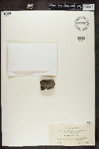 Lecanora cenisia Ach. 847460[1392304]Leppala Finland, Southern Ostrobothnia |
MIN:Lichens | 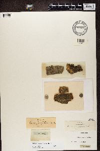 Lecanora cerina (Vain.) K.G.W. Lång 846472[1361002]Fries, E.M. Sweden |
MIN:Lichens | 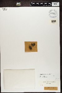 Lecanora cerina (Vain.) K.G.W. Lång 652740[1362563]Harmand, J. France |
MIN:Lichens | 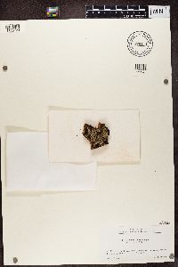 870111[1365420]Togashi Japan |
MIN:Lichens |  918321[1389654]Ohmura, Y. Japan, Akita, Ugo |
MIN:Lichens | Lecanora chlaronella Nyl. 437630[]Fink, B. 13081915-12-24 Puerto Rico, Mayaguez |
MIN:Lichens | Lecanora chlaronella Nyl. 437631[]Fink, B. 5381915-12-01 Puerto Rico, Rio Piedras |
MIN:Lichens | Lecanora chlaronella Nyl. 735477[]Fink, B. 3991915-11-29 Puerto Rico, Rio Piedras |
MIN:Lichens | Lecanora chlarotera Nyl. 626466[]Wetmore, C. 152921966-08-12 United States, Virginia, Page, Lewis Falls Trail; Shenandoah National Park |
MIN:Lichens | Lecanora chlarotera Nyl. 626467[]Wetmore, C. 139911966-05-22 United States, Iowa, Fayette, Between Fayette & Wadena, 42.83333333 -91.71305556 |
MIN:Lichens | Lecanora chlarotera Nyl. 630946[]Wetmore, C. 195801970-05-12 United States, Texas, Brewster, Emory Peak; Big Bend National Park, 29.24611111 -103.3052778 |
MIN:Lichens | Lecanora chlarotera Nyl. 630947[]Wetmore, C. 19578C1970-05-12 United States, Texas, Brewster, Emory Peak; Big Bend National Park, 29.24611111 -103.3052778 |
MIN:Lichens | Lecanora chlarotera Nyl. 631192[]Wetmore, C. 194491970-05-06 United States, Texas, Brewster, Emory Peak, Sw Slope; Big Bend National Park, 29.24555556 -103.3075 |
MIN:Lichens | Lecanora chlarotera Nyl. 634260[]Wetmore, C. 195301970-05-10 United States, Texas, Brewster, Casa Grande; Big Bend National Park, 29.26694444 -103.2869444 |
MIN:Lichens | Lecanora chlarotera Nyl. 638133[]Weber, W. 193081961-08-23 Denmark, Sjaelland, Greve, Copenhagen, S of |
MIN:Lichens | Lecanora chlarotera Nyl. 638298[]Weber, W. s.n.1958-06-19 Sweden, Skane, Segeltorp, Torekov |
MIN:Lichens | Lecanora chlarotera Nyl. 638311[]Weber, W. s.n.1971-07-03 Greece, Peloponnese, Mt. Mainalon, Vitina |
MIN:Lichens | Lecanora chlarotera Nyl. 656599[]Nash, T. 77001973-07-24 United States, Arizona, Greenlee, Hannagan Meadows, 33.6333333 -109.3166667 |
MIN:Lichens | Lecanora chlarotera Nyl. 662110[]Harris, R. 100021975-07-19 United States, Michigan, Gogebic, Bobcat Lake Campground, Swamp Ne of; Ottawa National Forest |
MIN:Lichens | Lecanora chlarotera Nyl. 666506[]Tucker, S. 121371974-04-01 United States, Louisiana, East Baton Rouge, Baton Rouge, 30.3791667 -91.125 |
MIN:Lichens | Lecanora chlarotera Nyl. 677125[]Weber, W. 575141973-08-22 United States, Montana, Park, Silver Gate, .5 Mi Nw of |
MIN:Lichens | Lecanora chlarotera Nyl. 735449[]Kjellmert, G. s.n.1951-09-04 Sweden, Vastmanland, St. Satra |
MIN:Lichens | Lecanora chlarotera Nyl. 740762[]Christiansen, M. 15941981-10-05 Denmark, Syddanmark, Langeland, Snode |
MIN:Lichens | Lecanora chlarotera Nyl. 741687[]Wetmore, C. 456311982-07-31 United States, North Dakota, Billings, Ne of Cottonwood Campground; Theodore Roosevelt National Park, 46.95388889 -103.5266667 |
MIN:Lichens | Lecanora chlarotera Nyl. 741701[]Wetmore, C. 456171982-07-31 United States, North Dakota, Billings, Peaceful Valley, Ne End; Theodore Roosevelt National Park, 46.96333333 -103.4888889 |
MIN:Lichens | Lecanora chlarotera Nyl. 741705[]Wetmore, C. 456131982-07-31 United States, North Dakota, Billings, Peaceful Valley, Ne End; Theodore Roosevelt National Park, 46.96333333 -103.4888889 |
MIN:Lichens | Lecanora chlarotera Nyl. 741727[]Wetmore, C. 455901982-07-31 United States, North Dakota, Billings, Se Corner Spring; Theodore Roosevelt National Park, 46.89694444 -103.3294444 |
MIN:Lichens | Lecanora chlarotera Nyl. 741754[]Wetmore, C. 455641982-07-30 United States, North Dakota, Billings, Talakeington Trail, N Slope; Theodore Roosevelt National Park, 46.95861111 -103.4116667 |
MIN:Lichens | Lecanora chlarotera Nyl. 741758[]Wetmore, C. 455601982-07-30 United States, North Dakota, Billings, Talakeington Trail, N Slope; Theodore Roosevelt National Park, 46.95861111 -103.4116667 |
MIN:Lichens | Lecanora chlarotera Nyl. 741814[]Wetmore, C. 455031982-07-29 United States, North Dakota, Billings, Lone Tree Spring, W Slope; Theodore Roosevelt National Park, 46.98194444 -103.5430556 |
MIN:Lichens | Lecanora chlarotera Nyl. 741853[]Wetmore, C. 454631982-07-29 United States, North Dakota, Billings, Wannagan Seeps, Valley; Theodore Roosevelt National Park, 46.99277778 -103.5763889 |
MIN:Lichens | Lecanora chlarotera Nyl. 741859[]Wetmore, C. 454581982-07-29 United States, North Dakota, Billings, Wannagan Seeps, Valley; Theodore Roosevelt National Park, 46.99277778 -103.5763889 |
MIN:Lichens | Lecanora chlarotera Nyl. 741914[]Wetmore, C. 454041982-07-28 United States, North Dakota, Billings, Along Jones Creek, Valley; Theodore Roosevelt National Park, 46.96027778 -103.465 |
MIN:Lichens | Lecanora chlarotera Nyl. 742006[]Wetmore, C. 453111982-07-27 United States, North Dakota, Billings, Elkhorn Ranch, E Hillside; Theodore Roosevelt National Park, 47.25111111 -103.6277778 |
MIN:Lichens | Lecanora chlarotera Nyl. 742018[]Wetmore, C. 452981982-07-27 United States, North Dakota, Billings, Elkhorn Ranch, E Hillside; Theodore Roosevelt National Park, 47.25111111 -103.6277778 |
MIN:Lichens | Lecanora chlarotera Nyl. 742077[]Wetmore, C. 452351982-07-27 United States, North Dakota, Billings, Elkhorn Ranch, Floodplain; Theodore Roosevelt National Park, 47.24805556 -103.6213889 |
MIN:Lichens | Lecanora chlarotera Nyl. 742099[]Wetmore, C. 452131982-07-26 United States, North Dakota, Billings, Buck Hill, N Facing Hill; Theodore Roosevelt National Park, 46.92638889 -103.3872222 |
MIN:Lichens | Lecanora chlarotera Nyl. 742115[]Wetmore, C. 451971982-07-26 United States, North Dakota, Billings, Buck Hill, N Facing Hill; Theodore Roosevelt National Park, 46.92638889 -103.3872222 |
MIN:Lichens | Lecanora chlarotera Nyl. 742226[]Wetmore, C. 450771982-07-25 United States, North Dakota, Billings, Badlands Overlook, N Slope; Theodore Roosevelt National Park, 46.92305556 -103.4513889 |
MIN:Lichens | Lecanora chlarotera Nyl. 742317[]Wetmore, C. 449781982-07-24 United States, North Dakota, Billings, Scoria Pt Overlook, N Hillside; Theodore Roosevelt National Park, 46.93111111 -103.4866667 |
MIN:Lichens | Lecanora chlarotera Nyl. 742327[]Wetmore, C. 449671982-07-24 United States, North Dakota, Billings, Scoria Pt Overlook, N Hillside; Theodore Roosevelt National Park, 46.93111111 -103.4866667 |
MIN:Lichens | Lecanora chlarotera Nyl. 742434[]Wetmore, C. 448591982-07-21 United States, North Dakota, McKenzie, Squaw Creek Campground; Theodore Roosevelt National Park, 47.59222222 -103.3391667 |
MIN:Lichens | Lecanora chlarotera Nyl. 742444[]Wetmore, C. 448491982-07-20 United States, North Dakota, McKenzie, Cedar Canyon,S Side-N Slope; Theodore Roosevelt National Park, 47.61 -103.3652778 |
MIN:Lichens | Lecanora chlarotera Nyl. 742478[]Wetmore, C. 448141982-07-20 United States, North Dakota, McKenzie, Cedar Canyon,S Side-N Slope; Theodore Roosevelt National Park, 47.61 -103.3652778 |
MIN:Lichens | Lecanora chlarotera Nyl. 742485[]Wetmore, C. 448061982-07-20 United States, North Dakota, McKenzie, Cedar Canyon,S Side-N Slope; Theodore Roosevelt National Park, 47.61 -103.3652778 |
MIN:Lichens | Lecanora chlarotera Nyl. 742549[]Wetmore, C. 447381982-07-19 United States, North Dakota, McKenzie, W of Us 85, N Border, Hill; Theodore Roosevelt National Park, 47.67083333 -103.3136111 |
MIN:Lichens | Lecanora chlarotera Nyl. 742652[]Wetmore, C. 446271982-07-18 United States, North Dakota, McKenzie, Achenbach Spring, Valley; Theodore Roosevelt National Park, 47.57638889 -103.3983333 |
MIN:Lichens | Lecanora chlarotera Nyl. 742664[]Wetmore, C. 446151982-07-17 United States, North Dakota, McKenzie, Hagen Spring, Valley; Theodore Roosevelt National Park, 47.61777778 -103.4163889 |
MIN:Lichens | Lecanora chlarotera Nyl. 742750[]Wetmore, C. 445231982-07-17 United States, North Dakota, McKenzie, Spirati Point, Valley; Theodore Roosevelt National Park, 47.59694444 -103.45 |
MIN:Lichens | Lecanora chlarotera Nyl. 742878[]Wetmore, C. 443921982-07-15 United States, North Dakota, McKenzie, Nw of Hagen Spring; Theodore Roosevelt National Park, 47.62638889 -103.4188889 |
MIN:Lichens | Lecanora chlarotera Nyl. 742885[]Wetmore, C. 443861982-07-15 United States, North Dakota, McKenzie, Grassland Overlook, Valley; Theodore Roosevelt National Park, 47.62527778 -103.3963889 |
MIN:Lichens | Lecanora chlarotera Nyl. 742916[]Wetmore, C. 443561982-07-15 United States, North Dakota, McKenzie, Grassland Overlook, Valley; Theodore Roosevelt National Park, 47.62527778 -103.3963889 |
MIN:Lichens | Lecanora chlarotera Nyl. 742958[]Wetmore, C. 443101982-07-14 United States, North Dakota, McKenzie, 1 Mi E of Squaw Creek Campground.; Theodore Roosevelt National Park, 47.59916667 -103.3230556 |
MIN:Lichens | Lecanora chlarotera Nyl. 743016[]Wetmore, C. 442501982-07-14 United States, North Dakota, McKenzie, Stevens Plateau, Gully; Theodore Roosevelt National Park, 47.60166667 -103.3033333 |
MIN:Lichens | Lecanora chlarotera Nyl. 757387[]Christiansen, M. 28901966-09-14 Denmark, Sjaelland, Zealand, Nordruposter |
MIN:Lichens | Lecanora chlarotera Nyl. 768426[]Wetmore, C. 513351984-05-24 United States, California, Tulare, Colony Peak, 1 Mi Ne of; Sequoia National Park, 36.56972222 -118.8113889 |
MIN:Lichens | Lecanora chlarotera Nyl. 768488[]Wetmore, C. 512181984-05-21 United States, California, Tulare, Oreole Lake; Sequoia National Park, 36.45916667 -118.7372222 |
MIN:Lichens | Lecanora chlarotera Nyl. 768505[]Wetmore, C. 511641984-05-21 United States, California, Tulare, Milk Ranch Peak; Sequoia National Park, 36.48638889 -118.7808333 |
MIN:Lichens | Lecanora chlarotera Nyl. 768517[]Wetmore, C. 511241984-05-19 United States, California, Tulare, General Sherman Tree, E of; Sequoia National Park, 36.58138889 -118.7436111 |
MIN:Lichens | Lecanora chlarotera Nyl. 768530[]Wetmore, C. 510511984-05-18 United States, California, Tulare, Lost Grove; Sequoia National Park, 36.64944444 -118.8297222 |
MIN:Lichens | Lecanora chlarotera Nyl. 768547[]Wetmore, C. 509751984-05-17 United States, California, Tulare, Muir Grove W of Dorst Campground; Sequoia National Park, 36.63416667 -118.8380556 |
MIN:Lichens | Lecanora chlarotera Nyl. 768549[]Wetmore, C. 509671984-05-17 United States, California, Tulare, Muir Grove W of Dorst Campground; Sequoia National Park, 36.63416667 -118.8380556 |
MIN:Lichens | Lecanora chlarotera Nyl. 768562[]Wetmore, C. 508931984-05-15 United States, California, Tulare, Potwisha Campground, S of; Sequoia National Park, 36.50777778 -118.8013889 |
MIN:Lichens | Lecanora chlarotera Nyl. 768567[]Wetmore, C. 508661984-05-14 United States, California, Tulare, Park Headquarters, E of; Sequoia National Park, 36.49166667 -118.8222222 |
MIN:Lichens | Lecanora chlarotera Nyl. 768577[]Wetmore, C. 507811984-05-12 United States, California, Tulare, Ladybug Campground E of South Fork Ranger Station; Sequoia National Park, 36.34694444 -118.74 |
MIN:Lichens | Lecanora chlarotera Nyl. 768592[]Wetmore, C. 506881984-05-10 United States, California, Tulare, Halstead Meadow, S of; Sequoia National Park, 36.61333333 -118.7880556 |
MIN:Lichens | Lecanora chlarotera Nyl. 768607[]Wetmore, C. 506101984-05-09 United States, California, Tulare, Sunset Rock; Sequoia National Park, 36.5775 -118.7813889 |
MIN:Lichens | Lecanora chlarotera Nyl. 768612[]Wetmore, C. 505721984-05-09 United States, California, Tulare, Hospital Rock, 1 Mi N; Sequoia National Park, 36.53333333 -118.7761111 |
MIN:Lichens | Lecanora chlarotera Nyl. 768622[]Wetmore, C. 504911984-05-07 United States, California, Tulare, Ccc Camp At Yucca Creek; Sequoia National Park, 36.54555556 -118.8925 |
MIN:Lichens | Lecanora chlarotera Nyl. 768635[]Wetmore, C. 504261984-05-06 United States, California, Tulare, Log Meadow, N End; Sequoia National Park, 36.56527778 -118.7388889 |
MIN:Lichens | Lecanora chlarotera Nyl. 768642[]Wetmore, C. 504091984-05-05 United States, California, Tulare, N of Colony Mill; Sequoia National Park, 36.55777778 -118.8133333 |
MIN:Lichens | Lecanora chlarotera Nyl. 768652[]Wetmore, C. 503131984-05-04 United States, California, Tulare, Buckeye Flat Campground, Paradise River; Sequoia National Park, 36.50861111 -118.7588889 |
MIN:Lichens | Lecanora chlarotera Nyl. 768657[]Wetmore, C. 502941984-05-04 United States, California, Tulare, Shepherd Peak W of Ash Mt.; Sequoia National Park, 36.49027778 -118.8597222 |
MIN:Lichens | Lecanora chlarotera Nyl. 768676[]Wetmore, C. 501611984-05-03 United States, California, Tulare, Lookout Point Ranger Station,2 Mi E; Sequoia National Park, 36.43805556 -118.7333333 |
MIN:Lichens | Lecanora chlarotera Nyl. 779450[]Blakeman, J. 2961985-07-28 United States, California, Tulare, Redwood Canyon, Near Fallen Goliath Tree; Kings Canyon National Park |
MIN:Lichens | Lecanora chlarotera Nyl. 779499[]Blakeman, J. 2111985-07-25 United States, California, Tulare, Redwood Canyon, Hart Tree Trail; Kings Canyon National Park |
MIN:Lichens | Lecanora chlarotera Nyl. 779573[]Blakeman, J. 701985-07-19 United States, California, Tulare, Grant Grove, S of N Grove; Kings Canyon National Park |
MIN:Lichens | Lecanora chlarotera Nyl. 779583[]Blakeman, J. 481985-07-19 United States, California, Tulare, Grant Grove, S of N Grove; Kings Canyon National Park |
MIN:Lichens | Lecanora chlarotera Nyl. 783269[]Wetmore, C. 551091986-06-24 United States, Arizona, Pima, Rincon Section, Ne of Grass Shack; Saguaro National Monument, 32.19472222 -110.5641667 |
MIN:Lichens | Lecanora chlarotera Nyl. 783301[]Wetmore, C. 550691986-06-22 United States, Arizona, Pima, Rincon Section, On Mica Secondary - East Slope Trail; Saguaro National Monument, 32.22555556 -110.5225 |
MIN:Lichens | Lecanora chlarotera Nyl. 783385[]Wetmore, C. 549781986-06-20 United States, Arizona, Pima, Rincon Section, W of Manning Camp; Saguaro National Monument, 32.2075 -110.5575 |
MIN:Lichens | Lecanora chlarotera Nyl. 783447[]Wetmore, C. 549131986-06-19 United States, Arizona, Pima, Rincon Section, Cow Head Saddle, Ne; Saguaro National Monument, 32.20638889 -110.5827778 |
MIN:Lichens | Lecanora chlarotera Nyl. 783683[]Wetmore, C. 546451986-06-16 United States, Arizona, Pima, Rincon Section, Deerhead Spring; Saguaro National Monument, 32.19833333 -110.5338889 |
MIN:Lichens | Lecanora chlarotera Nyl. 788054[]Sullivan, T. 21951983-07-20 United States, Maine, Hancock, Lake Wood, Nw of; Acadia National Park |
MIN:Lichens | Lecanora chlarotera Nyl. 811842[]Pos, R. 2581970-10-00 Netherlands, Limburg, Asselt |
MIN:Lichens | Lecanora chlarotera Nyl. 817938[]Hafellner, J. 136401985-07-04 Austria, Carinthia, Karawanken, Feistritz, 6 km S of |
MIN:Lichens | Lecanora chlarotera Nyl. 823936[]Wetmore, C. 729421993-08-09 United States, Vermont, Bennington, 1 Mi E of Prospect Rock; Lye Brook Wilderness, 43.14944444 -72.98888889 |
MIN:Lichens | Lecanora chlarotera Nyl. 823961[]Wetmore, C. 728671993-08-06 United States, Vermont, Bennington, N of Little Mud Pond Shelter; Lye Brook Wilderness, 43.14694444 -72.99166667 |
MIN:Lichens | Lecanora chlarotera Nyl. 823966[]Wetmore, C. 728581993-08-06 United States, Vermont, Bennington, N of Little Mud Pond Shelter; Lye Brook Wilderness, 43.14694444 -72.99166667 |
MIN:Lichens | Lecanora chlarotera Nyl. 824082[]Wetmore, C. 725661993-07-30 United States, Vermont, Bennington, N of Kelly Stand; Lye Brook Wilderness, 43.05555556 -73.04277778 |
MIN:Lichens | Lecanora chlarotera Nyl. 830948[]Imshaug, H. 352011964-02-07 Spain, Isla De Tenerife, San Diego Del Monte, Pastured Areas, 28.507 -16.32 |
MIN:Lichens | Lecanora chlarotera Nyl. 841885[]Imshaug, H. 358711964-02-26 Spain, Isla De Tenerife, Central Mountain Range, 28.45 -16.39 |
MIN:Lichens | Lecanora chlarotera Nyl. 841898[]Imshaug, H. 351401964-02-03 Spain, Isla De Tenerife, Roque Los Pasos, S of |
MIN:Lichens | Lecanora chlarotera Nyl. 841932[]Imshaug, H. 336411963-12-26 Spain, Isla De Tenerife, Montana Cruz De Taborno, 2-3 km From Las Canteras |
MIN:Lichens | Lecanora chlarotera Nyl. 861541[]Wetmore, C. 808091998-07-19 United States, Wyoming, Teton, Below Mt. Jackson; Yellowstone National Park, 44.64944444 -110.9433333 |
MIN:Lichens | Lecanora chlarotera Nyl. 861600[]Wetmore, C. 804861998-06-29 United States, North Dakota, Billings, S Unit, Ne of Peaceful Valley Ranch; Theodore Roosevelt National Park, 46.96 -103.4947222 |
Google Map
Google Maps is a web mapping service provided by Google that features a map that users can pan (by dragging the mouse) and zoom (by using the mouse wheel). Collection points are displayed as colored markers that when clicked on, displays the full information for that collection. When multiple species are queried (separated by semi-colons), different colored markers denote each individual species.