University of Minnesota
http://www.umn.edu/
612-625-5000
http://www.umn.edu/
612-625-5000
Minnesota Biodiversity Atlas
Bell Museum
Dataset: MIN-Lichens
Search Criteria: Kazakhstan; excluding cultivated/captive occurrences
1
Page 1, records 1-22 of 22
Bell Museum lichens | |
 MIN:Lichens | 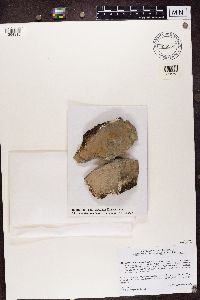 Lecidea atrobrunnea (Ramond ex. Lam. & DC) Schaerer 855553[1364315]Andreev Kazakhstan |
MIN:Lichens | 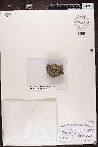 Lecidea tessellata Flörke 855546[1364322]Andreev Kazakhstan |
MIN:Lichens |  Acarospora bohlinii H. Magn. 843772[1387796]Moberg, R. Kazakhstan |
MIN:Lichens |  Anaptychia ulothricoides (Vain.) Vain. 843770[1387798]Morberg Kazakhstan |
MIN:Lichens |  Dimelaena oreina (Ach.) Norman 843753[1387815]Moberg, R. Kazakhstan |
MIN:Lichens | 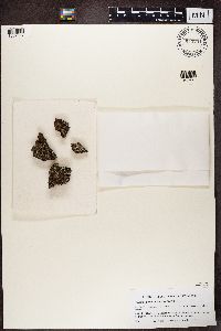 Hypogymnia austerodes (Nyl.) Räsänen 843751[1387817]Moberg, R. Kazakhstan |
MIN:Lichens | 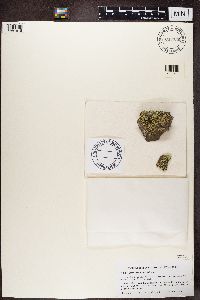 Lecanora argopholis (Ach.) Ach. 843750[1387818]Moberg, R. Kazakhstan |
MIN:Lichens | 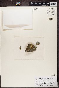 Lecanora baicalensis Zahlbr. 843749[1387819]Moberg, R. Kazakhstan |
MIN:Lichens | 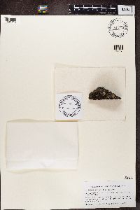 Melanelia substygia (Räsänen) Essl. 843745[1387823]Moberg, R. Kazakhstan |
MIN:Lichens |  Neofuscelia pokornyi (Körb.) Essl. 843743[1387825]Moberg, R. Kazakhstan |
MIN:Lichens |  Phaeophyscia chloantha (Ach.) Moberg 843742[1387826]Moberg, R. Kazakhstan |
MIN:Lichens |  Phaeophyscia nigricans (Flörke) Moberg 843741[1387827]Moberg, R. Kazakhstan |
MIN:Lichens |  Pleopsidium gobiense (H. Magn.) Hafellner 843738[1387829]Moberg, R. Kazakhstan |
MIN:Lichens | 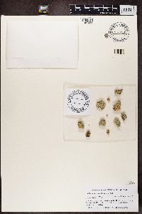 Rhizoplaca chrysoleuca (Sm.) Zopf 843733[1387834]Moberg, R. Kazakhstan |
MIN:Lichens | 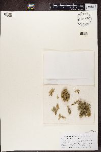 Teloschistes lacunosus (P. Rupr.) Savicz 843728[1387839]Moberg, R. Kazakhstan |
MIN:Lichens | 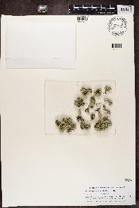 Xanthoparmelia camtschadalis (Ach.) Hale 843726[1387841]Moberg, R. Kazakhstan |
MIN:Lichens | 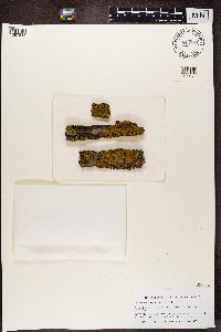 843724[1387843]Moberg, R. Kazakhstan |
MIN:Lichens |  Sarcogyne picea H. Magn. 868577[1387932]Moberg, R. Kazakhstan |
MIN:Lichens |  Staurothele levinae Oxner 868571[1387938]Moberg, R. Kazakhstan |
MIN:Lichens |  Aspicilia fruticulosa (Eversm.) Flagey 913381[1389529]Wagner Kazakhstan |
MIN:Lichens |  Caloplaca communis Vondrák, P. Ríha, Arup & Søchting 935954[1374131]Vondrakova, O. Kazakhstan |
MIN:Lichens |  Physcia biziana (A. Massal.) Zahlbr. 843740[1373069]Moberg, R. 1831993-06-18 Kazakhstan, 43.316667 76.916667, 1000m |
1
Page 1, records 1-22 of 22
Google Map
Google Maps is a web mapping service provided by Google that features a map that users can pan (by dragging the mouse) and zoom (by using the mouse wheel). Collection points are displayed as colored markers that when clicked on, displays the full information for that collection. When multiple species are queried (separated by semi-colons), different colored markers denote each individual species.