University of Minnesota
http://www.umn.edu/
612-625-5000
http://www.umn.edu/
612-625-5000
Minnesota Biodiversity Atlas
Bell Museum
Dataset: MIN-Lichens
Search Criteria: Vanuatu; excluding cultivated/captive occurrences
1
Page 1, records 1-17 of 17
Bell Museum lichens | |
 MIN:Lichens | 870700[]Streimann, H. 625051998-10-22 Vanuatu, Espiritu Santo, 48 Km Nnw of Luganville, -15.11666667 167.0166667 |
MIN:Lichens | 870701[]Streimann, H. 627601998-10-22 Vanuatu, Espiritu Santo, Navota, 48 Km Nnw of Luganville, -15.11666667 167.0166667 |
MIN:Lichens | 870702[]Streimann, H. 629081998-10-23 Vanuatu, Espiritu Santo, Navota, 16 Km Se of Luganville, -15.58333333 167.0333333 |
MIN:Lichens | 870703[]Streimann, H. 629711998-10-24 Vanuatu, Espiritu Santo, 18 Km N of Luganville, -15.35 167.1833333 |
MIN:Lichens | 870704[]Streimann, H. 630181998-10-25 Vanuatu, Efate, 17 Km Ene of Port Vila, -17.63333333 168.45 |
MIN:Lichens | 870705[]Streimann, H. 620251998-10-15 Vanuatu, Efate, 11 Km E of Port Vila, -17.75 168.4166667 |
MIN:Lichens |  Ramalina nervulosa (Müll. Arg.) Abbayes 855663[1365379]Iwashina Vanuatu, Shefa |
MIN:Lichens |  Ramalina subfraxinea Nyl. 855661[1365381]Iwashina Vanuatu, Shefa |
MIN:Lichens |  Ramalina farinacea (L.) Ach. 870079[1365452]Iwashina Vanuatu |
MIN:Lichens |  Ramalina nervulosa (Müll. Arg.) Abbayes 870077[1365454]Iwashina Vanuatu |
MIN:Lichens | 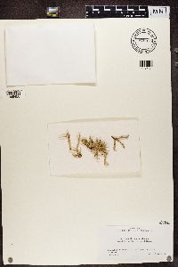 Ramalina subfraxinea Nyl. 870075[1365456]Iwashina Vanuatu |
MIN:Lichens | 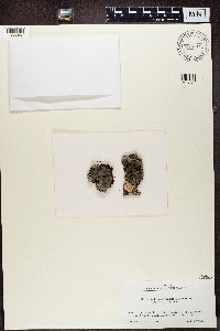 Parmeliella stylophora (Vain.) P.M. Jørg. 876719[1365493]Kashiwadani Vanuatu, Sanma |
MIN:Lichens | 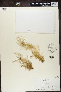 Usnea nidifica Taylor 876703[1365499]Kashiwadani Vanuatu, Sanma |
MIN:Lichens | 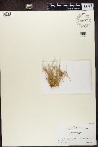 Usnea nidifica Taylor 876702[1365500]Kashiwadani Vanuatu, Sanma |
MIN:Lichens | 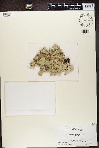 876717[1365505]Kashiwadani Vanuatu, Sanma |
MIN:Lichens | 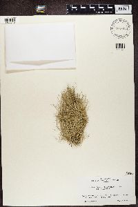 Ramalina nervulosa (Müll. Arg.) Abbayes 876712[1365510]Kashiwadani Vanuatu, Shefa |
MIN:Lichens | 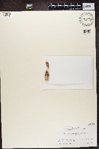 Graphina subserpentina (Nyl.) Müll. Arg. 880876[1365516]Kashiwadani Vanuatu, Samma |
1
Page 1, records 1-17 of 17
Google Map
Google Maps is a web mapping service provided by Google that features a map that users can pan (by dragging the mouse) and zoom (by using the mouse wheel). Collection points are displayed as colored markers that when clicked on, displays the full information for that collection. When multiple species are queried (separated by semi-colons), different colored markers denote each individual species.