University of Minnesota
http://www.umn.edu/
612-625-5000
http://www.umn.edu/
612-625-5000
Minnesota Biodiversity Atlas
Bell Museum
Dataset: MIN-Lichens
Taxa: Cetrariastrum
Search Criteria: excluding cultivated/captive occurrences
1
Page 1, records 1-8 of 8
Bell Museum lichens | |
 MIN:Lichens | Cetrariastrum rhizodendroideum J.C. Wei & Y.M. Jiang 832650[]Li, W. 75 China, Xizang, (Tibet) |
MIN:Lichens | 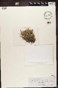 Cetrariastrum cirrhatum (Fr.) W.L. Culb. & C.F. Culb. 855448[1364781]Kalb, K. Brazil, Rio De Janeiro |
MIN:Lichens |  Cetrariastrum ecuadoriense (R. Sant.) Sipman 855124[1365106]Kalb, K. Ecuador, Cotopaxi |
MIN:Lichens |  Cetrariastrum andense Kärnefelt ex Sipman 855085[1365145]Kalb, K. Venezuela, Merida |
MIN:Lichens | 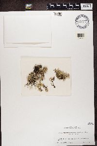 Cetrariastrum cirrhatum (Fr.) W.L. Culb. & C.F. Culb. 890255[1365586]Shibuichi, H. Taiwan, Province of China, Hualien |
MIN:Lichens | 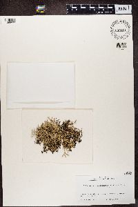 Cetrariastrum cirrhatum (Fr.) W.L. Culb. & C.F. Culb. 899914[1365637]Izumi Taiwan, Province of China, Chiayi |
MIN:Lichens | 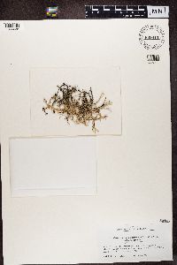 Cetrariastrum neocirrhatum (Hale & M. Wirth) W.L. Culb. & C.F. Culb. 899913[1365638]Kashiwadani Peru |
MIN:Lichens |  Cetrariastrum andense Kärnefelt ex Sipman 777314[1390299]Oberwinkler Venezuela, Merida |
1
Page 1, records 1-8 of 8
Google Map
Google Maps is a web mapping service provided by Google that features a map that users can pan (by dragging the mouse) and zoom (by using the mouse wheel). Collection points are displayed as colored markers that when clicked on, displays the full information for that collection. When multiple species are queried (separated by semi-colons), different colored markers denote each individual species.