University of Minnesota
http://www.umn.edu/
612-625-5000
http://www.umn.edu/
612-625-5000
Minnesota Biodiversity Atlas
Bell Museum
Dataset: MIN-Lichens
Taxa: Mytilinidiaceae
Search Criteria: excluding cultivated/captive occurrences
1
Page 1, records 1-5 of 5
Bell Museum lichens | |
 MIN:Lichens | Taeniolella caespitosa M.S. Cole & D. Hawksw. 870333[]Cole, Mariette S. 70381997-08-07 Canada, Quebec, Quebec, Stoneham, Mont Wright Parc de conservaton municipal. Station 1.1 ABLS 1997 excursion, 47.011667 -71.345833, 230m |
MIN:Lichens | Taeniolella delicata M.S. Christ. & D. Hawksw. 757441[]Christiansen, M. 15811981-10-05 Denmark, Syddanmark, Langeland, Snode |
MIN:Lichens | Taeniolella laevistipitata M.S. Cole & D. Hawksw. 872017[]Wetmore, Clifford M. 40239B1979-07-15 United States, Minnesota, Saint Louis, North side of small bay S of Mukooda Lake (Sand Point Lake area); Sec. 1, T67N, R17W. Voyageurs National Park, 48.32138889 -92.47555556 |
MIN:Lichens | 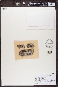 Taeniolella serusiauxii Diederich 858255[1385512]Santesson, R. Tanzania, United Republic of, Arusha |
MIN:Lichens |  Taeniolella verrucosa M.S. Christ. & D. Hawksw. 940047[1361967]Christiansen, M.S. Denmark, Sjaelland |
1
Page 1, records 1-5 of 5
Google Map
Google Maps is a web mapping service provided by Google that features a map that users can pan (by dragging the mouse) and zoom (by using the mouse wheel). Collection points are displayed as colored markers that when clicked on, displays the full information for that collection. When multiple species are queried (separated by semi-colons), different colored markers denote each individual species.