University of Minnesota
http://www.umn.edu/
612-625-5000
http://www.umn.edu/
612-625-5000
Minnesota Biodiversity Atlas
Bell Museum
Dataset: MIN-Lichens
Taxa: Ochrolechiaceae
Search Criteria: excluding cultivated/captive occurrences
Bell Museum lichens | |
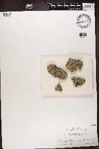
MIN:Lichens | 021636[]Calkins, W. 46 United States, Washington |
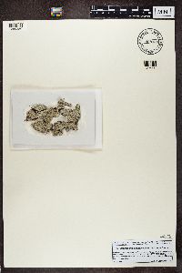
MIN:Lichens | 744079[]Henderson, L. 176931935-08-10 United States, Oregon, Lane, Siltcoos Lake, N Beach |
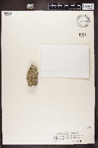
MIN:Lichens | 902192[]Hasse, H. s.n.1909-00-00 United States, California, Los Angeles, Santa Monica Mountains |
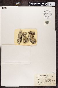
MIN:Lichens | 970388[1373161]Caleb A. Morse 186932009-04-28 United States, Texas, Montague, 33.45824 -97.87535, 305 - 323m |
MIN:Lichens | Ochrolechia africana Zahlbr. 634948[]Nash, T. 77021973-07-24 United States, Arizona, Greenlee, Hannagan Meadows, 33.6333333 -109.3166667 |
MIN:Lichens | Ochrolechia africana Zahlbr. 640393[]Tucker, S. 109101972-10-14 United States, Louisiana, East Baton Rouge, Baton Rouge |
MIN:Lichens | Ochrolechia africana Zahlbr. 796137[]Wetmore, C. 615211988-06-24 United States, South Carolina, Charleston, Bull Island, S End of Beach Road; Cape Romain National Wildlife Refuge, 32.89972222 -79.60555556 |
MIN:Lichens | Ochrolechia africana Zahlbr. 796319[]Wetmore, C. 612811988-06-21 United States, South Carolina, Charleston, Bull Island, Ne of Fire Tower; Cape Romain National Wildlife Refuge, 32.91194444 -79.60666667 |
MIN:Lichens | Ochrolechia africana Vain. 805316[]Tucker, S. 141821975-05-31 United States, Louisiana, East Baton Rouge, Baton Rouge, 30.413005 -91.11328 |
MIN:Lichens | Ochrolechia africana Zahlbr. 808605[]Wetmore, C. 661611989-12-11 United States, Georgia, Charlton, Chase Prairie, E Side; Okefenokee National Wildlife Refuge, 30.80472222 -82.18694444 |
MIN:Lichens | Ochrolechia africana Zahlbr. 808606[]Wetmore, C. 655911989-12-01 United States, Georgia, Charlton, Kingfisher Landing; Okefenokee National Wildlife Refuge, 30.95388889 -82.13833333 |
MIN:Lichens | Ochrolechia africana Zahlbr. 808607[]Wetmore, C. 654481989-11-29 United States, Georgia, Charlton, Double Lakes, Carters Prairie; Okefenokee National Wildlife Refuge, 30.97666667 -82.17083333 |
MIN:Lichens | Ochrolechia africana Zahlbr. 808608[]Wetmore, C. 651711989-11-25 United States, Georgia, Ware, Cedar Hammock Canal, N End; Okefenokee National Wildlife Refuge, 30.76 -82.18805556 |
MIN:Lichens | Ochrolechia africana Zahlbr. 808609[]Wetmore, C. 649901989-11-22 United States, Georgia, Charlton, Middle Island, N Edge; Okefenokee National Wildlife Refuge, 30.81444444 -82.41361111 |
MIN:Lichens | Ochrolechia africana Zahlbr. 808610[]Wetmore, C. 644561989-11-16 United States, Georgia, Ware, Suwannee Canal, 2 Mi W; Okefenokee National Wildlife Refuge, 30.73722222 -82.17027778 |
MIN:Lichens | Ochrolechia africana Zahlbr. 808611[]Wetmore, C. 642851989-11-14 United States, Georgia, Charlton, Chesser Island Near Homestead; Okefenokee National Wildlife Refuge, 30.71416667 -82.15694444 |
MIN:Lichens | Ochrolechia africana Zahlbr. 808657[]Wetmore, C. 175531967-08-26 United States, Louisiana, Sabine, Many, 12 Mi S, Hodges Gardens |
MIN:Lichens | Ochrolechia africana Zahlbr. 814222[]Wetmore, C. 691851991-09-08 United States, Missouri, Taney, Coy Bald, 0.5 Mi Ne; Hercules Glades Wilderness, 36.68944444 -92.94611111 |
MIN:Lichens | Ochrolechia africana Zahlbr. 814249[]Wetmore, C. 691071991-09-07 United States, Missouri, Taney, Hercules Tower, 0.5 Mi Nw; Hercules Glades Wilderness, 36.69055556 -92.8875 |
MIN:Lichens | Ochrolechia africana Zahlbr. 814269[]Wetmore, C. 690541991-09-06 United States, Missouri, Taney, Coy Bald, 1 Mi Se; Hercules Glades Wilderness, 36.67527778 -92.94416667 |
MIN:Lichens | Ochrolechia africana Zahlbr. 814369[]Wetmore, C. 688451991-09-03 United States, Missouri, Taney, Coy Bald; Hercules Glades Wilderness, 36.68361111 -92.95416667 |
MIN:Lichens | Ochrolechia africana Zahlbr. 814462[]Wetmore, C. 686491991-09-01 United States, Missouri, Taney, Blair Ridge; Hercules Glades Wilderness, 36.65166667 -92.93138889 |
MIN:Lichens | Ochrolechia africana Zahlbr. 814495[]Wetmore, C. 685441991-08-30 United States, Missouri, Taney, Persimmon Hollow, 0.5 Mi N; Hercules Glades Wilderness, 36.65944444 -92.9525 |
MIN:Lichens | Ochrolechia africana Zahlbr. 814579[]Wetmore, C. 683411991-08-28 United States, Missouri, Taney, Hercules Tower, 1.75 Mi W; Hercules Glades Wilderness, 36.68388889 -92.91472222 |
MIN:Lichens | Ochrolechia africana Zahlbr. 819292[]Tucker, S. 311661991-10-05 United States, Louisiana, East Baton Rouge, S Baton Rouge |
MIN:Lichens | Ochrolechia africana Zahlbr. 825948[]Tucker, S. 16920E1977-03-08 United States, Louisiana, East Baton Rouge, Burden Research Plantation, 30.413005 -91.11328 |
MIN:Lichens | Ochrolechia africana Zahlbr. 858664[]Cole, M. 73931997-10-12 United States, Missouri, Carter, Stegall Mountain Fire Tower; Peck Ranch Conservation Area, 37.075 -91.2 |
MIN:Lichens | Ochrolechia africana Zahlbr. 870789[]Wetmore, C. 841992000-05-15 United States, Missouri, Taney, Se Corner of Coy Bald; Hercules Glades Wilderness, 36.67972222 -92.94916667 |
MIN:Lichens | Ochrolechia africana Zahlbr. 870866[]Wetmore, C. 841142000-05-13 United States, Missouri, Taney, 1.5 Mi Ne of Upper Pilot Knob; Hercules Glades Wilderness, 36.705 -92.90527778 |
MIN:Lichens | Ochrolechia africana Zahlbr. 871481[]Wetmore, C. 846912000-05-23 United States, Arkansas, Polk, 1/2 Mi W of East Caney Creek Trailhead; Caney Creek Wilderness Area, 34.4 -94.03 |
MIN:Lichens | Ochrolechia africana Zahlbr. 871954[]Wetmore, C. 661061989-12-11 United States, Georgia, Ware, Grand Prairie, W Side at Double Lakes; Okefenokee National Wildlife Refuge, 30.67722222 -82.23694444 |
MIN:Lichens | Ochrolechia africana Zahlbr. 871955[]Wetmore, C. 658991989-12-07 United States, Georgia, Ware, Sapp Prairie, S of; Okefenokee National Wildlife Refuge, 30.60333333 -82.41055556 |
MIN:Lichens | Ochrolechia africana Zahlbr. 871956[]Wetmore, C. 661051989-12-11 United States, Georgia, Ware, Grand Prairie, W Side at Double Lakes; Okefenokee National Wildlife Refuge, 30.67722222 -82.23694444 |
MIN:Lichens | Ochrolechia africana Zahlbr. 871957[]Wetmore, C. 658371989-12-06 United States, Georgia, Charlton, Camp Cornelia; Okefenokee National Wildlife Refuge, 30.67444444 -82.12916667 |
MIN:Lichens | Ochrolechia africana Zahlbr. 871958[]Wetmore, C. 657791989-12-04 United States, South Carolina, Charleston, Bull Island Beach Road; Cape Romain National Wildlife Refuge, 32.90722222 -79.61138889 |
MIN:Lichens | Ochrolechia africana Zahlbr. 871959[]Wetmore, C. 657211989-12-03 United States, Georgia, Glynn, St. Simons Island, Brunswick; Fort Frederica National Monument, 31.22555556 -81.39194444 |
MIN:Lichens | Ochrolechia africana Zahlbr. 871960[]Wetmore, C. 654801989-11-29 United States, Georgia, Ware, Chesser Island, 1 Mi W; Okefenokee National Wildlife Refuge, 30.70722222 -82.19194444 |
MIN:Lichens | Ochrolechia africana Zahlbr. 871961[]Wetmore, C. 646861989-11-19 United States, Georgia, Ware, Suwannee And Cedar Hammock Canal; Okefenokee National Wildlife Refuge, 30.74777778 -82.18833333 |
MIN:Lichens | Ochrolechia africana Zahlbr. 871962[]Wetmore, C. 644161989-11-16 United States, Georgia, Charlton, Suwannee Canal, 1 Mi W; Okefenokee National Wildlife Refuge, 30.73555556 -82.1525 |
MIN:Lichens | Ochrolechia africana Zahlbr. 872042[]Wetmore, C. 247551976-05-28 United States, Louisiana, Natchitoches, Longleaf Trail Vista; Kisatchie National Forest, 31.47777778 -92.99694444 |
MIN:Lichens | Ochrolechia africana Zahlbr. 872043[]Wetmore, C. 247471976-05-28 United States, Louisiana, Natchitoches, Longleaf Trail Vista; Kisatchie National Forest, 31.47777778 -92.99694444 |
MIN:Lichens | Ochrolechia africana Zahlbr. 872082[]Wetmore, C. 141171966-06-02 United States, Oklahoma, Le Flore, Cedar Lake Campground; Ouachita National Forest |
MIN:Lichens | Ochrolechia africana Zahlbr. 872084[]Wetmore, C. 139631965-12-23 United States, Florida, Polk, Lake Wales, E of |
MIN:Lichens | Ochrolechia africana Zahlbr. 872085[]Wetmore, C. 138211965-12-21 United States, Florida, Polk, Avon Park, 7 Mi E of |
MIN:Lichens | Ochrolechia africana Zahlbr. 872520[]Egan, R. 97501977-01-06 United States, Georgia, Camden, S End, 5 Mi Ne of Saint Marys; Cumberland Island National Seashore |
MIN:Lichens | Ochrolechia africana Zahlbr. 872521[]Egan, R. 97271977-01-06 United States, Georgia, Camden, S End, 5 Mi Ne of Saint Marys; Cumberland Island National Seashore |
MIN:Lichens | Ochrolechia africana Zahlbr. 872522[]Egan, R. 96961976-12-30 United States, Georgia, Glynn, Jekyll Island, N End; Clam Creek |
MIN:Lichens | Ochrolechia africana Zahlbr. 872523[]Egan, R. 95841976-11-27 United States, Texas, Uvalde, Frio River, 25 Mi N of Uvalde; Garner State Park |
MIN:Lichens | Ochrolechia africana Zahlbr. 872531[]Egan, R. 90621976-07-08 United States, Texas, Smith, S End of Tyler Lake East |
MIN:Lichens | Ochrolechia africana Zahlbr. 872536[]Egan, R. 8719A1976-05-14 United States, Texas, Polk, Menard Creek Unit, Dallardsville; Big Thicket National Preserve |
MIN:Lichens | Ochrolechia africana Zahlbr. 872545[]Egan, R. 83181976-04-09 United States, Texas, Burleson, Clay, 9 Mi Se of Snook, 30.389374 -96.343574 |
MIN:Lichens | Ochrolechia africana Zahlbr. 872550[]Egan, R. 82201976-03-19 United States, Texas, Robertson, Wheelock, 10 Mi Se of Franklin |
MIN:Lichens | Ochrolechia africana Zahlbr. 872551[]Egan, R. 81841976-03-19 United States, Texas, Bastrop, E of Bastrop; Bastrop State Park |
MIN:Lichens | Ochrolechia africana Zahlbr. 872565[]Egan, R. 76261975-12-30 United States, Texas, Grimes, E of The Navasota River |
MIN:Lichens | Ochrolechia africana Zahlbr. 872572[]Egan, R. 69561975-07-26 United States, Texas, Robertson, Boy Scout Camp Arrowmoon |
MIN:Lichens | Ochrolechia africana Zahlbr. 872576[]Egan, R. 63011969-12-24 United States, Georgia, Glynn, Jekyll Island, North Picnic Ground |
MIN:Lichens | Ochrolechia africana Zahlbr. 872583[]Egan, R. 55761974-06-22 United States, Georgia, Camden, Kingsland, W of Crooked River State Park |
MIN:Lichens | Ochrolechia africana Zahlbr. 872605[]Egan, R. 38581969-12-24 United States, Georgia, Glynn, Jekyll Island, North Picnic Ground, 31.1 -81.40416667 |
MIN:Lichens | Ochrolechia africana Zahlbr. 874852[]Wetmore, C. 865222001-05-27 United States, Arkansas, Garland, W of Fox Pass Rd. at E Side of Park; Hot Springs National Park, 34.55166667 -93.03 |
MIN:Lichens | Ochrolechia africana Zahlbr. 874870[]Wetmore, C. 864742001-05-26 United States, Arkansas, Garland, W of Black Snake Rd. On Sunset Trail; Hot Springs National Park, 34.51166667 -93.09888889 |
MIN:Lichens | Ochrolechia africana Zahlbr. 874874[]Wetmore, C. 864672001-05-26 United States, Arkansas, Garland, W of Black Snake Rd. On Sunset Trail; Hot Springs National Park, 34.51166667 -93.09888889 |
MIN:Lichens | Ochrolechia africana Zahlbr. 874895[]Wetmore, C. 864032001-05-26 United States, Arkansas, Garland, N Slope of Sw Peak of Music Mt.; Hot Springs National Park, 34.50194444 -93.10472222 |
MIN:Lichens | Ochrolechia africana Zahlbr. 874966[]Wetmore, C. 861992001-05-24 United States, Arkansas, Garland, W of Cedar Glades Rd. On Sunset Trail; Hot Springs National Park, 34.52833333 -93.06722222 |
MIN:Lichens | Ochrolechia africana Zahlbr. 875051[]Wetmore, C. 859442001-05-22 United States, Arkansas, Garland, Nw of Desoto Park On Sunset Trail; Hot Springs National Park, 34.54805556 -93.03777778 |
MIN:Lichens | Ochrolechia africana Zahlbr. 875087[]Wetmore, C. 858132001-05-20 United States, Arkansas, Garland, W of Towers On Sunset Trail; Hot Springs National Park, 34.50416667 -93.08583333 |
MIN:Lichens | Ochrolechia africana Zahlbr. 875120[]Wetmore, C. 857002001-05-19 United States, Arkansas, Garland, Balanced Rock On Sugarloaf Mt.; Hot Springs National Park, 34.52527778 -93.07388889 |
MIN:Lichens | Ochrolechia africana Zahlbr. 875130[]Wetmore, C. 856642001-05-18 United States, Arkansas, Garland, Nw of West Mt. Overlook; Hot Springs National Park, 34.50888889 -93.06777778 |
MIN:Lichens | Ochrolechia africana Zahlbr. 875138[]Wetmore, C. 856332001-05-18 United States, Arkansas, Garland, E of Whittington at Graves Quarry; Hot Springs National Park, 34.51194444 -93.0825 |
MIN:Lichens | Ochrolechia africana Zahlbr. 875170[]Wetmore, C. 855312001-05-17 United States, Arkansas, Garland, Upper Floral Trail On Hot Springs Mt.; Hot Springs National Park, 34.52 -93.04722222 |
MIN:Lichens | Ochrolechia africana Zahlbr. 875200[]Wetmore, C. 854382001-05-16 United States, Arkansas, Garland, N of Tower On Hot Springs Mt.; Hot Springs National Park, 34.51694444 -93.04638889 |
MIN:Lichens | Ochrolechia africana Zahlbr. 891199[]Morse, C. 106702004-09-08 United States, Oklahoma, Murray, Davis, Wsw, Lake of The Arbuckles; Chickasaw National Recreation Area, 34.47916667 -97.02888889 |
MIN:Lichens | Ochrolechia africana Zahlbr. 902193[]Nelson, N. 107B1915-04-30 United States, Florida, Alachua, Gainesville |
MIN:Lichens | Ochrolechia africana Zahlbr. 940268[]Wetmore, C. 720651993-02-17 Mexico, Baja California Sur, 5 km From San Pedro Along Hwy 19, At Microdas, Radio Tower, 23.83333333 -110.25 |
MIN:Lichens | Ochrolechia africana Zahlbr. 940270[]Wetmore, C. 719191993-02-14 Mexico, Baja California Sur, 6 km Ssw of San Pedro Along El Carrizal Rd off Hwy 19 To Todos Santos, 23.8 -110.3 |
MIN:Lichens | Ochrolechia africana Zahlbr. 940272[]Wetmore, C. 721081993-02-18 Mexico, Baja California Sur, 20 km of Hwy 1 Along Rd To Puerto Cancun, 24.58333333 -111.6 |
MIN:Lichens | Ochrolechia africana Zahlbr. 940274[]Wetmore, C. 718411993-02-11 Mexico, Sonora, Los Medanos, W of Ciudad Obregon, 27.15 -110.1333333 |
MIN:Lichens | Ochrolechia africana Zahlbr. 940276[]Wetmore, C. 718211993-02-11 Mexico, Sonora, Los Medanos, W of Ciudad Obregon, 27.15 -110.1333333 |
MIN:Lichens | Ochrolechia africana Zahlbr. 940277[]Wetmore, C. 795301998-01-04 Mexico, Baja California Sur, 74 km Nnw of Ciudad Insurgentes, Along Paved Rd, Magdalena Region, 25.88222222 -112.0680556 |
MIN:Lichens | Ochrolechia africana Zahlbr. 940278[]Wetmore, C. 702051992-03-20 Mexico, Baja California Sur, 36 km Nnw of Ciudad Insurgentes, Just W of Paved Rd, In Magdalena Region, 25.66666667 -111.9666667 |
MIN:Lichens | Ochrolechia africana Zahlbr. 940280[]Wetmore, C. 635631989-01-04 Mexico, Baja California, Cerro Kenton Between Bahia Falsa And Bahia San Quintin, 30.46666667 -116 |
MIN:Lichens | Ochrolechia africana Zahlbr. 940294[]Wetmore, C. 721091993-02-18 Mexico, Baja California Sur, 20 km W of Hwy 1 Along Rd To Puerto Cancun, 24.58333333 -111.6 |
MIN:Lichens | Ochrolechia africana Zahlbr. 940296[]Wetmore, C. 721241993-02-18 Mexico, Baja California Sur, 20 km W of Hwy 1 Along Rd To Puerto Cancun, 24.58333333 -111.6 |
MIN:Lichens | Ochrolechia africana Zahlbr. 940342[]Wetmore, C. 732581993-12-28 United States, California, Los Angeles, Santa Catalina Island, 0.8 km Nw of Catalina Airfield, 33.40416667 -118.4125 |
MIN:Lichens | Ochrolechia africana Zahlbr. 940426[]Egan, R.S. 138011989-01-04 Mexico, Baja California Norte, Cerro Kenton Between Bahia Falsa & Bahia San Quintin, 30.46666667 -116 |
MIN:Lichens | Ochrolechia africana Zahlbr. 883531[1365916]Lendemer, J.C. United States, North Carolina, Pender |
MIN:Lichens | Ochrolechia africana Zahlbr. 834744[1388300]Nash, T.H. Mexico, Baja California Sur |
MIN:Lichens | Ochrolechia africana Zahlbr. 868466[1388449]Nash, T.H. Mexico, Baja California |
MIN:Lichens | Ochrolechia akagiensis Yasuda 890243[1365598]Kashiwadani Japan, Hokkaido |
MIN:Lichens | Ochrolechia alboflavescens (Wulfen) Zahlbr. 638322[]Weber, W. 546901971-07-03 Greece, Thessaly |
MIN:Lichens | Ochrolechia alboflavescens (Wulfen) Zahlbr. 660765[]Llano, G. s.n.1946-10-02 Sweden, Uppland, Balinge, Ryggmossen |
MIN:Lichens | Ochrolechia alboflavescens (Wulfen) Zahlbr. 832849[]Tonsberg, T. 101361987-07-26 Norway, Aust-Agder, Bykle, Between State Road 12 And Egrasen |
MIN:Lichens | Ochrolechia alboflavescens (Wulfen) Zahlbr. 868389[1389350]Obermayer, W. Austria, Styria, Steiermark |
MIN:Lichens | Ochrolechia alboflavescens (Wulfen) Zahlbr. 822752[1390044]Hafellner, J. Italy, Trentino-South Tyrol |
MIN:Lichens | Ochrolechia alboflavescens (Wulfen) Zahlbr. 673033[1392230]Leppala Finland, Southern Ostrobothnia |
MIN:Lichens | Ochrolechia alboflavescens (Wulfen) Zahlbr. 847337[1392427]Koskinen, A. Finland, Tavastia |
MIN:Lichens | Ochrolechia alboflavescens (Wulfen) Zahlbr. 855977[1386789]Vezda, A. Czech Republic |
MIN:Lichens | Ochrolechia androgyna (Hoffm.) Arnold 537560[]Eyerdam, W. 11061948-03-30 United States, Washington, Snohomish, Mt. Pilchuck, Gold Basin, 48.077821 -121.73506 |
MIN:Lichens | Ochrolechia androgyna (Hoffm.) Arnold 627330[]Wetmore, C. 13278A1965-08-20 United States, Wisconsin, Ashland, Mellen, 3 Mi N of; Copper Falls State Park |
MIN:Lichens | Ochrolechia androgyna (Hoffm.) Arnold 627331[]Wetmore, C. 133901965-08-21 United States, Wisconsin, Bayfield, Point Detour N of Bayfield, 46.95777778 -90.84694444 |
MIN:Lichens | Ochrolechia androgyna (Hoffm.) Arnold 627332[]Anderson, R. 206891960-06-08 United States, South Dakota, Custer, Black Hills, N of Bismark Lake |
Google Map
Google Maps is a web mapping service provided by Google that features a map that users can pan (by dragging the mouse) and zoom (by using the mouse wheel). Collection points are displayed as colored markers that when clicked on, displays the full information for that collection. When multiple species are queried (separated by semi-colons), different colored markers denote each individual species.
