University of Minnesota
http://www.umn.edu/
612-625-5000
http://www.umn.edu/
612-625-5000
Minnesota Biodiversity Atlas
Bell Museum
Dataset: MIN-Lichens
Taxa: Strigulaceae
Search Criteria: excluding cultivated/captive occurrences
Bell Museum lichens | |
 MIN:Lichens | 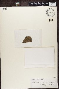 855461[1364768]Kalb, K. Brazil, Rio De Janeiro |
MIN:Lichens | Strigula stigmatella (Ach.) R. C. Harris 624656[]Harris, R. 74471971-09-11 United States, Michigan, Dickinson, O'Neil Lake |
MIN:Lichens | Strigula stigmatella (Ach.) R. C. Harris 624657[]Harris, R. 76551971-10-09 United States, Michigan, Clare, Long Lake, 2 Mi N, 44.140161 -84.799299 |
MIN:Lichens | Strigula stigmatella (Ach.) R. C. Harris 662216[]Harris, R. 101181975-07-19 United States, Michigan, Gogebic, Marenisco, 2 Mi Se, 46.35455 -89.667757 |
MIN:Lichens | Strigula stigmatella (Ach.) R. C. Harris 673543[]Wetmore, C. 208671972-08-23 United States, Michigan, Keweenaw, Copper Harbor, Clark E |
MIN:Lichens | Strigula stigmatella (Ach.) R. C. Harris 686540[]Wetmore, C. 280761977-06-17 United States, Minnesota, Saint Louis, Babbitt, 5 Mi E of; Superior National Forest, 47.705 -91.7025 |
MIN:Lichens | Strigula stigmatella (Ach.) R. C. Harris 686544[]Wetmore, C. 280551977-06-17 United States, Minnesota, Saint Louis, Babbitt, 5 Mi E of; Superior National Forest, 47.705 -91.7025 |
MIN:Lichens | Strigula stigmatella (Ach.) R. C. Harris 718836[]Wetmore, C. 355401978-07-07 United States, Minnesota, Saint Louis, Namakan Narrows, W of; Voyageurs National Park, 48.42611111 -92.50222222 |
MIN:Lichens | Strigula stigmatella (Ach.) R. C. Harris 718837[]Wetmore, C. 355371978-07-07 United States, Minnesota, Saint Louis, Namakan Narrows, W of; Voyageurs National Park, 48.42611111 -92.50222222 |
MIN:Lichens | Strigula stigmatella (Ach.) R. C. Harris 718846[]Wetmore, C. 349561978-07-03 United States, Minnesota, Saint Louis, Namakan Narrows Peninsula; Voyageurs National Park, 48.43305556 -92.49611111 |
MIN:Lichens | Strigula stigmatella (Ach.) R. C. Harris 718847[]Wetmore, C. 349381978-07-03 United States, Minnesota, Saint Louis, Namakan Narrows Peninsula; Voyageurs National Park, 48.43305556 -92.49611111 |
MIN:Lichens | Strigula stigmatella (Ach.) R. C. Harris 718857[]Wetmore, C. 347361978-06-28 United States, Minnesota, Saint Louis, Junction Bay, Johnson River; Voyageurs National Park, 48.40333333 -92.67472222 |
MIN:Lichens | Strigula stigmatella (Ach.) R. C. Harris 718928[]Wetmore, C. 333341978-06-14 Canada, Ontario, Oakpoint Island |
MIN:Lichens | Strigula stigmatella (Ach.) R. C. Harris 721719[]Wetmore, C. 41757A1980-08-12 United States, Minnesota, Lake, Half Mile N of Entrance; Crosby State Park, 47.48638889 -91.12388889 |
MIN:Lichens | Strigula stigmatella (Ach.) R. C. Harris 721880[]Wetmore, C. 412281980-07-06 United States, Michigan, Keweenaw, Starvation Point, Behind; Isle Royale National Park, 48.16083333 -88.47222222 |
MIN:Lichens | Strigula stigmatella (Ach.) R. C. Harris 723265[]Wetmore, C. 287541977-07-16 Canada, Ontario, Slate Islands, Patterson Island, Bog, 48.66916667 -86.99805556 |
MIN:Lichens | Strigula stigmatella (Ach.) R. C. Harris 743209[]Wetmore, C. 440451982-06-25 Canada, Ontario, Smooth Rock Falls, S of, 49.1755 -81.633333 |
MIN:Lichens | Strigula stigmatella (Ach.) R. C. Harris 771101[]Wetmore, C. 529771984-07-21 United States, Michigan, Keweenaw, Beaver Island, Nw of; Isle Royale National Park, 47.90583333 -89.18805556 |
MIN:Lichens | Strigula stigmatella (Ach.) R. C. Harris 771142[]Wetmore, C. 526551984-07-18 United States, Michigan, Keweenaw, Long Point, Half Mile E; Isle Royale National Park, 47.83611111 -89.11111111 |
MIN:Lichens | Strigula stigmatella (Ach.) R. C. Harris 771148[]Wetmore, C. 525921984-07-16 United States, Michigan, Keweenaw, Island E, 1 Mi N of; Isle Royale National Park, 47.92777778 -89.04055556 |
MIN:Lichens | Strigula stigmatella (Ach.) R. C. Harris 771164[]Wetmore, C. 524541984-07-14 United States, Michigan, Keweenaw, Huginnin Cove, Se; Isle Royale National Park, 47.93916667 -89.11861111 |
MIN:Lichens | Strigula stigmatella (Ach.) R. C. Harris 771193[]Wetmore, C. 521961984-07-10 United States, Michigan, Keweenaw, Washington Harbor, Se of; Isle Royale National Park, 47.88666667 -89.15444444 |
MIN:Lichens | Strigula stigmatella (Ach.) R. C. Harris 771381[]Wetmore, C. 482341983-07-15 United States, Michigan, Keweenaw, Brady Cove, S of; Isle Royale National Park, 48.10861111 -88.67861111 |
MIN:Lichens | Strigula stigmatella (Ach.) R. C. Harris 771388[]Wetmore, C. 482051983-07-14 United States, Michigan, Keweenaw, Todd Harbor, Green Isle; Isle Royale National Park, 48.07166667 -88.77111111 |
MIN:Lichens | Strigula stigmatella (Ach.) R. C. Harris 771446[]Wetmore, C. 477591983-07-11 United States, Michigan, Keweenaw, Pickerel Cove, W End; Isle Royale National Park, 48.12055556 -88.65972222 |
MIN:Lichens | Strigula stigmatella (Ach.) R. C. Harris 771455[]Wetmore, C. 476941983-07-11 United States, Michigan, Keweenaw, Across From Clay Island; Isle Royale National Park, 48.14194444 -88.59 |
MIN:Lichens | Strigula stigmatella (Ach.) R. C. Harris 771522[]Wetmore, C. 472871983-07-08 United States, Michigan, Keweenaw, Duncan Bay, Head of; Isle Royale National Park, 48.14527778 -88.52916667 |
MIN:Lichens | Strigula stigmatella (Ach.) R. C. Harris 771587[]Wetmore, C. 467601983-07-03 United States, Michigan, Keweenaw, Lane Cove; Isle Royale National Park, 48.15166667 -88.5525 |
MIN:Lichens | Strigula stigmatella (Ach.) R. C. Harris 771618[]Wetmore, C. 520781984-07-10 United States, Michigan, Keweenaw, Grace Creek Bog, Se of; Isle Royale National Park, 47.89166667 -89.16444444 |
MIN:Lichens | Strigula stigmatella (Ach.) R. C. Harris 771630[]Wetmore, C. 519171984-07-07 United States, Michigan, Keweenaw, Rainbow Cove, E of; Isle Royale National Park, 47.845 -89.18611111 |
MIN:Lichens | Strigula stigmatella (Ach.) R. C. Harris 771635[]Wetmore, C. 518951984-07-06 United States, Michigan, Keweenaw, Windigo, .5 Mi E; Isle Royale National Park, 47.91444444 -89.14277778 |
MIN:Lichens | Strigula stigmatella (Ach.) R. C. Harris 771646[]Wetmore, C. 517191984-07-05 United States, Michigan, Keweenaw, Middle Point Se of Washington Island; Isle Royale National Park, 47.86638889 -89.22083333 |
MIN:Lichens | Strigula stigmatella (Ach.) R. C. Harris 771654[]Wetmore, C. 516701984-07-04 United States, Michigan, Keweenaw, Johns Island In Washington Harbor; Isle Royale National Park, 47.89138889 -89.24333333 |
MIN:Lichens | Strigula stigmatella (Ach.) R. C. Harris 771722[]Wetmore, C. 492391983-07-24 United States, Michigan, Keweenaw, Tobin Harbor, Hidden Lake; Isle Royale National Park, 48.15833333 -88.47583333 |
MIN:Lichens | Strigula stigmatella (Ach.) R. C. Harris 771737[]Wetmore, C. 490711983-07-22 United States, Michigan, Keweenaw, Spruce Point; Isle Royale National Park, 47.95388889 -88.88944444 |
MIN:Lichens | Strigula stigmatella (Ach.) R. C. Harris 771756[]Wetmore, C. 487571983-07-20 United States, Michigan, Keweenaw, Checker Point; Isle Royale National Park, 47.89333333 -88.97 |
MIN:Lichens | Strigula stigmatella (Ach.) R. C. Harris 771766[]Wetmore, C. 486521983-07-19 United States, Michigan, Keweenaw, New Feldtman Tower, S Slope; Isle Royale National Park, 47.86 -89.09083333 |
MIN:Lichens | Strigula stigmatella (Ach.) R. C. Harris 771769[]Wetmore, C. 486311983-07-19 United States, Michigan, Keweenaw, New Feldtman Tower, N Slope; Isle Royale National Park, 47.86166667 -89.09333333 |
MIN:Lichens | Strigula stigmatella (Ach.) R. C. Harris 771782[]Wetmore, C. 483921983-07-16 United States, Michigan, Keweenaw, Moskey Basin, Ne Side; Isle Royale National Park, 48.06472222 -88.64638889 |
MIN:Lichens | Strigula stigmatella (Ach.) R. C. Harris 785566[]Wetmore, C. 578561986-09-24 United States, Minnesota, Saint Louis, Trout Lake, Se Corner; Boundary Waters Canoe Area Wilderness, 47.92916667 -92.295 |
MIN:Lichens | Strigula stigmatella (Ach.) R. C. Harris 786268[]Trana, T. 144461986-09-20 United States, Minnesota, Cook, Whale Lake, W Shore; Boundary Waters Canoe Area Wilderness, 47.86666667 -90.55 |
MIN:Lichens | Strigula stigmatella (Ach.) R. C. Harris 791646[]Wetmore, C. 598551987-07-21 United States, Michigan, Alger, Mosquito River Mouth; Pictured Rocks National Lakeshore, 46.52583333 -86.49055556 |
MIN:Lichens | Strigula stigmatella (Ach.) R. C. Harris 791766[]Wetmore, C. 595511987-07-18 United States, Michigan, Alger, Ers Falls, S of; Pictured Rocks National Lakeshore, 46.47305556 -86.535 |
MIN:Lichens | Strigula stigmatella (Ach.) R. C. Harris 791859[]Wetmore, C. 592881987-07-15 United States, Michigan, Alger, Hurricane River Campground, 0.5 Mi Sw; Pictured Rocks National Lakeshore, 44.25611111 -86.22 |
MIN:Lichens | Strigula stigmatella (Ach.) R. C. Harris 791906[]Wetmore, C. 591331987-07-14 United States, Michigan, Alger, Sevenmile Creek, Mouth; Pictured Rocks National Lakeshore, 46.61833333 -86.25694444 |
MIN:Lichens | Strigula stigmatella (Ach.) R. C. Harris 792344[]Wetmore, C. 611981987-08-18 United States, Wisconsin, Bayfield, Mainland At Sand Point; Apostle Islands National Lakeshore, 46.93972222 -90.95888889 |
MIN:Lichens | Strigula stigmatella (Ach.) R. C. Harris 792567[]Wetmore, C. 605921987-08-09 United States, Wisconsin, Ashland, Rocky Island, Inland; Apostle Islands National Lakeshore, 47.03388889 -90.68138889 |
MIN:Lichens | Strigula stigmatella (Ach.) R. C. Harris 797767[]Harris, R. 194031986-09-07 United States, New York, Hamilton, Raquette Lake Village |
MIN:Lichens | Strigula stigmatella (Ach.) R. C. Harris 807382[]Wetmore, C. 669801990-07-16 United States, Wisconsin, Douglas, Gordon Dam; Saint Croix National Scenic Riverway, 46.25416667 -91.92972222 |
MIN:Lichens | Strigula stigmatella (Ach.) R. C. Harris 808066[]Wetmore, C. 675461990-09-03 United States, Wisconsin, Burnett, Norway Point Landing; Saint Croix National Scenic Riverway, 45.92305556 -92.63666667 |
MIN:Lichens | Strigula stigmatella (Ach.) R. C. Harris 813423[]Wetmore, C. 681001991-08-13 United States, Minnesota, Cook, Fort Charlotte On Pigeon River; Grand Portage National Monument, 48.00388889 -89.82833333 |
MIN:Lichens | Strigula stigmatella (Ach.) R. C. Harris 838167[]Erbisch, F. 45331976-10-13 United States, Michigan, Keweenaw, Central Creek N of Central |
MIN:Lichens | Strigula stigmatella (Ach.) R. C. Harris 842222[]Harris, R. 74471971-09-11 United States, Michigan, Dickinson, O'Neil Lake, S End of |
MIN:Lichens | Strigula stigmatella (Ach.) R. C. Harris 868624[]Wetmore, C. 832131999-07-30 United States, Minnesota, Cook, Amenda Creek at Usfs 342; Superior National Forest, 47.56722222 -91.00138889 |
MIN:Lichens | Strigula stigmatella (Ach.) R. C. Harris 868669[]Wetmore, C. 830781999-07-27 United States, Minnesota, Cook, N Side of Marsh Lake; Superior National Forest, 47.835 -90.81944444 |
MIN:Lichens | Strigula stigmatella (Ach.) R. C. Harris 868678[]Wetmore, C. 830561999-07-27 United States, Minnesota, Cook, N Side of Marsh Lake; Superior National Forest, 47.835 -90.81944444 |
MIN:Lichens | Strigula stigmatella (Ach.) R. C. Harris 868804[]Wetmore, C. 826101999-07-10 United States, Minnesota, Saint Louis, S Side of Bass Lake; Superior National Forest, 47.95611111 -91.85833333 |
MIN:Lichens | Strigula stigmatella (Ach.) R. C. Harris 868871[]Wetmore, C. 823621999-06-23 United States, Minnesota, Saint Louis, North of Pfeifer Lake; Superior National Forest, 47.75666667 -92.46555556 |
MIN:Lichens | Strigula stigmatella (Ach.) R. C. Harris 868933[]Wetmore, C. 838461999-08-21 United States, Minnesota, Cook, S of Kimball Lake On Usfs 304; Superior National Forest, 47.83305556 -90.22722222 |
MIN:Lichens | Strigula stigmatella (Ach.) R. C. Harris 868978[]Wetmore, C. 836791999-08-18 United States, Minnesota, Cook, Sw of Assinika Lake On 309; Superior National Forest, 47.95305556 -90.26555556 |
MIN:Lichens | Strigula stigmatella (Ach.) R. C. Harris 869005[]Wetmore, C. 836131999-08-17 United States, Minnesota, Cook, E End of K Lake; Superior National Forest, 47.8675 -90.21694444 |
MIN:Lichens | Strigula stigmatella (Ach.) R. C. Harris 869062[]Wetmore, C. 834201999-08-04 United States, Minnesota, Cook, S of Deer Yard Lake; Superior National Forest, 47.67944444 -90.61694444 |
MIN:Lichens | Strigula stigmatella (Ach.) R. C. Harris 869070[]Wetmore, C. 833911999-08-03 United States, Minnesota, Cook, E of Tait Lake; Superior National Forest, 47.82444444 -90.65694444 |
MIN:Lichens | Strigula stigmatella (Ach.) R. C. Harris 869085[]Wetmore, C. 833351999-08-02 United States, Minnesota, Cook, 1.5 Mi N of Oberg Mountain; Superior National Forest, 47.64888889 -90.78777778 |
MIN:Lichens | Strigula stigmatella (Ach.) R. C. Harris 869114[]Wetmore, C. 832611999-08-01 United States, Minnesota, Lake, Wanless Creek; Superior National Forest, 47.63833333 -91.08111111 |
MIN:Lichens | Strigula stigmatella (Ach.) R. C. Harris 879879[]Wetmore, C. 879002002-06-13 United States, Minnesota, Saint Louis, 3.5 Mi N of Kinney; Superior National Forest, 47.56555556 -92.74972222 |
MIN:Lichens | Strigula stigmatella (Ach.) R. C. Harris 879888[]Wetmore, C. 878782002-06-12 United States, Minnesota, Saint Louis, 3 Mi Sw of Dark Lake; Superior National Forest, 47.60861111 -92.83611111 |
MIN:Lichens | Strigula stigmatella (Ach.) R. C. Harris 879896[]Wetmore, C. 876732002-04-29 United States, Wisconsin, Oneida, W Clear Lake Road (W of Woodruff), 1.2 Mi S of Hwy 70; Patterson Hemlocks Scientific Natural Area, 45.89694444 -89.97444444 |
MIN:Lichens | Strigula stigmatella (Ach.) R. C. Harris 880072[]Wetmore, C. 899132003-08-09 United States, Michigan, Baraga, Sturgeon River Campground Ne of Wat; Ottawa National Forest, 46.56972222 -88.65388889 |
MIN:Lichens | Strigula stigmatella (Ach.) R. C. Harris 880134[]Wetmore, C. 897712003-08-08 United States, Michigan, Iron, Jake Creek 14.7 Mi Ne of Watersmeet; Ottawa National Forest, 46.40305556 -88.9475 |
MIN:Lichens | Strigula stigmatella (Ach.) R. C. Harris 880210[]Wetmore, C. 895642003-08-05 United States, Michigan, Gogebic, Sucker Lake Road Nw of Watersmeet; Ottawa National Forest, 46.35583333 -89.39222222 |
MIN:Lichens | Strigula stigmatella (Ach.) R. C. Harris 880264[]Wetmore, C. 894282003-08-03 United States, Michigan, Gogebic, Banner Creek 4.6 Mi E of Marenisco; Ottawa National Forest, 46.37222222 -89.6 |
MIN:Lichens | Strigula stigmatella (Ach.) R. C. Harris 880283[]Wetmore, C. 893912003-08-03 United States, Michigan, Gogebic, Bobcat Lake 2 Mi Se of Marenisco; Ottawa National Forest, 46.36138889 -89.66666667 |
MIN:Lichens | Strigula stigmatella (Ach.) R. C. Harris 881460[]Lendemer, J. 14032003-09-19 United States, Connecticut, Litchfield, Sharon, Silver Lake Conference Center, 41.89194444 -73.485 |
MIN:Lichens | Strigula stigmatella (Ach.) R. C. Harris 881846[]Buck, W. 389272001-04-20 United States, West Virginia, Pendleton, Fanny Nennett Hemlock Grove; Monongahela National Forest, 38.65027778 -73.55527778 |
MIN:Lichens | Strigula stigmatella (Ach.) R. C. Harris 882773[]Wetmore, C. 909022004-07-10 United States, Michigan, Gogebic, E of Heart Lake; Ottawa National Forest, 46.35583333 -89.70638889 |
MIN:Lichens | Strigula stigmatella (Ach.) R. C. Harris 882837[]Wetmore, C. 908352004-07-10 United States, Michigan, Gogebic, Se of Foxpaw Lake; Ottawa National Forest, 46.30611111 -89.80722222 |
MIN:Lichens | Strigula stigmatella (Ach.) R. C. Harris 882889[]Wetmore, C. 907812004-07-09 United States, Michigan, Gogebic, Yondota Falls N of Marenisco; Ottawa National Forest, 46.43055556 -89.685 |
MIN:Lichens | Strigula stigmatella (Ach.) R. C. Harris 883010[]Wetmore, C. 910632004-07-14 United States, Michigan, Ontonagon, Highway 28 At Ontonagon/Gogebic Co. Line; Ottawa National Forest, 46.55083333 -89.73972222 |
MIN:Lichens | Strigula stigmatella (Ach.) R. C. Harris 883131[]Wetmore, C. 912742004-07-16 United States, Michigan, Houghton, 2.5 Mi Sw of Bob Lake; Ottawa National Forest, 46.65388889 -88.97166667 |
MIN:Lichens | Strigula stigmatella (Ach.) R. C. Harris 884019[]Wetmore, C. 916042004-07-22 United States, Michigan, Schoolcraft, Stutts Bog 11 Mi Se of Munising; Hiawatha National Forest, 46.28638889 -86.50944444 |
MIN:Lichens | Strigula stigmatella (Ach.) R. C. Harris 884104[]Wetmore, C. 915172004-07-21 United States, Michigan, Delta, 1 Mile N of Sandstrom Lake; Hiawatha National Forest, 45.74555556 -86.92861111 |
MIN:Lichens | Strigula stigmatella (Ach.) R. C. Harris 884180[]Wetmore, C. 914372004-07-20 United States, Michigan, Alger, Bog Behind Au Train Point W of Munising; Hiawatha National Forest, 46.475 -86.77361111 |
MIN:Lichens | Strigula stigmatella (Ach.) R. C. Harris 884247[]Wetmore, C. 920792004-07-29 United States, Michigan, Chippewa, W Side of Tahquamenon Bay; Hiawatha National Forest, 46.48777778 -85.03416667 |
MIN:Lichens | Strigula stigmatella (Ach.) R. C. Harris 884373[]Wetmore, C. 919402004-07-26 United States, Michigan, Mackinac, Summerby Swamp S of Highway 123; Hiawatha National Forest, 45.96777778 -84.78638889 |
MIN:Lichens | Strigula stigmatella (Ach.) R. C. Harris 884381[]Wetmore, C. 919322004-07-26 United States, Michigan, Mackinac, At Foley Creek; Horseshoe Bay Wilderness Area, 45.94305556 -84.74027778 |
MIN:Lichens | Strigula stigmatella (Ach.) R. C. Harris 884457[]Wetmore, C. 918502004-07-24 United States, Michigan, Schoolcraft, 1 Mi E of Lard Lake; Hiawatha National Forest, 46.28416667 -86.55916667 |
MIN:Lichens | Strigula stigmatella (Ach.) R. C. Harris 886879[]Wetmore, C. 936982005-07-23 United States, Michigan, Keweenaw, Arnold E (3.1 Mi E of Eagle River), 47.41805556 -88.23 |
MIN:Lichens | Strigula stigmatella (Ach.) R. C. Harris 887124[]Wetmore, C. 942792005-07-27 United States, Michigan, Keweenaw, 2 Mi Sw of Eagle River At Central Creek, 47.39222222 -88.26611111 |
MIN:Lichens | Strigula stigmatella (Ach.) R. C. Harris 908143[]Wetmore, C. 975782008-09-19 Canada, Ontario, Halfway Log Dump 15 km Ese of Tobermory; Bruce Peninsula National Park, 45.23388889 -81.47861111 |
MIN:Lichens | Strigula stigmatella (Ach.) R. C. Harris 916274[]Wetmore, C. 979752009-07-19 United States, Wisconsin, Douglas, Stones Bridge; Brule River State Forest, 46.43416667 -91.67305556 |
MIN:Lichens | Strigula stigmatella (Ach.) R. C. Harris 916304[]Wetmore, C. 978972009-07-18 United States, Wisconsin, Douglas, Divide Swamp Along Brule River; Brule River State Forest, 46.39694444 -91.76333333 |
MIN:Lichens | 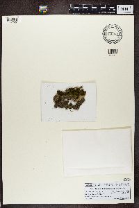 Strigula stigmatella (Ach.) R. C. Harris 868372[1389367]Turk, R. Austria, Salzburg |
MIN:Lichens |  Strigula stigmatella (Ach.) R. C. Harris 876750[1389423]Hafellner, J. Austria, Salzburg |
MIN:Lichens | Strigula submuriformis (R. C. Harris) R. C. Harris 015236[]Fink, B. s.n.1893-06-00 United States, Iowa, Fayette |
MIN:Lichens | Strigula submuriformis (R. C. Harris) R. C. Harris 015238[]Fink, B. 4701899-06-15 United States, Minnesota, Yellow Medicine, Granite Falls, 44.806697 -95.545452 |
MIN:Lichens | Strigula submuriformis (R. C. Harris) R. C. Harris 015239[]Fink, B. 321899-06-23 United States, Minnesota, Blue Earth, Mankato, 44.164809 -94.012103 |
MIN:Lichens | Strigula submuriformis (R. C. Harris) R. C. Harris 015240[]Fink, B. 711899-06-25 United States, Minnesota, Blue Earth, Mankato, 44.164809 -94.012103 |
MIN:Lichens | Strigula submuriformis (R. C. Harris) R. C. Harris 015241[]Fink, B. 8871900-07-26 United States, Minnesota, Beltrami, Red Lake |
MIN:Lichens | Strigula submuriformis (R. C. Harris) R. C. Harris 015365[]Fink, B. 2081899-07-01 United States, Minnesota, Blue Earth, Mankato, 44.164809 -94.012103 |
Google Map
Google Maps is a web mapping service provided by Google that features a map that users can pan (by dragging the mouse) and zoom (by using the mouse wheel). Collection points are displayed as colored markers that when clicked on, displays the full information for that collection. When multiple species are queried (separated by semi-colons), different colored markers denote each individual species.