University of Minnesota
http://www.umn.edu/
612-625-5000
http://www.umn.edu/
612-625-5000
Minnesota Biodiversity Atlas
Bell Museum
Dataset: DUL-
Taxa: Zosterella
Search Criteria: excluding cultivated/captive occurrences
1
Page 1, records 1-6 of 6
Olga Lakela Herbarium, University of Minnesota Duluth | |
 DUL | 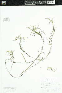 Zosterella dubia (Jacq.) Small 43767[DUL-V-32210]Myhre, Karen M. 083231998-09-11 United States, Minnesota, Crow Wing, T134N R29W SW¼ SW¼ S1 |
DUL |  Zosterella dubia (Jacq.) Small 45945[DUL-V-32446]Myhre, Karen M. 93062003-07-08 United States, Minnesota, Douglas, T127N R38W SE¼ NW¼ S15, 45.81 -95.440278 |
DUL | 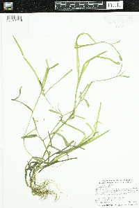 Zosterella dubia (Jacq.) Small 45952[DUL-V-32215]Myhre, Karen M. 093222003-07-16 United States, Minnesota, Douglas, T128N R39W NW¼ NW¼ S36, 45.86 -95.530278 |
DUL |  Zosterella dubia (Jacq.) Small 45966[DUL-V-32445]Myhre, Karen M. 093582003-07-24 United States, Minnesota, Otter Tail, T134N R42W NE¼ SE¼ S29 |
DUL | 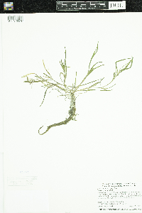 Zosterella dubia (Jacq.) Small 45971[DUL-V-32214]Myhre, Karen M. 094842003-08-20 United States, Minnesota, Becker, T139N R39W SW¼ NW¼ S6 |
DUL | 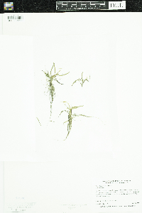 Zosterella dubia (Jacq.) Small 47024[DUL-V-32209]Myhre, Karen M. 075271998-07-01 United States, Minnesota, Pine, T43N R21W NW¼ NE¼ S18 |
1
Page 1, records 1-6 of 6
Google Map
Google Maps is a web mapping service provided by Google that features a map that users can pan (by dragging the mouse) and zoom (by using the mouse wheel). Collection points are displayed as colored markers that when clicked on, displays the full information for that collection. When multiple species are queried (separated by semi-colons), different colored markers denote each individual species.