University of Minnesota
http://www.umn.edu/
612-625-5000
http://www.umn.edu/
612-625-5000
Minnesota Biodiversity Atlas
Bell Museum
Dataset: DUL-
Taxa: Linderniaceae
Search Criteria: excluding cultivated/captive occurrences
1
Page 1, records 1-18 of 18
Olga Lakela Herbarium, University of Minnesota Duluth | |
 DUL | 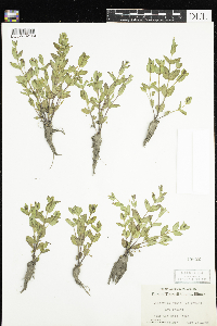 Lindernia dubia (L.) Pennell 15652[DUL-V-02104]Chase, Virginius H. 112871950-07-15 United States, Illinois, Tazewell |
DUL | 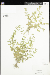 Lindernia dubia (L.) Pennell 15738[DUL-V-02105]Chase, Virginius H. 114341950-08-22 United States, Illinois, Woodford |
DUL | 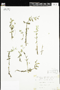 Lindernia dubia (L.) Pennell 22377[DUL-V-02101]Lakela, Olga K. 168861953-08-25 United States, Minnesota, Saint Louis |
DUL |  Lindernia dubia (L.) Pennell 24341[DUL-V-02092]Lakela, Olga K. 185111954-09-26 United States, Minnesota, Saint Louis |
DUL | 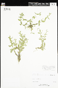 Lindernia dubia (L.) Pennell 41079[DUL-V-02102]Monson, Paul H. 50061974-07-24 United States, Wisconsin, Buffalo, T22N R13W |
DUL |  Lindernia dubia (L.) Pennell 47041[DUL-V-02100]Myhre, Karen M. 81251998-08-23 United States, Minnesota, Kanabec, T38N R24W NE¼ SE¼ S13, 45.779722 -93.268333 |
DUL |  Lindernia dubia (L.) Pennell 47188[DUL-V-02097]Myhre, Karen M. 82261998-08-28 United States, Minnesota, Aitkin, T46N R27W NE¼ NE¼ S19, 46.459167 -93.793333 |
DUL |  Lindernia dubia (L.) Pennell 47317[DUL-V-02099]Myhre, Karen M. 077751998-07-22 United States, Minnesota, Pine, T44N R20W NW¼ NE¼ S8, 46.314722 -92.891667 |
DUL |  Lindernia dubia (L.) Pennell 47996[DUL-V-02098]Smith, Welby R. 137421987-08-06 United States, Minnesota, Washington, T26N R20W SE¼ SW¼ S8, 44.750833 -92.834444 |
DUL |  Lindernia dubia (L.) Pennell 48736[DUL-V-02091]Smith, Welby R. 135301987-07-18 United States, Minnesota, Sherburne, T34N R27W SE¼ SE¼ S11, 45.445 -93.655556 |
DUL |  27661[DUL-V-02096]Lakela, Olga 206431956-07-29 United States, Minnesota, Saint Louis |
DUL | 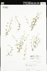 Lindernia anagallidea (Michx.) Pennell 34321[DUL-V-02103]Thomas, R. Dale 260921971-09-30 United States, Louisiana, Morehouse, T20N R6E S21 |
DUL | 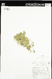 Hemianthus glomeratus (Chapm.) Pennell 33239[DUL-V-02189]Lakela, Olga K. 255051962-10-29 United States, Florida, Hillsborough |
DUL |  Hemianthus glomeratus (Chapm.) Pennell 33249[DUL-V-02190]Lakela, Olga K. 255051962-10-29 United States, Florida, Hillsborough |
DUL |  Hemianthus glomeratus (Chapm.) Pennell 33444[DUL-V-02191]Lakela, Olga K. 270771964-04-21 United States, Florida, Collier |
DUL |  Lindernia dubia var. riparia (Raf.) Fernald 19485[DUL-V-02093]Lakela, Olga K. 158711952-09-13 United States, Minnesota, Saint Louis, T65N R18W |
DUL |  Lindernia dubia var. riparia (Raf.) Fernald 19486[DUL-V-02094]Lakela, Olga K. 158711952-09-13 United States, Minnesota, Saint Louis, T65N R18W |
DUL |  Lindernia dubia var. riparia (Raf.) Fernald 27599[DUL-V-02095]Lakela, Olga K. 209611956-08-22 United States, Minnesota, Saint Louis |
1
Page 1, records 1-18 of 18
Google Map
Google Maps is a web mapping service provided by Google that features a map that users can pan (by dragging the mouse) and zoom (by using the mouse wheel). Collection points are displayed as colored markers that when clicked on, displays the full information for that collection. When multiple species are queried (separated by semi-colons), different colored markers denote each individual species.