University of Minnesota
http://www.umn.edu/
612-625-5000
http://www.umn.edu/
612-625-5000
Minnesota Biodiversity Atlas
Bell Museum
Dataset: DUL-
Taxa: Tofieldiaceae
Search Criteria: excluding cultivated/captive occurrences
1
Page 1, records 1-14 of 14
Olga Lakela Herbarium, University of Minnesota Duluth | |
 DUL | 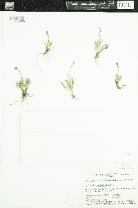 Tofieldia coccinea Richardson 14301[DUL-V-36829]Calder, J.A. 20331948-07-15 Canada, Nunavet, Qikiqtaaluk |
DUL | Tofieldia pusilla (Michaux) Persoon 1354[DUL-V-36825]Lakela, Olga K. Finland, Detailed locality information protected. This is typically done to protect rare or threatened species localities. |
DUL | Tofieldia pusilla (Michaux) Persoon 9544[DUL-V-36824]Lakela, Olga K. United States, Minnesota, Cook, Detailed locality information protected. This is typically done to protect rare or threatened species localities. |
DUL | Tofieldia pusilla (Michaux) Persoon 14292[DUL-V-36828]Gillett, J.M. Canada, Manitoba, Northern, Detailed locality information protected. This is typically done to protect rare or threatened species localities. |
DUL | Tofieldia pusilla (Michaux) Persoon 21624[DUL-V-36827]Schofield, W.B. Canada, Manitoba, Northern, Detailed locality information protected. This is typically done to protect rare or threatened species localities. |
DUL | Tofieldia pusilla (Michaux) Persoon 33967[DUL-V-36826]Cormack, R.G.H. Canada, British Columbia, Mount Waddington, Detailed locality information protected. This is typically done to protect rare or threatened species localities. |
DUL | Tofieldia pusilla (Michaux) Persoon 37799[DUL-V-36821]Lederle, K.A. United States, Minnesota, Cook, Detailed locality information protected. This is typically done to protect rare or threatened species localities. |
DUL | Tofieldia pusilla (Michaux) Persoon 37800[DUL-V-36822]Lederle, K.A. United States, Minnesota, Cook, Detailed locality information protected. This is typically done to protect rare or threatened species localities. |
DUL | Tofieldia pusilla (Michaux) Persoon 33966[]R.G.H. Cormack Detailed locality information protected. This is typically done to protect rare or threatened species localities. |
DUL | 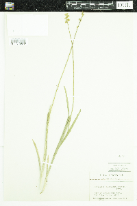 Tofieldia glutinosa (Michx.) Pers. 9545[DUL-V-36817]Wadmond, Samuel C. 195341934-07-13 United States, Wisconsin, Waukesha |
DUL | 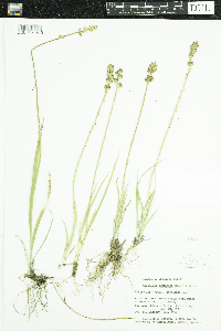 Tofieldia glutinosa (Michx.) Pers. 14562[DUL-V-36819]Senn, H.A. 54041950-07-29 Canada, Ontario, Manitoulin |
DUL | 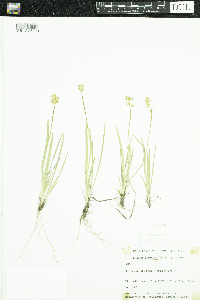 Tofieldia glutinosa (Michx.) Pers. 21623[DUL-V-36820]Schofield, W.B. 12241950-07-21 Canada, Manitoba, Northern |
DUL | 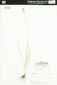 Tofieldia glutinosa (Michx.) Pers. 37971[DUL-V-36818]Severson, M. 4681980-07-08 United States, Minnesota, Clay, T139N R46W NE¼ SW¼ S23 |
DUL | Tofieldia palustris auct. non Huds. 39077[DUL-V-36823]Monson, Paul H. United States, Minnesota, Cook, Detailed locality information protected. This is typically done to protect rare or threatened species localities. |
1
Page 1, records 1-14 of 14
Google Map
Google Maps is a web mapping service provided by Google that features a map that users can pan (by dragging the mouse) and zoom (by using the mouse wheel). Collection points are displayed as colored markers that when clicked on, displays the full information for that collection. When multiple species are queried (separated by semi-colons), different colored markers denote each individual species.