University of Minnesota
http://www.umn.edu/
612-625-5000
http://www.umn.edu/
612-625-5000
Minnesota Biodiversity Atlas
Bell Museum
Dataset: USACE
Taxa: Betulaceae
Search Criteria: excluding cultivated/captive occurrences
1
Page 1, records 1-44 of 44
Biodiversity of the U.S. Army Corps of Engineers Mississippi Headwaters Recreation Area Sites | |
 USACE | Alnus incana (L.) Moench 3957[] 2019-06-25 United States, Minnesota, Itasca, Pokegama Dam Recreation Area; campground, 47.248838 -93.582245 |
USACE | 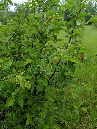 Alnus incana (L.) Moench 4097[] 2019-06-24 United States, Minnesota, Cass, Leech Lake Recreation Area; sedge meadow, 47.255038 -94.219292 |
USACE | Alnus incana (L.) Moench 4272[] 2019-06-26 United States, Minnesota, Aitkin, Sandy Lake Recreation Area; shrub swamp, 46.79457 -93.317365 |
USACE | Alnus incana (L.) Moench 4631[] 2019-06-29 United States, Minnesota, Crow Wing, Cross Lake Recreation Area; campground, 46.669904 -94.110921 |
USACE | Alnus incana (L.) Moench 1727762[] 2019-08-25 United States, Minnesota, Crow Wing, Gull Lake Recreation Area; marsh, 46.411512 -94.354028 |
USACE | 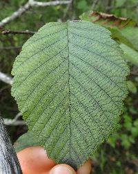 Alnus incana (L.) Moench 1727972[] 2019-08-29 United States, Minnesota, Itasca, Lake Winnibigoshish Recreation Area; point, 47.431903 -94.050469 |
USACE | 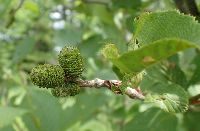 Alnus incana (L.) Moench 1728196[] 2021-06-28 United States, Minnesota, Crow Wing, Cross Lake Recreation Area; Big Trout Lake; shoreline, 46.723256 -94.130139 |
USACE | Alnus incana (L.) Moench 1728423[] 2021-06-29 United States, Minnesota, Crow Wing, Cross Lake Recreation Area; Arrowhead Lake; southest shore, 46.712712 -94.214854 |
USACE | 4273[] 2019-06-27 United States, Minnesota, Aitkin, Sandy Lake Recreation Area; campground-marsh, 46.7879157 -93.318433 |
USACE | 4471[] 2019-06-28 United States, Minnesota, Crow Wing, Gull Lake Recreation Area; open forest, 46.411821 -94.357081 |
USACE | Corylus americana Walter 3631[] 2019-06-23 United States, Minnesota, Itasca, Lake Winnibigoshish Recreation Area; point, 47.43237 -94.052647 |
USACE | Corylus americana Walter 3959[]Whitfeld, T.J.S., Weiblen, G.D., Crum, A.H. & Ezedin, Z. 22842019-06-25 United States, Minnesota, Itasca, Pokegama Dam Recreation Area; campground, 47.248838 -93.582245 |
USACE | Corylus americana Walter 4100[] 2019-06-24 United States, Minnesota, Cass, Leech Lake Recreation Area; mesic forest, 47.257453 -94.220343 |
USACE | Corylus americana Walter 4276[] 2019-06-26 United States, Minnesota, Aitkin, Sandy Lake Recreation Area; shrub swamp, 46.79457 -93.317365 |
USACE | 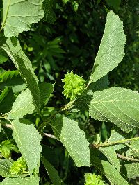 Corylus americana Walter 4473[] 2019-06-28 United States, Minnesota, Crow Wing, Gull Lake Recreation Area; campgrounds-forest, 46.410838 -94.349683 |
USACE | Corylus americana Walter 4633[] 2019-06-29 United States, Minnesota, Crow Wing, Cross Lake Recreation Area; campground, 46.669904 -94.110921 |
USACE | 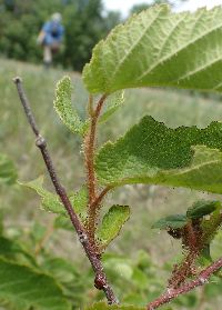 Corylus americana Walter 1728248[] 2021-06-28 United States, Minnesota, Crow Wing, Cross Lake Recreation Area; Big Trout Lake; shoreline, 46.723895 -94.130318 |
USACE | Corylus americana Walter 1728462[] 2021-06-29 United States, Minnesota, Crow Wing, Cross Lake Recreation Area; Arrowhead Lake; southest shore, 46.712712 -94.214854 |
USACE | 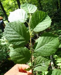 Corylus americana Walter 1728480
[]Whitfeld, T.J.S., Weiblen, G.D., Yang, Y., & Lee, A.K. 28262021-06-29 United States, Minnesota, Crow Wing, Cross Lake Recreation Area; Arrowhead Lake; southeast shore, 46.718436 -94.218164 |
USACE | 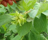 Corylus americana Walter 1728500[] 2021-06-29 United States, Minnesota, Crow Wing, Cross Lake Recreation Area; Arrowhead Lake; north shore, 46.718333 -94.2175 |
USACE | 4099[] 2019-06-24 United States, Minnesota, Cass, Leech Lake Recreation Area; rich fen, 47.2445 -94.229 |
USACE | 4275[] 2019-06-26 United States, Minnesota, Aitkin, Sandy Lake Recreation Area; shrub swamp, 46.79457 -93.317365 |
USACE | Betula papyrifera Marshall 3630[] 2019-06-22 United States, Minnesota, Cass, Lake Winnibigoshish Recreation Area; triangle, 47.422547 -94.053783 |
USACE | Betula papyrifera Marshall 3958[] 2019-06-25 United States, Minnesota, Itasca, Pokegama Dam Recreation Area; campground, 47.248838 -93.582245 |
USACE | 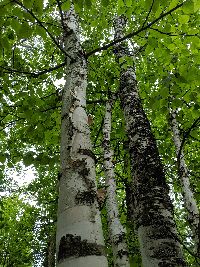 Betula papyrifera Marshall 4098[] 2019-06-24 United States, Minnesota, Cass, Leech Lake Recreation Area; mesic forest, 47.257453 -94.220343 |
USACE | Betula papyrifera Marshall 4274[] 2019-06-26 United States, Minnesota, Aitkin, Sandy Lake Recreation Area; shrub swamp, 46.79457 -93.317365 |
USACE | Betula papyrifera Marshall 4472[] 2019-06-28 United States, Minnesota, Crow Wing, Gull Lake Recreation Area; open forest, 46.411821 -94.357081 |
USACE | Betula papyrifera Marshall 4632[] 2019-06-29 United States, Minnesota, Crow Wing, Cross Lake Recreation Area; campground, 46.669904 -94.110921 |
USACE |  Betula papyrifera Marshall 1728225[] 2021-06-28 United States, Minnesota, Crow Wing, Cross Lake Recreation Area; Big Trout Lake; shoreline, 46.723088 -94.129537 |
USACE | Betula papyrifera Marshall 1728365[] 2021-06-29 United States, Minnesota, Crow Wing, Cross Lake Recreation Area; Arrowhead Lake; southest shore, 46.715213 -94.209693 |
USACE | Ostrya virginiana (Miller) K. Koch 3633[] 2019-06-22 United States, Minnesota, Cass, Lake Winnibigoshish Recreation Area; triangle, 47.422547 -94.053783 |
USACE | Ostrya virginiana (Miller) K. Koch 4475[] 2019-06-28 United States, Minnesota, Crow Wing, Gull Lake Recreation Area; open forest, 46.411821 -94.357081 |
USACE | Ostrya virginiana (Miller) K. Koch 4635[] 2019-06-29 United States, Minnesota, Crow Wing, Cross Lake Recreation Area; campground, 46.669904 -94.110921 |
USACE | Ostrya virginiana (Miller) K. Koch 1728263[] 2021-06-28 United States, Minnesota, Crow Wing, Cross Lake Recreation Area; Big Trout Lake; north triangle, 46.724336 -94.130111 |
USACE | Ostrya virginiana (Miller) K. Koch 1728367[] 2021-06-29 United States, Minnesota, Crow Wing, Cross Lake Recreation Area; Arrowhead Lake; southest shore, 46.715213 -94.209693 |
USACE | Corylus cornuta Marshall 3632[] 2019-06-23 United States, Minnesota, Itasca, Lake Winnibigoshish Recreation Area; point, 47.43237 -94.052647 |
USACE | Corylus cornuta Marshall 3960[] 2019-06-25 United States, Minnesota, Itasca, Pokegama Dam Recreation Area; campground, 47.248838 -93.582245 |
USACE | Corylus cornuta Marshall 4101[]Whitfeld, T.J.S., Weiblen, G.D., Crum, A.H. & Ezedin, Z. 22592019-06-24 United States, Minnesota, Cass, Leech Lake Recreation Area; mesic forest, 47.257453 -94.220343 |
USACE | Corylus cornuta Marshall 4277[] 2019-06-26 United States, Minnesota, Aitkin, Sandy Lake Recreation Area; shrub swamp, 46.79457 -93.317365 |
USACE |  Corylus cornuta Marshall 4474[] 2019-06-28 United States, Minnesota, Crow Wing, Gull Lake Recreation Area; campgrounds-forest, 46.410492 -94.351803 |
USACE | Corylus cornuta Marshall 4634[] 2019-06-29 United States, Minnesota, Crow Wing, Cross Lake Recreation Area; campground, 46.669904 -94.110921 |
USACE | Corylus cornuta Marshall 1728315[] 2021-06-28 United States, Minnesota, Crow Wing, Cross Lake Recreation Area; Four Acre Lake, 46.723609 -94.127264 |
USACE |  Corylus cornuta Marshall 1728359[] 2021-06-28 United States, Minnesota, Crow Wing, Cross Lake Recreation Area; Four Acre Lake, 46.722778 -94.123889 |
USACE |  Corylus cornuta Marshall 1728425
[]Whitfeld, T.J.S., Weiblen, G.D., Yang, Y., & Lee, A.K. 28212021-06-29 United States, Minnesota, Crow Wing, Cross Lake Recreation Area; Arrowhead Lake; southeast shore, 46.717222 -94.206111 |
1
Page 1, records 1-44 of 44
Google Map
Google Maps is a web mapping service provided by Google that features a map that users can pan (by dragging the mouse) and zoom (by using the mouse wheel). Collection points are displayed as colored markers that when clicked on, displays the full information for that collection. When multiple species are queried (separated by semi-colons), different colored markers denote each individual species.