University of Minnesota
http://www.umn.edu/
612-625-5000
http://www.umn.edu/
612-625-5000
Minnesota Biodiversity Atlas
Bell Museum
Dataset: NGBRC
Taxa: Ganophyllum
Search Criteria: excluding cultivated/captive occurrences
1
Page 1, records 1-14 of 14
Plant records from the New Guinea Binatang Research Center | |
 NGBRC | 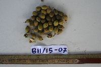 Ganophyllum falcatum Blume Ctvrtecka1485[]Ctvrtecka, R. 14852008-07-15 Papua New Guinea, Madang Province, Baitabag, -5.13333 145.767, 50m |
NGBRC | 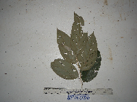 Ganophyllum falcatum Blume NP1A0056[]Binatang Research Center NP1A00562014-05-29 Papua New Guinea, Madang, Numba, -5.7222 145.2714, 1200m |
NGBRC | 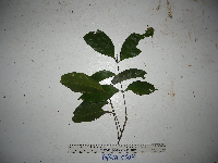 Ganophyllum falcatum Blume NP1A0007[]Binatang Research Center NP1A00072014-09-05 Papua New Guinea, Madang, Numba, -5.7222 145.2714, 1200m |
NGBRC | Ganophyllum falcatum Blume NP1A0018[]Binatang Research Center NP1A00182016-09-19 Papua New Guinea, Madang, Numba, -5.7222 145.2714, 1200m |
NGBRC | Ganophyllum falcatum Blume NP4A0602[]Binatang Research Center NP4A06022014-06-02 Papua New Guinea, Madang, Numba, -5.7222 145.2714, 1200m |
NGBRC | Ganophyllum falcatum Blume SC1D0066[]Binatang Research Center SC1D00662008-08-20 Papua New Guinea, Madang Province, Wanang, -5.235917 145.160017, 174m |
NGBRC | Ganophyllum falcatum Blume WC41D0665[]Binatang Research Center WC41D06652014-10-29 Papua New Guinea, Madang Province, Wanang Conservation, -5.277778 145.111111, 150m |
NGBRC | 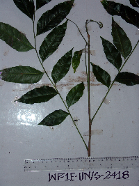 Ganophyllum falcatum Blume WP1E2418[]Binatang Research Center WP1E24182007-07-23 Papua New Guinea, Madang Province, Wanang, -5.2373 145.177183, 115m |
NGBRC | 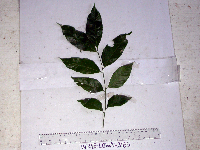 Ganophyllum falcatum Blume WP1E2465[]Binatang Research Center WP1E24652007-07-23 Papua New Guinea, Madang Province, Wanang, -5.2373 145.177183, 115m |
NGBRC | 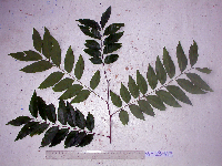 Ganophyllum falcatum Blume WP2B0483[]Binatang Research Center WP2B04832007-07-21 Papua New Guinea, Madang Province, Wanang, -5.2373 145.177183, 115m |
NGBRC | 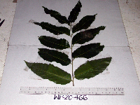 Ganophyllum falcatum Blume WP2C0466[]Binatang Research Center WP2C04662007-07-21 Papua New Guinea, Madang Province, Wanang, -5.2373 145.177183, 115m |
NGBRC | 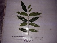 Ganophyllum falcatum Blume WP2E2567[]Binatang Research Center WP2E25672007-07-22 Papua New Guinea, Madang Province, Wanang, -5.2373 145.177183, 115m |
NGBRC | 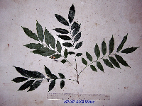 Ganophyllum falcatum Blume WP3B3268[]Binatang Research Center WP3B32682009-12-28 Papua New Guinea, Madang Province, Wanang, -5.2373 145.177183, 115m |
NGBRC | 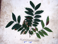 Ganophyllum falcatum Blume WP5C3175[]Binatang Research Center WP5C31752007-08-04 Papua New Guinea, Madang Province, Wanang, -5.2373 145.177183, 115m |
1
Page 1, records 1-14 of 14
Google Map
Google Maps is a web mapping service provided by Google that features a map that users can pan (by dragging the mouse) and zoom (by using the mouse wheel). Collection points are displayed as colored markers that when clicked on, displays the full information for that collection. When multiple species are queried (separated by semi-colons), different colored markers denote each individual species.