University of Minnesota
http://www.umn.edu/
612-625-5000
http://www.umn.edu/
612-625-5000
Minnesota Biodiversity Atlas
Bell Museum
Dataset: NGBRC
Taxa: Melodinus
Search Criteria: excluding cultivated/captive occurrences
1
Page 1, records 1-12 of 12
Plant records from the New Guinea Binatang Research Center | |
 NGBRC | 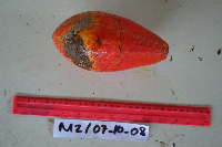 Melodinus australis (F.Muell.) Pierre Ctvrtecka2584[]Ctvrtecka, R. 25842008-10-07 Papua New Guinea, Madang Province, Mis, -5.15 145.783, 10m |
NGBRC | 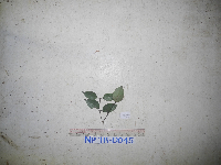 Melodinus forbesii Fawc. NP1B0045[]Binatang Research Center NP1B00452014-07-17 Papua New Guinea, Madang, Numba, -5.7222 145.2714, 1200m |
NGBRC | 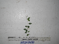 Melodinus forbesii Fawc. NP2A0434[]Binatang Research Center NP2A04342014-09-17 Papua New Guinea, Madang, Numba, -5.7222 145.2714, 1200m |
NGBRC | 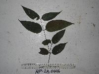 Melodinus forbesii Fawc. NP2A0446[]Binatang Research Center NP2A04462014-06-25 Papua New Guinea, Madang, Numba, -5.7222 145.2714, 1200m |
NGBRC | Melodinus forbesii Fawc. NP2B0456[]Binatang Research Center NP2B04562014-07-18 Papua New Guinea, Madang, Numba, -5.7222 145.2714, 1200m |
NGBRC | 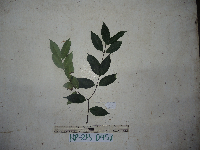 Melodinus forbesii Fawc. NP2B0457[]Binatang Research Center NP2B04572014-07-18 Papua New Guinea, Madang, Numba, -5.7222 145.2714, 1200m |
NGBRC | Melodinus forbesii Fawc. NP4A0676[]Binatang Research Center NP4A06762014-06-24 Papua New Guinea, Madang, Numba, -5.7222 145.2714, 1200m |
NGBRC | Melodinus forbesii Fawc. NS4A0578[]Binatang Research Center NS4A05782014-03-04 Papua New Guinea, Madang, Numba, -5.7222 145.2714, 1200m |
NGBRC | 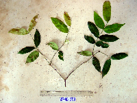 Melodinus forbesii Fawc. WP4C2943[]Binatang Research Center WP4C29432007-07-26 Papua New Guinea, Madang Province, Wanang, -5.2373 145.177183, 115m |
NGBRC | 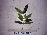 Melodinus forbesii Fawc. WS3E3039[]Binatang Research Center WS3E30392008-07-23 Papua New Guinea, Madang Province, Wanang, -5.229583 145.178467, 115m |
NGBRC | 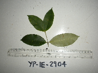 Melodinus forbesii Fawc. YP1E2904[]Binatang Research Center YP1E29042015-10-21 Papua New Guinea, Morobe Province, Yawan, -6.164067 146.83985, 1719m |
NGBRC | 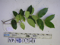 Melodinus forbesii Fawc. YP4D3741[]Binatang Research Center YP4D37412015-10-22 Papua New Guinea, Morobe Province, Yawan, -6.1642 146.840083, 1738m |
1
Page 1, records 1-12 of 12
Google Map
Google Maps is a web mapping service provided by Google that features a map that users can pan (by dragging the mouse) and zoom (by using the mouse wheel). Collection points are displayed as colored markers that when clicked on, displays the full information for that collection. When multiple species are queried (separated by semi-colons), different colored markers denote each individual species.