University of Minnesota
http://www.umn.edu/
612-625-5000
http://www.umn.edu/
612-625-5000
Minnesota Biodiversity Atlas
Bell Museum
Dataset: NGBRC
Taxa: Planchonia
Search Criteria: excluding cultivated/captive occurrences
1
Page 1, records 1-13 of 13
Plant records from the New Guinea Binatang Research Center | |
 NGBRC | 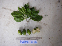 Planchonia papuana R.Knuth Ctvrtecka2711[]Ctvrtecka, R. 27112008-10-16 Papua New Guinea, Madang Province, Wanang, -5.23088 145.182, 115m |
NGBRC | Planchonia papuana R.Knuth Ctvrtecka2774[]Ctvrtecka, R. 27742008-10-21 Papua New Guinea, Madang Province, Wanang, -5.23088 145.182, 115m |
NGBRC | 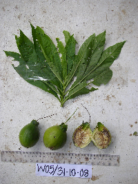 Planchonia papuana R.Knuth Ctvrtecka3026[]Ctvrtecka, R. 30262008-10-31 Papua New Guinea, Madang Province, Wanang, -5.23088 145.182, 115m |
NGBRC | Planchonia papuana R.Knuth Ctvrtecka2298[]Ctvrtecka, R. 22982008-09-19 Papua New Guinea, Madang Province, Wanang, -5.23088 145.182, 115m |
NGBRC | 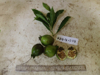 Planchonia papuana R.Knuth Ctvrtecka3524[]Ctvrtecka, R. 35242008-12-01 Papua New Guinea, Madang Province, Wanang, -5.23088 145.182, 115m |
NGBRC | 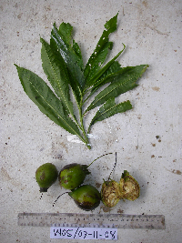 Planchonia papuana R.Knuth Ctvrtecka3140[]Ctvrtecka, R. 31402008-11-07 Papua New Guinea, Madang Province, Wanang, -5.23088 145.182, 115m |
NGBRC | 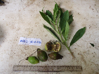 Planchonia papuana R.Knuth Ctvrtecka3412[]Ctvrtecka, R. 34122008-11-25 Papua New Guinea, Madang Province, Wanang, -5.23088 145.182, 115m |
NGBRC | 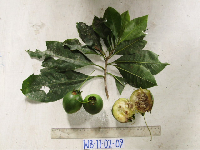 Planchonia papuana R.Knuth Ctvrtecka4009[]Ctvrtecka, R. 40092009-02-11 Papua New Guinea, Madang Province, Wanang, -5.23088 145.182, 115m |
NGBRC | 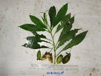 Planchonia papuana R.Knuth Ctvrtecka4086[]Ctvrtecka, R. 40862009-02-17 Papua New Guinea, Madang Province, Wanang, -5.23088 145.182, 115m |
NGBRC | 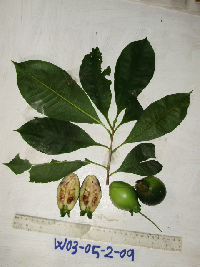 Planchonia papuana R.Knuth Ctvrtecka3932[]Ctvrtecka, R. 39322009-02-05 Papua New Guinea, Madang Province, Wanang, -5.23088 145.182, 115m |
NGBRC | 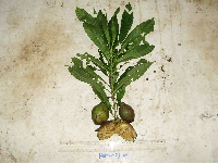 Planchonia papuana R.Knuth Ctvrtecka4481[]Ctvrtecka, R. 44812009-03-06 Papua New Guinea, Madang Province, Wanang, -5.23088 145.182, 115m |
NGBRC | Planchonia papuana R.Knuth Ctvrtecka2427[]Ctvrtecka, R. 24272008-09-30 Papua New Guinea, Madang Province, Baitabag, -5.13333 145.767, 50m |
NGBRC | Planchonia Blume WC38C0868[]Binatang Research Center WC38C08682014-11-05 Papua New Guinea, Madang Province, Wanang Conservation, -5.277778 145.069444, 150m |
1
Page 1, records 1-13 of 13
Google Map
Google Maps is a web mapping service provided by Google that features a map that users can pan (by dragging the mouse) and zoom (by using the mouse wheel). Collection points are displayed as colored markers that when clicked on, displays the full information for that collection. When multiple species are queried (separated by semi-colons), different colored markers denote each individual species.