University of Minnesota
http://www.umn.edu/
612-625-5000
http://www.umn.edu/
612-625-5000
Minnesota Biodiversity Atlas
Bell Museum
Dataset: NGBRC
Taxa: Pouteria
Search Criteria: excluding cultivated/captive occurrences
1
Page 1, records 1-7 of 7
Plant records from the New Guinea Binatang Research Center | |
 NGBRC | 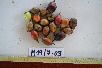 Ctvrtecka0261[]Ctvrtecka, R. 02612008-03-07 Papua New Guinea, Madang Province, Mis, -5.15 145.783, 10m |
NGBRC | 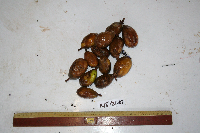 Ctvrtecka0485[]Ctvrtecka, R. 04852008-03-21 Papua New Guinea, Madang Province, Mis, -5.15 145.783, 10m |
NGBRC | OE3C0141[]Binatang Research Center OE3C01412008-08-06 Papua New Guinea, Madang Province, Wanang, -5.2328 145.177017, 175m |
NGBRC | WC25A1804[]Binatang Research Center WC25A18042014-12-06 Papua New Guinea, Madang Province, Wanang Conservation, -5.25 145.097222, 150m |
NGBRC | WP2B0403[]Binatang Research Center WP2B04032006-05-01 Papua New Guinea, Madang Province, Wanang, -5.2373 145.177183, 115m |
NGBRC | WP2C0398[]Binatang Research Center WP2C0398 Papua New Guinea, Madang Province, Wanang, -5.2373 145.177183, 115m |
NGBRC | WP5E1280[]Binatang Research Center WP5E1280 Papua New Guinea, Madang Province, Wanang, -5.2373 145.177183, 115m |
1
Page 1, records 1-7 of 7
Google Map
Google Maps is a web mapping service provided by Google that features a map that users can pan (by dragging the mouse) and zoom (by using the mouse wheel). Collection points are displayed as colored markers that when clicked on, displays the full information for that collection. When multiple species are queried (separated by semi-colons), different colored markers denote each individual species.