University of Minnesota
http://www.umn.edu/
612-625-5000
http://www.umn.edu/
612-625-5000
Minnesota Biodiversity Atlas
Bell Museum
Dataset: NGBRC
Taxa: Selliguea
Search Criteria: excluding cultivated/captive occurrences
1
Page 1, records 1-6 of 6
Plant records from the New Guinea Binatang Research Center | |
 NGBRC | 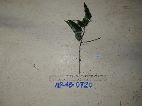 NP4B0720[]Binatang Research Center NP4B07202014-10-02 Papua New Guinea, Madang, Numba, -5.7222 145.2714, 1200m |
NGBRC | 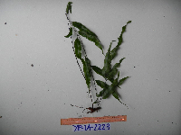 Selliguea albidosquamata (Blume) Parris YP1A2223[]Binatang Research Center YP1A22232021-07-10 Papua New Guinea, Morobe Province, Yawan, -6.162617 146.841967, 1777m |
NGBRC |  Selliguea enervis (Cav.) Ching YP2A2284[]Binatang Research Center YP2A22842021-07-10 Papua New Guinea, Morobe Province, Yawan, -6.162617 146.841967, 1777m |
NGBRC | 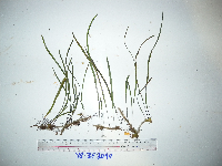 Selliguea enervis (Cav.) Ching YS3F2090[]Binatang Research Center YS3F20902021-07-10 Papua New Guinea, Morobe Province, Yawan, -6.16255 146.839933, 1721m |
NGBRC | 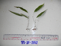 Selliguea albidosquamata (Blume) Parris YS3F2102[]Binatang Research Center YS3F21022021-07-10 Papua New Guinea, Morobe Province, Yawan, -6.16255 146.839933, 1721m |
NGBRC | 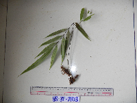 Selliguea albidosquamata (Blume) Parris YS3F2103[]Binatang Research Center YS3F21032021-07-10 Papua New Guinea, Morobe Province, Yawan, -6.16255 146.839933, 1721m |
1
Page 1, records 1-6 of 6
Google Map
Google Maps is a web mapping service provided by Google that features a map that users can pan (by dragging the mouse) and zoom (by using the mouse wheel). Collection points are displayed as colored markers that when clicked on, displays the full information for that collection. When multiple species are queried (separated by semi-colons), different colored markers denote each individual species.