University of Minnesota
http://www.umn.edu/
612-625-5000
http://www.umn.edu/
612-625-5000
Minnesota Biodiversity Atlas
Bell Museum
Dataset: NGBRC
Taxa: Streblus
Search Criteria: excluding cultivated/captive occurrences
1
Page 1, records 1-14 of 14
Plant records from the New Guinea Binatang Research Center | |
 NGBRC | 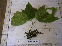 Streblus ascendens Corner Ctvrtecka3035[]Ctvrtecka, R. 30352008-11-03 Papua New Guinea, Madang Province, Wanang, -5.23088 145.182, 115m |
NGBRC | 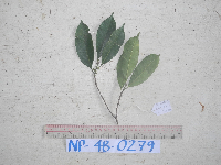 NP4B0279[]Binatang Research Center NP4B02792014-07-17 Papua New Guinea, Madang, Numba, -5.7222 145.2714, 1200m |
NGBRC | 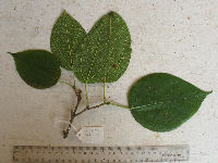 Streblus ascendens Corner OC2D0051[]Timothy J. S. Whitfeld OC2D00512009-12-29 Papua New Guinea, Madang Province, Wanang, -5.2319 145.155767, 218m |
NGBRC | 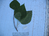 Streblus ascendens Corner SC4C0280[]Binatang Research Center SC4C02802008-12-29 Papua New Guinea, Madang Province, Wanang, -5.235917 145.160017, 174m |
NGBRC | Streblus ascendens Corner WC13D1316[]Binatang Research Center WC13D13162014-11-24 Papua New Guinea, Madang Province, Wanang Conservation, -5.236111 145.083333, 150m |
NGBRC | WC24A1677[]Binatang Research Center WC24A16772014-12-04 Papua New Guinea, Madang Province, Wanang Conservation, -5.25 145.083333, 150m |
NGBRC | 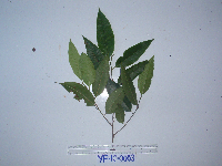 YP1C0003[]Binatang Research Center YP1C00032011-06-02 Papua New Guinea, Morobe Province, Yawan, -6.163017 146.842983, 1732m |
NGBRC |  YP2C0099[]Binatang Research Center YP2C00992011-06-02 Papua New Guinea, Morobe Province, Yawan, -6.163017 146.842983, 1732m |
NGBRC | 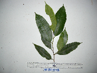 YP2C0113[]Binatang Research Center YP2C01132011-06-02 Papua New Guinea, Morobe Province, Yawan, -6.163017 146.842983, 1732m |
NGBRC | 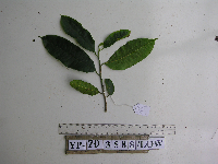 YP2D3588[]Binatang Research Center YP2D35882015-10-21 Papua New Guinea, Morobe Province, Yawan, -6.1642 146.840083, 1738m |
NGBRC | 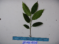 YP4A0214[]Binatang Research Center YP4A02142011-06-02 Papua New Guinea, Morobe Province, Yawan, -6.162617 146.841967, 1777m |
NGBRC | 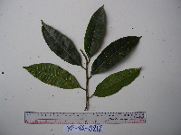 YP4A0218[]Binatang Research Center YP4A02182011-06-02 Papua New Guinea, Morobe Province, Yawan, -6.162617 146.841967, 1777m |
NGBRC | 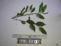 YS1X3819[]Binatang Research Center YS1X38192012-09-08 Papua New Guinea |
NGBRC | YS3F0369[]Binatang Research Center YS3F03692011-06-02 Papua New Guinea, Morobe Province, Yawan, -6.16255 146.839933, 1721m |
1
Page 1, records 1-14 of 14
Google Map
Google Maps is a web mapping service provided by Google that features a map that users can pan (by dragging the mouse) and zoom (by using the mouse wheel). Collection points are displayed as colored markers that when clicked on, displays the full information for that collection. When multiple species are queried (separated by semi-colons), different colored markers denote each individual species.