University of Minnesota
http://www.umn.edu/
612-625-5000
http://www.umn.edu/
612-625-5000
Minnesota Biodiversity Atlas
Bell Museum
Dataset: NGBRC
Taxa: Bignoniaceae
Search Criteria: excluding cultivated/captive occurrences
1
Page 1, records 1-11 of 11
Plant records from the New Guinea Binatang Research Center | |
 NGBRC | 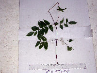 Pandorea montana (Diels) Steenis WP1E2468[]Binatang Research Center WP1E24682007-07-26 Papua New Guinea, Madang Province, Wanang, -5.2373 145.177183, 115m |
NGBRC | Neosepicaea viticoides Diels WP1Z3078[]Binatang Research Center WP1Z30782008-04-03 Papua New Guinea, Madang Province, Wanang, -5.2373 145.177183, 115m |
NGBRC | 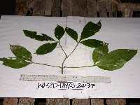 Neosepicaea viticoides Diels WP2D2497[]Binatang Research Center WP2D24972007-07-26 Papua New Guinea, Madang Province, Wanang, -5.2373 145.177183, 115m |
NGBRC | 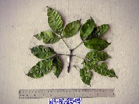 Neosepicaea viticoides Diels WS3C2545[]Binatang Research Center WS3C25452007-07-20 Papua New Guinea, Madang Province, Wanang, -5.229583 145.178467, 115m |
NGBRC | 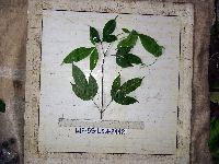 Neosepicaea viticoides Diels WS5B2442[]Binatang Research Center WS5B24422007-07-20 Papua New Guinea, Madang Province, Wanang, -5.229583 145.178467, 115m |
NGBRC | 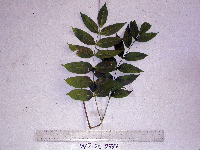 Pandorea pandorana (Andrews) Steenis WP2C2337[]Binatang Research Center WP2C23372007-07-26 Papua New Guinea, Madang Province, Wanang, -5.2373 145.177183, 115m |
NGBRC | 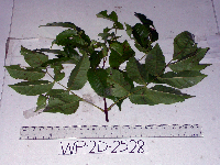 Pandorea pandorana (Andrews) Steenis WP2D2528[]Binatang Research Center WP2D25282007-07-26 Papua New Guinea, Madang Province, Wanang, -5.2373 145.177183, 115m |
NGBRC | 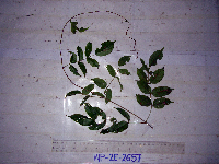 Pandorea pandorana (Andrews) Steenis WP2E2657[]Binatang Research Center WP2E26572017-04-02 Papua New Guinea, Madang Province, Wanang, -5.2373 145.177183, 115m |
NGBRC | 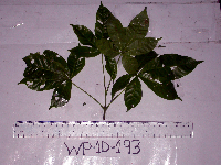 Tecomanthe dendrophila (Blume) K.Schum. WP1D0193[]Binatang Research Center WP1D01932007-11-21 Papua New Guinea, Madang Province, Wanang, -5.2373 145.177183, 115m |
NGBRC | 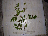 Tecomanthe dendrophila (Blume) K.Schum. WP3E2653[]Binatang Research Center WP3E26532007-07-23 Papua New Guinea, Madang Province, Wanang, -5.2373 145.177183, 115m |
NGBRC | 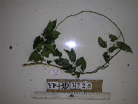 Tecomanthe dendrophila (Blume) K.Schum. YP3D3725[]Binatang Research Center YP3D37252021-07-10 Papua New Guinea, Morobe Province, Yawan, -6.1642 146.840083, 1738m |
1
Page 1, records 1-11 of 11
Google Map
Google Maps is a web mapping service provided by Google that features a map that users can pan (by dragging the mouse) and zoom (by using the mouse wheel). Collection points are displayed as colored markers that when clicked on, displays the full information for that collection. When multiple species are queried (separated by semi-colons), different colored markers denote each individual species.