University of Minnesota
http://www.umn.edu/
612-625-5000
http://www.umn.edu/
612-625-5000
Minnesota Biodiversity Atlas
Bell Museum
Dataset: JFBM-Fishes
Taxa: Synagrops
Search Criteria: excluding cultivated/captive occurrences
1
Page 1, records 1-7 of 7
Bell Museum fishes | |
 JFBM:Fishes | 16763[]Shoemaker 1951-06-21 United States, Mississippi, Harrison, Gulf of Mexico near Gulfport |
JFBM:Fishes | 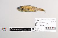 Synagrops japonicus Döderlein 48705[]Egan, Josh; Chew, Uik-Sen; Ghedotti, Michael 2016-05-07 Taiwan (Republic of China), Taiwan Strait, 22.661874 119.895642 |
JFBM:Fishes | 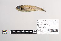 Synagrops japonicus Döderlein 48683[]Egan, Josh; Chew, Uik-Sen; Hundt, Peter; Ghedotti, Michael 2016-05-11 Taiwan (Republic of China), Taiwan Strait, 22.661874 119.895642 |
JFBM:Fishes | 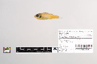 Synagrops philippinensis Günther 48684[]Egan, Josh; Chew, Uik-Sen; Hundt, Peter; Ghedotti, Michael 2016-05-11 Taiwan (Republic of China), Taiwan Strait, 22.661874 119.895642 |
JFBM:Fishes | 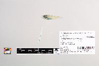 Synagrops philippinensis Günther 48698[]Egan, Josh; Chew, Uik-Sen; Hundt, Peter; Ghedotti, Michael 2016-05-14 Taiwan (Republic of China), Taiwan Strait, 22.661874 119.895642 |
JFBM:Fishes | 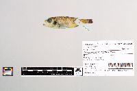 Synagrops philippinensis Günther 48730[]Egan, Josh; Chew, Uik-Sen; Hundt, Peter; Ghedotti, Michael 2016-05-13 Taiwan (Republic of China), Taiwan Strait, 22.661874 119.895642 |
JFBM:Fishes | 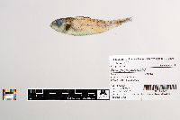 Synagrops japonicus Döderlein 48732[]Egan, Josh; Chew, Uik-Sen; Hundt, Peter; Ghedotti, Michael 2016-05-19 Taiwan (Republic of China), Taiwan Strait, 22.661874 119.895642 |
1
Page 1, records 1-7 of 7
Google Map
Google Maps is a web mapping service provided by Google that features a map that users can pan (by dragging the mouse) and zoom (by using the mouse wheel). Collection points are displayed as colored markers that when clicked on, displays the full information for that collection. When multiple species are queried (separated by semi-colons), different colored markers denote each individual species.