University of Minnesota
http://www.umn.edu/
612-625-5000
http://www.umn.edu/
612-625-5000
Minnesota Biodiversity Atlas
Bell Museum
Dataset: JFBM-Fishes
Taxa: Terapon
Search Criteria: excluding cultivated/captive occurrences
1
Page 1, records 1-9 of 9
Bell Museum fishes | |
 JFBM:Fishes | 47642[]Egan, Josh; Zhao, Yu-Shen 2013-08-14 Taiwan (Republic of China), Chiayi, Sandy beach near Haomeili, 23.3635139 120.1296528 |
JFBM:Fishes | 47627[]Egan, Josh; Zhao, Yu-Shen 2013-08-11 Taiwan (Republic of China), Chiayi, Sandy beach near Haomeili, 23.3635139 120.1296528 |
JFBM:Fishes | 48004[]Egan, Josh; Hundt, Peter; Chew, Uik-Sen 2014-06-14 Taiwan (Republic of China), Chiayi, Tidal mud flat near oyster farming platforms, Haomei, 23.3602861 120.1298944 |
JFBM:Fishes | 48058[]Egan, Josh; Bradley, Michael; Buelow, Christina 2014-07-13 Australia, Queensland, Arthur Bay tidal inlet, Magnetic Island, Queensland, Australia, -19.129517 -146.876255 |
JFBM:Fishes | 48119[]Egan, Josh; Jaeckli, Anya; Stolpmann, Lea 2014-07-27 Australia, Queensland, Rowes Bay, beach access 10, near Townsville, Queensland, Australia, -19.2176083 146.7784139 |
JFBM:Fishes | 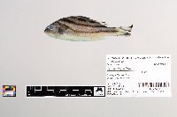 48741[]Egan, Josh; Chew, Uik-Sen; Hundt, Peter; Ghedotti, Michael 2016-05-13 Taiwan (Republic of China), Taiwan Strait, 22.661874 119.895642 |
JFBM:Fishes | 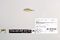 48744[]Egan, Josh; Hundt, Peter; Kaeoprakan, Patcharee 2015-11-12 Thailand, Chonburi, Bangsean Beach, 13.278998 100.918087 |
JFBM:Fishes | 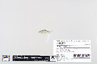 48751[]Egan, Josh; Hundt, Peter 2015-11-13 Thailand, Chonburi, North Bangsean Beach, 13.295165 100.90511 |
JFBM:Fishes |  48938[]Egan, Josh; Chew, Uik-Sen; Ghedotti, Michael 2016-05-05 Taiwan (Republic of China), Chiayi, Tidal mud flat near oyster farming platforms, Haomei, 23.3602861 120.1298944 |
1
Page 1, records 1-9 of 9
Google Map
Google Maps is a web mapping service provided by Google that features a map that users can pan (by dragging the mouse) and zoom (by using the mouse wheel). Collection points are displayed as colored markers that when clicked on, displays the full information for that collection. When multiple species are queried (separated by semi-colons), different colored markers denote each individual species.