University of Minnesota
http://www.umn.edu/
612-625-5000
http://www.umn.edu/
612-625-5000
Minnesota Biodiversity Atlas
Bell Museum
Dataset: JFBM-Fishes
Taxa: Trachinotus
Search Criteria: excluding cultivated/captive occurrences
1
Page 1, records 1-6 of 6
Bell Museum fishes | |
 JFBM:Fishes | 18667[]Springer and Hoskins 1957-07-00 United States, Texas, Neuces, S end of jetty to S pier at Port Aransas |
JFBM:Fishes | 18734[]V.G. Springer and W. Clive 1957-07-23 United States, Texas, Nueces, Ship channel to Corpus Christi on access road, 11.6 mi S of Port Aransas, 27.6800003 -97.171669 |
JFBM:Fishes | 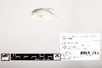 47589[]Egan, Josh; Zhao, Yu-Shen 2013-08-04 Taiwan (Republic of China), Chiayi, Sandy beach near Haomeili, 23.3635139 120.1296528 |
JFBM:Fishes | 47625[]Egan, Josh; Zhao, Yu-Shen 2013-08-11 Taiwan (Republic of China), Chiayi, Sandy beach near Haomeili, 23.3635139 120.1296528 |
JFBM:Fishes | 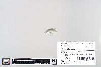 47975[]Egan, Josh; Chen, Vincent 2014-06-09 Taiwan (Republic of China), Shuang Chun beach, Tainan County, Taiwan (Republic of China), 23.305965 120.108181 |
JFBM:Fishes | 48971[]Egan, Josh; Akina, Kaila 2017-07-16 Australia, Queensland, Rowes Bay, beach access 10, near Townsville, Queensland, Australia, -19.2176083 146.7784139 |
1
Page 1, records 1-6 of 6
Google Map
Google Maps is a web mapping service provided by Google that features a map that users can pan (by dragging the mouse) and zoom (by using the mouse wheel). Collection points are displayed as colored markers that when clicked on, displays the full information for that collection. When multiple species are queried (separated by semi-colons), different colored markers denote each individual species.