University of Minnesota
http://www.umn.edu/
612-625-5000
http://www.umn.edu/
612-625-5000
Minnesota Biodiversity Atlas
Bell Museum
Dataset: JFBM-Fishes
Taxa: Hiodontidae
Search Criteria: excluding cultivated/captive occurrences
Bell Museum fishes | |
 JFBM:Fishes | 42639[]Niemela, Scott; Feist, Mike 2004-09-10 United States, Minnesota, Redwood, Minnesota River ca. 1.5 miles downstream of Judson, 44.19466855 -94.17076765 |
JFBM:Fishes | 41121[]Wisconsin Department of Natural Resources 2001-09-18 United States, Wisconsin, Jackson, Black River, at Irving, 44.29565 -90.84523 |
JFBM:Fishes | 43331[]Berendzen, Peter; Talmage, Phil 2000-09-12 United States, Minnesota, Washington, St. Croix River at Franconia, 45.3430557 -92.7233353 |
JFBM:Fishes | 41436[]Bartels, Andy 1989-08-16 United States, Wisconsin, La Crosse, Mississippi River, Pool 8, French Lake at River Mile 701.4, 2.3 miles NE of La Crescent, 43.8508339 -91.2702789 |
JFBM:Fishes | 45829[]Haworth, Matt; Frye, Jordan; Smith, April 2008-05-28 United States, Wisconsin, Buffalo, Mississippi River (Pool 4), 2.4 miles E of Wabasha, 44.3755556 -91.9861111 |
JFBM:Fishes | 38093[]Krosch, H. 1969-00-00 United States, Minnesota, Washington, St. Croix River, Lake St. Croix, downstream of Bayport, ca. River Mile 17.5- 19.0, 45 -92.7666702 |
JFBM:Fishes | 45783[]Kramschuster, M. 2008-08-21 United States, Minnesota, St. Louis, Little Fork River at County Road 495, 6 miles E of Greaney, 47.88252192 -92.97466686 |
JFBM:Fishes | 46021[]Feist, Mike; Butterfield, Chris; Koschak, M.; Spindler, Bryan 2009-08-19 United States, Minnesota, Blue Earth, Minnesota River upstream of Highway 23, 3 miles NW of Judson, 44.2172222 -94.2486111 |
JFBM:Fishes | 37512[]Niemela, Scott 2003-08-07 United States, Minnesota, Hennepin, Minnesota River, ca. 1 mile downstream of I-35, in Burnsville, 44.80662399 -93.27900874 |
JFBM:Fishes | 45837[]Schmidt, Konrad; Smith, April 2008-08-21 United States, Wisconsin, Polk, St. Croix River, 0.8 miles SW of Osceola, 45.3144444 -92.7183333 |
JFBM:Fishes | 2718[] 1900-00-00 United States, Minnesota, Goodhue/Wabasha, Mississippi River, Lake Pepin, 44.50826 -92.30301 |
JFBM:Fishes | 7359[]Nachtrieb, Henry; Natural History Survey 1899-07-18 United States, Minnesota, Washington, Grey Cloud Island, Mississippi River, 44.77623 -92.98073 |
JFBM:Fishes | 7360[]Nachtrieb, Henry; Natural History Survey 1899-07-18 United States, Minnesota, Washington, Grey Cloud Island, Mississippi River, 44.77623 -92.98073 |
JFBM:Fishes | 7361[]no data 1899-07-30 United States, Minnesota, Washington, St. Croix River, at mouth, 44.7498389 -92.8072444 |
JFBM:Fishes | 7362[]no data 1899-07-30 United States, Minnesota, Washington, St. Croix River, at mouth, 44.7498389 -92.8072444 |
JFBM:Fishes | 7399[] 2000-07-03 United States, Minnesota, Goodhue, Lake Pepin, upper end of the lake, 44.5458 -92.33185 |
JFBM:Fishes | 7467[]Nachtrieb, Henry 2000-07-25 United States, Minnesota, Wabasha, Mississippi River sand bar, at Minnieska, 44.19365 -91.86819 |
JFBM:Fishes | 7468[]Nachtrieb, Henry 2000-07-25 United States, Minnesota, Wabasha, Mississippi River sand bar, at Minnieska, 44.19365 -91.86819 |
JFBM:Fishes | 11262[] 1940-10-02 United States, Minnesota, Washington, St. Croix River, Lake St. Croix at Bayport, 45.01943 -92.76684 |
JFBM:Fishes | 12028[]Carlander, Kenneth 1941-09-00 United States, Minnesota, Lake of the Woods, Lake of the Woods, 49.27497 -94.71863 |
JFBM:Fishes | 12739[] 1940-10-00 United States, Minnesota, Washington, St. Croix River, Lake St. Croix, 44.78915 -92.78984 |
JFBM:Fishes | 13946[] 1942-10-22 United States, Minnesota, Washington, Pine Tree Lake, 45.10125 -92.95342 |
JFBM:Fishes | 13947[] 1942-10-22 United States, Minnesota, Washington, Pine Tree Lake, 45.10125 -92.95342 |
JFBM:Fishes | 13963[] 1942-10-22 United States, Minnesota, Washington, Pine Tree Lake, 45.10125 -92.95342 |
JFBM:Fishes | 20446[]Minnesota Department of Conservation 1967-00-00 United States, Minnesota, Washington, St. Croix River, Lake St. Croix at Bayport, 45.01943 -92.76684 |
JFBM:Fishes | 20632[]Kaercher, Roger 1971-07-17 United States, Minnesota, Washington, St. Croix River, 1.5 mi S of Hudson Bridge |
JFBM:Fishes | 22746[]Church, Wade; McCormack, David 1983-06-29 United States, Minnesota, St. Louis, Little Fork River at State Highway 1, 1.5 miles W of Linden Grove, 47.86275 -92.90456 |
JFBM:Fishes | 22747[]Church, Wade; McCormack, David 1983-06-30 United States, Minnesota, St. Louis, Little Fork River, at County Road 495, 47.87997 -92.97523 |
JFBM:Fishes | 22748[]Church, Wade; McCormack, David 1983-06-30 United States, Minnesota, St. Louis, Little Fork River at County Road 114, 47.89439 -93.0412 |
JFBM:Fishes | 23941[]Haugstad, Mel 1984-10-03 United States, Minnesota, Houston, Root River near Hokah, 43.76428 -91.36711 |
JFBM:Fishes | 24509[]Nachtrieb, Henry; Natural History Survey 1899-07-18 United States, Minnesota, Washington, Grey Cloud Island, Mississippi River, 44.77623 -92.98073 |
JFBM:Fishes | 24760[]Anderson and Erickson 1971-07-27 United States, Minnesota, Polk, Red Lake River at Fisher |
JFBM:Fishes | 24800[]Hatch, Jay; Landwher, Tom 1977-08-04 United States, Minnesota, Koochiching, Little Fork River at State Highway 11, 48.5207 -93.58635 |
JFBM:Fishes | 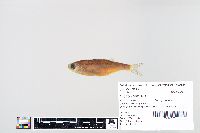 27863[]Schmidt, Konrad 1994-09-13 United States, Minnesota, Houston, Mississippi River, Pool 9 at Twin Island, 43.53192 -91.24069 |
JFBM:Fishes | 27676[]United States Geological Survey; Minnesota Pollution Control Agency 1994-08-11 United States, North Dakota, Cass, Red River of the North, below Fargo, 46.87936 -96.78136 |
JFBM:Fishes | 27739[]United States Geological Survey; Minnesota Pollution Control Agency 1994-00-00 United States, Minnesota, Norman, Red River of the North at County Road 3, 2 miles W of Shelley, 47.4545 -96.85444 |
JFBM:Fishes | 27756[]USGS-NAWQA/Goldstein 1994-09-12 United States, North Dakota, Pembina, Red River or the North, East of Joliette, 48.81794 -97.18214 |
JFBM:Fishes | 27819[]United States Geological Survey; Minnesota Pollution Control Agency 1994-00-00 United States, Minnesota, Norman, Marsh River at County Road 109, 1.5 miles NW of Shelly, 47.47025 -96.84716 |
JFBM:Fishes | 27766[]United States Geological Survey; Minnesota Pollution Control Agency 1994-00-00 United States, Minnesota, Norman, Wild Rice River 3.5 miles NE of Perley, 47.19683 -96.72398 |
JFBM:Fishes | 27968[]Schmidt, Konrad 1994-09-14 United States, Minnesota, Houston, Mississippi River, Pool 8, Wildcat landing, 43.68662 -91.27218 |
JFBM:Fishes | 27508[]Haugstad, Mel 1984-10-03 United States, Minnesota, Houston, Root River near Hokah, 43.76428 -91.36711 |
JFBM:Fishes | 27937[]Schmidt, Konrad 1994-11-10 United States, Buffalo, unspecified |
JFBM:Fishes | 2873[] No data |
JFBM:Fishes | 3045[]Nachtrieb, Henry; Natural History Survey 1899-07-18 United States, Minnesota, Washington, Grey Cloud Island, Mississippi River, 44.77623 -92.98073 |
JFBM:Fishes | 43839[]Hrabik, Robert; Schmidt, Konrad 2003-09-29 United States, Missouri, Cape Girardeau, Mississippi River just upstream of Red Star Access, 37.3133316 -89.5124969 |
JFBM:Fishes | 35966[]Hatch, Jay 1994-08-24 United States, Wisconsin, Buffalo, Mississippi River in Lower Pool 4 @ RM 754.4; First island in navigation channel upstream of Alma Marina |
JFBM:Fishes | 43332[]Berendzen, Peter; Talmage, Phil 2000-09-12 United States, Minnesota, Washington, St. Croix River at Franconia, 45.3430557 -92.7233353 |
JFBM:Fishes | 43923[]Niemela, Scott 2004-08-31 United States, Minnesota, Wabasha, Zumbro River downstream of County Road 86, 6 miles SW of Wabasha, 44.32154 -92.12483 |
JFBM:Fishes | 45223[]Feist, Mike; Weitzell, Roy 2006-08-30 United States, Minnesota, Koochiching, Rainy River, just upstream of Vidas Access at Clementson, 48.7105556 -94.4113889 |
JFBM:Fishes | 41451[]Bartels, Andy 1991-06-25 United States, Wisconsin, Vernon, Miss. Riv, Pool 8, Turtle Island @ Riv mi 686.3, 2.5 mi SE of Brownsville, 43.6633339 -91.2525024 |
JFBM:Fishes | 43803[]Schmidt, Konrad 2003-08-27 United States, Minnesota, Dakota, Mississippi River at River Mile 812, 1.3 miles E of Hastings, 44.75 -92.8280563 |
JFBM:Fishes | 41120[]Wisconsin Department of Natural Resources 2001-09-18 United States, Wisconsin, Jackson, Black River, at Irving, 44.29565 -90.84523 |
JFBM:Fishes | 43320[]no data United States, Minnesota, Chippewa River |
JFBM:Fishes | 45185[]Niemela, Scott 2006-09-08 United States, Minnesota, Polk, Red Lake River, 1.5 miles W of Crookston, downstream of US Highway 75, 47.77645129 -96.64861308 |
JFBM:Fishes | 45845[]Feist, Mike 2008-08-26 United States, Minnesota, Houston, Root River upstream of Highway 16 bridge 0.5 miles NW of Hokah, 43.76333393 -91.35583665 |
JFBM:Fishes | 44299[]Feist, Mike 2005-09-14 United States, Minnesota, Renville, Minnesota River, 1.5 miles upstream of County Road 101/1, 44.58401934 -95.10176078 |
JFBM:Fishes | 45233[]Feist, Mike; Weitzell, Roy 2006-08-30 United States, Minnesota, Koochiching, Rainy river, 0.5 miles downstream of Frontier Access, 48.6641667 -94.2555556 |
JFBM:Fishes | 46825[]Onsrud, Aaron 2011-08-21 United States, Minnesota, Goodhue, Cannon River, upstream of County-State-Aid-Highway 7, in Welch Village, 44.5675 -92.7433333 |
JFBM:Fishes | 47220[]Dollinger, Dave 2012-07-25 United States, Minnesota, Polk, Red Lake River, 1.5 miles downstream of Crookston, 47.2442778 -94.1932222 |
JFBM:Fishes | 47469[]Mielke, Nathan 2013-07-30 United States, Minnesota, Kittson, Two River, 6.5 miles W of Hallock, upstream of unknown Rd, 0.5 miles E of Highway 16, 48.788 -97.0938056 |
JFBM:Fishes | 48276[]Feist, Mike 2014-09-03 United States, Minnesota, Scott, Minnesota River near Jordan, reach 1, 44.6946389 -93.6486111 |
JFBM:Fishes | 48441[]Dingmann, Tony; Petersen, Andrew 2015-08-07 United States, Minnesota, St. Louis, Rice River downstream of County Road 25, 2 miles SW of Cook, 47.8358547 -92.7676031 |
JFBM:Fishes | 18141[]North Dakota Conservation Department 1953-07-24 United States, North Dakota, Mountrail, White Earth Creek, near mouth, Lower Sta. N. B., 48.5388889 -102.755 |
JFBM:Fishes | 43308[]Bellig, Robert 2000-10-01 United States, Minnesota, Nicollet, Minnesota River, 5.5 miles SW of St. Peter, 44.26167 -94.02117 |
JFBM:Fishes | 41768[]Bartels, Andy 1994-07-06 United States, Wisconsin, La Crosse, Mississippi River, Pool 8, lock and dam 7 tailwater, at River Mile 702.3, 2.5 miles N of La Crescent, 43.8641663 -91.3038864 |
JFBM:Fishes | 43306[]Bellig, Robert 2000-10-01 United States, Minnesota, Nicollet, Minnesota River, 5.5 miles SW of St. Peter, 44.26167 -94.02117 |
JFBM:Fishes | 43312[]Bellig, Robert 2000-10-01 United States, Minnesota, Nicollet, Minnesota River, 5.5 miles SW of St. Peter, 44.26167 -94.02117 |
JFBM:Fishes | 40126[]Hendrickson, J. 1998-06-08 United States, North Dakota, McLean, Lake Sakakawea, 47.78411 -102.32242 |
JFBM:Fishes | 41431[]Bartels, Andy 1994-09-03 United States, Minnesota, Winona, Mississippi River, Pool 8, Lock & Dam 7 at River Mile 702.3, 2.2 miles N of La Crescent, 43.8602791 -91.3077774 |
JFBM:Fishes | 44306[]Feist, Mike 2005-09-15 United States, Minnesota, Brown, Minnesota River, 0.25 mile upstream of HIghway 4 bridge, 44.44030229 -94.73111722 |
JFBM:Fishes | 45152[]Niemela, Scott 2006-09-18 United States, Minnesota, Kittson, Red River of the North, at Hastings boat launch in Drayton, ND, 48.55885991 -97.17276753 |
JFBM:Fishes | 43310[]Bellig, Robert 2000-10-01 United States, Minnesota, Nicollet, Minnesota River, 5.5 miles SW of St. Peter, 44.26167 -94.02117 |
JFBM:Fishes | 41921[]Talmage, Phil; Walerak, Mike; Hoffman, Brent 2002-07-30 United States, Minnesota, Houston, Root River station 08, downstream of Highway 26 at River Mile 3, 3 miles E of Hokah, 43.7711105 -91.2897186 |
JFBM:Fishes | 41767[]Bartels, Andy 1994-06-28 United States, Wisconsin, Vernon, Mississippi River, Pool 8 at River Mile 687.6, Horseshoe Island, 2.5 miles SE of Brownsville, 43.6613884 -91.2738876 |
JFBM:Fishes | 45151[]Niemela, Scott 2006-09-07 United States, Minnesota, Douglas, Red River of the North, 1 mile W of Warren, at public boat launch, 48.19538723 -97.13722987 |
JFBM:Fishes | 43314[]Bellig, Robert 2000-10-01 United States, Minnesota, Nicollet, Minnesota River, 5.5 miles SW of St. Peter, 44.26167 -94.02117 |
JFBM:Fishes | 43311[]Bellig, Robert 2000-10-01 United States, Minnesota, Nicollet, Minnesota River, 5.5 miles SW of St. Peter, 44.26167 -94.02117 |
JFBM:Fishes | 13945[] 1942-10-22 United States, Minnesota, Washington, Pine Tree Lake, 45.10125 -92.95342 |
JFBM:Fishes | 18848[] 1958-09-27 United States, Ramsey, below the Ford Dam |
JFBM:Fishes | 20445[]Minnesota Department of Conservation 1967-00-00 United States, Minnesota, Washington, St. Croix River, Lake St. Croix at Bayport, 45.01943 -92.76684 |
JFBM:Fishes | 24510[] 1943-09-13 United States, Minnesota, Brown, Minnesota River |
JFBM:Fishes | 24511[]Bellig, Robert 1983-10-21 United States, Minnesota, Nicollet, Minnesota River at St. Peter, 44.32483 -93.95285 |
JFBM:Fishes | 27488[]Mueller, Ken 1978-00-00 United States, Minnesota, Goodhue, Mississippi River at Prairie Island, 44.65107 -92.66556 |
JFBM:Fishes | 27755[]USGS-NAWQA/Goldstein 1994-09-12 United States, North Dakota, Pembina, Red River or the North, East of Joliette, 48.81794 -97.18214 |
JFBM:Fishes | 27765[]United States Geological Survey; Minnesota Pollution Control Agency 1994-00-00 United States, Minnesota, Norman, Wild Rice River 3.5 miles NE of Perley, 47.19683 -96.72398 |
JFBM:Fishes | 28058[]Stopyro, Mark; Schmidt, Konrad 1995-05-23 United States, Minnesota, Wabasha, Lower Weaver Bottoms, closing structure, 44.19894 -91.87283 |
JFBM:Fishes | 28075[]Stopyro, Mark; Schmidt, Konrad 1995-05-23 United States, Minnesota, Wabasha, Lower Weaver Bottoms, closing structure, 44.19894 -91.87283 |
JFBM:Fishes | 28110[]Stopyro, Mark 1995-05-19 United States, Minnesota, Houston, Mississippi River, Pool 9, Running Slough, 43.56174 -91.25793 |
JFBM:Fishes | 45150[]Niemela, Scott 2006-09-07 United States, Minnesota, Polk, Red River of the North, upstream of Demers Avenue, in East Grand Forks, 47.9252778 -97.0252778 |
JFBM:Fishes | 38800[]Hendrickson, J. United States, North Dakota, McLean, Lake Sakakawea, 47.5833321 -101.1222229 |
JFBM:Fishes | 45137[]Niemela, Scott 2006-09-06 United States, Minnesota, Wilkin, Red River of the North, downstream of County-State-Aid-Highway 22, 1.5 miles NE of Kent, in Fort Abercrombie State Historic Area, 46.44601143 -96.71890269 |
JFBM:Fishes | 45153[]Niemela, Scott 2006-09-19 United States, Minnesota, Kittson, Red River of the North, access from Pembina, North Dakota, boat launch in Fort Daer Recreation Area, 48.96459856 -97.23317709 |
JFBM:Fishes | 16591[]Personius, Robert 1950-07-00 United States, North Dakota, Missouri River |
JFBM:Fishes | 41119[]Jaeger, M. 2002-04-13 United States, Montana, Prairie, Yellowstone River, 0.5 mi downstream of confluence with Power River, 46.7322235 -105.4386139 |
JFBM:Fishes | 19130[]Personius, Robert 1950-06-00 United States, North Dakota, Hart River |
JFBM:Fishes | 46637[]B. Bellig United States, Minnesota, Minnesota River |
JFBM:Fishes | 17724[]. Canada, Northwest Territories, Slave river at Fort Smith, Northwest Territory, Canada, 60.0116667 -111.8816667 |
JFBM:Fishes | 43313[]Bellig, Robert 2000-10-01 United States, Minnesota, Nicollet, Minnesota River, 5.5 miles SW of St. Peter, 44.26167 -94.02117 |
JFBM:Fishes | 41718[]Simons, Andrew; Berendzen, Peter; Schmidt, Konrad 2001-06-15 United States, Minnesota, Ramsey/Hennepin, Mississippi River below Ford Dam, St. Paul, 44.91249 -93.20007 |
JFBM:Fishes | 47219[]Dollinger, Dave 2012-07-25 United States, Minnesota, Polk, Red Lake River, 1.5 miles downstream of Crookston, 47.2442778 -94.1932222 |
Google Map
Google Maps is a web mapping service provided by Google that features a map that users can pan (by dragging the mouse) and zoom (by using the mouse wheel). Collection points are displayed as colored markers that when clicked on, displays the full information for that collection. When multiple species are queried (separated by semi-colons), different colored markers denote each individual species.