University of Minnesota
http://www.umn.edu/
612-625-5000
http://www.umn.edu/
612-625-5000
Minnesota Biodiversity Atlas
Bell Museum
Dataset: MIN-Fungi
Taxa: Exobasidiaceae
Search Criteria: excluding cultivated/captive occurrences
1
Page 1, records 1-16 of 16
Bell Museum fungi | |
 MIN:Fungi | 927638[]E.C. Swann ECS6641994-08-18 Canada, British Columbia, Garibaldi Park. |
MIN:Fungi | 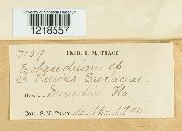 47514[1218557]Tracy, S.M. 71591900-04-16 United States, Florida |
MIN:Fungi | 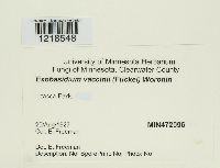 Exobasidium vaccinii (Fuckel) Woronin 472096[1218548]Freeman, E. 1927-08-20 United States, Minnesota, Clearwater, Itasca [State] Park, 47.188635 -95.222956 |
MIN:Fungi | 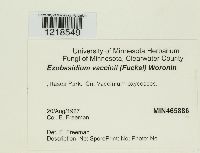 Exobasidium vaccinii (Fuckel) Woronin 465886[1218549]Freeman, E. 1927-08-20 United States, Minnesota, Clearwater, Itasca Park, 47.188635 -95.222956 |
MIN:Fungi | 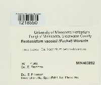 Exobasidium vaccinii (Fuckel) Woronin 465892[1218550]Freeman, E. 1908-00-00 United States, Minnesota, Clearwater, Lake Itasca, 47.212632 -95.195921 |
MIN:Fungi | 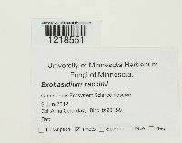 Exobasidium vaccinii (Fuckel) Woronin 432400[1218551]Gerenday, Anna BioBlitz 2012-92012-06-09 United States, Minnesota, Cedar Creek Ecosystem Science Reserve |
MIN:Fungi |  Exobasidium vaccinii (Fuckel) Woronin 548140[1218553]Bonar, L. 8901954-08-21 United States, California, Shasta, Manzanita Lake, Lassen National Park |
MIN:Fungi |  Exobasidium vaccinii (Fuckel) Woronin 47515[1218554]Shear, C.L. 17281899-05-22 United States, District of Columbia |
MIN:Fungi |  Exobasidium vaccinii (Fuckel) Woronin 615613[1218558]Whetzel 52011909-07-10 United States, New York, Taughannock Falls |
MIN:Fungi | 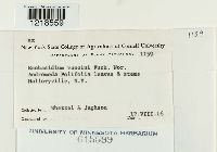 Exobasidium vaccinii (Fuckel) Woronin 615599[1218559]Whetzel 11591916-08-17 United States, New York |
MIN:Fungi |  Exobasidium vaccinii (Fuckel) Woronin 964651[1301214]Lueth, Dylan G. DGL62011012011-06-20 United States, Minnesota, Lake, Superior National Forest, Approximately 10.89km W of Isabella, MN and 16.84km N of Whyte, MN., 47.596432 -91.496465 |
MIN:Fungi | 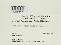 Exobasidium azaleae Peck 466416[1218547]Babcock s.n.1913-10-17 |
MIN:Fungi | 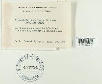 Exobasidium decolorans Harkn. 457794[1218555]Rodin, Robert J. s.n.1946-09-10 United States, California, Old Village, Yosemite National Park |
MIN:Fungi | 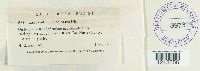 Exobasidium decolorans Harkn. 397376[1218556]Parks, H.E. 6351941-06-00 United States, California, Del norte, Darlingtonia Lodge, Smith River, 137m |
MIN:Fungi | 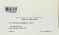 Exobasidium leucothoes Henn. 819134[1218560]Petrak, F. 17011950-06-12 United States, Maryland |
MIN:Fungi | 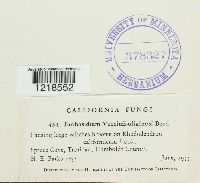 378327[1218552]Parks, H.E. 4541933-06-00 United States, California, Humboldt, Spruce Cove |
1
Page 1, records 1-16 of 16
Google Map
Google Maps is a web mapping service provided by Google that features a map that users can pan (by dragging the mouse) and zoom (by using the mouse wheel). Collection points are displayed as colored markers that when clicked on, displays the full information for that collection. When multiple species are queried (separated by semi-colons), different colored markers denote each individual species.