University of Minnesota
http://www.umn.edu/
612-625-5000
http://www.umn.edu/
612-625-5000
Minnesota Biodiversity Atlas
Bell Museum
Dataset: MIN-Fungi
Taxa: Orbiliaceae
Search Criteria: excluding cultivated/captive occurrences
1
Page 1, records 1-26 of 26
Bell Museum fungi | |
 MIN:Fungi | 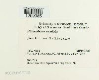 16349[1209985]Holway, E.W.D. 38 H1886-07-18 United States, Minnesota, Saint Louis, Vermilion Lake, 47.872329 -92.335084 |
MIN:Fungi | 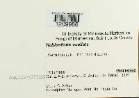 16350[1209986]Holway, E.W.D. 38 H1886-07-18 United States, Minnesota, Saint Louis, Vermilion Lake, 47.872329 -92.335084 |
MIN:Fungi | 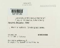 881999[1210130]Bell, A. s.n.2004-07-06 United States, Minnesota, Lake, North of Isabella |
MIN:Fungi |  724539[1178340]Weaver, M.G. 21181971-06-27 United States, Minnesota, Crow Wing, Pelican Lake, Section 35, Pelican Township, (site of old log pile), 46.700101 -96.019563 |
MIN:Fungi |  Calloria luteorubella (Nyl.) P. Karst. 8931[1212214]Sydow, P. 24491888-07-00 |
MIN:Fungi |  Calloria luteorubella (Nyl.) P. Karst. 8932[1212215]Sydow, P. 6701884-10-00 Germany |
MIN:Fungi |  Calloria luteorubella (Nyl.) P. Karst. 8933[1212216]Sydow, P. 23701888-09-00 |
MIN:Fungi | 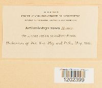 Arthrobotrys rosea Massee 8123[1202399] s.n.1899-05-00 |
MIN:Fungi | 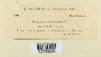 Dactylium dendroides (Bull.) Fr. 947228[1275839] |
MIN:Fungi | 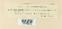 Dactylium dendroides (Bull.) Fr. 947229[1275840] |
MIN:Fungi | 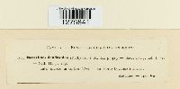 Dactylium dendroides (Bull.) Fr. 947230[1275841] |
MIN:Fungi | 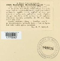 947231[1275842] |
MIN:Fungi | 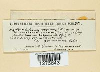 947232[1275843] |
MIN:Fungi | 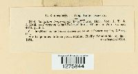 Dactylium tenuissimum Berk. 947233[1275844] |
MIN:Fungi | 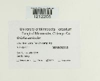 926545[1212205]Healy, R. RH12782011-08-09 United States, Minnesota, Chisago, Wild River State Park, 45.535642 -92.74332 |
MIN:Fungi | 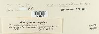 8927[1212211]Sydow, P. 24501888-08-00 |
MIN:Fungi |  954655[1212212]Sydow, P. 8191885-09-00 Germany, Thiergarten |
MIN:Fungi |  921434[1178958]Healy, R. 2009-08-15 United States, Minnesota, Kittson, Lake Bronson State Park, 48.751806 -96.610778 |
MIN:Fungi |  615639[1212208]Cain, R.F. 412311963-09-28 Canada, Ontario, Leads |
MIN:Fungi |  8930[1212213]Roumeguere, C. 1073 |
MIN:Fungi |  912624[1178953]Healy, R. 2009-09-05 United States, Minnesota, Rice, Nerstrand State Park, 44.344959 -93.111378 |
MIN:Fungi |  925913[1178950]Healy, R. 2009-09-05 United States, Minnesota, Rice, Nerstrand State Park, 44.344959 -93.111378 |
MIN:Fungi | 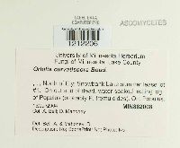 Orbilia curvatispora Boud. 882008[1212206]Bell, A. s.n.2004-07-15 United States, Minnesota, Lake, North of Ely, Snowbank Lake summer lease lot #1 |
MIN:Fungi | 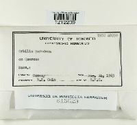 Orbilia paradoxa Ade 615623[1212209]Cain, R.F. 405591963-08-24 United States, Massachusetts |
MIN:Fungi |  Orbilia paradoxa Ade 615164[1212210]Cain, R.F. 342201968-08-23 United States, Indiana, Brown, Brown County State Park, East of Bloomington. |
MIN:Fungi |  Orbilia sarraziniana Boud. 926167[1212207]Cholewa, Anita s.n.2011-07-08 United States, Minnesota, Anoka, Blaine, 121st Ave. NE, T31N R23W S8, 45.190833 -93.230278 |
1
Page 1, records 1-26 of 26
Google Map
Google Maps is a web mapping service provided by Google that features a map that users can pan (by dragging the mouse) and zoom (by using the mouse wheel). Collection points are displayed as colored markers that when clicked on, displays the full information for that collection. When multiple species are queried (separated by semi-colons), different colored markers denote each individual species.