University of Minnesota
http://www.umn.edu/
612-625-5000
http://www.umn.edu/
612-625-5000
Minnesota Biodiversity Atlas
Bell Museum
Dataset: MIN-Bryophytes
Search Criteria: United States OR USA OR U.S.A. OR United States of America; excluding cultivated/captive occurrences
Bell Museum bryophytes | |
 MIN:Bryophytes |  Brachythecium Schimp. 957716[1298442]F. H. Erbisch 24951968-07-11 United States, Michigan, Keweenaw, T58N, R28W, along line 95E 5 + 008 in sec. 27 |
MIN:Bryophytes | 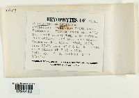 Brachythecium salebrosum (Hoffm. ex F. Weber & D. Mohr) Schimp. [1298443]F. H. Erbisch 24191968-06-27 United States, Michigan, Keweenaw, T58N, R28W, sec 29-NS line of C & H. Near marker MH12 18 + 005 |
MIN:Bryophytes | 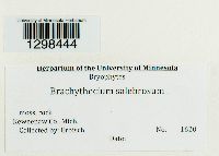 Brachythecium salebrosum (Hoffm. ex F. Weber & D. Mohr) Schimp. [1298444]F. H. Erbisch 1620 United States, Michigan, Keweenaw |
MIN:Bryophytes |  Hedwigia ciliata (Hedw.) P. Beauv. [1298445]F H Erbisch 16341967-06-29 United States, Michigan, Keweenaw, Manganese Lake |
MIN:Bryophytes | 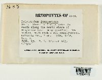 Polytrichum juniperinum Hedw. [1298446]F. H. Erbisch 16351967-06-29 United States, Michigan, Keweenaw, north shore of Manganese Lake. T58N, R28W, Sec. 5 |
MIN:Bryophytes |  Polytrichum piliferum Hedw. [1298447]F H Erbisch 16401967-06-29 United States, Michigan, Keweenaw, Manganese Lake, 47.452589 -87.888575 |
MIN:Bryophytes |  Sphagnum squarrosum Crome 957722[1298448]Erbisch, F.H. 16601967-06-29 United States, Michigan, Keweenaw, Clark E, N of |
MIN:Bryophytes |  Brachythecium salebrosum (Hoffm. ex F. Weber & D. Mohr) Schimp. [1298449]F H Erbisch 16661967-06-29 United States, Michigan, Keweenaw, Clark Mine, 0.5 mi N; 47.452632 -87.867208, 47.452632 -87.867208 |
MIN:Bryophytes |  Mnium punctatum Hedw. [1298450]F. H. Erbisch 16671967-06-29 United States, Michigan, Keweenaw, 1/2 mile north of the Clark Mine. T58N, R28W, Sec. 4 |
MIN:Bryophytes |  Polytrichum juniperinum Hedw. [1298451]F H Erbisch 16731967-06-29 United States, Michigan, Keweenaw, Clark Mine, 0.5 mi N, 47.452632 -87.867208 |
MIN:Bryophytes |  Polytrichum juniperinum Hedw. 957726[1298452]F. H. Erbisch 16741967-06-29 United States, Michigan, Keweenaw, 1/2 mile north of the Clark Mine. T58N, R28W, Sec. 4. |
MIN:Bryophytes |  Polytrichum Hedw. [1298453]Erbisch, F.H. 16821967-07-06 United States, Michigan, Houghton, Little Rice Lake, W of |
MIN:Bryophytes |  Polytrichum Hedw. [1298454]F. H. Erbisch 1699 United States, Michigan, Keweenaw |
MIN:Bryophytes |  Polytrichum juniperinum Hedw. [1298455]F H Erbisch 17001967-07-06 United States, Michigan, Houghton, Little Rice Lake, W of |
MIN:Bryophytes |  Brachythecium salebrosum (Hoffm. ex F. Weber & D. Mohr) Schimp. 957730[1298456]Erbisch, F.H. 17031967-07-06 United States, Michigan, Keweenaw |
MIN:Bryophytes |  Mnium Hedw. [1298457]F H Erbisch 17051967-07-06 United States, Michigan, Houghton, Traverse Point, Lake Superior |
MIN:Bryophytes |  Polytrichum juniperinum Hedw. [1298458]F. H. Erbisch 1708 United States, Michigan, Keweenaw |
MIN:Bryophytes |  Brachythecium Schimp. [1298459]F H Erbisch 28961968-02-09 United States, Ohio, Coreen Co, Clifton Gorge, gorge of Little Miami river |
MIN:Bryophytes |  Mnium Hedw. 957734[1298460]F. H. Erbisch 29071968-09-02 United States, Ohio, Coreen Co. Clifton gorge, gorge of little Miami River |
MIN:Bryophytes | 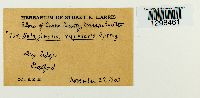 Selaginella rupestris (L.) Spring [1298461]Harris, Stuart K. 9381933-11-29 United States, Massachusetts, Essex, Boxford |
MIN:Bryophytes | 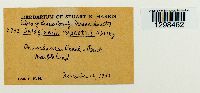 Selaginella rupestris (L.) Spring [1298462]Harris, Stuart K. c9421933-11-12 United States, Massachusetts, Essex, near Peach's Point; Marblehead |
MIN:Bryophytes | 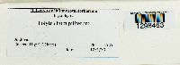 Polytrichum piliferum Hedw. [1298463]Harris, Stuart K. 9491933-12-01 United States, Andover |
MIN:Bryophytes | 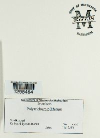 Polytrichum piliferum Hedw. 957738[1298464]S K Harris 9501933-12-11 USA, Marblehead |
MIN:Bryophytes |  Buxbaumia aphylla Hedw. [1298465]Harris, Stuart K. 9591933-12-01 United States, Minnesota, Anoka |
MIN:Bryophytes |  Buxbaumia aphylla Hedw. [1298467]Harris, Stuart K. 9611933-11-29 United States, Minnesota, Anoka |
MIN:Bryophytes |  Diphyscium foliosum (Hedw.) D. Mohr [1298466]Harris, S.K. c958 United States, Minnesota, Anoka |
MIN:Bryophytes |  Polytrichum piliferum Hedw. [1298469]Harris, Stuart K. 29291936-04-04 United States, Rhode Island, Washington, South Kingston |
MIN:Bryophytes | 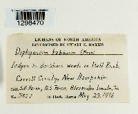 Diphyscium foliosum (Hedw.) D. Mohr [1298470]Harris, Stuart K. 30771936-05-23 United States, New Hampshire, Carroll, Moultonboro, Bald Knob |
MIN:Bryophytes | 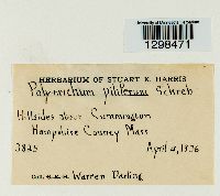 Polytrichum piliferum Hedw. [1298471]Darling, Warren 38251936-04-04 United States, Massachusetts, Hampshire, Cumington, Hillside Above |
MIN:Bryophytes |  Buxbaumia Hedw. 957746[1298472]S.K. Harris 4072 United States, Massachusetts, Hampshire |
MIN:Bryophytes |  Polytrichum Hedw. [1298473]Harris, Stuart K. 161881933-05-27 United States, Massachusetts, Middlesex, Winchester, Middlesex Fells |
MIN:Bryophytes |  Sphagnum L. [1298481]Cheever, Clarence A. 14468 United States, Massachusetts, Barnstable |
MIN:Bryophytes |  Bryoerythrophyllum recurvirostrum (Hedw.) P.C. Chen 957756[1298482]Trana, Thomas D. 37281977-10-23 United States, Minnesota, Beltrami, Washkish, 5 Mi S of |
MIN:Bryophytes |  Aulacomnium palustre (Hedw.) Schwägr. [1298484]Trana, Thomas D. 37291977-10-23 United States, Minnesota, Beltrami, Washkish, 5 Mi S of |
MIN:Bryophytes |  Amblystegium trichopodium (Schultz) Hartm. [1298485]Thomas D Trana 37671978-04-30 United States, Minnesota, Olmsted, [no info] |
MIN:Bryophytes | 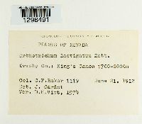 Orthotrichum laevigatum J.E. Zetterst. [1298491]Baker, C.F. 11191912-06-21 United States, Nevada, Ormsby, King's Canon, 1700 - 2000m |
MIN:Bryophytes | 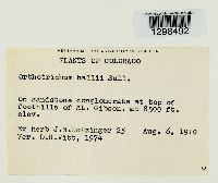 Orthotrichum hallii Sull. & Lesq. [1298492]Holzinger, J.M. 251910-08-06 United States, Colorado, at top of foothills of Mt. Gibson, 2591m |
MIN:Bryophytes | 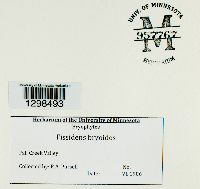 Fissidens bryoides Hedw. 957767[1298493]Pursell, R.A. s.n.1906-06-00 United States, Indiana, Fall Creek Valley |
MIN:Bryophytes | 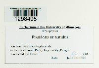 Fissidens minutulus Sull. [1298495]Foster 2101905-06-08 United States, Oregon, Clackamas, south of Canemah Park, Oregon City, 45.345676 -122.621203 |
MIN:Bryophytes |  Fissidens dubius P. Beauv. [1298496]Pursell, R.A. s.n.1996-06-00 United States, Minnesota, Winona Bluffs |
MIN:Bryophytes |  Fissidens dubius P. Beauv. 957771[1298497] s.n.1996-06-00 United States, Minnesota, Redwing |
MIN:Bryophytes |  Brachythecium reflexum (Starke) Schimp. 957550[1298276]Erbisch, F.H. 20071967-07-25 United States, Michigan, Houghton, Calumet, 4.5 Mi Se of, 47.206875 -88.33011 |
MIN:Bryophytes | 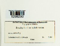 Brachythecium salebrosum (Hoffm. ex F. Weber & D. Mohr) Schimp. [1298290]F H Erbisch 21861967-08-11 United States, Michigan, Ontonagon, Ontonagon, At E Edge of |
MIN:Bryophytes |  Brachythecium Schimp. [1298433]Erbisch, F.H. 28571968-08-13 United States, Michigan, Baraga, Above southern shore of L. Superior, 46.778543 -88.489019 |
MIN:Bryophytes | Syntrichia obtusissima stellaris W Kramer 516335[]Leo F Koch 40361951-08-00 United States, California, Kern, Lost Hills area near Taft |
MIN:Bryophytes | Syntrichia ruralis (Hedw.) F. Weber & D. Mohr 45484[]Cooper, William S. 1909-08-23 United States, Michigan, Keweenaw, Isle Royale; Gull Islands, 48.262091 -88.26479 |
MIN:Bryophytes | Syntrichia princeps (De Notaris) Mitten 441475[]C H Kauffman 1925-12-00 United States, Oregon, Takilma, 42.051504 -123.619511 |
MIN:Bryophytes | Syntrichia ruralis (Hedw.) F. Weber & D. Mohr 441474[]Steere, W.C. 1940-07-15 United States, Michigan, Emmet, Cecil Bay |
MIN:Bryophytes | Syntrichia princeps (De Notaris) Mitten 380086[]Donald Richards 13311941-09-19 United States, California, Trinity, Weaverville; Weaver creek NW of, 40.772716 -122.980152, 671m |
MIN:Bryophytes | Syntrichia ruralis (Hedw.) F. Weber & D. Mohr 636025[]Holzinger, J.M. 1897-06-12 United States, Minnesota, at camp III, on Basswood Lake, at the farther end of the portage across the United States peninsula |
MIN:Bryophytes | Syntrichia ruralis (Hedw.) F. Weber & D. Mohr 28648[]Holzinger, J.M. 1901-06-22 United States, Minnesota, Big Stone, near Ortonville, 45.304687 -96.444779 |
MIN:Bryophytes | Syntrichia ruralis (Hedw.) F. Weber & D. Mohr 28651[]Conway MacMillan 1895-09-00 United States, Minnesota, International Boundary Line, Northern Minnesota, Saganaga Lake to South Lake |
MIN:Bryophytes | Syntrichia ruralis (Hedw.) F. Weber & D. Mohr 45482[]Heller, A.A. 29781896-04-27 United States, Idaho, Nez Perce, Lewiston, 46.416551 -117.017657, 229 - 305m |
MIN:Bryophytes | Syntrichia ruralis (Hedw.) F. Weber & D. Mohr 678143[]Mark G Noble 4751974-08-05 United States, Alaska, Ryegrass association, Muir Point, Glacier Bay, 58.826944 -136.077222 |
MIN:Bryophytes | 635866[]P H Hawkins 10001922-08-22 United States, Wyoming, Yellowstone National Park; Slough Creek, 44.918272 -110.347419 |
MIN:Bryophytes | Syntrichia ruralis (Hedw.) F. Weber & D. Mohr 655554[]Wright United States, Texas |
MIN:Bryophytes | Syntrichia norvegica Weber 662017[]Flowers, S. 131926-08-13 United States, Utah, Utah, Mt Timpanogos, 40.390787 -111.645755, 2134m |
MIN:Bryophytes | 636045[]Frederick V Coville 6611891-00-00 United States, California, Death Valley, Paramount Mountains |
MIN:Bryophytes | Syntrichia princeps (De Notaris) Mitten 636043[]C F Baker 6821902-05-01 United States, California, San Mateo, Crystal Springs Lake |
MIN:Bryophytes | Syntrichia virescens (De Not.) Ochyra 502062[]Leo F Koch 33711950-12-02 United States, California, San Mateo, Lake Pilarcitos, 37.55253 -122.42809 |
MIN:Bryophytes | Syntrichia obtusissima (C Müller Hal.) Zander 636041[]Marshall A Howe 1892-00-00 United States, California, Alameda, Berkeley |
MIN:Bryophytes | Syntrichia laeviuscula (Kindberg) W. Kramer 650535[]Holzinger, J.M. 1902-07-16 United States, Minnesota, Cook, in the vicinity of Grand Marais, 47.750447 -90.334273 |
MIN:Bryophytes | Syntrichia laeviuscula (Kindberg) W. Kramer 853162[]Frank D Bowers 235421995-09-09 United States, Minnesota, Cook, Along lower falls. Temperence River State Park, 1.2 km N of Schroeder on Hwy 61; T59 N, R 4 W, sec. 30 + sec. 31, 47.516667 -90.933333 |
MIN:Bryophytes | Syntrichia laeviuscula (Kindberg) W. Kramer 537405[]Eyerdam, W.J. 22421950-04-12 United States, California, Yosemite valley, 37.716316 -119.665168 |
MIN:Bryophytes | Syntrichia laeviuscula (Kindberg) W. Kramer 537404[]Eyerdam, W.J. 1950-04-15 United States, California, Siskiyou, Summit |
MIN:Bryophytes | Syntrichia laeviuscula W Kramer 537021[]Welch, Winona H. 161851953-08-13 United States, Wyoming, Taggart Lake Trail, to and fro Grand Teton National Park |
MIN:Bryophytes | Syntrichia ruralis subsp. subpapillosissima (Bizot et RB Pierrot ex W Kramer) W Kramer 662061[]Flowers, S. 37881955-07-20 United States, Idaho, Gooding, Bliss 6mi SE; junction of Malad and Snake rivers, 42.769174 -114.903385, 1127m |
MIN:Bryophytes | Syntrichia ruralis (Hedw.) F. Weber & D. Mohr 876331[]Gerald A Wheeler 185261998-05-06 United States, Minnesota, Lac Qui Parle, Ca. 6 mi NNE of Bellingham ... NE1/4 NE1/4 SW1/4 Sec. 12 T120N R45W (Agassiz 12);;120N;45W;12, 45.214683 -96.23671 |
MIN:Bryophytes | Syntrichia ruralis (Hedw.) F. Weber & D. Mohr 876404[]Gerald A Wheeler 199601999-06-10 United States, Minnesota, Cottonwood, Ca. 7.5 mi. NE of Jeffers. Jeffers Petroglyph Historic Site. (Delton 9) |
MIN:Bryophytes | 45364[]John W Bailey 1915-08-15 USA, Washington, bluffs N of Ellensburg, 47.153638 -120.576686, 488m |
MIN:Bryophytes | Syntrichia ruralis subpapillosissima (Bizot et RB Pierrot ex W Kramer) W Kramer 45490[]Mulford, A. Isabel 1892-06-21 United States, Idaho, Caribou, near Soda Springs, 42.654365 -111.604669 |
MIN:Bryophytes | Syntrichia ruralis hirsuta (Venturi) W Kramer 662063[]Flowers, S. 85431959-08-25 USA, Utah, Daggett, Green River, Red Canyon Area, Hideout Forest Camp, 40.914425 -109.494204, 1786m |
MIN:Bryophytes | Syntrichia ruralis papillosissima (Bizot et RB Pierrot ex W Kramer) W Kramer 383057[]Mary C Van Wert 1922-07-00 United States, Washington, San Juan Island, Friday Harbor, 48.5351 -123.01 |
MIN:Bryophytes | 636011[]J. M. Holzinger 1898-07-28 United States, Montana, Flathead, Vicinity of Lake Mcdonald, 4 Mi N of Belton, 30 Mi E of Kalispell, 48.583475 -113.925898, 1372m |
MIN:Bryophytes | Syntrichia ruralis (Hedw.) F. Weber & D. Mohr 876295[]Gerald A Wheeler 187441998-05-25 United States, Minnesota, Lac Qui Parle, Big Stone National Wildlife Refuge. Lac Qui Parle County ... Ca. 2.2 mi. SE of Ortonville; Big Stone Wildlife Refuge ... ourcopr N of auto tour route ... S1/2 SW1/4 SE1/4 Sec. 26 T121N R46W (Yellow Bank 26). 121N 46W 26, 45.256467 -96.401389 |
MIN:Bryophytes | Syntrichia ruralis (Hedw.) F. Weber & D. Mohr 876165[]Gerald A Wheeler 195791999-05-13 United States, Minnesota, Pipestone, NW edge of Pipestone; Pipestone National Monument. E1/2, SW1/4 of Sec. 1 (Sweet 1) |
MIN:Bryophytes | Syntrichia ruralis (Hedw.) F. Weber & D. Mohr 864960[]Gerald A Wheeler 175761997-09-02 United States, Minnesota, Redwood, Ca. 3 mi. NE of Delhi, Cedar Rock State WMA; NW1/4, NW1/4, NW 1/4 of Sec. 11 |
MIN:Bryophytes | Syntrichia ruralis (Hedw.) F. Weber & D. Mohr 864848[]Gerald A Wheeler 165111997-07-01 United States, Minnesota, Yellow Medicine, Yellow Medicine County ... Ca. 5 mi. NE of Echo ... SE1/4 SE1/4 Sec. 12 T114N R38W;;114N;38W;12, 44.694088 -95.370736 |
MIN:Bryophytes | Syntrichia ruralis (Hedw.) F. Weber & D. Mohr 865058[]Gerald A Wheeler 160491997-06-09 United States, Minnesota, Brown, Brown County ... Ca. 2.3 mi. NW of Rte. 13, NW of New Ulm ... N1/2 NW1/4 SW1/4 Sec. 3 T110N R31W (Milford 3);;110N;31W;3, 44.360707 -94.543113 |
MIN:Bryophytes | Syntrichia ruralis (Hedw.) F. Weber & D. Mohr 865009[]Gerald A Wheeler 173551997-08-28 United States, Minnesota, Nicollet, Ca. 2.5 mi. NW of Courtland on Rte. 14; Red Rock area. E1/2 SE1/4 SW1/4 of Sec. 34 (Courtland 34) |
MIN:Bryophytes | 636034[]M A Flinn 1905-01-02 USA, Oregon, Portland |
MIN:Bryophytes | Syntrichia ruralis (Hedw.) F. Weber & D. Mohr 733933[]Paula Mabee 0000-00-00 USA, South Dakota, Black hills, locality unknown |
MIN:Bryophytes | Syntrichia ruralis (Hedw.) F. Weber & D. Mohr 636029[] USA, New York |
MIN:Bryophytes | Syntrichia ruralis (Hedw.) F. Weber & D. Mohr 340799[]G J Ikenberry 1935-05-01 USA, California, North Fork, 37.229669 -119.509581, 792m |
MIN:Bryophytes | Syntrichia ruralis (Hedw.) F. Weber & D. Mohr 599464[]Cooper, William S. 1691929-08-29 United States, Alaska, Glacier Bay, Station 19;Glacier Bay National Park;;;, 58.59655 -135.84048 |
MIN:Bryophytes |  Trichocolea tomentella (Ehrh.) Dumort. 960823[1329743]Perry, Ethan F. 170372017-07-27 United States, Minnesota, 2.7 miles east of Big Falls, south side of Route 31. T066N R27W sec24, 48.19 -93.75 |
MIN:Bryophytes | Scapania glaucocephala (Taylor) Austin 961045[]J A Janssens 432982000-10-19 USA, Minnesota, Lake, Little Marais Area: north-facing cliff along Caribou River, below Caribou Falls, 400m NNW of Highway 61, 8.5 km NE of Little Marais, 47.468333 -91.031111, 257m |
MIN:Bryophytes | Scapania glaucocephala (Taylor) Austin 961046[]J. A. Janssens 526432007-06-07 USA, Minnesota, Becker, Park Rapids Area: Two Inlets State Forest and surrounding area, 165 m east of the shore of Mud Lake, 575 m NE of beginning of trail at gravel road, 22.5 km NW of Park Rapids, 47.075222 -95.250222, 475m |
MIN:Bryophytes | Scapania glaucocephala (Taylor) Austin 961047[]J. A. Janssens 482202003-04-30 USA, Minnesota, Lake, Isabella Area: Superior National Forest, 370 m N of intersection of FS roads 177 and 949, 9.5 km NW of Isabella, 47.673889 -91.451389, 523m |
MIN:Bryophytes | Scapania glaucocephala (Taylor) Austin 961048[]J. A. Janssens 483282003-05-02 USA, Minnesota, Lake, Isabella Area: Superior National Forest, 50 E of Highway 1, 1.1 km SSE of Little Isabella River Campground, 5.2 km WNW of Isabella, 47.638056 -91.416667, 563m |
MIN:Bryophytes | Scapania glaucocephala (Taylor) Austin 961049[]J. A. Janssens 526472007-06-07 USA, Minnesota, Becker, Park Rapids Area: Two Inlets State Forest and surrounding area, 165 m east of the shore of Mud Lake, 575 m NE of beginning of trail at gravel road, 22.5 km NW of Park Rapids, 47.075222 -95.250222, 475m |
MIN:Bryophytes | Scapania glaucocephala (Taylor) Austin 961050[]J. A. Janssens 464992002-08-13 USA, Minnesota, Saint louis, Peyla Area: Superior National Forest, 180 SE of FS road 256, 1.8 km north of Big Rice Lake, 10.4 km SW of Peyla, 47.723333 -92.471944, 450m |
MIN:Bryophytes | Scapania glaucocephala (Taylor) Austin 961051[]J. A. Janssens 526462007-06-07 USA, Minnesota, Becker, Park Rapids Area: Two Inlets State Forest and surrounding area, 165 m east of the shore of Mud Lake, 575 m NE of beginning of trail at gravel road, 22.5 km NW of Park Rapids, 47.075222 -95.250222, 475m |
MIN:Bryophytes | Scapania glaucocephala (Taylor) Austin 961052[]J. A. Janssens 432532000-10-19 USA, Minnesota, Lake, Little Marais Area: north-facing cliff along Caribou River, below Caribou Falls, 400m NNW of Highway 61, 8.5 km NE of Little Marais; 47.468333 -91.031111, 47.468333 -91.031111, 257m |
MIN:Bryophytes | Scapania glaucocephala (Taylor) Austin 961053[]J. A. Janssens 368321998-08-04 USA, Minnesota, Cook, Grand Portage Area: Susie Island, along north shore on south side of bay, 47.978333 -89.578056, 185m |
MIN:Bryophytes | Scapania glaucocephala (Taylor) Austin 961054[]J. A. Janssens 44636B2001-06-25 USA, Minnesota, Saint louis, Side Lake Area: Superior National Forest, 100 m northeast of the intersection of county road 652 and 65, 650 m northeast of Perch Lake, 47.677222 -92.974722, 418m |
MIN:Bryophytes |  961065[1373407]Bryan Piatkowski 2018-492018-05-17 USA, Florida, Franklin, Apalachicola National Forest; near Write lake. Swamp lake and basin swamp surrounding lake with Magnolia virginiana, Nyssa sylvatica, Cyrilla racemiflora, and Chamaecyparis thyoides., 30.00189 85.0026, 3m |
MIN:Bryophytes | Sphagnum perichaetiale Hampe 961064[]Bryan Piatkowski 2018-782018-05-19 USA, Alabama, Baldwin, Baldwin: Weeks Bay Pitcher Plant Bog; along County Road 17 ca. 0.4 km N of US Highway 98. Elev. 5 m., 30.41638 87.81995, 5m |
MIN:Bryophytes |  Sphagnum recurvum P. Beauv. 961063[1373411]Bryan Piatkowski 2018-832018-05-19 USA, Alabama, Baldwin, Baldwin: Weeks Bay National Estuarine Research Reserve, along US Highway 102. Elev. 9 m., 30.41652 87.83037, 9m |
MIN:Bryophytes | Sphagnum affine Renauld & Cardot 961062[]Bryan Piatkowski 2017-3412017-12-18 USA, North Carolina, Hoke, Hoke: Sandhills area. Elev. 91 m., 35.04323 78.38904, 91m |
Google Map
Google Maps is a web mapping service provided by Google that features a map that users can pan (by dragging the mouse) and zoom (by using the mouse wheel). Collection points are displayed as colored markers that when clicked on, displays the full information for that collection. When multiple species are queried (separated by semi-colons), different colored markers denote each individual species.