University of Minnesota
http://www.umn.edu/
612-625-5000
http://www.umn.edu/
612-625-5000
Minnesota Biodiversity Atlas
Bell Museum
Dataset: MIN-Bryophytes
Search Criteria: Madagascar; excluding cultivated/captive occurrences
1
Page 1, records 1-18 of 18
Bell Museum bryophytes | |
 MIN:Bryophytes | 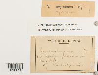 Anoectangium impressum Hampe 636717[1098693] s.n.1907-11-20 Madagascar, Vakinankaratra, Betafo |
MIN:Bryophytes | 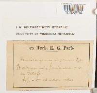 Anoectangium impressum Hampe 636716[1098694]E. G. Paris s.n.1907-11-20 Madagascar, Betafo, Janjanina |
MIN:Bryophytes | 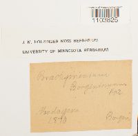 636488[1103825]Borgen s.n.1870-00-00 Madagascar |
MIN:Bryophytes | 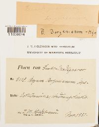 638818[1103824] 21191880-11-00 Madagascar, Antananarivo, east Imerina (Central Madagascar), Andrangoloaka |
MIN:Bryophytes | 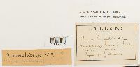 Bryum homalobolax Müll. Hal. ex Renauld 639307[1112228]Golinon s.n.1901-08-00 Madagascar, Vakinankaratra, Antanarivo, west bank of Lake ? |
MIN:Bryophytes | 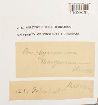 636487[1103826] 1281 Madagascar, ? |
MIN:Bryophytes | 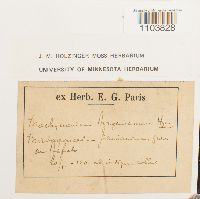 636485[1103828] s.n.1901-11-20 Madagascar |
MIN:Bryophytes | 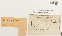 Bryum subgracilescens Renauld & Paris 639480[1111059] s.n.1901-00-00 Madagascar, Cerde au Moramanga |
MIN:Bryophytes | 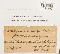 Bryum huillense Welw. & Duby 639306[1112295]Hildebrandt 21431881-03-00 Madagascar |
MIN:Bryophytes | 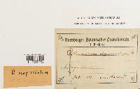 641908[1120788]L. Renauld s.n.1901-07-00 Madagascar |
MIN:Bryophytes | 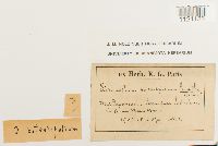 Dicranoloma patentifolium Renauld & Paris 641906[1121135]E. G. Paris s.n.1901-00-00 Madagascar |
MIN:Bryophytes | 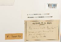 Fissidens savellii Paris & Renauld 642658[1130083]Savelli s.n.1900-00-00 Madagascar |
MIN:Bryophytes | 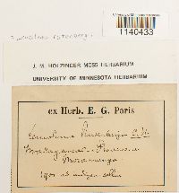 Leucoloma rutenbergii (Müll. Hal.) C.H. Wright 646786[1140433] s.n.1901-00-00 Madagascar |
MIN:Bryophytes | 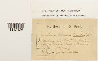 Leucoloma garnieri Paris & Renauld 646793[1142426]Savelli s.n.1904-08-24 Madagascar, District of Ambositra, in valley ... |
MIN:Bryophytes | 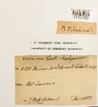 647146[1143750]F. M. Hildebrandt 21091880-12-00 Madagascar |
MIN:Bryophytes | 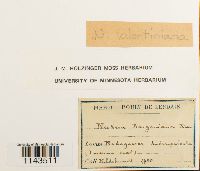 Neckera valentiniana Besch. 647453[1143511]Hildebrant s.n.1880-00-00 Madagascar, Andranguloaka (Imerina Omest) |
MIN:Bryophytes | 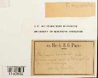 Philonotis hastata (Duby) Wijk & Margad. 647916[1150932] s.n.1900-00-00 Madagascar |
MIN:Bryophytes | 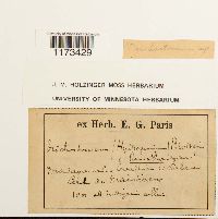 Trichostomum Bruch 650654[1173429]E. G. Paris 1901-00-00 Madagascar, [Around?] Maintirano |
1
Page 1, records 1-18 of 18
Google Map
Google Maps is a web mapping service provided by Google that features a map that users can pan (by dragging the mouse) and zoom (by using the mouse wheel). Collection points are displayed as colored markers that when clicked on, displays the full information for that collection. When multiple species are queried (separated by semi-colons), different colored markers denote each individual species.