University of Minnesota
http://www.umn.edu/
612-625-5000
http://www.umn.edu/
612-625-5000
Minnesota Biodiversity Atlas
Bell Museum
Dataset: MIN-Bryophytes
Search Criteria: Scotland; excluding cultivated/captive occurrences
1
Page 1, records 1-20 of 20
Bell Museum bryophytes | |
 MIN:Bryophytes | 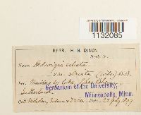 Hedwigia ciliata var. striata Bruch & Schimp. 36118[1132085]Nicholson s.n.1899-07-22 Scotland, Sutherland |
MIN:Bryophytes | 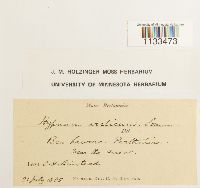 Hygrohypnum smithii (Sw.) Broth. 645167[1133473]C.H. Binstead s.n.1885-07-21 scotland |
MIN:Bryophytes | 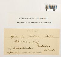 Grimmia hartmanii Schimp. 644075[1131005] s.n.1897-07-20 Scotland |
MIN:Bryophytes | 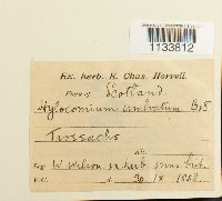 Hylocomium umbratum (Hedw.) Schimp. in B.S.G. 36353[1133812]W. Wilson s.n.1858-01-30 scotland |
MIN:Bryophytes | 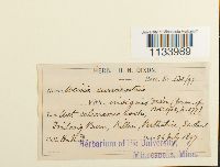 36437[1133989]H.N. Dixon 130/971897-07-26 Scotland |
MIN:Bryophytes | 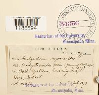 Isothecium myosuroides Brid. 34366[1136894]H.N. Dixon 591893-07-30 Scotland |
MIN:Bryophytes | 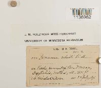 Kiaeria blyttii (Bruch & Schimp.) Broth. 637335[1136962]H.N. Dixon s.n.1898-07-23 Scotland, summit of Ben Douran, 1067m |
MIN:Bryophytes | 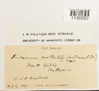 Kiaeria glacialis (Berggr.) I. Hagen 633526[1136983]Binstead, C. H. s.n.1885-07-16 Scotland, Perthshire |
MIN:Bryophytes | 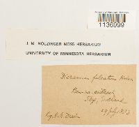 Kiaeria falcata (Hedw.) I. Hagen 642103[1136999]Dixon, H. N. s.n.1883-07-29 Scotland, Skye Ben-na-Cailleach |
MIN:Bryophytes | 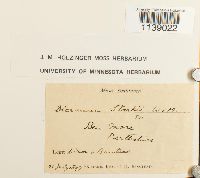 Kiaeria starkei (F. Weber & D. Mohr) I. Hagen 632078[1139022]H.N. Dixon s.n.1897-07-21 Scotland, Perthshire: Ben More |
MIN:Bryophytes |  Plagiothecium denticulatum (Hedw.) Schimp. 41332[1152223]H.N. Dixon 102/971897-07-24 Scotland, 914m |
MIN:Bryophytes |  Oncophorus virens (Hedw.) Brid. 647517[1143889] s.n.1893-07-00 Scotland, 3000m |
MIN:Bryophytes |  Philonotis seriata Mitt. 648054[1150882]H.N. Dixon s.n.1897-07-00 Scotland, 914m |
MIN:Bryophytes | 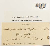 Plagiobryum zieri (Hedw.) Lindb. 648279[1151370] s.n.1897-07-24 Scotland |
MIN:Bryophytes | 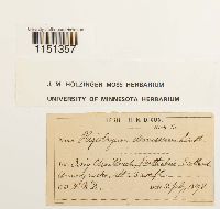 Plagiobryum demissum (Hook.) Lindb. 637336[1151357]D., H.N. s.n.1898-07-15 Scotland, Craig Chailleach., 1006m |
MIN:Bryophytes | 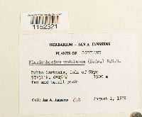 Plagiothecium undulatum (Hedw.) Schimp. 748564[1152321]J.A. Janssens 6481975-08-01 Scotland, Rubha Garbhaig, Isle of Skye, 57.516667 -6.25, 1500m |
MIN:Bryophytes |  Polytrichum strictum Menzies ex Brid. 648887[1157810]C.H. Binstead s.n.1897-07-00 Scotland |
MIN:Bryophytes | 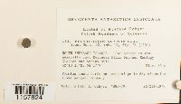 Polytrichum alpinum Hedw. 756715[1157824]R. Ochyra 1551979-12-21 Scotland, SOUTH SHETLAND ISLANDS - KING GEORGE ISLAND: Admiralty Bay, Rescuers Hills between Ecology Glacier and Sphinx Hill.; -62.175 -58.45, -62.175 -58.45, 35m |
MIN:Bryophytes |  Polytrichum alpinum Hedw. 648632[1157542]C.H. Binstead s.n.1897-07-18 Scotland |
MIN:Bryophytes |  Pogonatum aloides (Hedw.) P. Beauv. 648471[1153389][illegible] s.n.1886-03-00 Scotland, Perthshire, [illegible]. |
1
Page 1, records 1-20 of 20
Google Map
Google Maps is a web mapping service provided by Google that features a map that users can pan (by dragging the mouse) and zoom (by using the mouse wheel). Collection points are displayed as colored markers that when clicked on, displays the full information for that collection. When multiple species are queried (separated by semi-colons), different colored markers denote each individual species.