University of Minnesota
http://www.umn.edu/
612-625-5000
http://www.umn.edu/
612-625-5000
Minnesota Biodiversity Atlas
Bell Museum
Dataset: All Collections
Taxa: Campylium
Search Criteria: Bell Museum bryophytes; Minnesota; excluding cultivated/captive occurrences
Bell Museum bryophytes | |
 MIN:Bryophytes | 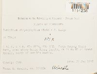 Campylium chrysophyllum (Brid.) Lange 852670[1114238]Frank D Bowers 23653a1995-09-21 United States, Minnesota, Cook, Judge Magney State Park, area above Brule River (west), ca 24 km NE of Grand Marais, North of Devil's Kettle, 47.766667 -90.033333 |
MIN:Bryophytes | 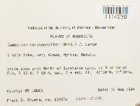 Campylium chrysophyllum (Brid.) Lange 852791[1114239]Frank D Bowers 23917a1994-08-31 United States, Minnesota, Saint Louis, White pine area North of Burntside Lake, ca 9 km NW Ely, 47.966667 -91.966667 |
MIN:Bryophytes | 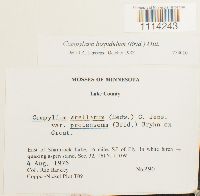 Campylium hispidulum (Brid.) Mitt. 754010[1114243]Barkley, Rae 2901976-08-04 United States, Minnesota, Lake, East of Shamrock Lake, 16 miles SE of Ely. Sec. 32. T6I N. T10W. |
MIN:Bryophytes | 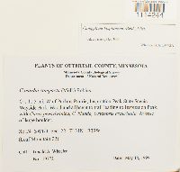 Campylium hispidulum (Brid.) Mitt. 876288[1114244]Gerald A. Wheeler 197721999-05-18 United States, Minnesota, Ca. 11.5 mi. W of Parkers Prairie. Inspiration Peak State Scenic Wayside Park. Woodland adjacent to trail leading to Inspiration Peak. SE1/4 and SW1/4 of Sec. 22 |
MIN:Bryophytes | 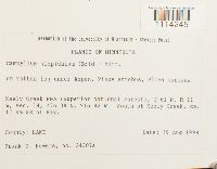 Campylium hispidulum (Brid.) Mitt. 851545[1114245]Frank D Bowers 24307a1994-08-29 United States, Minnesota, Lake, Keely Creek RNA (Superior National Forest). South of Keely Creek, ca. 17 km SE of Ely, 47.633333 -91.7 |
MIN:Bryophytes | 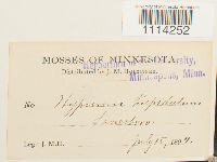 Campylium hispidulum (Brid.) Mitt. 37480[1114252]J.M. H. s.n.1894-07-15 United States, Minnesota, Fillmore |
MIN:Bryophytes | 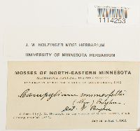 Campylium hispidulum (Brid.) Mitt. 639530[1114253]J.M Holzinger s.n.1902-07-16 United States, Minnesota, Cook, In the vicinity of Grand Marais |
MIN:Bryophytes | 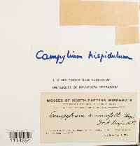 Campylium hispidulum (Brid.) Mitt. 639529[1114254]J.M. Holzinger 51581902-07-16 United States, Minnesota, Cook, In the vicinity of Grand Marais |
MIN:Bryophytes | 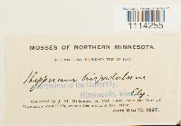 Campylium hispidulum (Brid.) Mitt. 37486[1114255]J.M. Holzinger s.n.1897-06-08 United States, Minnesota, On Fall Lake, near the foot Kawasatchong Falls, seven miles N of Ely |
MIN:Bryophytes | 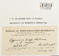 Campylium hispidulum (Brid.) Mitt. 645628[1114260]J.M. Holzinger s.n.1902-07-16 United States, Minnesota, Cook, in the vicinity of Grand Marais |
MIN:Bryophytes | 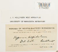 Campylium hispidulum (Brid.) Mitt. 645627[1114261]J.M. Holzinger s.n.1902-07-16 United States, Minnesota, Cook, In the vicinity of Grand Marais |
MIN:Bryophytes | 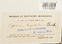 Campylium hispidulum (Brid.) Mitt. 37488[1114266]J.M. Holzinger s.n.1897-06-08 United States, Minnesota, On Fall Lake, near the foot of Kawasatchong Falls, 7 mi N of Ely |
MIN:Bryophytes |  Campylium hispidulum (Brid.) Mitt. 37487[1114267]J.M. Holzinger s.n.1897-06-08 United States, Minnesota, On Fall Lake, near the foot Kawasatchong Falls, seven miles N of Ely |
MIN:Bryophytes | 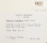 Campylium hispidulum (Brid.) Mitt. 856825[1114268]Gerald A. Wheeler 311281985-05-27 United States, Minnesota, Stearns, About 3.5 mi. SW of St. Cloud on Rte. 15, outcrop just E of road |
MIN:Bryophytes | 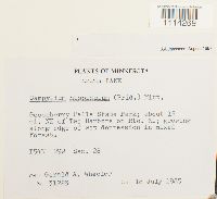 Campylium hispidulum (Brid.) Mitt. 857016[1114269]Gerald A. Wheeler 312231985-07-18 United States, Minnesota, Lake, Gooseberry Falls State Park; about 15 mi. NE of Two Harbors on Rte. 61 |
MIN:Bryophytes | 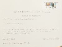 Campylium hispidulum (Brid.) Mitt. 852570[1114270]Frank D. Bowers 22987a1994-09-17 United States, Minnesota, Cook, Heartbreak Creek cRNA old growth white cedar. Ca 8 km NNE of Schroeder, west of Road 343, 47.583333 -90.916667 |
MIN:Bryophytes | 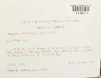 Campylium hispidulum (Brid.) Mitt. 852555[1114271]Frank D Bowers 223801994-08-29 United States, Minnesota, Lake, Keely Creek RNA, Superior National Forest, Just west of Hwy 1, South of Keely Creek, ca. 17 km SE of Ely, 47.633333 -91.7 |
MIN:Bryophytes | 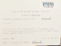 Campylium hispidulum (Brid.) Mitt. 853510[1114276]Frank D. Bowers 23651a1995-09-21 United States, Minnesota, Cook, Judge Magney State Park, area above Brule River (west), ca 24 km NE of Grand Marais, North of Devil's Kettle,T 61 N, R 4 E, 47.766667 -90.033333 |
MIN:Bryophytes | 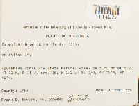 Campylium hispidulum (Brid.) Mitt. 853507[1114277]Frank D Bowers 22648b1994-09-01 United States, Minnesota, Lake, Kawishiwi Pines RNA State Natural Area, ca 9 mi SE of Ely. W 1/2 of SW 1/4 of Sec. 16, 47.83333 -91.75 |
MIN:Bryophytes |  Campylium hispidulum (Brid.) Mitt. 382962[1114278]Mary C. Van Wert s.n.1927-06-19 United States, Minnesota, Taylor's Falls |
MIN:Bryophytes | 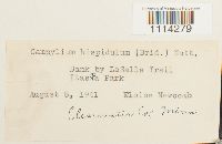 Campylium hispidulum (Brid.) Mitt. 400938[1114279]Eloise Newcomb s.n.1941-08-08 United States, Minnesota, Clearwater, Bank by LaSalle Trail: Itasca Park |
MIN:Bryophytes | 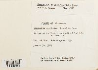 Campylium polygamum (Schimp.) C.E.O. Jensen 733546[1114283]Quinn, Robert 4291979-08-10 United States, Minnesota, Beltrami, In Thuja area south of Red Lake |
MIN:Bryophytes | 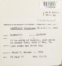 Campylium polygamum (Schimp.) C.E.O. Jensen 734161[1114284]Frank D. Bowers 79501977-07-29 United States, Minnesota, Beltrami, 21 km N of Waskish, just south of county line, east of Hwy. 72 |
MIN:Bryophytes | 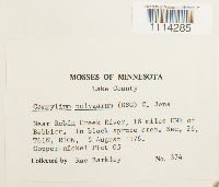 Campylium polygamum (Schimp.) C.E.O. Jensen 735378[1114285]Barkley, Rae 3741976-08-05 United States, Minnesota, Lake, Near Robin Creek River, 18 miles ENE of Babbitt |
MIN:Bryophytes | 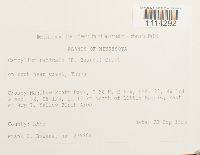 Campylium radicale (P. Beauv.) Grout 851590[1114292]Frank D. Bowers 23990a1995-09-23 United States, Minnesota, Lake, Crosby-Manitou State Park ca. 12 km north of Little Marais and east of Hwy 7. SW 1/4 of Sec. 28 and SE 1/4 of Sec. 32. Yellow Birch Area |
MIN:Bryophytes | 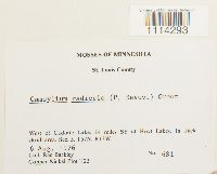 Campylium radicale (P. Beauv.) Grout 754090[1114293]Barkley, Rae 6811976-08-06 United States, Minnesota, Saint Louis, West of Cadotte Lake. 14 mi SE of Hoyt Lakes. |
MIN:Bryophytes |  Campylium stellatum (Hedw.) C.E.O. Jensen 851801[1114294]Frank D Bowers 231211994-08-31 United States, Minnesota, Lake, Wanless Lake white cedar area 1.2 km SW of Wanless Lake on hwy 17 1.2 km, ca 15 km NW of Schroeder, 47.616667 -91.166667 |
MIN:Bryophytes | 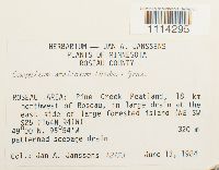 Campylium stellatum (Hedw.) C.E.O. Jensen 809347[1114295]Joannes A Janssens 121731984-06-13 United States, Minnesota, Roseau, Pine Creek Peatland, 18 km northwest of Roseau, in large drain at the east side of large forested island (NE SW of S25), 49 -95.9, 320m |
MIN:Bryophytes | 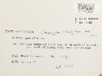 Campylium stellatum (Hedw.) C.E.O. Jensen 734127[1114302]Frank D. Bowers 79611977-07-29 United States, Minnesota, Lake of the Woods, 21 km N of Waskish, just north of county line, west side of road, 48.350135 -94.51222 |
MIN:Bryophytes | 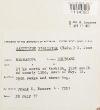 Campylium stellatum (Hedw.) C.E.O. Jensen 734144[1114303]Frank D. Bowers 79511977-07-29 United States, Minnesota, Beltrami, 21 km north of Waskish, just south of county line, east of Hwy. 72, 48.337573 -94.551594 |
MIN:Bryophytes | 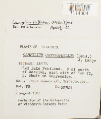 Campylium stellatum (Hedw.) C.E.O. Jensen 735500[1114304]Frank Bowers M53071981-08-01 United States, Minnesota, Beltrami, Red Lake Peatland. 9 mi north of Waskish, east side of Hwy 72 |
MIN:Bryophytes | 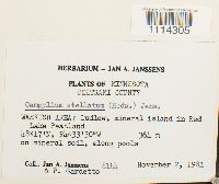 Campylium stellatum (Hedw.) C.E.O. Jensen 748842[1114305]Jan A. Janssens 81441981-11-02 United States, Minnesota, Beltrami, Waskish Area: Ludlow, mineral island in Red Lake Peatland, 48.283333 -94.55, 364m |
MIN:Bryophytes | 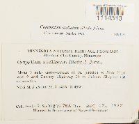 Campylium stellatum (Hedw.) C.E.O. Jensen 809473[1114313]Smith, Welby R. 7276A1982-08-12 United States, Minnesota, Clay, About 3 miles east-southeast of the junction of State Highway 9 and County Highway 34 in Felton, NW 1/4 SE 1/4 section 36 |
MIN:Bryophytes |  Campylium stellatum (Hedw.) C.E.O. Jensen 876354[1114314]Gerald A. Wheeler 184541998-05-04 United States, Minnesota, Redwood, Ca. 4.5 mi. NE of Belview; 0.3 mi. E of jet. of Rte. 19 and Rte. 58. N1/2 NE1/4 NW1/4 of Sec. 27 |
MIN:Bryophytes | 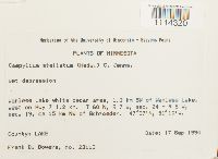 Campylium stellatum (Hedw.) C.E.O. Jensen 852354[1114320]Frank D Bowers 231131994-09-17 United States, Minnesota, Lake, Wanless Lake white cedar area, 1.2 km SW of Wanless, west on Hwy 7 1.2 km. ca 15 km NW of Schroeder, 47.616667 -91.166667 |
MIN:Bryophytes | 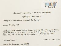 Campylium stellatum (Hedw.) C.E.O. Jensen 853321[1114321]Frank D. Bowers 231781994-09-17 United States, Minnesota, Lake, Wanless Lake white cedar area, 1.2 km SW of Wanless, west on Hwy. 7 , R 7 W, sec. 24 + R 6 W, sec. 19, ca 15 km NW of Schroeder, 47.616667 -91.166667 |
MIN:Bryophytes | 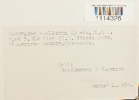 Campylium stellatum (Hedw.) C.E.O. Jensen 605286[1114326] s.n.1952-08-01 United States, Minnesota, Clearwater, Plot 5. Elk Lake (SW) Itasca Park |
MIN:Bryophytes | 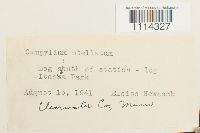 Campylium stellatum (Hedw.) C.E.O. Jensen 400937[1114327]Eloise Newcomb s.n.1941-08-15 United States, Minnesota, Clearwater, Bog south of station, Itasca Park |
MIN:Bryophytes | 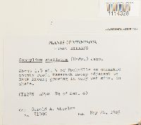 Campylium stellatum (Hedw.) C.E.O. Jensen 856851[1114328]Gerald A. Wheeler 310901985-05-26 United States, Minnesota, Stearns, About 1.5 mi. W of Rockville on unmarked county road; swamp adjacent to Sauk River. S1/2 of Sec. 8. |
MIN:Bryophytes | 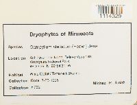 Campylium stellatum (Hedw.) C.E.O. Jensen 865228[1114329]Michael R. Smith 7321998-08-23 United States, Minnesota, Saint Louis, Ash River Trail North. Releve Voya 189. Voyageurs National Park, 48.391389 -92.908611 |
MIN:Bryophytes | 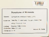 Campylium stellatum (Hedw.) C.E.O. Jensen 865215[1114330]Michael R. Smith 7791998-09-03 United States, Minnesota, Saint Louis, Daley Bay. St Louis. Voyageurs National Park., 48.20472 -92.93806 |
MIN:Bryophytes | 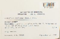 Campylium protensum (Brid.) Kindb. 812771[1114331]J.A. Janssens 215691990-09-19 United States, Minnesota, Roseau, Haug Area: peatland complex at Co. Rd. 7, 10 km west of Haug (SE of SW of Sec. 14), 48.851389 -96.310833, 310m |
MIN:Bryophytes | 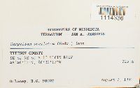 Campylium stellatum (Hedw.) C.E.O. Jensen 813001[1114336]B.C. Delaney 900021990-08-07 United States, Minnesota, Kittson, SE of NE of Sec. 13. TRS: T.161N, R.46W, Sec. 13, 48.769722 -96.538056, 325m |
MIN:Bryophytes | 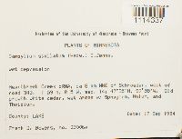 Campylium stellatum (Hedw.) C.E.O. Jensen 852758[1114337]Frank D. Bowers 23006a1994-09-17 United States, Minnesota, Cook, Heartbreak Creek cRNA old growth white cedar. Ca 8 km NNE of Schroeder, west of Road 343, 47.583333 -90.916667 |
MIN:Bryophytes | 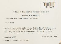 Campylium stellatum (Hedw.) C.E.O. Jensen 852477[1114338]Frank D Bowers 231681994-09-17 United States, Minnesota, Lake, Wanless Lake white cedar area, 1.2 km SW of Wanless, west on Hwy 7 1.2 km. ca 15 km NW of Schroeder, 47.616667 -91.166667 |
MIN:Bryophytes | 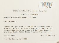 Campylium stellatum (Hedw.) C.E.O. Jensen 852444[1114339]Frank D Bowers 230101994-09-17 United States, Minnesota, Cook, Heartbreak Creek cRNA, ca 8km NNE of Schroeder, west of Road 343, 47.583333 -90.916667 |
MIN:Bryophytes | 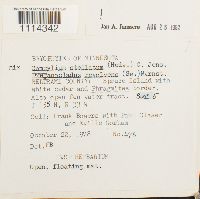 Campylium stellatum (Hedw.) C.E.O. Jensen 749352[1114342]Frank Bowers 4761978-10-22 United States, Minnesota, Beltrami, Spruce Island with white cedar and Phragmites border. Also open fen water tract. |
MIN:Bryophytes | 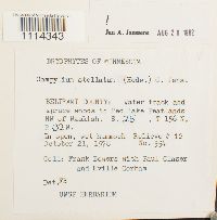 Campylium stellatum (Hedw.) C.E.O. Jensen 749353[1114343]Frank Bowers 5541978-10-21 United States, Minnesota, Beltrami, Water track and spruce woods in Red Lake Peatlands NW of Waskish |
MIN:Bryophytes | 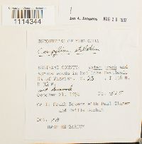 Campylium stellatum (Hedw.) C.E.O. Jensen 749354[1114344]Frank Bowers 5251978-10-21 United States, Minnesota, Beltrami, in Red Lake Peatlands NW of Waskish, 48.303133 -94.695865 |
MIN:Bryophytes | 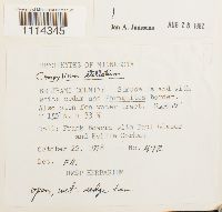 Campylium stellatum (Hedw.) C.E.O. Jensen 749356[1114345]Frank D. Bowers 4721978-10-22 United States, Minnesota, Beltrami, Spruce Island with white cedar and Phragmites border |
MIN:Bryophytes | 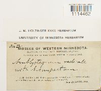 Campylium radicale (P. Beauv.) Grout 633158[1114462]J.M. Holzinger 221901-06-26 United States, Minnesota, On the west shore of Big Stone Lake, on the Dakota side |
MIN:Bryophytes | 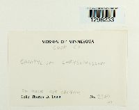 Campylium chrysophyllum (Brid.) Lange [1298233]Thomas D. Trana 2364 United States, Minnesota, Cook |
MIN:Bryophytes | Campylium stellatum (Hedw.) C.E.O. Jensen 976513[1403313]Kerstin O. Griffin 61c1966-06-00 United States, Minnesota, Koochiching, Red Lake Bog |
MIN:Bryophytes | Campylium stellatum (Hedw.) C.E.O. Jensen 976510[1403310]Kerstin O. Griffin 60b1966-06-00 United States, Minnesota, Koochiching, Red Lake Bog |
MIN:Bryophytes | Campylium stellatum (Hedw.) C.E.O. Jensen 976512[1403312]Kerstin O. Griffin 60c1966-06-00 United States, Minnesota, Koochiching, Red Lake Bog |
MIN:Bryophytes | Campylium stellatum (Hedw.) C.E.O. Jensen 976509[1403309]Kerstin O. Griffin 59b1966-06-00 United States, Minnesota, Koochiching, Red Lake Bog |
MIN:Bryophytes | Campylium stellatum (Hedw.) C.E.O. Jensen 976511[1403311]Kerstin O. Griffin 57e1966-06-00 United States, Minnesota, Koochiching, Red Lake Bog |
MIN:Bryophytes | Campylium stellatum (Hedw.) C.E.O. Jensen 976508[1403308]Kerstin O. Griffin 56c1966-06-00 United States, Minnesota, Koochiching, Red Lake Bog |
MIN:Bryophytes | Campylium stellatum (Hedw.) C.E.O. Jensen 976507[1403307]Kerstin O. Griffin 54d1966-06-00 United States, Minnesota, Koochiching, Red Lake Bog |
MIN:Bryophytes | Campylium polygamum (Schimp.) C.E.O. Jensen 976506[1403306]Kerstin O. Griffin 48-08 a1966-06-00 United States, Minnesota, Koochiching |
Google Map
Google Maps is a web mapping service provided by Google that features a map that users can pan (by dragging the mouse) and zoom (by using the mouse wheel). Collection points are displayed as colored markers that when clicked on, displays the full information for that collection. When multiple species are queried (separated by semi-colons), different colored markers denote each individual species.