University of Minnesota
http://www.umn.edu/
612-625-5000
http://www.umn.edu/
612-625-5000
Minnesota Biodiversity Atlas
Bell Museum
Dataset: All Collections
Taxa: Frullania eboracensis (Frullania saxatilis), Frullania eboracensis subsp. eboracensis, Frullania eboracensis subsp. virginica (Frullania virginica), Frullania eboracensis var. caduciloba
Search Criteria: Bell Museum bryophytes; Minnesota; excluding cultivated/captive occurrences
1
Page 1, records 1-9 of 9
Bell Museum bryophytes | |
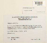
MIN:Bryophytes | Frullania eboracensis Gottsche 876428[1129915]Gerald A. Wheeler 200651999-06-13 United States, Minnesota, Carver, Ca. 1.2 mi. W of Watertown on Rte. 25, W of road. SE1/4 NW1/4 of Sec. 6. (Watertown 6) |
MIN:Bryophytes | Frullania eboracensis Lehm. 964875[]Glauser, Abby 4442018-07-26 United States, Minnesota, Anoka, Cedar Creek Ecosystem Reserve, Plot CC_THOC_01, 45.40713 -93.199308, 277m |
MIN:Bryophytes | Frullania eboracensis Lehm. 964870[]Glauser, Abby 556a2018-08-09 United States, Minnesota, Anoka, Cedar Creek Ecosystem Reserve, Plot CC_QUMA_03, 45.38601 -93.198141, 280m |
MIN:Bryophytes | Frullania eboracensis Lehm. 964876[]Glauser, Abby 6152018-09-07 United States, Minnesota, Isanti, Cedar Creek Ecosystem Reserve, Plot CC_LALA_02, 45.422013 -93.193017, 280m |
MIN:Bryophytes | Frullania eboracensis Lehm. 964871[1403262]Glauser, Abby 6572018-09-28 United States, Minnesota, Lake, Hubachek Wilderness Research Center, Plot HWRC_ABBA_01, 47.954007 -91.754419, 428m |
MIN:Bryophytes | Frullania eboracensis Lehm. 964872[1403263]Glauser, Abby 6612018-09-28 United States, Minnesota, Lake, Hubachek Wilderness Research Center, Plot HWRC_ABBA_01, 47.954007 -91.754419, 428m |
MIN:Bryophytes | Frullania eboracensis Lehm. 964874[1403253]Glauser, Abby 7142018-09-29 United States, Minnesota, Lake, Hubachek Wilderness Research Center, Plot HWRC_POTR_01, 47.958538 -91.754682, 429m |
MIN:Bryophytes | Frullania eboracensis Lehm. 964877[1403254]Glauser, Abby 9482018-10-19 United States, Minnesota, Carlton, Cloquet Forestry Center, Plot CFC_PIRE_02, 46.69663 -92.52657, 390m |
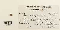
MIN:Bryophytes | 392325[1180904]Schuster, R.M. 100611948-05-08 United States, Minnesota, Wabasha, Northeast facing cliffs below Lake City. |
1
Page 1, records 1-9 of 9
Google Map
Google Maps is a web mapping service provided by Google that features a map that users can pan (by dragging the mouse) and zoom (by using the mouse wheel). Collection points are displayed as colored markers that when clicked on, displays the full information for that collection. When multiple species are queried (separated by semi-colons), different colored markers denote each individual species.

